Overview
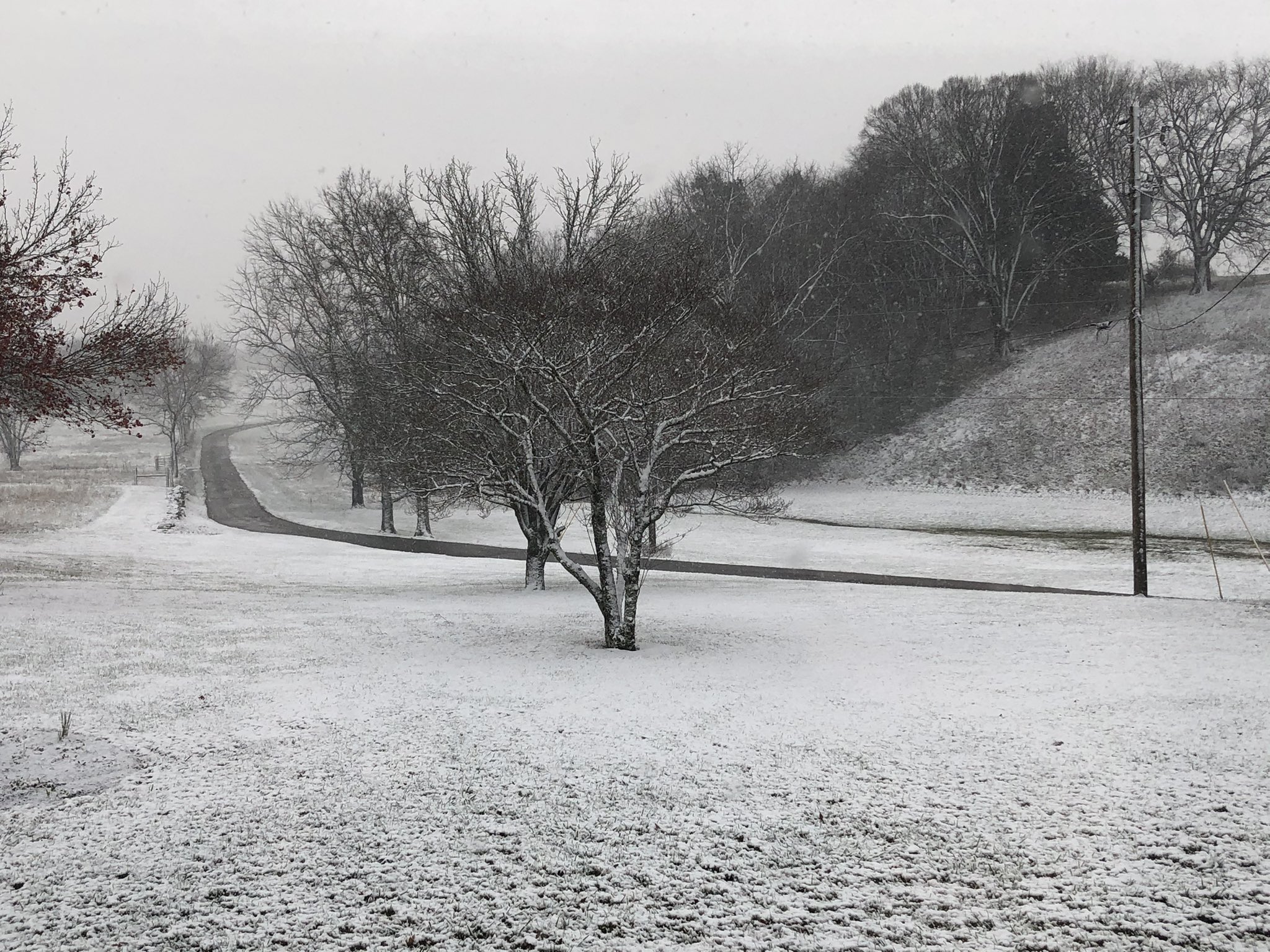
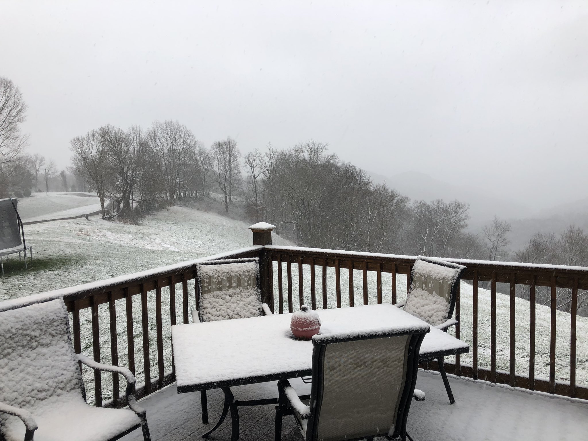
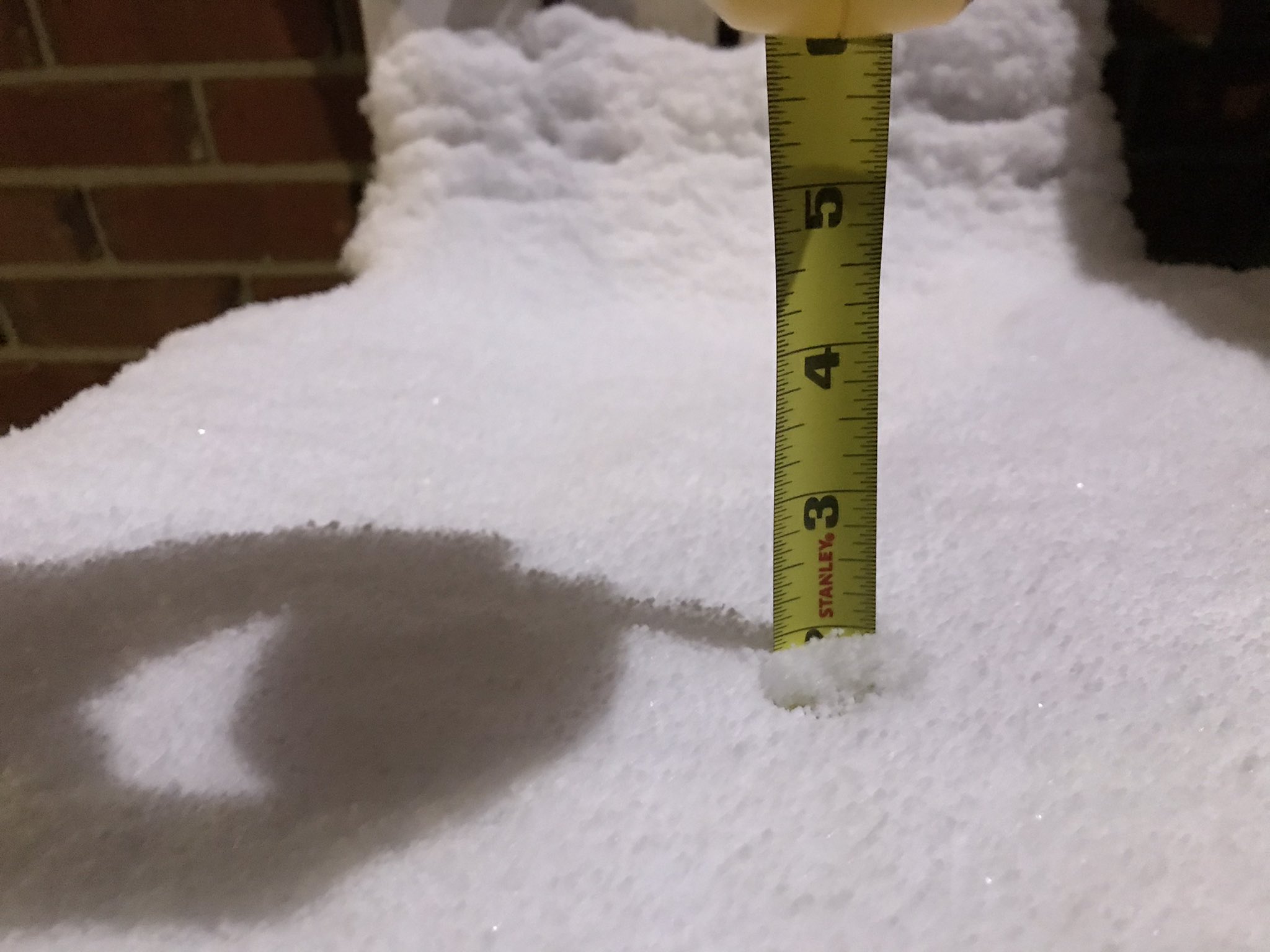
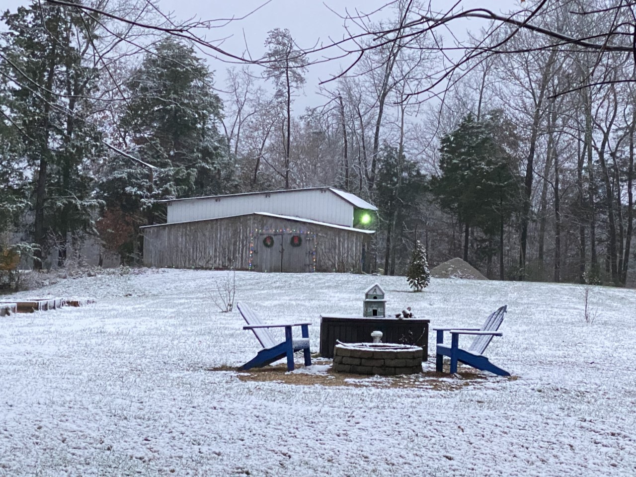
The collision of a surface low and strong cold front over Middle Tennessee produced a measurable and picturesque snow for the end of meteorological fall. Total accumulations ranged from a dusting to as much as four inches across portions of the Mid State. Before the cold front arrived late on November 29th into the 30th, rain had been falling in a number of areas. The rain briefly changed over to a wintry mix, including snow, early on the morning of November 30th before ending. Much of Middle Tennessee's accumulating snow fell on the back side of the low pressure system, which had already moved east to the Mid Atlantic states. Wrap-around moisture from the low pressure, in combination with falling temperatures during the day on November 30th, allowed precipitation to change into snow. By the time snow was concluding on the evening of November 30th, locations east of I-65 (especially on the Cumberland Plateau) saw the most snow accumulation.
Photos & Video
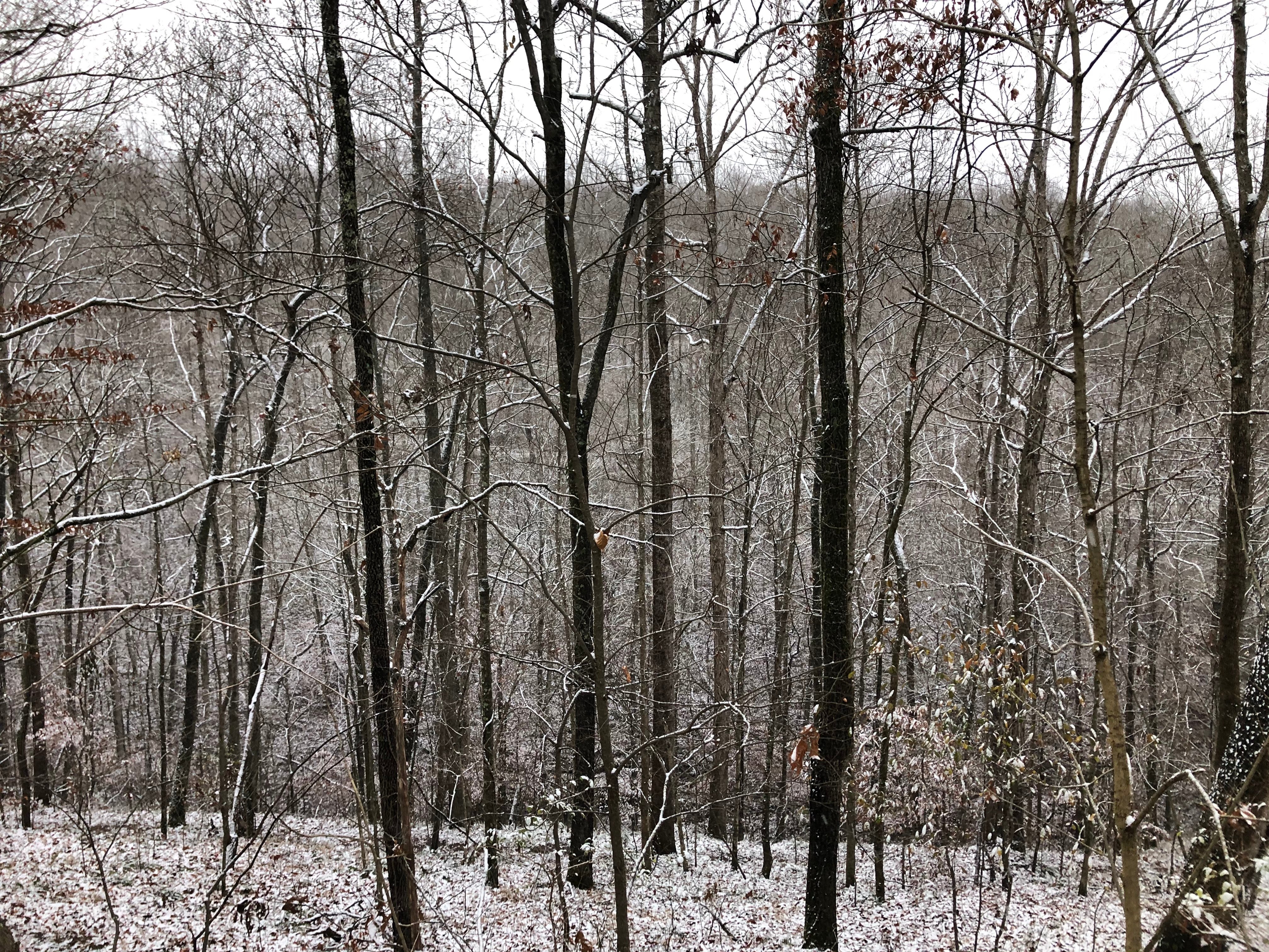
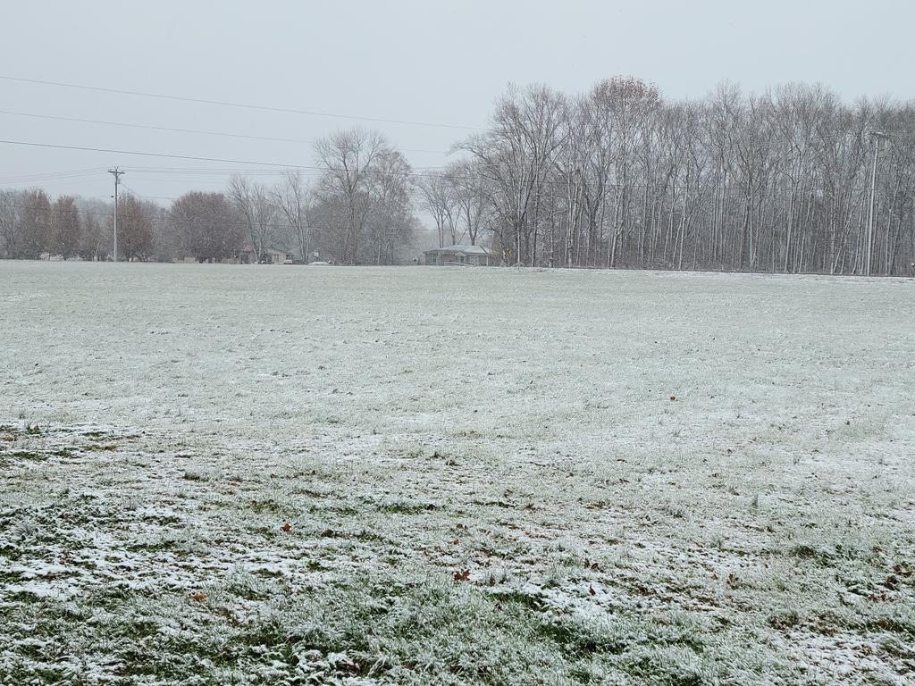
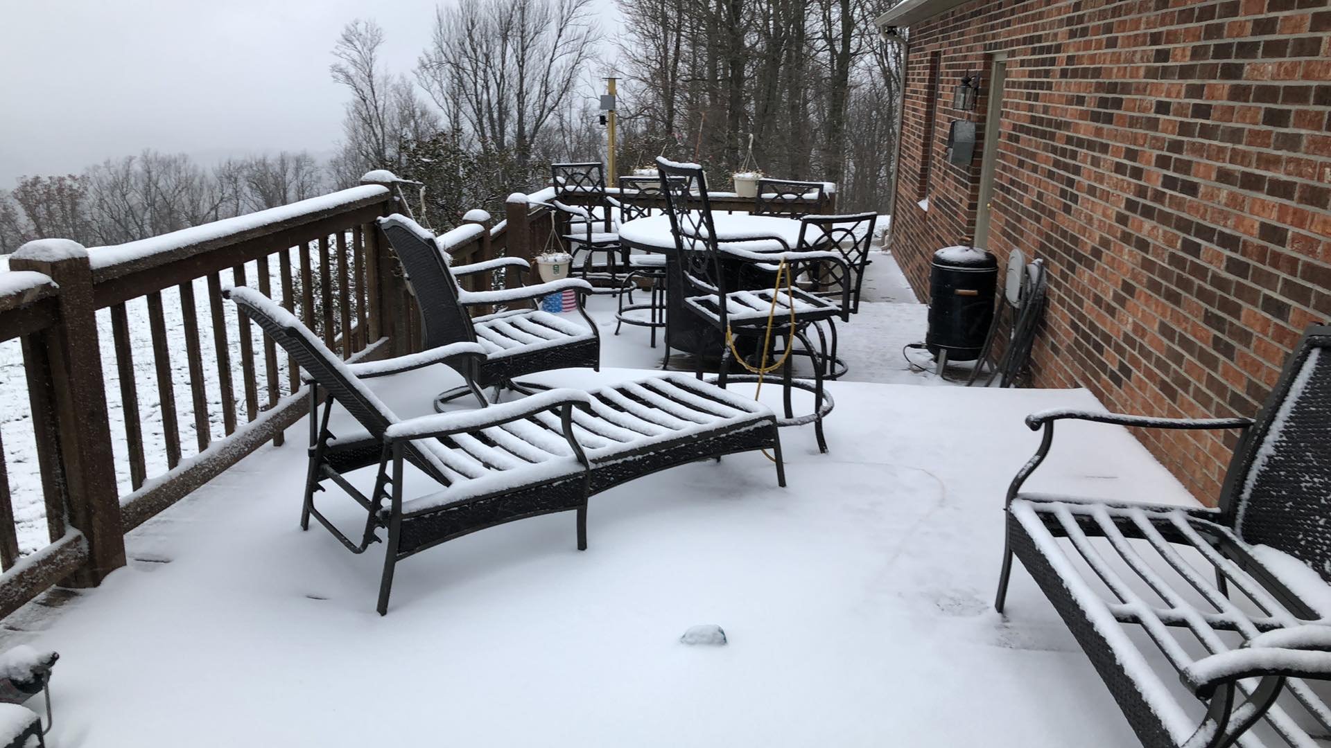
Snow on November 30, 2020
 |
 |
 |
 |
| East of Watertown, TN (Source: Twitter) |
Center Hill Lake (Source: Twitter) |
Cookeville near Tennessee Tech (Source: Twitter) |
Hilham, TN in Overton County (Source: Tina Ayers, Twitter) |
 |
 |
 |
 |
| Joelton, TN (Davidson Co.) (Source: Twitter) |
Snow in northeast Lebanon, TN (@WilsonSevereWx on Twitter) |
Short Mountain Bible Camp (Source: Jerry Nash, Twitter) |
Snow dusted trees in Lebanon, TN (@brendanschaper on Twitter) |
Storm Reports
PRELIMINARY LOCAL STORM REPORT...SUMMARY
NATIONAL WEATHER SERVICE NASHVILLE TN
835 AM CST TUE DEC 01 2020

..TIME...   ...EVENT...      ...CITY LOCATION...     ...LAT.LON...
..DATE...   ....MAG....      ..COUNTY LOCATION..ST.. ...SOURCE....
            ..REMARKS..

0405 PM     SNOW             3 E SMITHVILLE          35.96N  85.77W
11/30/2020  E1.0 INCH        DE KALB            TN   SOCIAL MEDIA

            TWITTER PHOTOS SHOWED AROUND 1 INCH OF SNOW EAST OF
            SMITHVILLE

0431 PM     SNOW             7 E SPARTA              35.94N  85.34W
11/30/2020  E1.3 INCH        WHITE              TN   PUBLIC

            REPORTED ON BON AIR MOUNTAIN

0500 PM     SNOW             E COOKEVILLE            36.16N  85.51W
11/30/2020  E1.5 INCH        PUTNAM             TN   EMERGENCY MNGR

            MEASURED IN EAST COOKEVILLE

0507 PM     SNOW             SPARTA                  35.93N  85.47W
11/30/2020  E1.0 INCH        WHITE              TN   SOCIAL MEDIA

            REPORTED IN SPARTA AT WOODLAND PARK ELEMENTARY SCHOOL

0530 PM     SNOW             COLLEGE GROVE           35.79N  86.67W
11/30/2020  E0.8 INCH        WILLIAMSON         TN   SOCIAL MEDIA

            3/4 INCH OF SNOW REPORTED IN COLLEGE GROVE

0532 PM     SNOW             JAMESTOWN               36.43N  84.94W
11/30/2020  E1.8 INCH        FENTRESS           TN   BROADCAST MEDIA

            1.75 INCHES OF SNOW MEASURED NEAR JAMESTOWN

0553 PM     SNOW             MONTEREY                36.13N  85.24W
11/30/2020  E3.0 INCH        PUTNAM             TN   SOCIAL MEDIA

0610 PM     SNOW             NORMANDY                35.45N  86.26W
11/30/2020  E0.5 INCH        BEDFORD            TN   SOCIAL MEDIA

0613 PM     SNOW             5 NE SMITHVILLE         36.01N  85.76W
11/30/2020  E1.0 INCH        DE KALB            TN   SOCIAL MEDIA

            1 INCH OF SNOW REPORTED NEAR CENTER HILL LAKE

0620 PM     SNOW             7 E SPARTA              35.92N  85.35W
11/30/2020  E3.0 INCH        WHITE              TN   SOCIAL MEDIA

            REPORTED ON HOLIDAY LANE ON BON AIR MOUNTAIN

0645 PM     SNOW             RINNIE                  36.15N  85.03W
11/30/2020  E0.8 INCH        CUMBERLAND         TN   SOCIAL MEDIA

0704 PM     SNOW             RICKMAN                 36.26N  85.38W
11/30/2020  E3.5 INCH        OVERTON            TN   SOCIAL MEDIA

0709 PM     SNOW             8 E SPARTA              35.94N  85.33W
11/30/2020  E2.8 INCH        WHITE              TN   SOCIAL MEDIA

            REPORTED NEAR BON DE CROFT ELEMENTARY SCHOOL ON BON AIR
            MOUNTAIN

0719 PM     SNOW             3 SSE WOODBURY          35.78N  86.05W
11/30/2020  E0.8 INCH        CANNON             TN   SOCIAL MEDIA

            3/4 INCH OF SNOW MEASURED IN THE ICONIUM COMMUNITY

0731 PM     SNOW             NORMANDY                35.45N  86.26W
11/30/2020  E0.9 INCH        BEDFORD            TN   SOCIAL MEDIA

0740 PM     SNOW             6 ENE WOODBURY          35.86N  85.97W
11/30/2020  E1.8 INCH        CANNON             TN   SOCIAL MEDIA

            UPDATED SNOW TOTAL. TWITTER PHOTOS SHOWED UP TO 1.75
            INCHES OF SNOW AT THE SHORT MOUNTAIN BIBLE CAMP AT 1825
            ELEVATION

0748 PM     SNOW             3 NW FAIRFIELD GLADE    36.03N  84.94W
11/30/2020  E0.9 INCH        CUMBERLAND         TN   SOCIAL MEDIA

0800 PM     SNOW             ALTAMONT                35.43N  85.73W
11/30/2020  M1.0 INCH        GRUNDY             TN   EMERGENCY MNGR

            AN AVERAGE OF AROUND 1 INCH OF SNOW FELL ACROSS THE
            COUNTY. SEVERAL SLICK ROADS.

0804 PM     SNOW             COOKEVILLE              36.16N  85.51W
11/30/2020  E2.5 INCH        PUTNAM             TN   SOCIAL MEDIA

            TWITTER PHOTOS SHOWED 1.5 TO 2.5 INCHES OF SNOW FELL
            ACROSS COOKEVILLE

0805 PM     SNOW             FLAT CREEK              35.39N  86.41W
11/30/2020  E0.8 INCH        BEDFORD            TN   SOCIAL MEDIA

0806 PM     SNOW             1 NE DE ROSSETT         35.96N  85.30W
11/30/2020  E3.5 INCH        WHITE              TN   SOCIAL MEDIA

            REPORTED ON DOE CREEK LOOP

0810 PM     SNOW             PLEASANT HILL           35.98N  85.20W
11/30/2020  E2.5 INCH        CUMBERLAND         TN   SOCIAL MEDIA

0813 PM     SNOW             PALMER                  35.36N  85.57W
11/30/2020  E2.0 INCH        GRUNDY             TN   EMERGENCY MNGR

0815 PM     SNOW             MORRISON                35.60N  85.92W
11/30/2020  E0.5 INCH        WARREN             TN   SOCIAL MEDIA

0815 PM     SNOW             LAKE TANSI              35.87N  85.05W
11/30/2020  E0.8 INCH        CUMBERLAND         TN   SOCIAL MEDIA

            1/2 TO 3/4 INCH OF SNOW IN LAKE TANSI

0819 PM     SNOW             LIVINGSTON              36.39N  85.33W
11/30/2020  E2.0 INCH        OVERTON            TN   PUBLIC

0835 PM     SNOW             MANCHESTER              35.47N  86.08W
11/30/2020  E0.5 INCH        COFFEE             TN   SOCIAL MEDIA

            AROUND ONE HALF INCH OF SNOW ACROSS MOST OF THE COUNTY

0845 PM     SNOW             MAYLAND                 36.05N  85.20W
11/30/2020  E3.0 INCH        CUMBERLAND         TN   SOCIAL MEDIA

0929 PM     SNOW             6 NNE CROSSVILLE        36.04N  85.00W
11/30/2020  E2.0 INCH        CUMBERLAND         TN   SOCIAL MEDIA

            REPORTED ON SUNSET RIDGE DRIVE

1130 PM     SNOW             JAMESTOWN               36.43N  84.94W
11/30/2020  M3.8 INCH        FENTRESS           TN   SOCIAL MEDIA

1130 PM     SNOW             JAMESTOWN               36.43N  84.94W
11/30/2020  M4.0 INCH        FENTRESS           TN   CO-OP OBSERVER

            COOP REPORT OF 4 INCHES OF SNOW.


&&

EVENT NUMBER OHX2000561 OHX2000562 OHX2000564 OHX2000565 OHX2000568
OHX2000566 OHX2000567 OHX2000569 OHX2000570 OHX2000571 OHX2000572
OHX2000581 OHX2000573 OHX2000574 OHX2000576 OHX2000560 OHX2000575
OHX2000577 OHX2000578 OHX2000579 OHX2000582 OHX2000583 OHX2000580
OHX2000584 OHX2000587 OHX2000585 OHX2000586 OHX2000588 OHX2000589
OHX2000590 OHX2000591


$$

fborden
Snow Totals
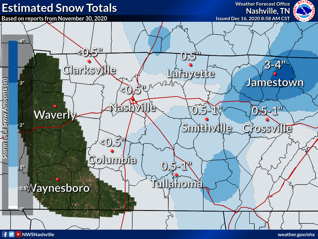 |
| Estimated Snowfall Totals Based on COOP, CoCoRaHS, and other local reports |
Public Information Statement
National Weather Service Nashville TN
830 AM CST Tue Dec 1 2020

...SNOWFALL REPORTS...

Location                     Amount    Time/Date       Elevation (ft.)
Jamestown 1 WNW              4.0 in    0700 AM 12/01   1739
Mcminnville 8.5 ESE          2.0 in    0700 AM 12/01   1889
Cookeville 1.0 SW            2.0 in    0800 AM 12/01   1112
Livingston                   2.0 in    0819 PM 11/30
Palmer                       2.0 in    0813 PM 11/30
Jamestown                    1.8 in    0532 PM 11/30
Cookeville                   1.5 in    0500 PM 11/30
7 E Sparta                   1.3 in    0431 PM 11/30
Beersheba Springs 2.1 ENE    1.2 in    0700 AM 12/01   964
Sparta 8.6 NW                1.0 in    0700 AM 12/01   1037
Portland 1.2 NNE             1.0 in    0700 AM 12/01   795
Altamont                     1.0 in    0800 PM 11/30
Crossville 4.6 NNW           1.0 in    0600 AM 12/01   1715
Shelbyville 8.7 W            1.0 in    0700 AM 12/01   804
Shelbyville 3.1 ESE          1.0 in    0700 AM 12/01   750
Crossville 4.7 S             0.9 in    0800 AM 12/01   1893
Lebanon 11.5 SSE             0.8 in    0700 AM 12/01   740
Eagleville 3.9 WSW           0.8 in    0700 AM 12/01   879
Morrison 1.9 SSW             0.8 in    0600 AM 12/01   1070
Cookeville 4.6 WNW           0.8 in    0612 AM 12/01   1000
Manchester 6.5 ENE           0.8 in    0700 AM 12/01   1095
2.2 SW Lewisburg             0.7 in    0705 AM 12/01   787
1.7 E Smithville             0.7 in    0700 AM 12/01   890
Crossville 6.9 S             0.6 in    0700 AM 12/01   1864
Lebanon 8.4 SSW              0.5 in    0700 AM 12/01   681
Spring Hill 3.2 NE           0.5 in    0600 AM 12/01
4 SE Portland                0.5 in    0330 AM 11/30
Elmwood 4.5 NNE              0.5 in    0700 AM 12/01   677
Carthage 8.7 NNE             0.5 in    0600 AM 12/01   722
0.6 NE Byrdstown             0.5 in    0630 AM 12/01   880
0.9 W Dickson                0.5 in    0800 PM 11/30   780
Centerville 9.5 N            0.4 in    0700 AM 12/01   560
Gallatin 5.7 SSE             0.3 in    0600 AM 12/01   533
4 ENE Lebanon                0.3 in    0330 AM 11/30
Gallatin 1.7 WNW             0.3 in    0645 AM 12/01   504
Columbia 1.2 SSW             0.3 in    0700 AM 12/01   722
Nashville 5.2 S              0.3 in    0700 AM 12/01   662
Green Hill 0.3 N             0.2 in    0700 AM 12/01   518
1.5 SE White House           0.2 in    0643 AM 12/01   820
Bon Aqua 3.0 ESE             0.2 in    0600 AM 12/01   935
4.8 E Berry Hill             0.2 in    0600 AM 12/01   560
Red Boiling Springs 6.7 NNE  0.2 in    0700 AM 12/01   762
Fairview 1.9 ENE             0.1 in    0630 AM 12/01   843
Franklin 4.4 W               0.1 in    0450 AM 12/01   654
3.7 NE Burns                 0.1 in    0600 AM 12/01   600

Observations are collected from a variety of sources with varying
equipment and exposures. We thank all volunteer weather observers
for their dedication. Not all data listed are considered official.

$$
 |
Media use of NWS Web News Stories is encouraged! Please acknowledge the NWS as the source of any news information accessed from this site. |
|

