 |
 |
|
| Today | Tomorrow |
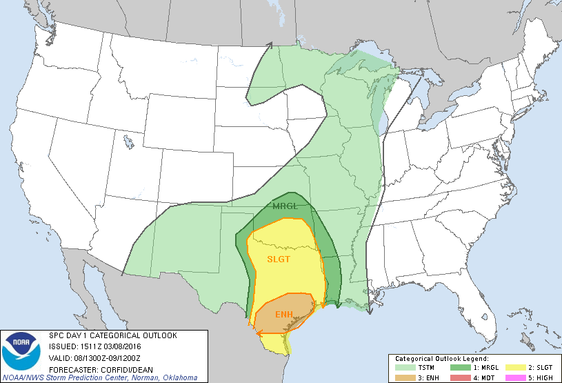
A large and anomalous upper-level low is digging into northern Mexico this morning, and will slowly move southeastward through the next couple days. At the surface, a low pressure system associated with the upper-low will move into western Texas by late this afternoon. A warm, moist, and unstable air mass across the Southern Plains and Mississippi Valley ahead of this system will result in the development of widespread showers and thunderstorms today from the Southern Plains to the great lakes. Some thunderstorms may become severe across portions of the Southern Plains, where the Storm Prediction Center (SPC) is forecasting a slight to enhanced risk of severe thunderstorms. Additionally, flash flooding is possible across portions of the Southern Plains and lower Mississippi Valley.
A cold front will spread rain and mountain snow into the Pacific Northwest and northern California today. This system will weaken tonight into early Wednesday morning as it moves inland, bringing scattered areas of rain and snow to the intermountain region.
High pressure at the mid and upper-levels of the atmosphere will promote well above average temperatures through the next couple days from the Midwest to the Northeast. Afternoon high temperatures today are forecast to be 15 to 30 degrees above average across the midwest and portions of the Mid-Atlantic. The warm temperatures will expand into the New England on Wednesday.

