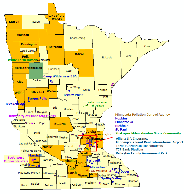
52 Sites:
26 Counties, 15 Communities, 3 Indian Nation
2 Government, 2 Universities, 5 Commercial
16 Supporters
Back to StormReady Communities
StormReady Home
 |
County |
 |
Government |
 |
Community |
 |
Commercial |
 |
Indian Nation |
 |
Supporter |
 |
University |
|
|
|
Counties
|
Communities
|
Indian Nations
|
- Anoka
- Beltrami
- Blue Earth
- Clay
- Hennepin
- Itasca
- Kittson
- Le Sueur
- Lyon
- Mahnomen
- Marshall
- Nicollet
- Norman
- Otter Tail
|
- Pennington
- Polk
- Ramsey
- Renville
- Scott
- Stearns
- Steele
- Stevens
- Wadena
- Waseca
- Washington
- Wilkin
|
|
- Breckenridge
- Breezy Point
- Camp Wilderness Boy Scout Camp
- Dover
- Eyota
- Faribault
- Fergus Falls
|
- Hopkins
- Marshall
- Minnetonka
- Morristown
- Richfield
- Spring Valley
- St. Paul
- Tracy
|
|
- Mille Lacs Band of Ojibwe
- Shakopee Mdewakanton Sioux Community
- White Earth Nation
|
|
Government
|
Universities
|
Commercial
|
- Federal Correctional Institution, Waseca
- Minnesota Pollution Control Agency
|
- Southwest Minnesota State
- University of Minnesota Morris
|
- Allianz Life Insurance
- Minneapolis St. Paul International Airport
- Target Corporate Headquarters
- TCF Bank Stadium
- Valleyfair Family Amusement Park
|
|
Supporters
|
- Albertville Premium Outlets
- Ames Center
- Best Buy Corp. Campus
- Fridley Public Schools
- Hopkins School District
|
- Intermediate School District 287
- Itasca-Mantrap Cooperative
- KAAL TV
- Mayo Clinic
- Miller Hill Mall
- Minnesota Twins, Target Fields
|
- Ridgeview Medical Center
- Southdale Center
- Twin Cities Premium Outlets
- WDIO-TV, Duluth
- WXOW Television
|

