
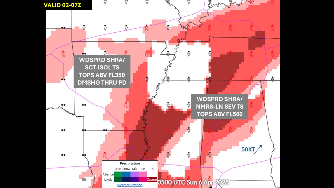
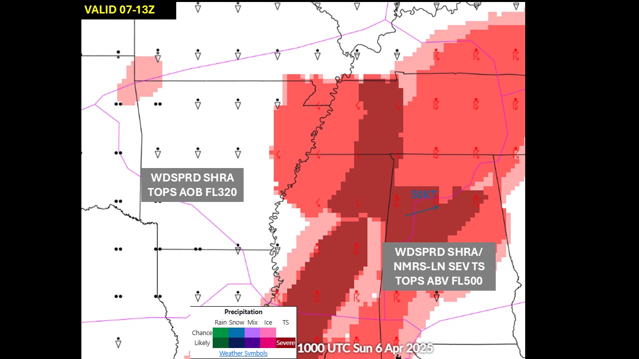
The storm system producing severe weather and isolated flash flooding will begin to weaken tonight. As the storm moves east, several chances for severe weather and heavy rain are possible from the Midwest and Ohio Valley to the Southern Plains, Lower Mississippi and Tennessee valley. Heavy snow continue to impact the Northern Rockies. Critical fire weather conditions persist in the Southern Plains Read More >
Memphis
Center Weather Service Unit
| Hover over or click station to get METAR and TAF (if available). | Flight Categories: |
 |
 |
|
 |
 |
 |
|
|
|
|
|
|
|


 Weather Briefing
 Radar Mosaic
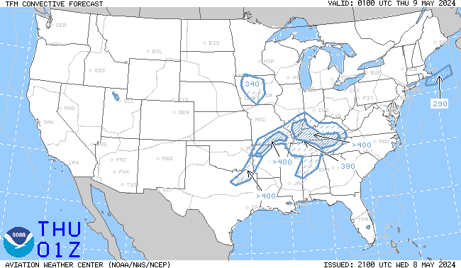 TCF Convective Forecast
 Sigmets and CWAs
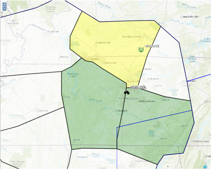 Area Hazard Pages
 Aviation Safety