Weather can impact the operations of any outdoor public gathering, whether it is a 5K fun run or COVID testing and vaccination centers. Strong winds can blow materials and tents around, disrupting work and risking injuries. Heavy snow can make access difficult and snow loads could bring down tents. In summer, gusty wind and rain can disrupt operations, and a lightning strike can change a vaccination event to a mass casualty event.
In order to make your event Weather Ready, the National Weather Service office in Boulder CO recommends that you have a plan and offers the resources below to make your event safe. You can't be weather proof, but you can be Weather Ready!
![]()
Having a plan in place will relieve you of having to figure out what do do "in the moment". With a hazardous weather operations plan you are set up to take action to secure operations and keep staff and participants safe and avoid a chaotic situation. A good plan will provide trigger points and predefined actions for communication and to move people to safety. When hazardous weather strikes all the tough decisions will have already been made, and organizers can follow the plan.
Your plan should:
Weather monitoring is a crucial aspect of keeping your event Weather Ready. You'll need to know the forecast in the days ahead of your event, as well as monitoring current weather during your event. Don't assume everyone is keeping an eye on the sky, or that someone else is doing it. Designate one person as your weather watcher, with either the authority to enact your hazardous weather plan or report conditions to someone of authority.
|
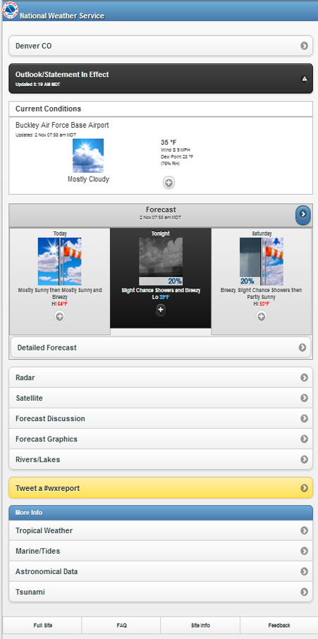
These NWS and FEMA mobile apps will help you monitor forecast and current conditions. There are also many good mobile apps from private vendors.
|
|
|
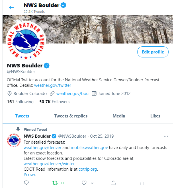
Social Media - NWSBoulder |
|
| NWS on the Internet: https://www.weather.gov/bou/ |
|
| Weather Story - what we think you should know about the weather. Access from our main page at www.weather.gov/bou/, then click on Weather Story near the bottom of the page. |
|
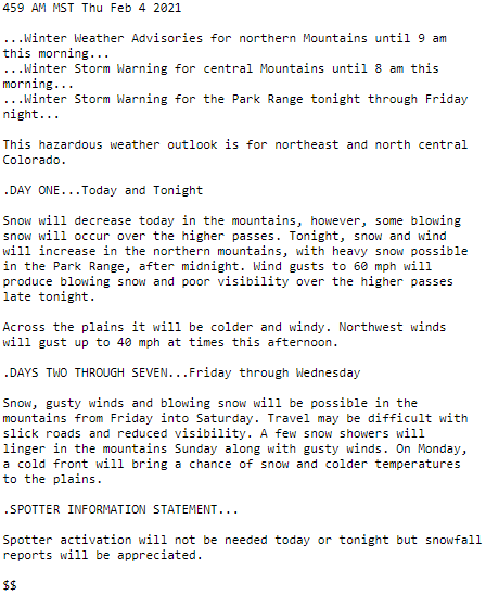
| Hazardous Weather Outlook for the next 7 days is a text product. Primarily intended for weather spotters, it is a good plain language overview of impactful weather in the coming week. |
|
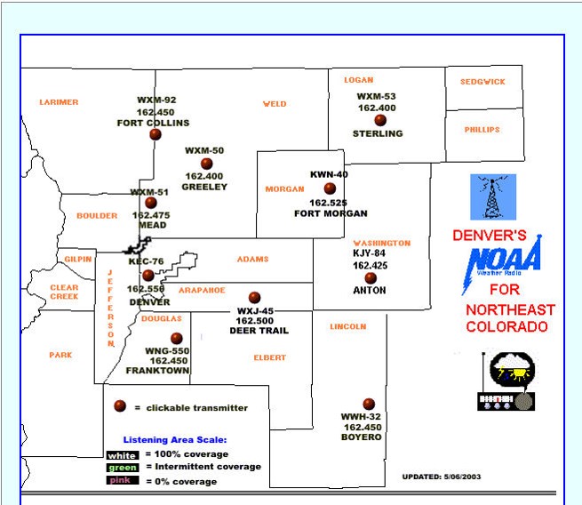
| NOAA Weather Radio is a good, low cost way to receive weather alerts and forecasts. It broadcasts continually on a special weather frequency. Make sure to get a receiver with Tone Alert and Specific Area Message Encoding (SAME) features. Tone Alert will make an audible sound to let you know the National Weather Service has issued a warning. SAME allows you to set your radio for your county, so your radio tone alerts only for where you are and ignores other counties. |
|
| If monitoring weather yourself is too much for you or your organization, there are many Private Weather Enterprise companies that can provide weather monitoring and notification services. The NWS maintains a list to choose from at: https://www.weather.gov/im/metdir#CO |
These tools will help you generate specialized forecast graphics to include in plans or post for all to see.
|
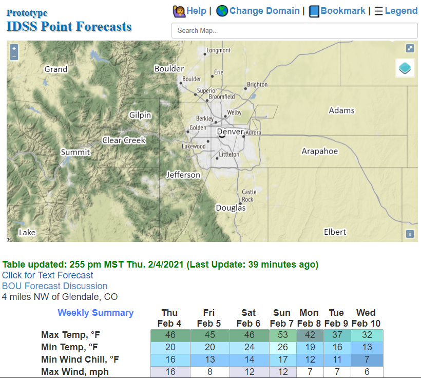
The Forecast Points interface allows you to zoom and click on your venue location, and produces tabular views of daily forecasts for the following week, as well as hourly forecasts and even trend graphs. Start here: https://go.usa.gov/xASw2 and navigate to your event location. Click the "bookmark" button to create a URL for your specific forecast point and save it for future use.
|
|
|
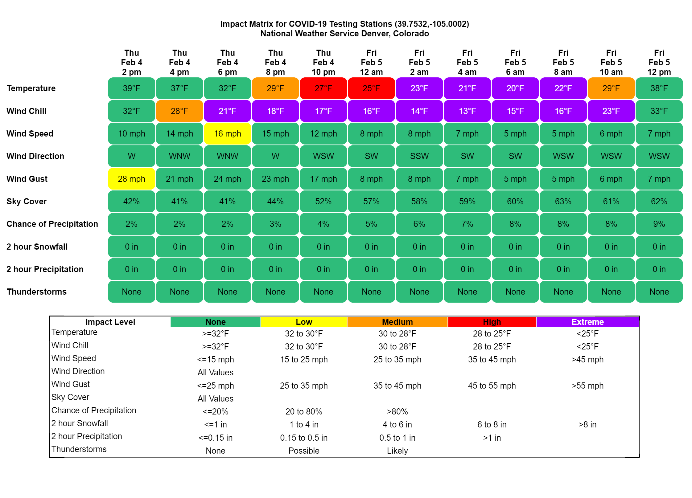
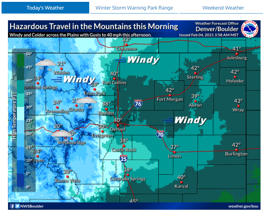
The Color Coded Weather Impact Matrix provides forecast information in a graphical table. Forecasts for a variety of weather elements are provided in two hour increments for the following 24 hours. The display is color coded to highlight more hazardous weather, such as hot temperatures or increasing chances for thunderstorm. Use the Save As Image button to create a .png version to include in planning documents or print and display. To use the graphic, you will need to know the latitude and longitude of your venue in decimal degrees. The example here is centered on Union Station in Denver. To create a plot for your location substitute in your latitude and longitude in the URL. Make sure to use decimal degrees and not degrees, minutes, seconds.
|
 |
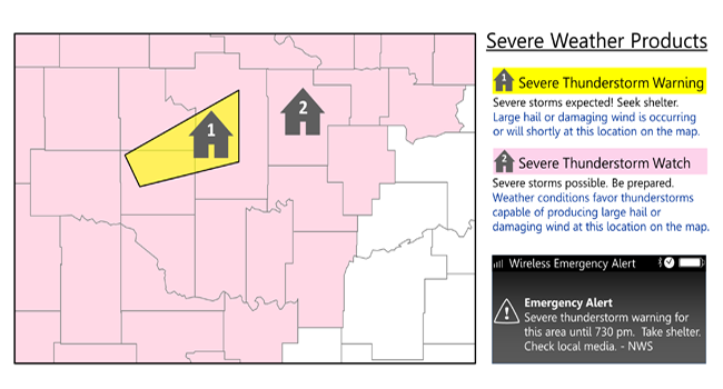
The NWS uses a variety of terms and language that may seem unfamiliar. For example do you know the difference between a Watch and a Warning? See below to help familiarize yourself with our terminology.
|
Outlook - describes hazardous weather possible in the coming days. Watch - More description of the hazardous weather threat. For winter storms, watches can be 1 to 3 days in advance. For summertime thunderstorms, a Severe Thunderstorm or Tornado Watch will be hours in advance. Both types of watches will describe the area and timing of hazardous weather in general terms. Warning - Hazardous weather is imminent. For winter storms, a Winter Storm Warning may be hours to a day in advance. For summertime thunderstorms, warnings of Severe Thunderstorms (hail larger than 1" or wind 58 mph or higher) or Tornadoes may be 15 minutes to an hour in advance. Note that in rapidly changing weather you may not receive a warning before hazardous weather strikes! Advisory - significant weather is imminent, but will remain below severe criteria for a warning. For winter weather an advisory may be for a few inches of snow that will cause slipper roads, and in the summer for heavy rainfall, small hail, or gusty winds up to 50 mph. For outdoor events, an Advisory should still trigger action. |
 |


 Follow us on YouTube