National Weather Service United States Department of Commerce

Snow in the Rockies; Showers and Thunderstorms Along the Gulf Coast; Potential Winter Storm for Northern Mid-Atlantic and Interior New England

A winter-like pattern will continue over much of the Lower 48 over the next few days, with snow stretching from the Rockies today into the Middle Mississippi Valley on Monday. Showers and thunderstorms will develop along the Gulf Coast and Southeast on Monday. As the storm moves northward late Monday into Tuesday, winter weather is possible from the Central Appalachians to Interior New England. Read More >

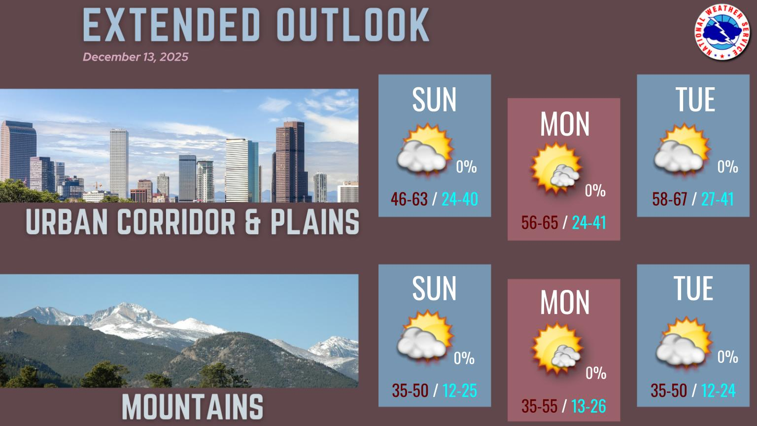
Snow will continue across the mountains tonight. Plan accordingly if headed to the high country, and be prepared for longer travel times and slick roads. On the plains and I-25 Corridor areas of mostly light snow or flurries will occur this evening. However, a couple briefly heavy bands will be possible, with the highest chance generally along and south of I-70. A couple spots could see at least 2 inches of snow, but most areas will only see a dusting to one half inch.
Travel impacts across the mountains tonight as another system brings snow to the high country. Another 2 to 5 inches are expected to accumulate across most of the higher elevations, and a Winter Weather Advisory is in effect through 5am Monday. Prepare for hazardous travel conditions across all mountain passes and the I-70 corridor.