Overview
|
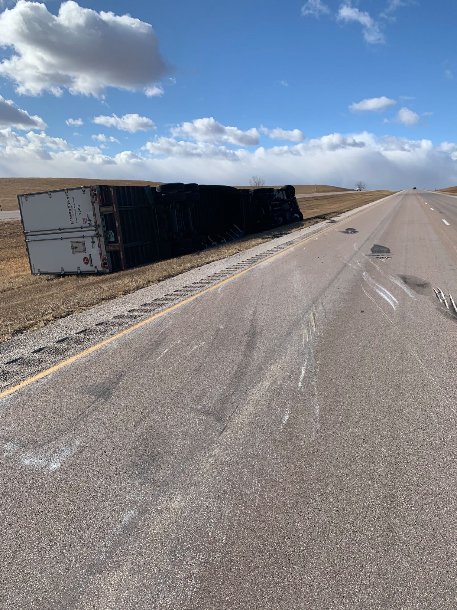
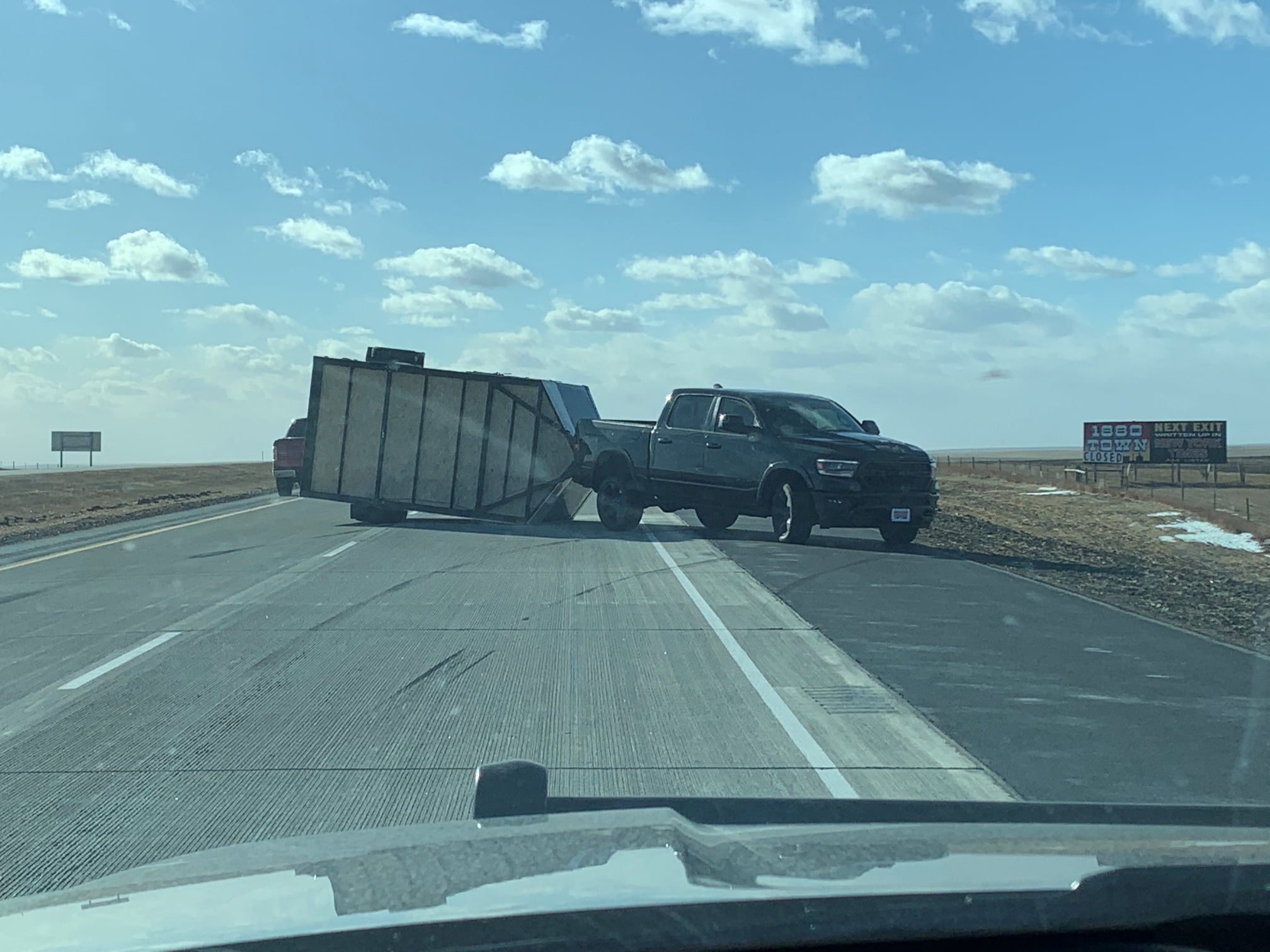
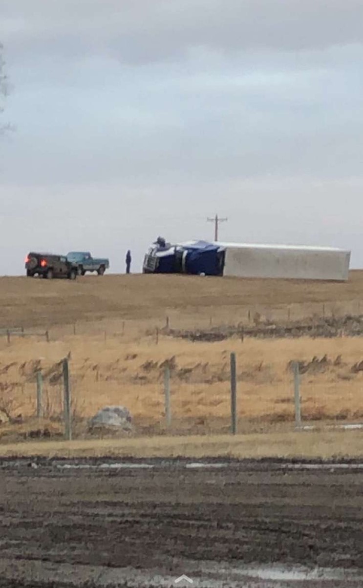
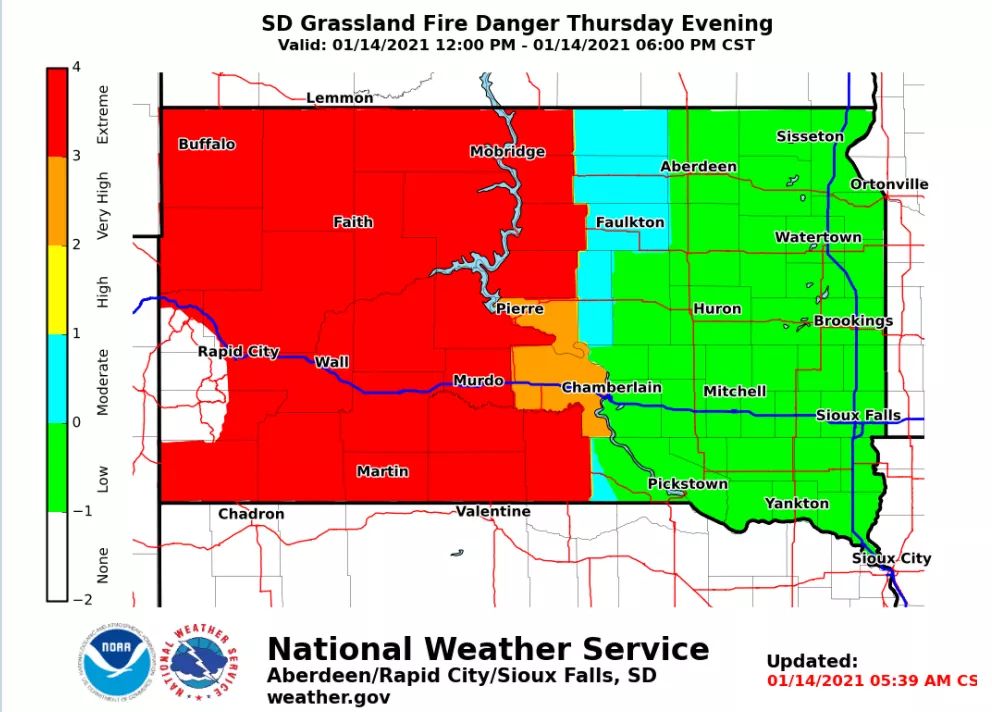
A strong area of Canadian low pressure dropped into the Northern Plains and then into Iowa from late Wednesday, January 13th into Friday, January 15th 2021. During this time, a variety of impactful weather occurred, driven largely by strong surface winds. Two separately-measured damaging wind gusts above 90 mph were recorded Wednesday evening, in the Bentley, North Dakota (north of Lemmon) and Buffalo, South Dakota areas, and wind gusts of 50 to 75 mph would go on to spread southeast across central and northeastern SD and west central MN Wednesday night, lasting unrelentingly through Friday afternoon. These winds were responsible for tipping numerous high-profile vehicles, as well as causing localized blowing dust. When combined with low relative humidity values across the snowless grasses of central South Dakota Thursday afternoon, conditions were ripe for wildfires. Several did occur, including just north of Pierre and in the Lemmon area, spreading into the night in some cases. Finally, while temperatures were too warm initially (a band of rain moved across the area Wednesday evening and night), a trace to locally 4” of snow accumulated Thursday into Friday across eastern South Dakota and west central Minnesota. Blizzard conditions were reported, and I-29 closed from 10pm Thursday into Friday morning from the North Dakota/South Dakota border to Iowa. |
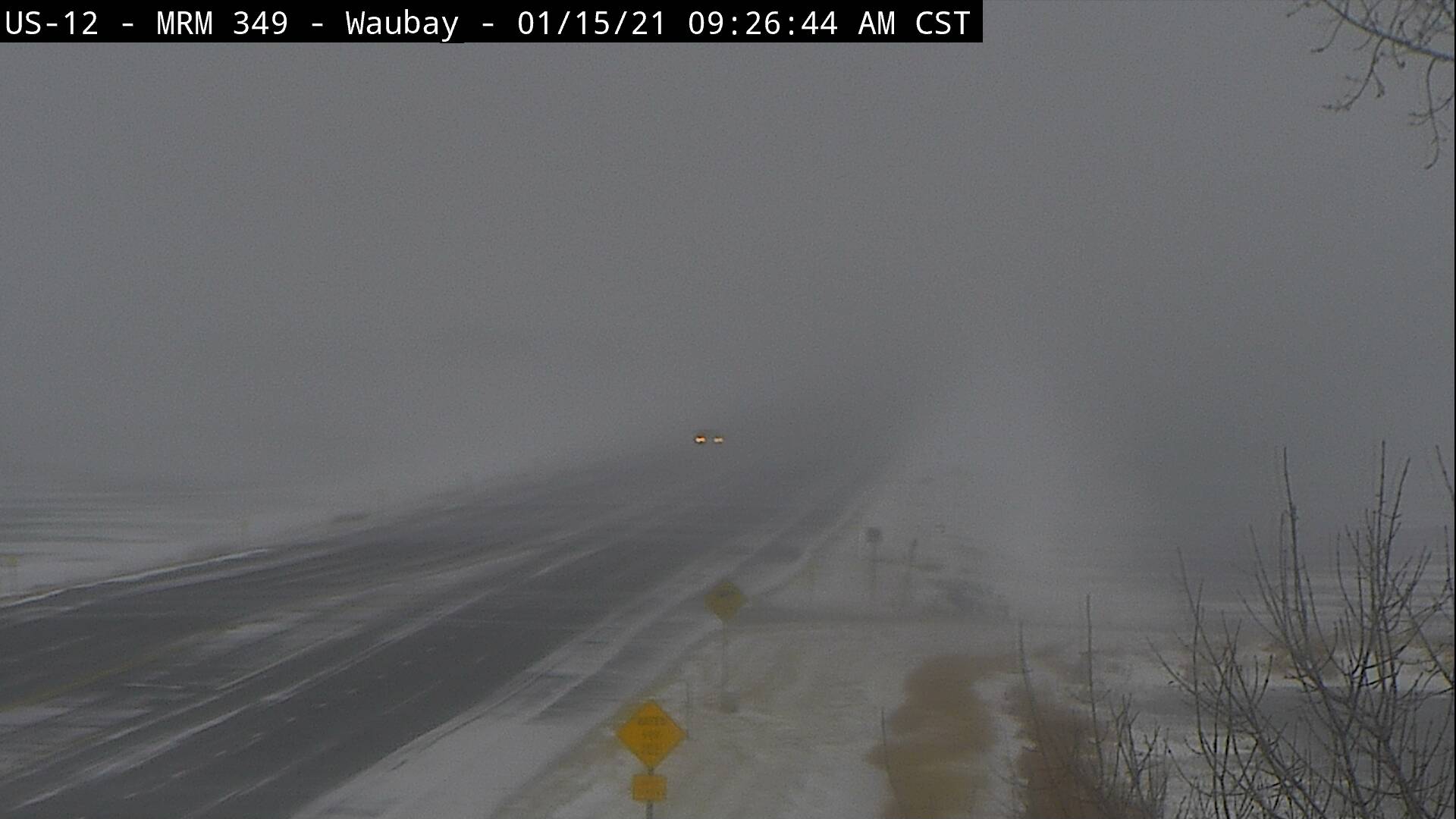
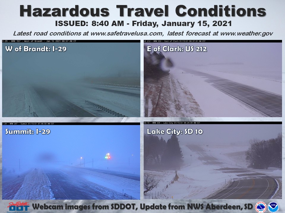 Friday, January 15, 2021: Travel conditions were hazardous across northeast South Dakota. Webcam images courtesy of the South Dakota Department of Transportation (SD DOT). |
Photos & Video
 |
 |
 |
 |
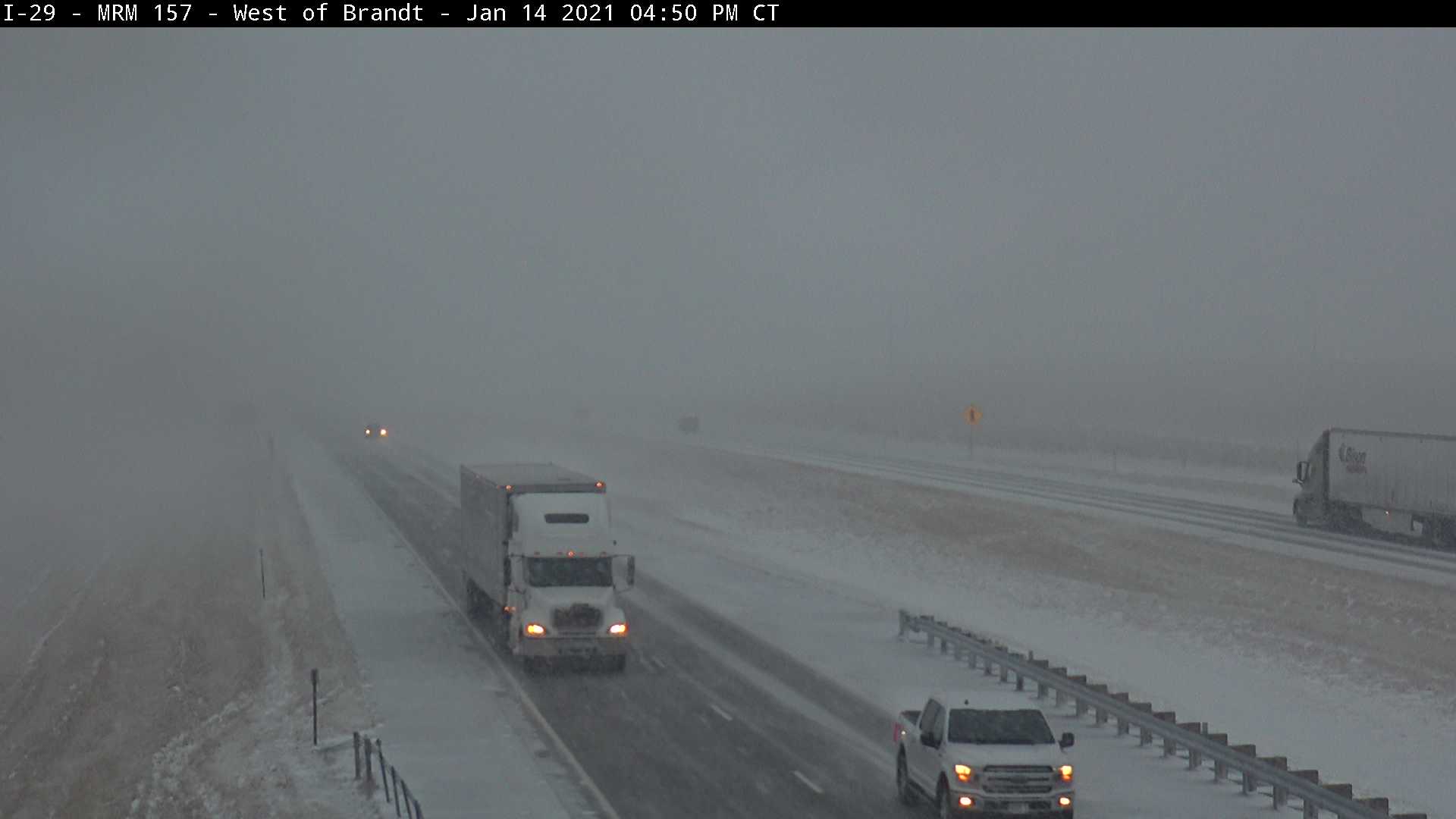
| SDDOT Webcam on I-29 near Brandt, SD at 4:50 PM on 1/14/2021 (SDDOT) |
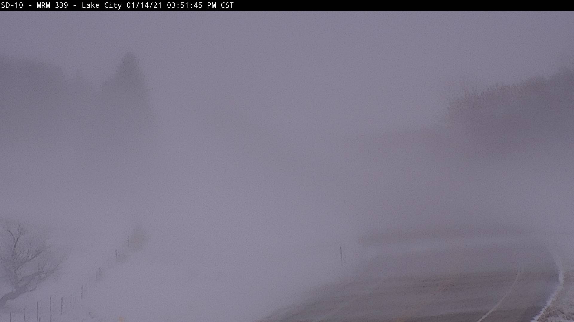
SDDOT Webcam on SD-10 near Lake City, SD at 3:51 PM on 1/14/2021 (SDDOT) |
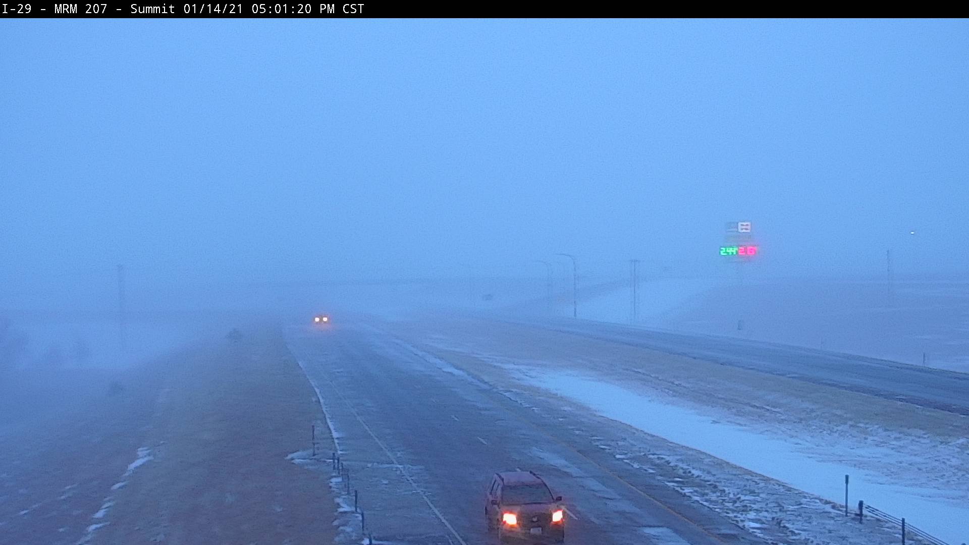
SDDOT Webcam on I-29 near Summit, SD at 5:01 PM on 1/14/2021 (SDDOT) | SDDOT Webcam on US-12 near Waubay, SD at 9:26 AM on 1/15/2021 (SDDOT) |
 |
 |
 |
.jpg) |
| High profile vehicles rolled over due to high winds. Photo courtesy of the South Dakota Highway Patrol. | High profile vehicles rolled over due to high winds. Photo courtesy of the South Dakota Highway Patrol. | High profile vehicles rolled over due to high winds. Photo courtesy of Hand County Emergency Management. | A car slid off I-29 due to icy roads and low visibility. Photo courtesy of the South Dakota Highway Patrol. |
 |
 |
 |
 |
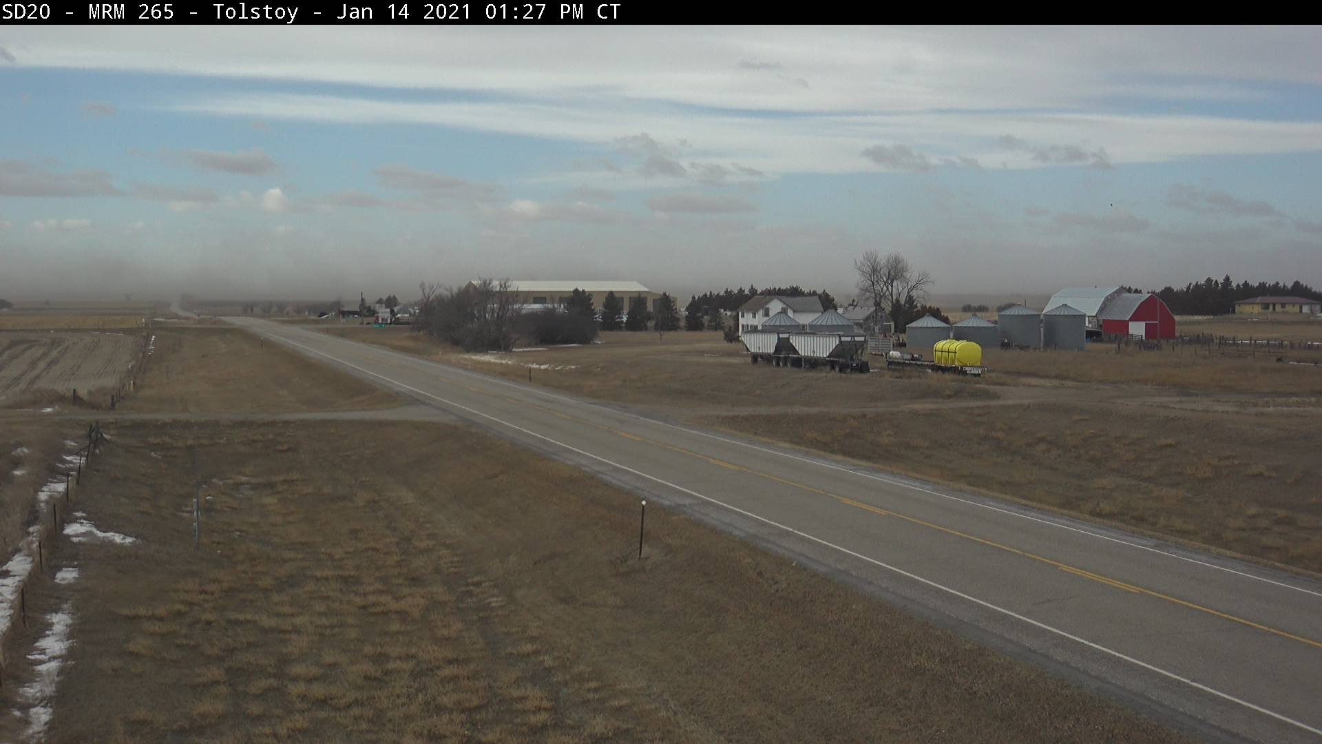
| Blowing dust near Tolstoy. SDDOT Webcam at 1:27 PM CT on 1/14/2021. (SDDOT) |
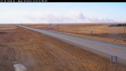
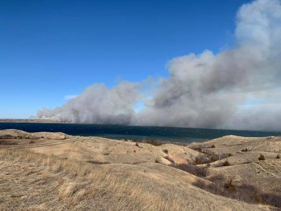
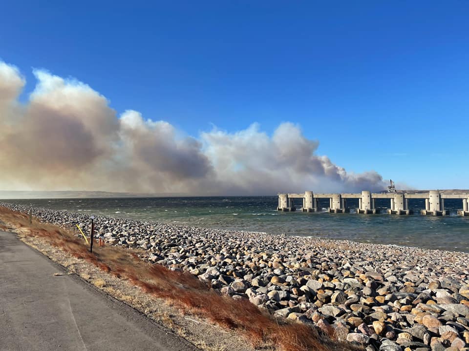
Smoke from large wildfire northwest of Pierre, SD. SD DOT Webcam at the JCT US-14/83 near Blunt at 12:33 PM CT on 1/14/2021. (SD DOT) | Smoke from large wildfire northwest of Pierre, SD. Photo courtesy of the South Dakota Highway Patrol. | Smoke from large wildfire northwest of Pierre, SD. Photo courtesy of the South Dakota Highway Patrol. |
 |
|||
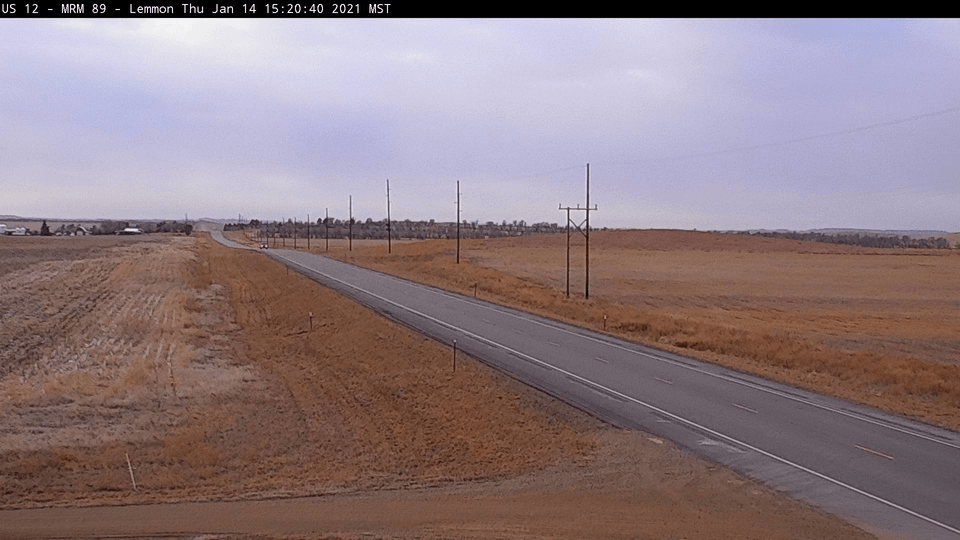
| Large wildfire in the Lemmon area, as seen via the SD DOT Webcam from 3:20pm to 9:50pm on the 14th |
 |
 |
 |
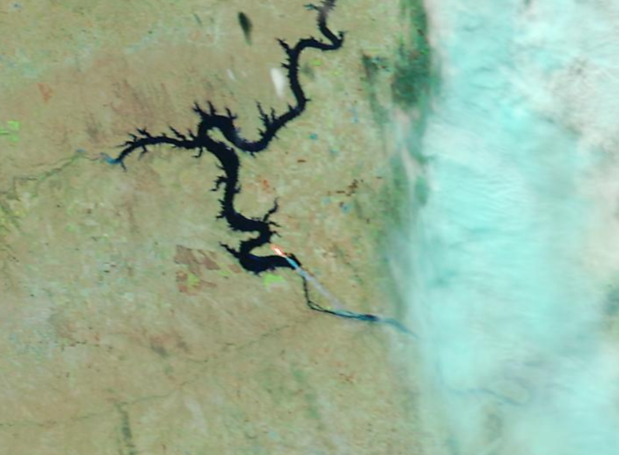 |
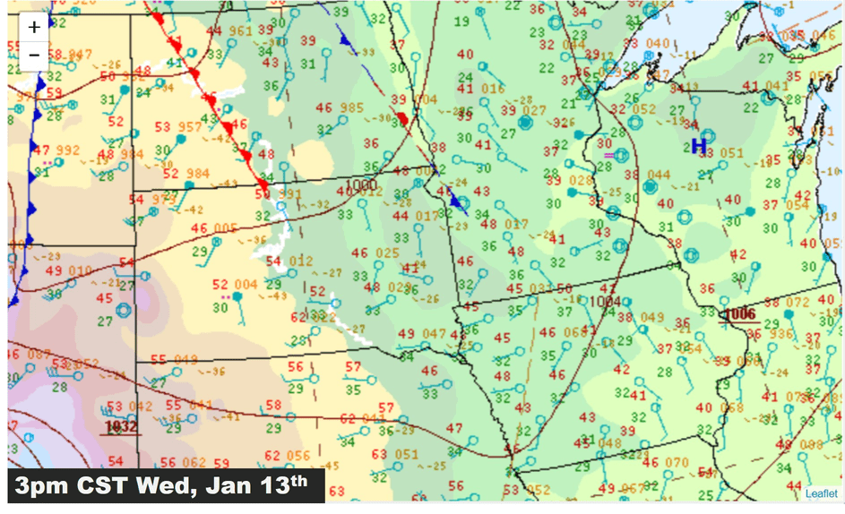
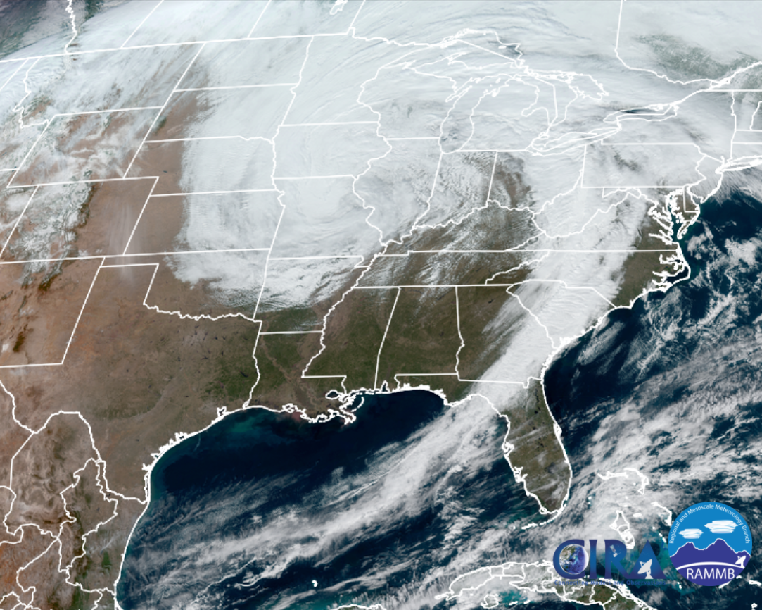
| Surface pressure pattern from 3 pm January 13 to 9 am January 15 | GOES16 GeoColor image showing wide expanse of the winter system as of noon on Friday, Jan 15th | Extreme fire danger was forecast due to lack of snow cover, dry/dead fuels, low relative humidity and high winds. Several wild fires were reported across the region. | MODIS False Color Satellite image of a fire northwest of Pierre, SD during the afternoon hours of Thursday, January 14, 2021 |
| Radar Reflectivity and approximate precipitation type from 3pm Wed, Jan 13 through 3pm Fri, Jan 15 |
Storm Reports
 |
 |
|
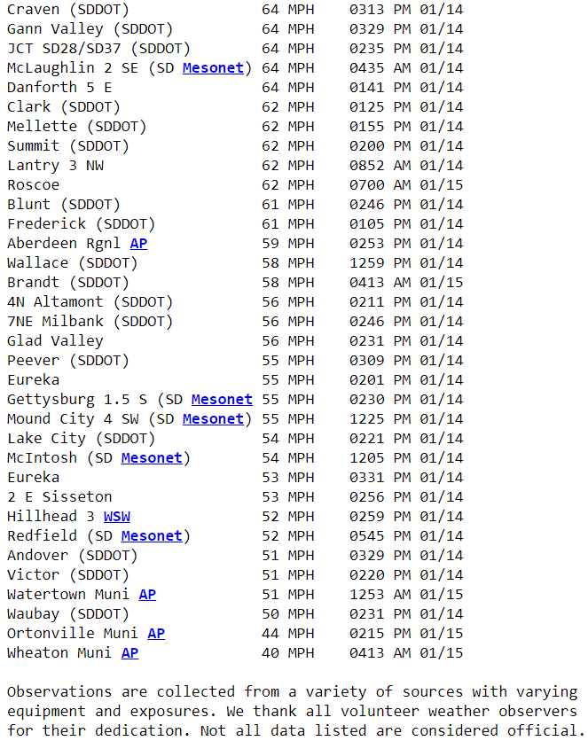 |
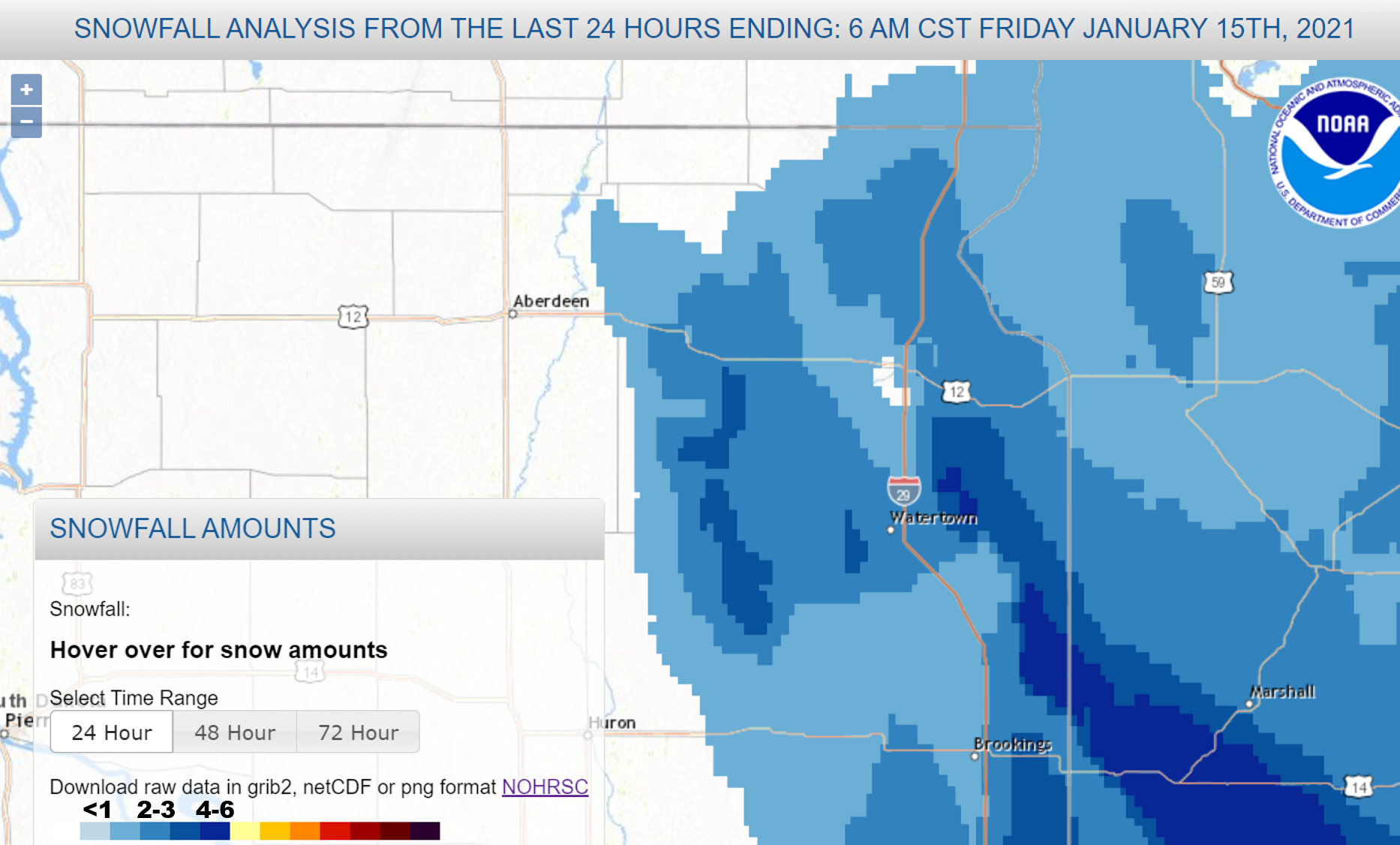
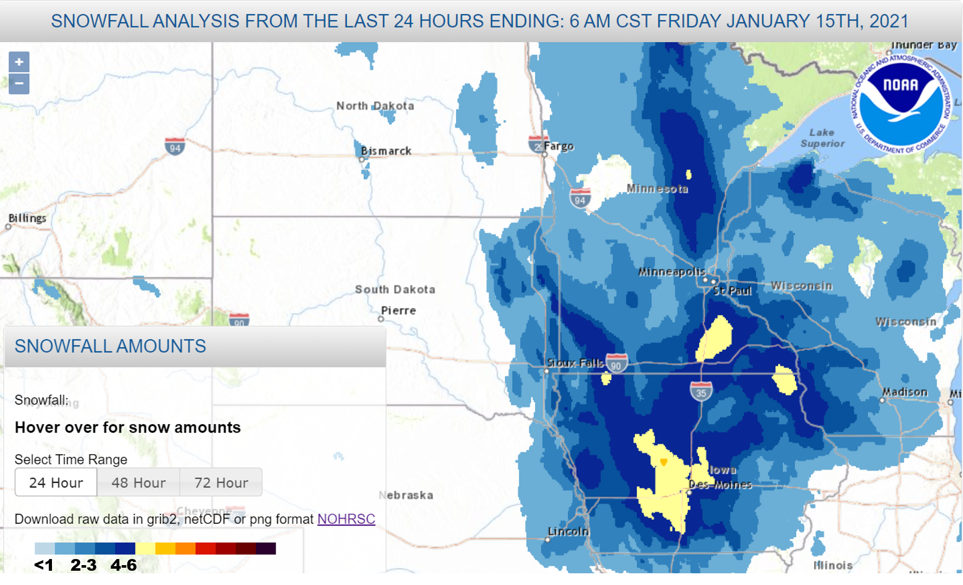
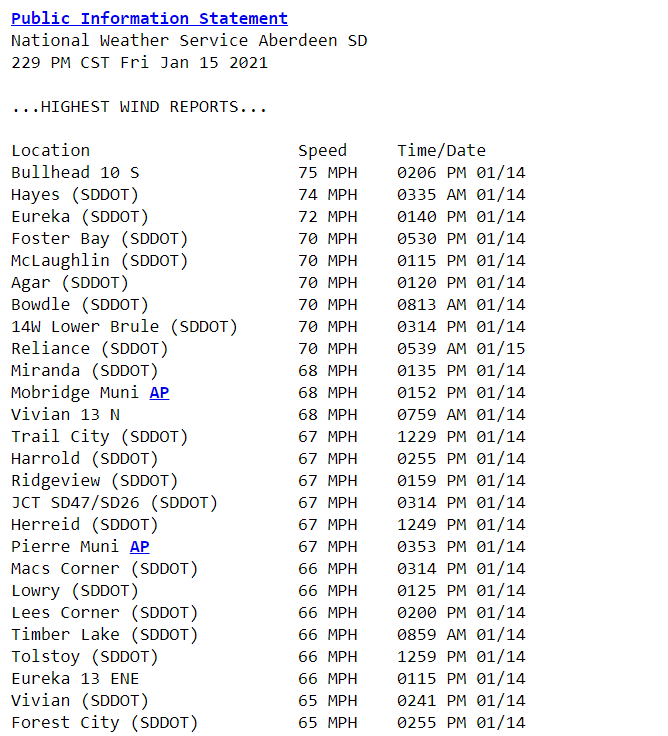
| Snowfall reports across northeast South Dakota and west central MN | Snowfall reports across the region | Peak wind gusts recorded on January 14 & 15 | Continued...Peak wind gusts recorded on January 14 & 15 |
 |
|
 |
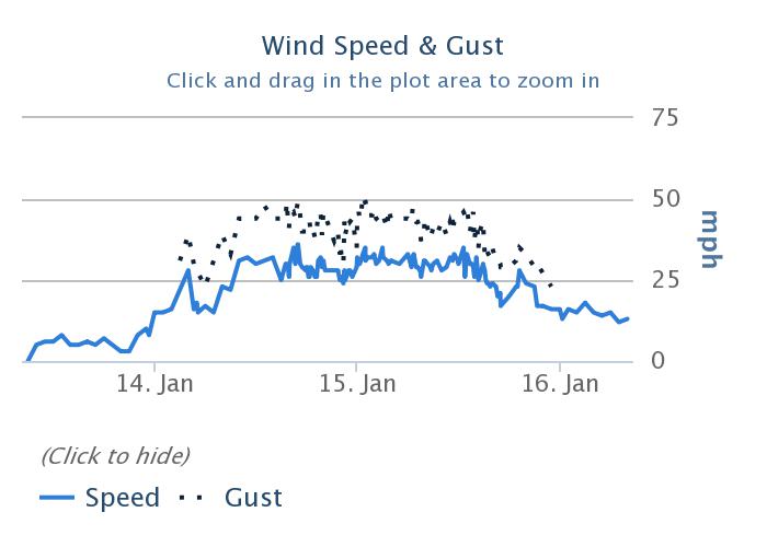 |
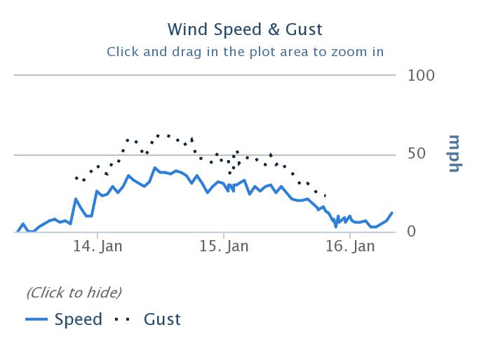
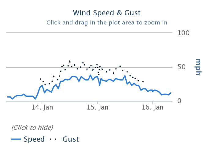
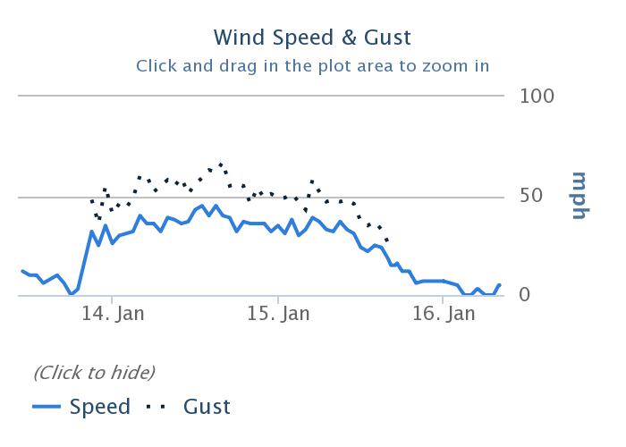
| KMBG Wind Graph - January 14 & 15 | KPIR Wind Graph - January 14 & 15 | KABR Wind Graph - January 14 & 15 | KATY Wind Graph - January 14 & 15 |
 |
Media use of NWS Web News Stories is encouraged! Please acknowledge the NWS as the source of any news information accessed from this site. |
|


 Follow us on YouTube