Bakerhill Tornado - February 17, 2008
|
Rating:
(Click for EF Scale) |
EF-0
|
|
Maximum Wind:
|
75 mph
|
|
Injuries/Fatalities:
|
None
|
|
Path Length:
|
0.4 miles
|
|
Maximum Path Width:
|
300 Yards
|
|
Start:
|
31.74/-85.29 at 438 PM
|
|
End:
|
31.75/-85.29 at 438 PM
|
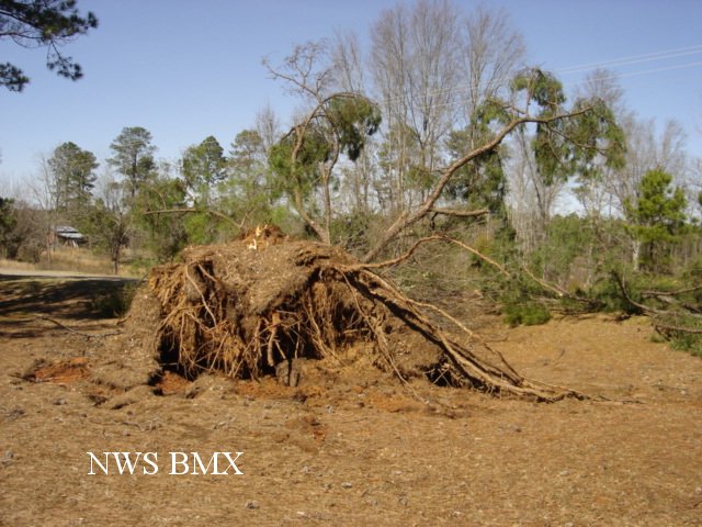
A National Weather Service Survey Team has assessed additional damage in southeastern Barbour County and determined it was the result of a tornado ranking EF-0 on the Enhanced Fujita Scale...with estimated winds up to 75 mph. The path length was one-half mile long and 300 yards wide at its widest point. The tornado touched down near Eubanks Road (also known as County Road 12) where it destroyed a barn, tore shingles off a roof, uprooted a large pine tree and damaged a tin roof. It then tracked northeast along County Road 79 before lifting near the intersection of County Road 79 South and Highway 18. Along the path several trees were uprooted or snapped and several road signs sustained minor damage. This damage occurred at approximately 438 pm. A Severe Thunderstorm Warning was in effect from 410 pm until 515 pm. A TornadoWarning was in effect from 405 pm until 445 pm. No injuries were reported.
|
|
||||||||||||||||||


 Follow us on YouTube