National Weather Service United States Department of Commerce

Brook Highland/Greystone Legacy Tornado - Shelby County
May 3, 2009


EF-0
Estimated Maximum Wind:
75-85 mph
Injuries/Fatalities:
None
Damage Path Length:
2.61 miles
Maximum Path Width:
200 yards
Approximate Start Point/Time:
33.4372/-86.6758
at 154 pm
Approximate End Point/Time:
33.4510/-86.6338
at 157 pm

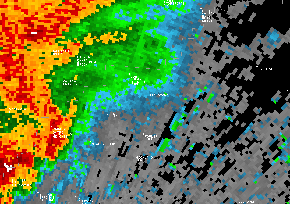
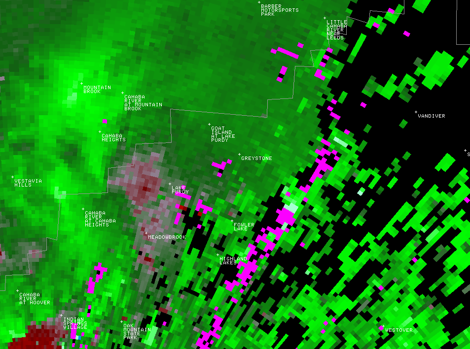
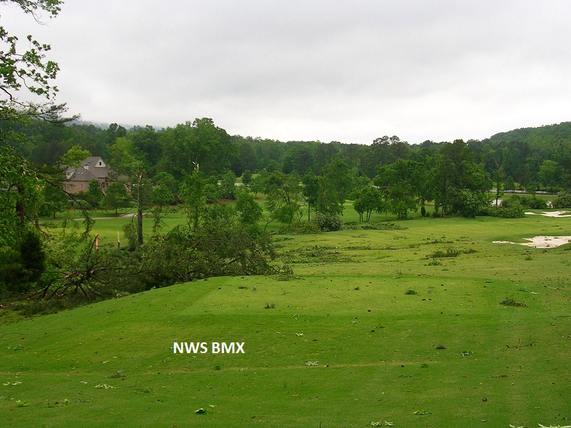
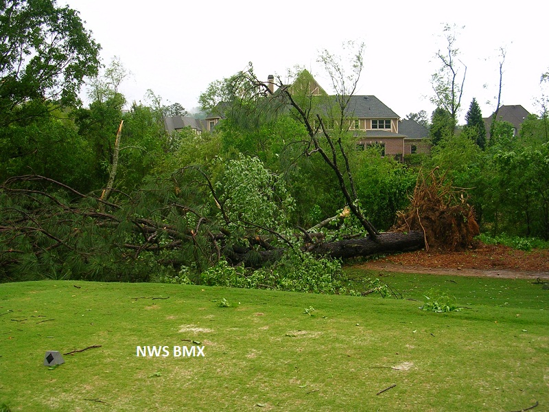
A National Weather Service Damage Assessment Team has surveyed the storm damage in ShelbyCounty. It has been determined the damage was the result of a tornado. The tornado has been rated an EF-0 on the Enhanced Fujita Scale. Damage estimates were consistent with winds between 75 and 85 mph.

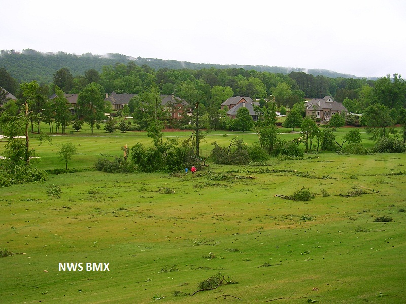
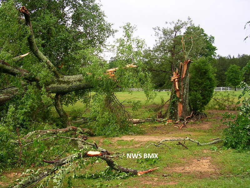
Numerous trees were uprooted along the path. At least 20 homes suffered minor roof damage mainly the loss of shingles. Damage was reported on Ashington Drive, Ashington Circle, Cannock Drive, Brook Highland Drive, Wingfield Drive, and Kesteven Drive in the Brook Highland subdivision. In addition, the tornado crossed Highway 119 and entered into the Greystone Legacy community. Damage was limited to trees uprooted and snapped on the golf course. The course was closed for a day due to clean up.


Reflectivity


Velocity
The top image is a KBMX 0.5 degree reflectivity loop. The bottom image is a KBMX 0.5 degree storm relative velocity loop. The green indicates wind blowing toward the radar while red indicates wind blowing away from the radar. Notice the brief gate to gate rotation near Greystone as the tornado was on the ground. The reflectivity data suggests this tornado was produced by a supercell in Jefferson County with the Hook Echo extending into Shelby County.

 
5/3
Greystone Tree Damage
5/3
Greystone Tree Damage
5/3
Debris
5/3
Tree Uprooted