National Weather Service United States Department of Commerce

Blount County Tornadoes - September 22, 2006


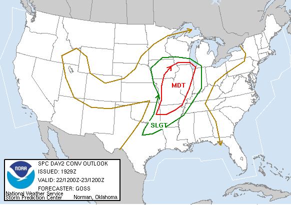
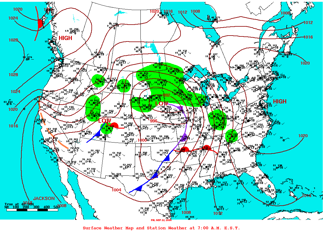
A warm front moved northward across Central Alabama during the afternoon and early evening hours on September 22, 2006. The combination of abnormally warm afternoon temperatures, a moist tropical-like atmosphere, instability, wind shear and a surface focusing mechanism produced rotating storms and a few tornadoes. Only a few reports of large hail, wind damage or funnel clouds were received outside of Blount County on this day.

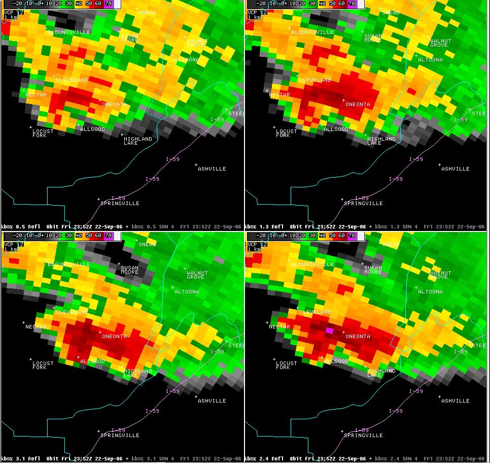
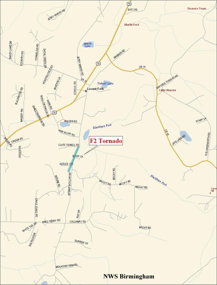
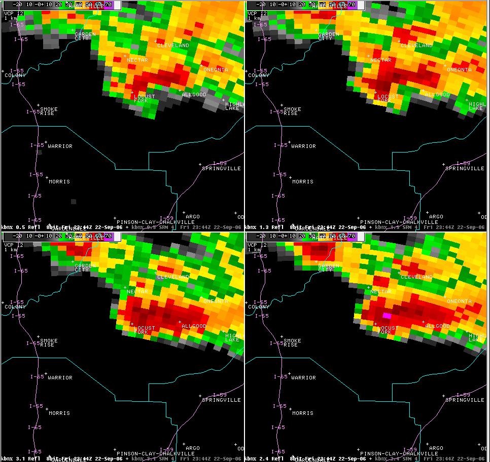
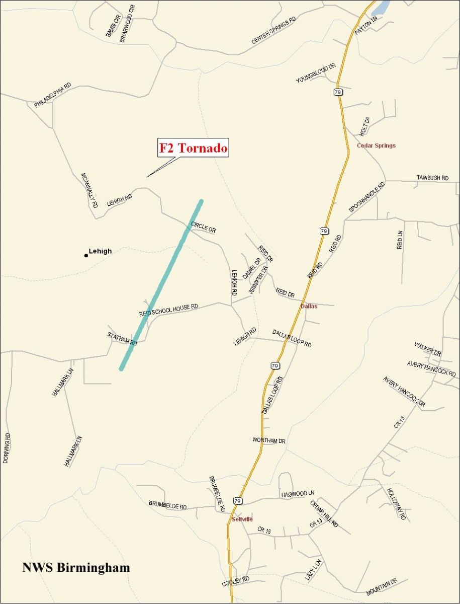
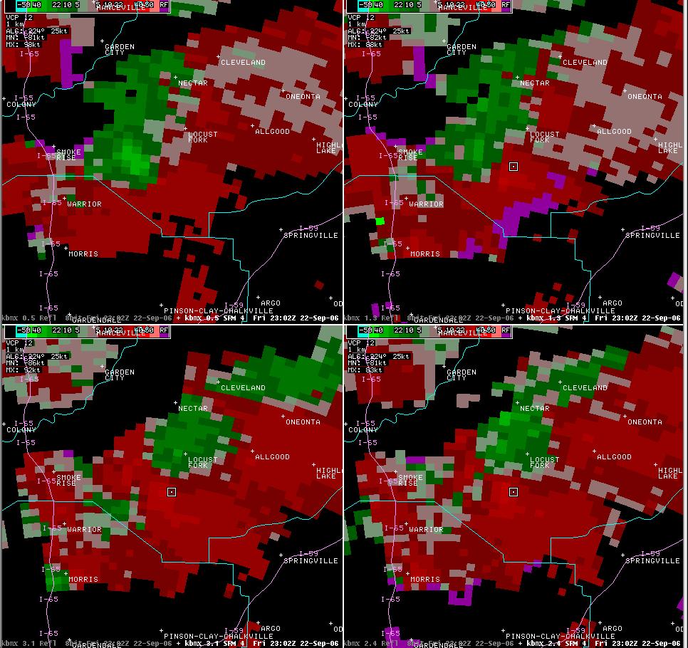
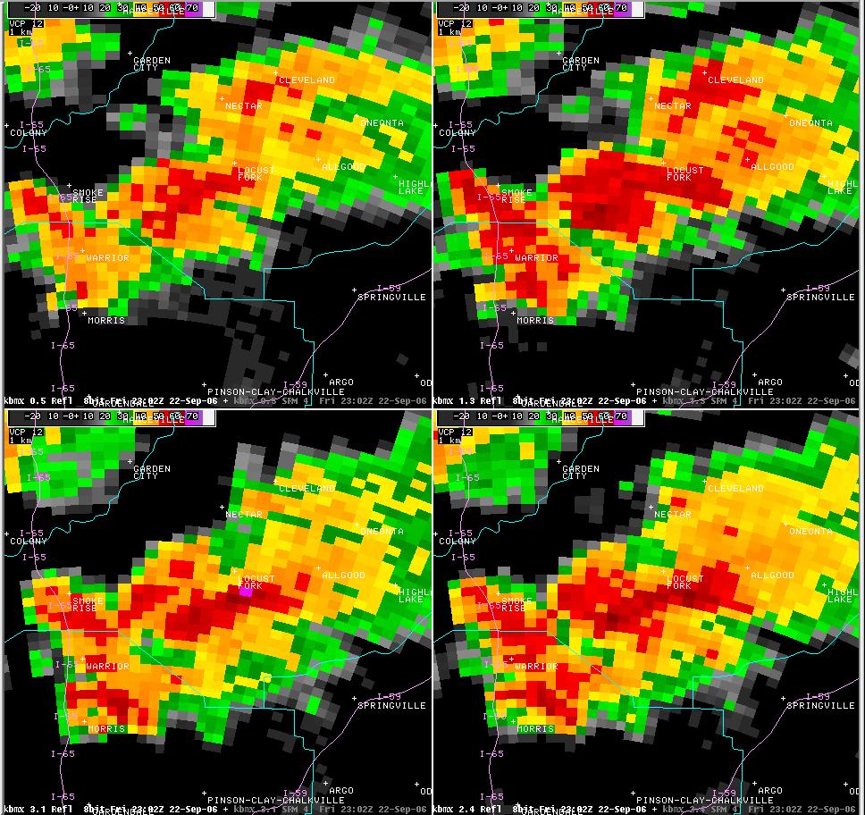
National Weather Service meteorologists surveyed the storm damage that affected Blount County. It has been determined that the damage was the result of a three distinct tornadoes. The tornadoes have all been rated as F2 on the Fujita Damage Intensity Scale.

Three people suffered injuries as the tornado hit. All of these people were in Oneonta. At least 51 homes were damaged and 3 were totally destroyed. Numerous other structures sustained damage as the tornadoes touched down. The Blount County Courthouse and Oneonta High School suffered damage. Numerous trees and power lines were blown down along the damage paths.

Special thanks go out to Max Armstrong, Director of the Blount County Emergency Management, and to Bobby Rollins, Deputy State Fire Marshall, for their assistance in conducting the NWS Storm Surveys. Additional recognition goes out to the Birmingham Area Television Media for sending storm related photos and communicating real-time reports.

Watches/Warnings:

Tornado Watch Number 789 was in effect from 213 pm CDT until 700 pm CDT.

Tornado or Severe Thunderstorm Warnings were in effect for Blount County from approximately 430 pm until 800 pm.


Oneonta Tornado: 652 pm CDT - 700 pm CDT
See Storm Related Photos...Here

The Oneonta Tornado touched down just southwest of the Allgood community, north of Highway 75. The tornado tracked northeastward remaining north of Highway 75 through its entire lifecycle. The tornado dissipated in Oneonta just north of the Blount County Courthouse near 7th Street. The Blount County Courthouse sustained roof damage and many flagpoles were broken down. Numerous trees and power lines were blown down along the tornado path. Oneonta High School suffered significant damage to its football field press box and two consession stands were destroyed. The high school structure also sustained roof damage. Several homes and out-buildings received major damage and a local gas station had its canopy blown off. Three people were injured as the tornado moved through, one seriously. The tornado damage path was approximately 4.4 miles long and 200 yards wide at its widest point. This tornado was rated and F2 on the Fujita Damage Intensity Scale.

Oneonta Damage Path
Tornado Damage Path 

Storm Relative Velocity Image with tight couplet 

Reflectivity Image...notice the hook  
 

Locust Fork Tornado: 640 pm CDT
See Storm Related Photos...Here

The Locust Fork Tornado briefly touched down along Spunky Hollow Road near Azzilee Circle. This location is just south of Locust Fork. A substantial workshop structure collapsed due to wall failure. The entire roof was removed and pushed off. A home under construction was completely destroyed. One home displayed the classic signature of rotation as leaves and grass were stuck to three sides of the building. Several other homes suffered roof and shingle damage. Several trees were knocked down along the path. The tornado damage path was approximately 1/4 of a mile long and 200 yards wide at its widest point.

Locust Fork Damage Path
Tornado Damage Path 

Storm Relative Velocity Image with rotation 

Reflectivity Image...notice appendage and inflow
 

Lehigh Tornado: 602-603 pm CDT
See Storm Related Photos...Here

The Lehigh Tornado touched down between the Lehigh Community and Highway 79. This location is between Locust Fork and the Blount Jefferson County Line. One mobile home and one barn were completely destroyed. Two automobiles and one motorcycle were lifted from inside a barn and thrown at least 50 yards. Numerous trees and power lines were blown down along the tornado damage path. The tornado damage path was approximately 1.3 miles long and 100 yards wide at its widest point.

Lehigh Damage Path
Tornado Damage Path 

Storm Relative Velocity Image with much
weaker rotation than the other storms 

Reflectivity Image near time of tornado
 
Severe Weather Episode Data 

Day 2 Convective Outlook 

Day 1 Convective Outlook 

7 am Surface Analysis September 22 

7 am 500 mb Analysis September 22 

Storm Reports September 22