|
Tornadoes of November 17, 2014
|
|
A surface low intensified as it moved from southwest to northeast across Central Alabama during the overnight hours Sunday, November 16th, and into early morning hours on Monday, November 17th. As it did so, moist, unstable air surged northward to the east of the low across the Interstate 85 corridor. Severe thunderstorms developed in the warm sector and produced a few weak tornadoes, which caused tree and power line damage across portions of rural Perry, Pike, Bullock and Russell Counties.
|
|
|
EF-1
|
|
Estimated Maximum Wind:
|
100 mph
|
|
Injuries/Fatalities:
|
None |
|
Damage Path Length:
|
3.5 miles
|
|
Maximum Path Width:
|
300 yards
|
|
Approximate Start Point/Time:
|
32.6990/-87.4659 at 111 am
|
|
Approximate End Point/Time:
|
32.7309/-87.4184 at 115 am
|
|
|
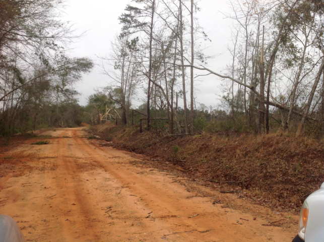
The tornado first touched down a few hundred yards west of Boots Northcutt Road, north of Alabama Hwy 14 in western Perry County. As it crossed the road to the east, the tornado tossed numerous unsecured objects around a home and into the woods, where a few hardwood trees were snapped. The tornado tracked to the northeast across inaccessible land, then crossed Lower Polecat Road. Numerous hardwood and softwood trees were snapped and tossed into an open field, and a few hardwoods at the opposite edge of the field were uprooted. The tornado crossed more inaccessible land and weakened as it crossed County Road 23, then quickly dissipated.
|
|

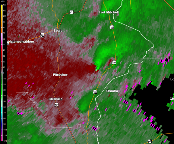
This is an image of the 0.5 degree reflectivity data from KBMX at 112 am as the tornado crossed Lower Polecat Road, just north of AL Hwy 14.
Click to enlarge.
|

This is an image of the 0.5 degree velocity data from KBMX at 112 am as the tornado crossed Lower Polecat Road, just north of AL Hwy 14.
Click to enlarge.
|
|
Storm Damage Images - Click to Enlarge
|
|
Damage
|
Tree damage
|
|
|
EF-1
|
|
Estimated Maximum Wind:
|
90 mph
|
|
Injuries/Fatalities:
|
None |
|
Damage Path Length:
|
24.7 miles
|
|
Maximum Path Width:
|
500 yards
|
|
Approximate Start Point/Time:
|
31.8436/-86.1844 at 445 am
|
|
Approximate End Point/Time:
|
32.0023/-85.8105 at 517 am
|
|
|
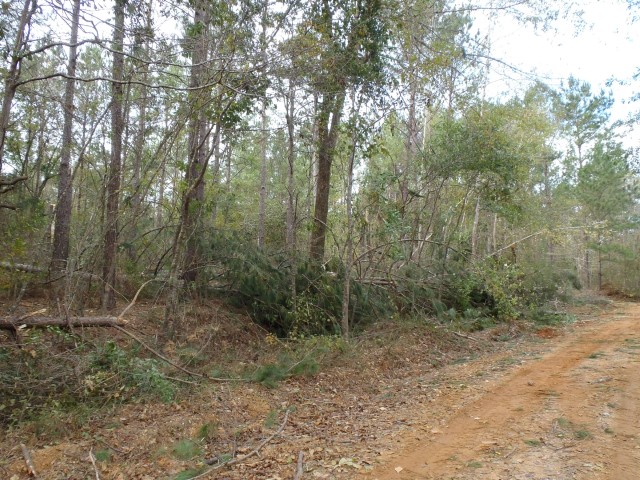
This tornado is a continuation from the track surveyed in Crenshaw County by the Mobile National Weather Service Forecast Office. The tornado continued into Pike County crossing County Road 1160 where numerous hard and softwood trees sustained damage. Most of the damage observed was sheared tree tops and large broken branches. From there, the damage path continued northeast across the northern portion of the county where the most significant and widespread damage occurred along County Road 1139. Several trees were snapped about half way up and several trees were also uprooted. The maximum width was also measured at this location. The tornado continued northeast crossing several more county roads and Highway 231. Tree damage was minor and sporadic for much of the rest of the path, with mainly large tree branches and limbs down. The tornado lifted as it crossed into Bullock County along County Roads 15 and 8, near Stills Crossroads.
|
|
|

This is an image of the 0.5 degree reflectivity data from KMXX at 452 am as the tornado passed just east of the Ansley community in Pike County.
Click to enlarge.
|

This is an image of the 0.5 degree velocity data from KMXX at 452 am as the tornado passed just east of the Ansley community in Pike County.
Click to enlarge.
|
|
Storm Damage Images - Click to Enlarge
|
|
Tree damage
|

Tree damage
|
|
|
EF-1
|
|
Estimated Maximum Wind:
|
90 mph
|
|
Injuries/Fatalities:
|
None |
|
Damage Path Length:
|
0.25 miles
|
|
Maximum Path Width:
|
100 yards
|
|
Approximate Start Point/Time:
|
32.1990/-85.0592 at 624 am
|
|
Approximate End Point/Time:
|
32.2011/-85.0564 at 625 am
|
|
|
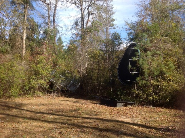
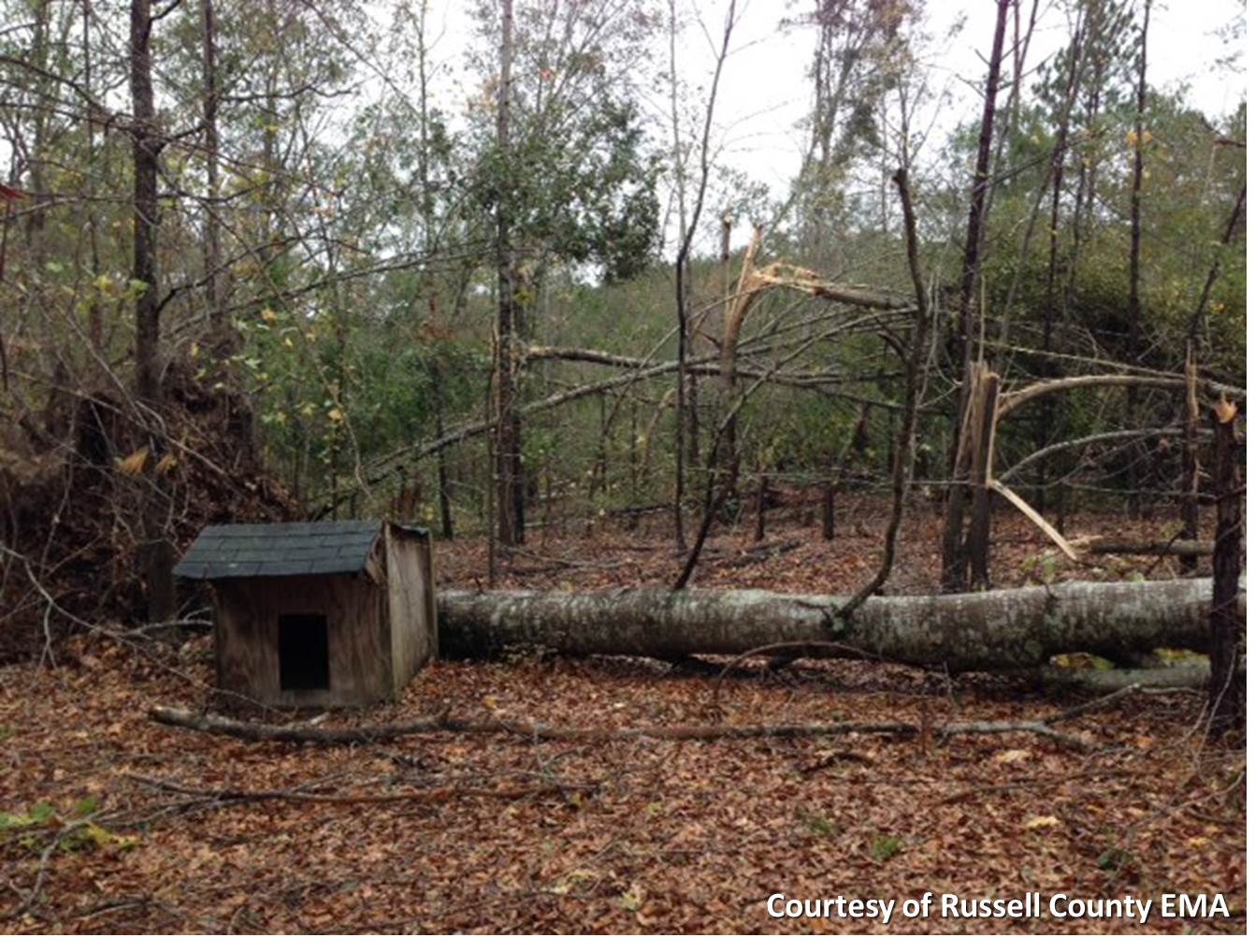
This brief tornado touched down just south of Firetower Road, then crossed the road and dissipated quickly just to the north. Damage was limited to mainly minor tree damage. However, one concentrated area at the center of the path had a grove of small to medium hardwood trees that were snapped. One larger hardwood was uprooted in the same location. Power lines were also knocked down along Firetower Road.
Special thanks to the Russell County Emergency Management Agency for assisting in the completion of the storm survey.
|
|

This is an image of the 0.5 degree reflectivity data from KMXX at 624 am as the weak tornado crossed Fire Tower Road just west of AL Hwy 165.
Click to enlarge.
|
This is an image of the 0.5 degree velocity data from KMXX at 624 am as the weak tornado crossed Fire Tower Road just west of AL Hwy 165.
Click to enlarge.
|
|
Storm Damage Images - Click to Enlarge
|
|
Tree damage
|

Tree damage
|
|
Although most of the severe weather was confined to southern Alabama on the 17th, heavy rainfall was also a factor for locations along the Interstate 20 corridor. 4 to 6 inches of rainfall fell in a heavy band that developed on the night of the 16th, and continued through much of the morning of the 17th.
|
|


 Follow us on YouTube