Overview
|
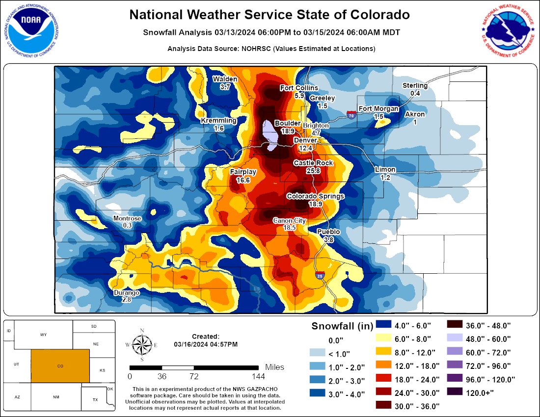
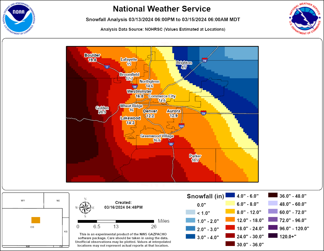
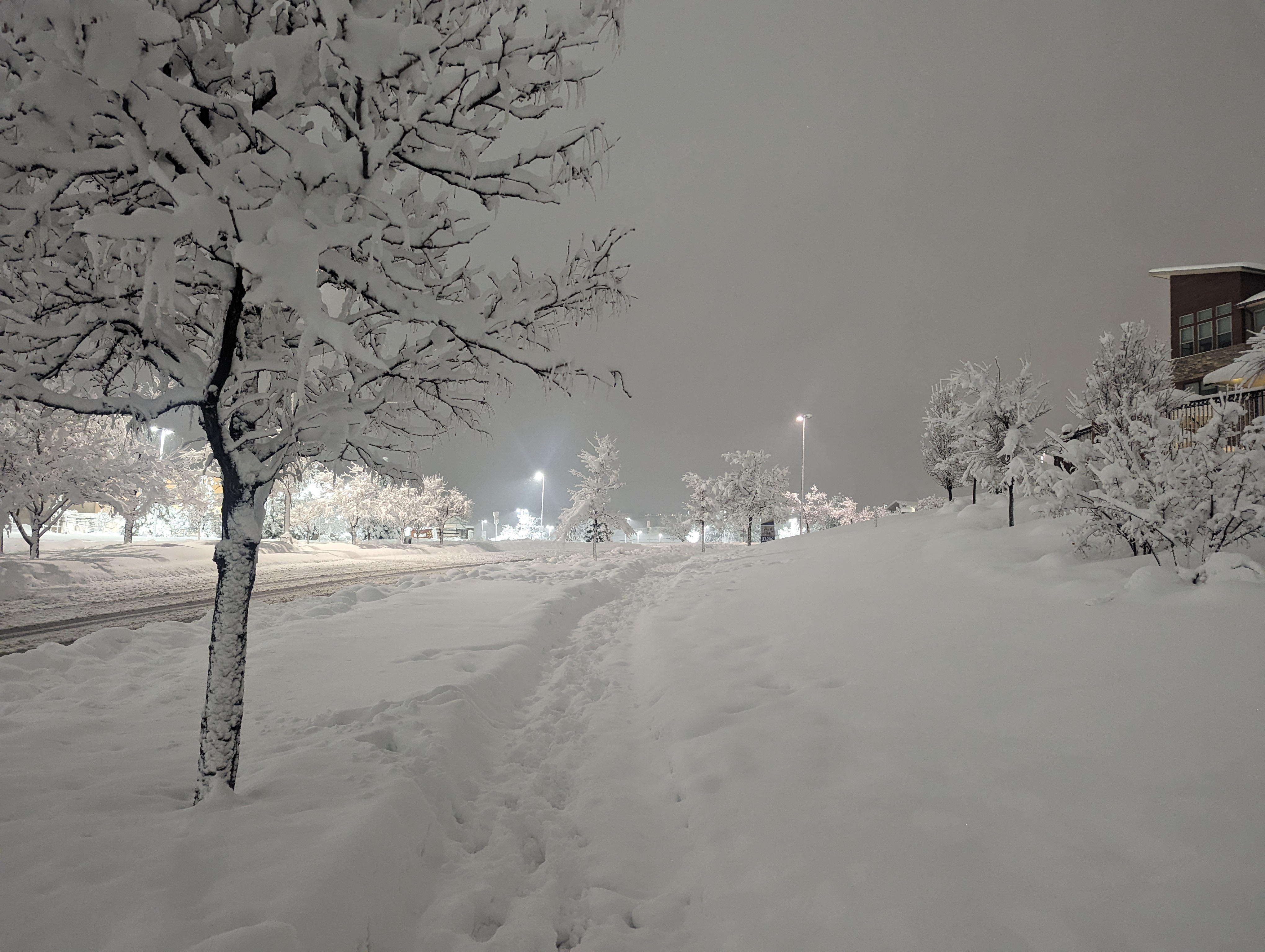
A powerful winter storm struck the Front Range of Colorado March 13th and 14th, 2024, producing extremely heavy snowfall, difficult if not impossible travel conditions, and scattered power outages. While precipitation started in the form of snow in the mountains and foothills on Wednesday, March 13, it started as rain across the I-25 Corridor and plains. That rain mixed with and changed to a heavy, wet snow across the Denver and Boulder metro areas during the late evening of the 13th. However, areas roughly along and east of a line from Fort Collins to Denver International Airport remained mostly rain or a rain snow mix until the early morning hours of Thursday, March 14th. Some locations farther east like Greeley, Fort Morgan, and Limon didn’t changeover until late on the 14th. Total precipitation amounts in those areas and farther east across the plains were also much lighter. While there was a slight lull in the storm and snowfall rates Thursday morning, snowfall rates increased again during the afternoon and early evening hours of the 14th. Finally, snow tapered off during the late evening and overnight hours, and ended in the early morning of Friday, March 15th. Difficult to impossible travel conditions started in the foothills shortly after the onset of heavy snow on the 13th. I-70 was closed, and dozens of vehicles became stuck and/or were abandoned. The depth of snow became so great that travel became impossible on unplowed roads for even high clearance or four-wheel drive vehicles. Some residents in the foothills were trapped for days in their homes. Also, numerous tree limbs snapped under the weight of snow, leading to scattered power outages. An estimated 113,000 customers were without power at some point during the storm, and that was before trees had even begun to leaf out for the spring! An estimated 800 flights were cancelled at DIA leading up to the snow, although fortunately the heaviest accumulations and impacts stayed just west of the airport. Widespread school closures occurred both Thursday and Friday from the Denver metro area into the foothills. Storm total snow accumulations in the feet were observed across the foothills and east facing slopes of the Front Range mountains. Most areas above 6,000 feet westward to the crest of the Front Range (Medicine Bow Range, Rocky Mountain National Park, Indian Peaks and Mosquito Range) saw at least two feet of snow, while most of the foothills from Estes Park southward through Boulder, Gilpin, Clear Creek, and Jefferson Counties received in excess of three feet! A few spots saw from four to as much as five feet between Ward and Blackhawk, and also southeast of Idaho Springs (Beaver Brook neighborhood). In the Denver metro area and Boulder, accumulations mostly ranged between 10 and 18 inches, with nearly two feet of snow from the southwestern sections of Boulder into the Golden area, extending southward through the far southern Denver suburbs into Douglas county and Castle Rock. There was a sharp gradient of snowfall to the east, with the far northeast sections of Denver - including DIA - receiving only 5 to 10 inches of snow. The official total at DIA was 5.7 inches. Similar amounts were seen farther north toward Firestone, Longmont, and the northeastern side of Fort Collins. Only an inch or two of snow accumulated around Greeley, Fort Morgan, and Limon.
This was the largest and most impactful storm for most of the Denver metro area since the Pi Day storm that occurred exactly three years earlier in 2021, and the most significant snowfall the foothills of Boulder through Jefferson Counties have seen since the historic March 17-20, 2003 snowstorm. |
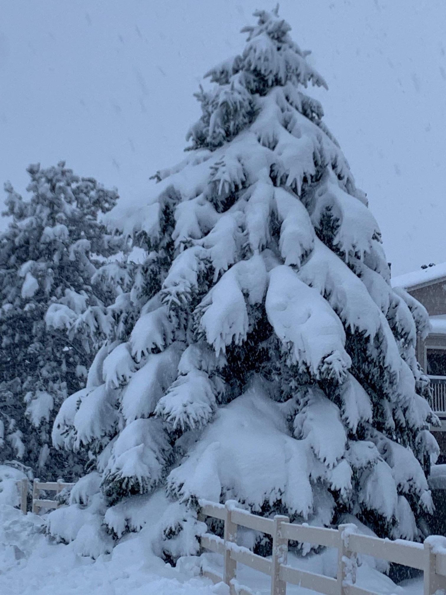
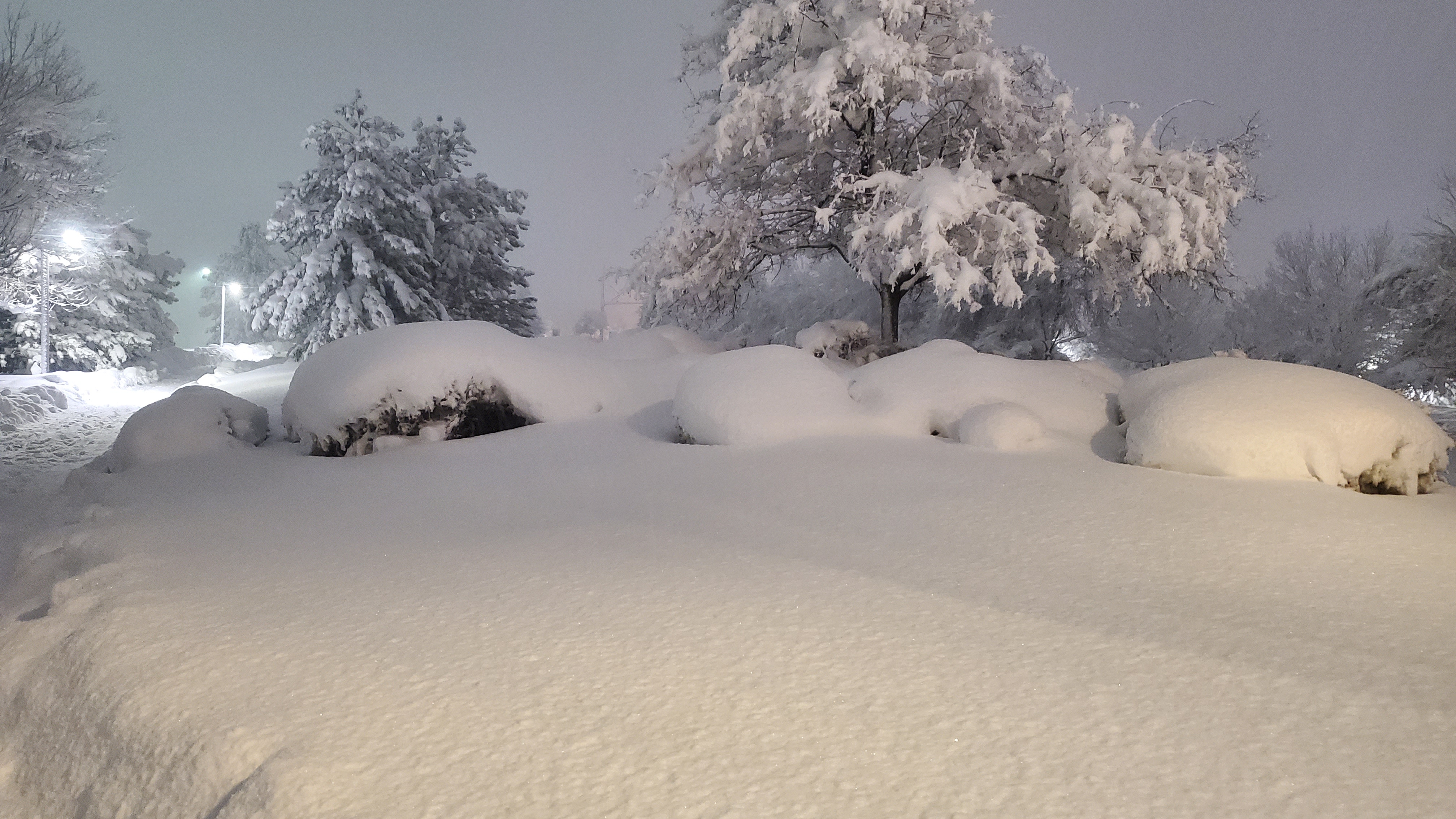
Heavy snow in Broomfield, CO. This image taken on the evening of March 14th.
Heavy snow near Flatirons Mall in Broomfield. |
Photos
.jpg) |
 |
 |
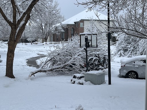 |
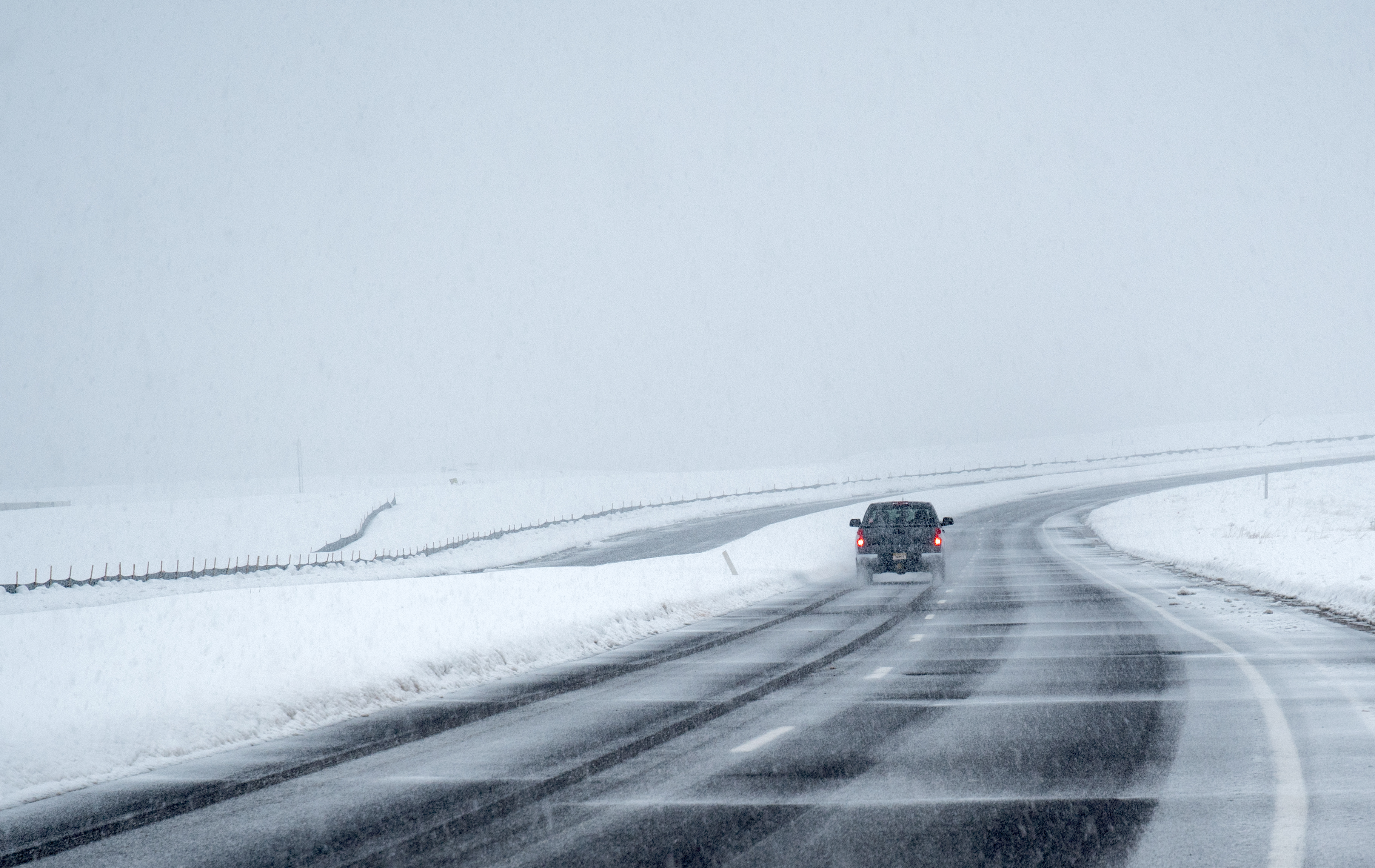
| Rain changed to heavy, wet snow in the Denver metro area on the evening of March 13th | Driving conditions varied considerably. Sometimes wet, sometimes snow packed with deep snow, some roads impassable. This image take between Broomfield and Erie, CO. | Heavy, wet snow accumulated on trees. Image from Broomfield, CO | Despite lack of leaves, the snow was so heavy and wet it still broke tree limbs and created scattered power outages. Image from Longmont, CO |
 |
 |
 |
.jpg) |
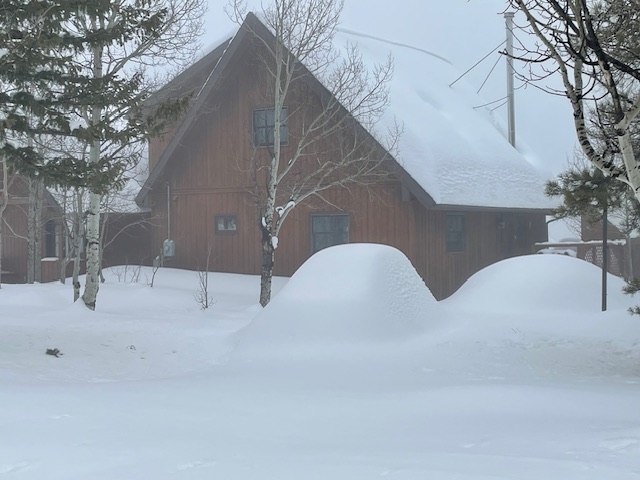
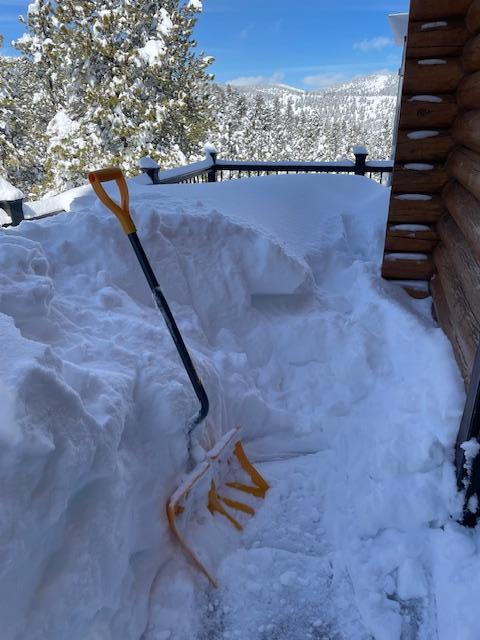
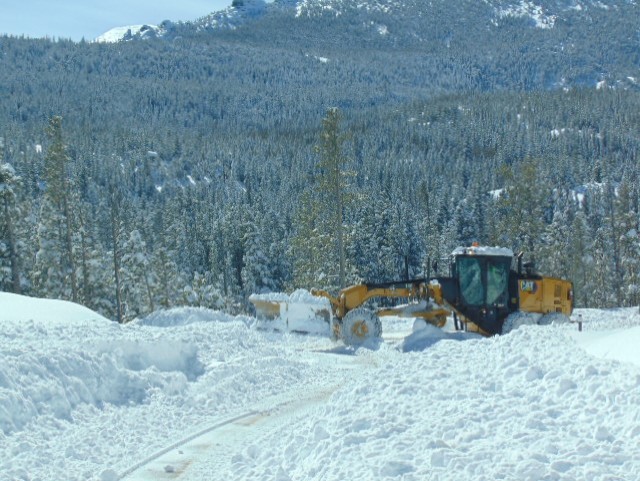
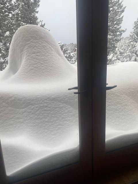
| Now, where did that car go? Image from Nederland, CO | Let the digging begin. Upwards of four feet of snow fell in some of the foothills! Image from Nederland, CO | Snowplow working hard to clear roads in Rocky Mountain National Park | Finally, able to escape after hours of work. Image from Nederland, CO |
Radar & Satellite
 |
 |
 |
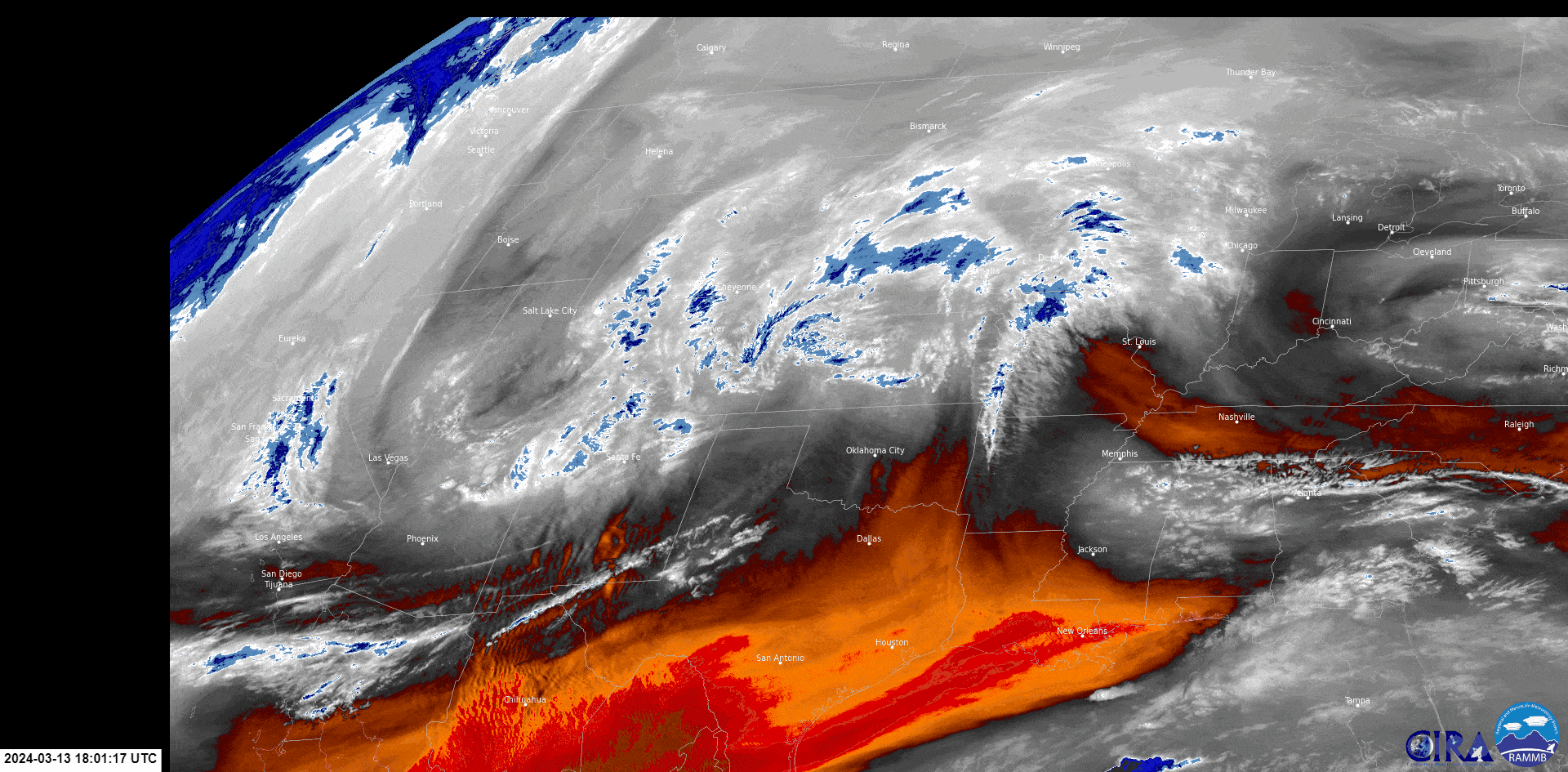 |
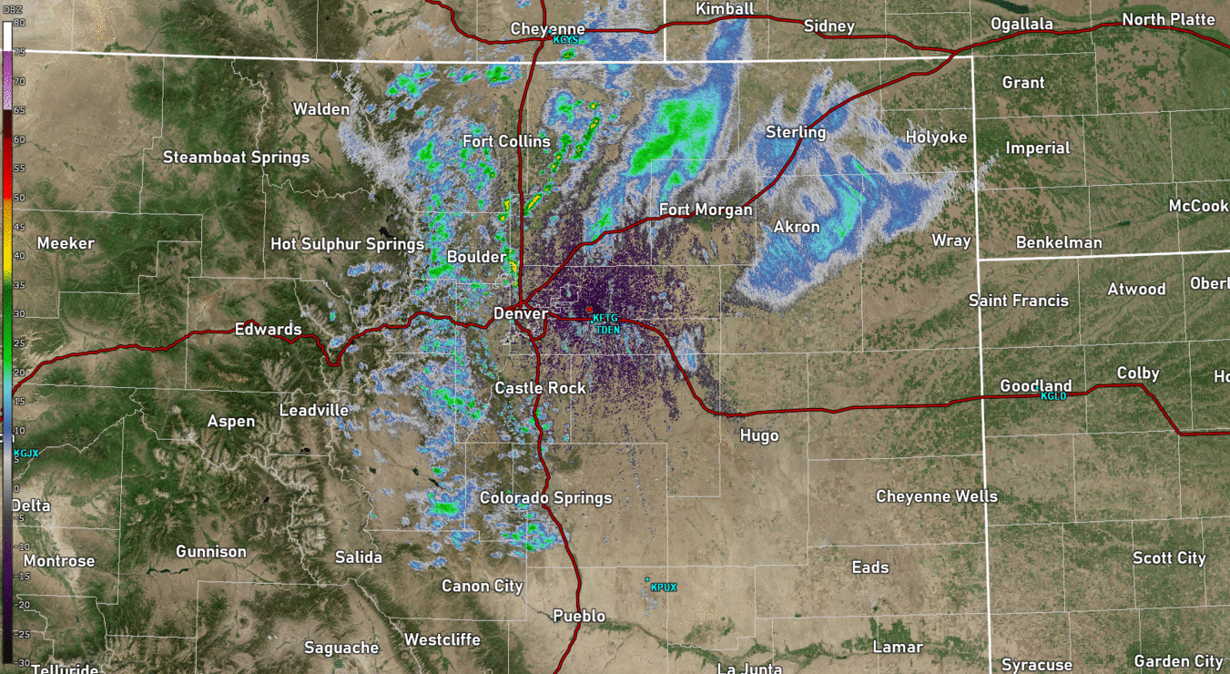
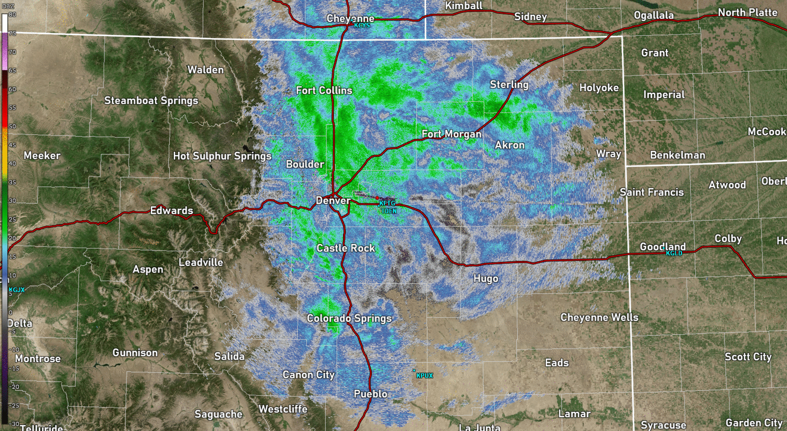
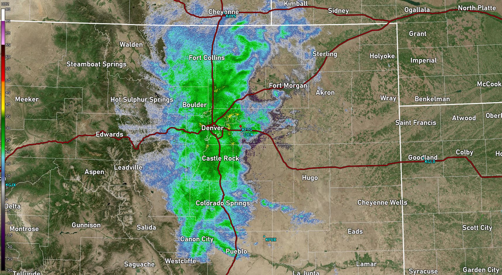
| Radar loop of the first half of the storm (Noon Wednesday to 11 am Thursday) | Radar loop showing the second round of heavier snow backing into the I-25 Corridor and Foothills (Noon Thursday to 6 am Friday) | Still image of radar near 11 pm March 13. Rain had just changed to heavy snow in most of metro Denver, with snowfall rates up to 3" per hour in the foothills | Satellite loop (water vapor imagery) for the entire duration of the storm March 13-15, 2024 |
Storm Reports
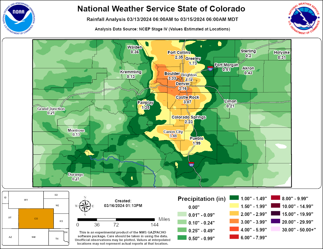
Observed Snowfall across Colorado March 13-15, 2024
Zoomed in Observed Snowfall for the Denver Metro Area
List of highest Snowfall Reports (>= 36")
| County | Location | Snowfall |
| Gilpin | Aspen Springs | 61.5 |
| Clear Creek | Evergreen 5.4 NW | 61.0 |
| Gilpin | 1 W Aspen Springs | 57.0 |
| Gilpin | Rollinsville 1.1 SSW | 54.4 |
| Clear Creek | Idaho Springs 4.7 SSE | 53.7 |
| Boulder | 4 ENE Nederland | 53.0 |
| Gilpin | Rollinsville 0.1 WNW | 50.7 |
| Jefferson | 4 SSE Pinecliffe | 50.7 |
| Boulder | Pinecliffe 2.5 WNW | 48.1 |
| Boulder | Nederland 4.3 ENE | 47.5 |
| Boulder | 1 WSW Eldora | 46.0 |
| Boulder | Ward 4.6 NE | 45.9 |
| Jefferson | 1 NNW Genesee | 45.7 |
| Boulder | 3 W Jamestown | 45.5 |
| Boulder | Nederland 2.8 NE | 45.1 |
| Jefferson | Aspen Park 1.9 ENE | 45.0 |
| Jefferson | Conifer 5.2 WNW | 44.7 |
| Jefferson | 4 W Conifer | 44.0 |
| Jefferson | Evergreen 2.5 SSW | 44.0 |
| Boulder | Nederland 3.7 ENE | 43.6 |
| Boulder | Nederland 4.2 E | 43.1 |
| Jefferson | 3 S Evergreen | 43.0 |
| Clear Creek | Evergreen 6.5 WSW | 42.6 |
| Jefferson | Kittredge 2.5 SSE | 42.2 |
| Gilpin | Pinecliffe 2.0 ESE | 42.0 |
| Jefferson | 1 SSW Crescent Village | 42.0 |
| Jefferson | Evergreen 4.2 SSE | 42.0 |
| Jefferson | Morrison 5.4 SSW | 42.0 |
| Boulder | Allenspark 0.9 W | 41.9 |
| Jefferson | Conifer 3.2 SW | 41.3 |
| Larimer | Estes Park 1.8 S | 41.1 |
| Clear Creek | 1 SSE St Mary's Glacier | 40.5 |
| Boulder | Nederland 5.8 E | 40.1 |
| Gilpin | Floyd Hill 3.7 N | 40.1 |
| Larimer | 2 WNW Pennock Pass | 40.0 |
| Clear Creek | Evergreen 3.4 WNW | 39.9 |
| Jefferson | Golden 1.6 SW | 39.7 |
| Jefferson | Evergreen 2.6 S | 38.0 |
| Clear Creek | Evergreen 5 W | 37.5 |
| Larimer | Glen Haven 1.2 N | 36.9 |
| Jefferson | Evergreen 5.3 S | 36.8 |
| Jefferson | Evergreen 2.0 ESE | 36.7 |
| Park | Guffey 2.7 E | 36.5 |
| Larimer | Drake 4.3 WSW | 36.4 |
| Clear Creek | Evergreen 3.5 W | 36.3 |
| Larimer | 2 S Estes Park | 36.0 |
A full list of storm reports can be viewed here, while a breakdown of most snowfall reports by county are here. Finally, here's all the CoCoRaHS volunteer observer reports for this storm.
In addition, this was a very heavy, wet snowfall that contained a significant amount of liquid (equivalent) precipitation. Total liquid equivalent in some areas exceeded a whopping 3 inches, or 15-20% of total annual precipitation in and near portions of the Front Range Foothills and Denver metro area.
Environment
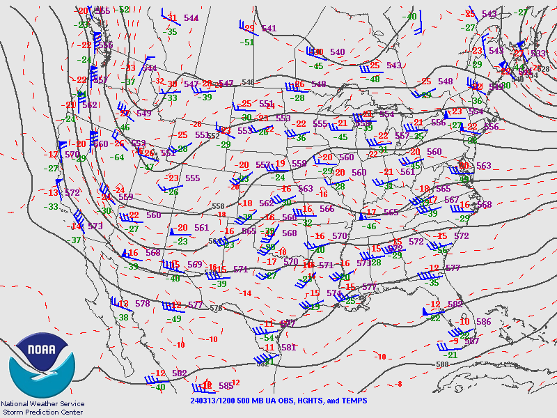
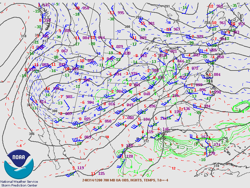
This storm did not take a typical track for producing heavy snowfall in northeast Colorado. Normally, storms that bring heavy March snow develop in the Four Corners region and track eastward across the New Mexico/Colorado border area and then move into the Texas/Oklahoma Panhandles or western Kansas. This storm set up quite differently. This time, a deep low pressure center developed and dropped almost straight south from Idaho to near Las Vegas, Nevada, and then eventually into the Mojave Desert (Figure 1 below). While the forecast track was in good agreement with the forecast models, it is not a favorable track for heavy snow. However, a couple factors played against that. First, a weak disturbance passed east of us earlier on Wednesday, March 13th, in essence leaving behind increased moisture, and plenty of that too as precipitable water values climbed to near the maximum observed for that time of year. After that system passed by, the mid level flow elongated east/west (as shown in Figure 2), allowing a deep fetch of that highly anomalous moisture to push back to the Front Range starting late Wednesday. This pattern then persisted through Thursday evening, with persistent and deep upslope flow (Figure 3) and snowfall in and near the Front Range Foothills. Snow finally tapered off and came to an end late Thursday night into the early morning hours of Friday, March 15th as the upslope flow weakened.
Temperatures were just cold enough, along with the intense precipitation rates that developed due to a combination of moisture and instability, to turn the rain over to snow across most of the Denver and Boulder metro areas during the evening of the Wednesday, the 13th. This was a very heavy, wet snow that accumulated at the rate of 1 to 2 inches per hour, with up to 3 inch per hour rates in the foothills. Meanwhile, temperatures remained just warm enough to have a rain/snow mix continue overnight into the early morning hours of Thursday the 14th in areas just to the east, including Fort Collins and Denver International Airport. While precipitation tapered off a little Thursday morning, more widespread and heavier snow developed in the afternoon and evening as another push of moisture and slightly stronger upslope arrived. Snowfall rates increased again to average close to one inch per hour, with somewhat heavier rates in the foothills. More of this precipitation was also in the form of snow, allowing locations like Fort Collins, DIA, and Limon to get in on the accumulating snowfall.
Liquid equivalent precipitation amounts were impressive, to say the least, with approximately 20% of average annual precipitation occurring in this storm in and near the foothills. Most locations west of I-25 from the south side of Fort Collins to Colorado Springs received in excess of 2 inches of rain and snow liquid equivalent, while many locations in the foothills west of Boulder and Denver received between three and four inches of total liquid precipitation.
 |
 |
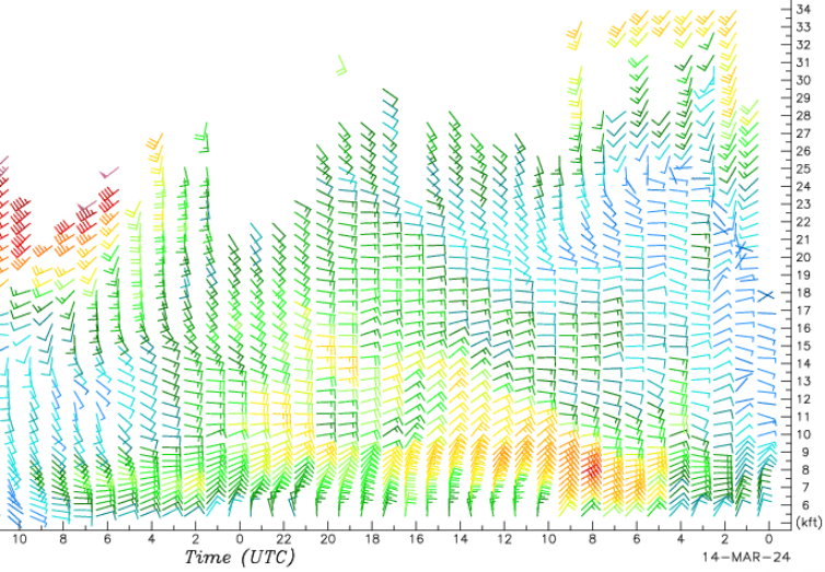 |
| Figure 1: 500 mb Loop (12Z 13 March - 12Z 15 March, 2024) showing storm track | Figure 2: 700 mb analysis at 12Z 14 March, 2024, mid storm | Figure 3: Platteville profiler showing persistent, deep easterly winds |
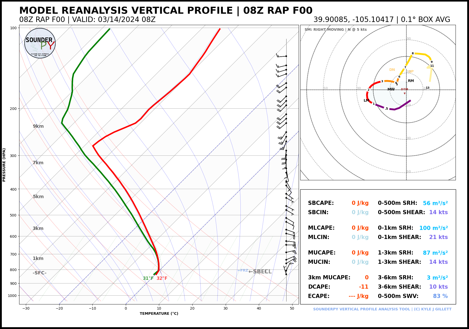
Since the storm track was not typical for producing heavy snow, we pose the question why it did snow so much and hopefully show a few answers. Several ingredients came together, including some of those we mentioned above, including a persistent and deep upslope flow. But it was also extremely moist, in fact bordering on too moist (too warm and wet) to produce snow. The airmass was quite unstable at the beginning of this storm, as there were even a few thunderstorms to start in the afternoon and early evening of the 13th. Figure 4 shows a model analysis of an atmospheric profile, or forecast sounding near Rocky Mountain Airport showing the deep easterly flow combined with what we call neutral lapse rates (change in temperature with height). This type of profile makes a very efficient precipitation process, especially when combined with the deep upslope flow. Also, we briefly touched on how much moisture was available (pushing the envelope of being too warm and wet to snow). It's these crucial events and thresholds we have to keep in mind during these types of warm spring storms, because if they do turn over to snow as this one did, then very heavy, wet snow will occur. This was eerily similar to the scenario in the historic March 17-19, 2003 storm that dumped feet of snow over the entire Front Range - that storm was just longer in duration.
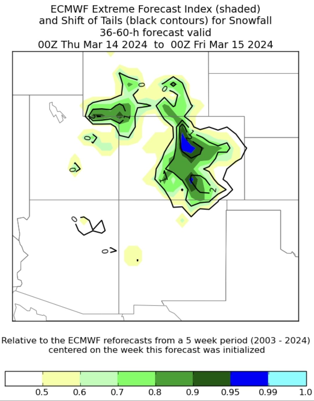
A key the forecasters are starting to use more frequently can be seen in Figure 5, and that's the comparison of model and ensemble precipitation to climatological model forecasts. When NWS forecasters see evidence of an extreme event unfolding, it gives us more confidence that an extreme precipitation event (in this case snowfall) is possible. Forecasts (Figure 6) called for 10-20" across metro Denver with up to two feet in the western suburbs, and between 2 and 4 feet in many foothill locations - note the large area of greater than three foot totals in the forecast! A high impact, heavy snow event indeed unfolded during the subsequent 36 hours, leading to numerous road closures, nearly impossible travel in the foothills, and broken tree limbs and scattered power outages across the Denver metro area.
 |
 |
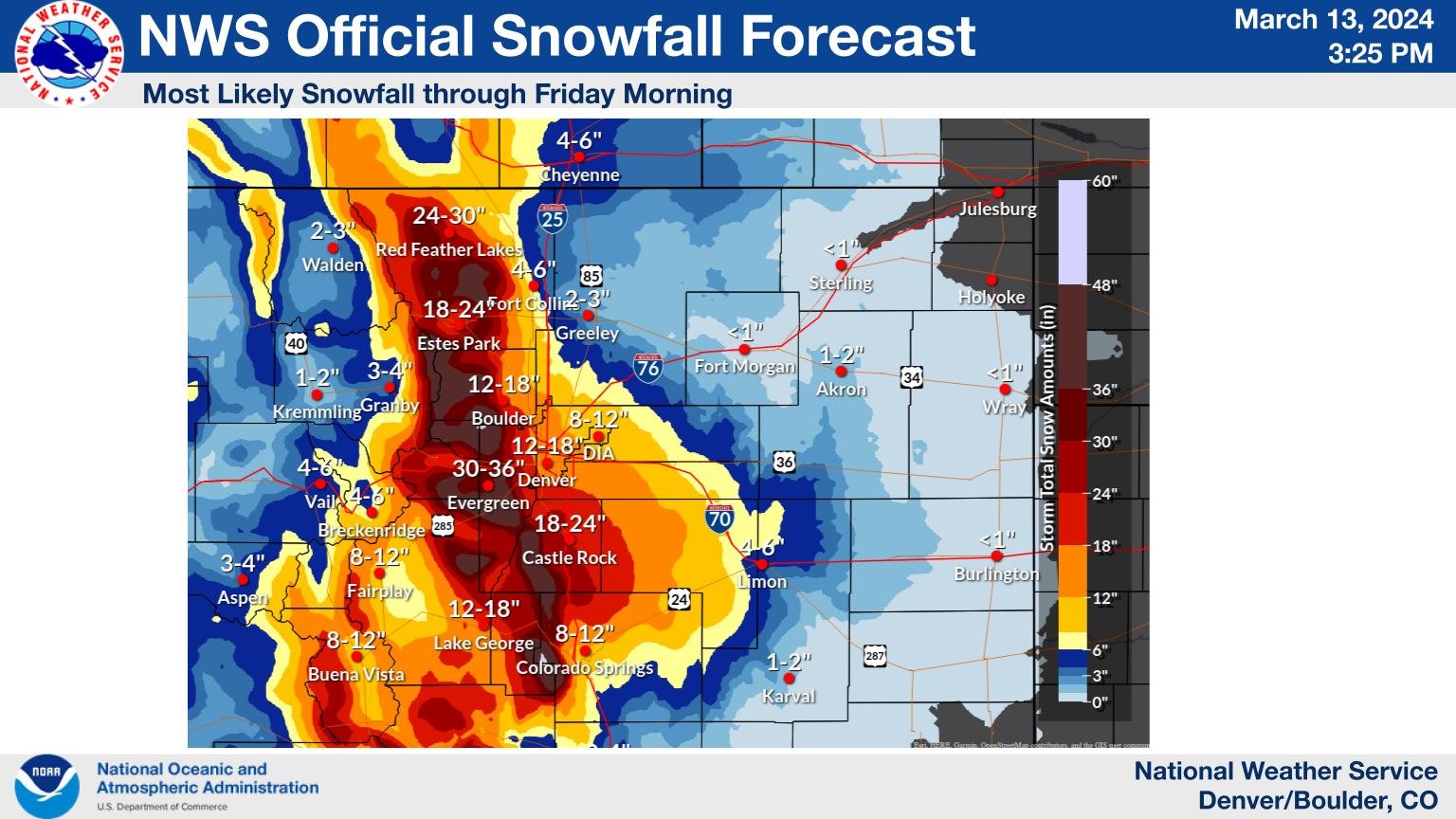 |
| Figure 4: 08Z Model reanalysis at 08Z (2AM) March 14, 2024 | Figure 5: Extreme Forecast Index and Shift of Tails for Snowfall | Figure 6: Official NWS Snow Forecast Issued 3:25 PM March 13, 2024 |
 |
Media use of NWS Web News Stories is encouraged! Please acknowledge the NWS as the source of any news information accessed from this site. |
|


 Follow us on YouTube