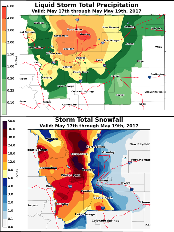
A potent and very moist spring storm produced heavy rain and snow across much of north central and northeast Colorado from May 17th through the 19th. Precipitation amounts across the I-25 Urban Corridor ranged between 1.5 and 4 inches. Greeley received between 4 and 5 of precipitation with some parts of town measuring over 5.5 inches. In addition, this storm produced very heavy snow over the northern Colorado mountains and foothills with amounts ranging between 1 and 4 feet. The highest snowfall totals occurred over the foothills of Boulder and Larimer Counties. On the plains, rain changed to snow along the I-25 corridor early Thursday morning, with accumulating snow falling Thursday and Thursday night. Some tree damage occurred with several inches of snow accumulating from Fort Collins southward through Boulder and the western suburbs of Denver, down onto the Palmer Divide.
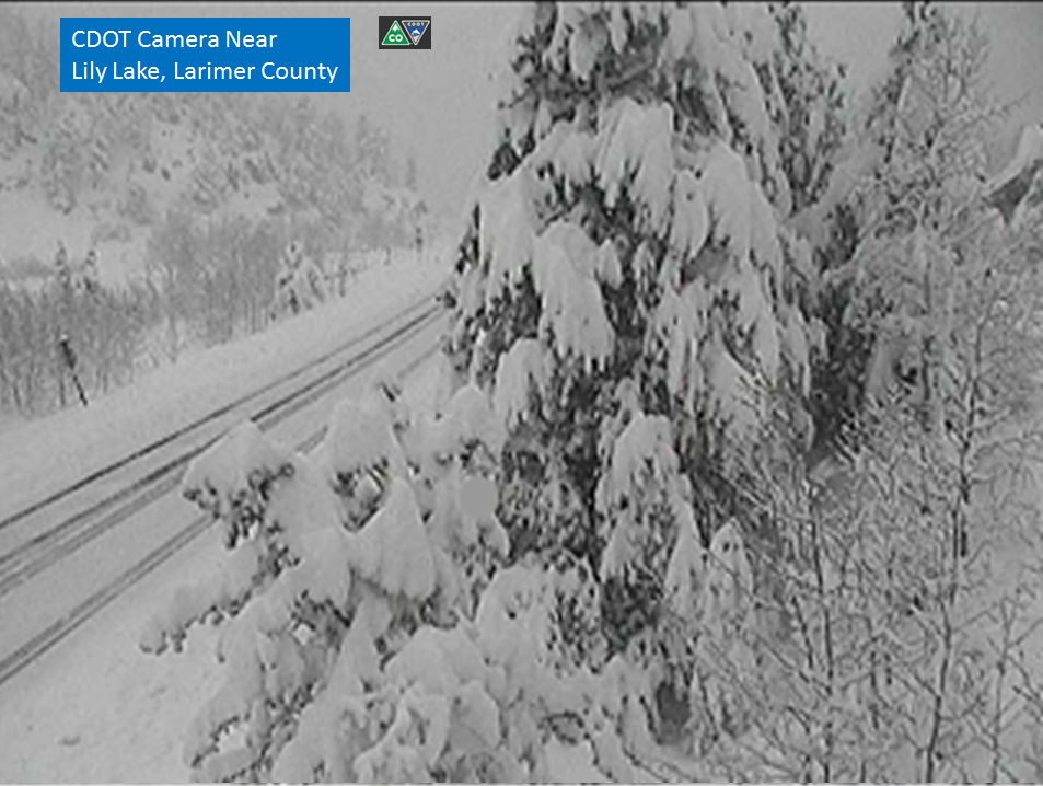
Lily Lake (just south of Estes Park in Larimer County) Thursday afternoon.


 Follow us on YouTube