Banks County EF-1 Tornado
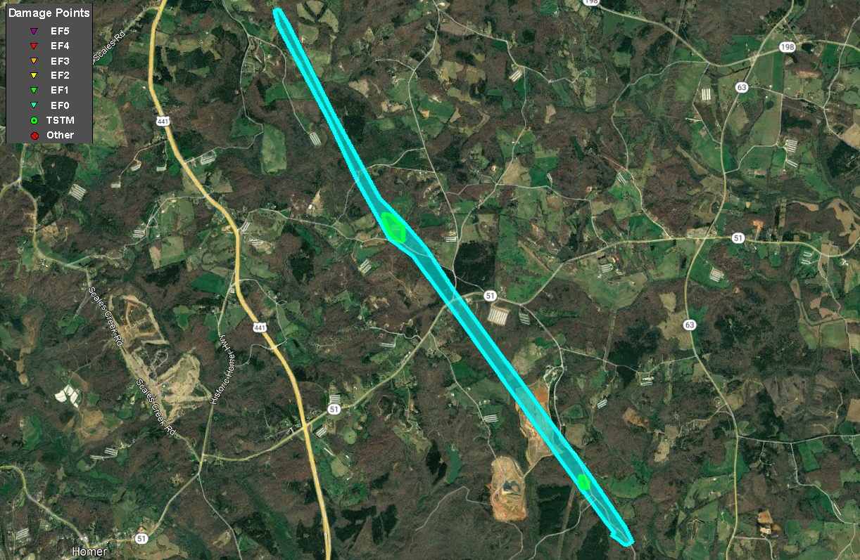 |
| Damage Path - Banks County |
|
| County |
Rating |
# of Fatalities/Injuries |
KML |
| Banks |
EF-1 |
0 Fatalities /
0 Injuries
|
 |
| Rating: |
EF-1 |
| Peak Wind: |
90 mph |
| Path Length: |
5.7 miles |
| Path Width: |
100 yards |
| Fatalities: |
0 |
| Injuries: |
0 |
| Start Date: |
August 17, 2021 |
| Start Time: |
10:24 AM EDT |
| Start Location: |
4 E Homer |
| Start Lat/Lon: |
34.3330 / -83.4161 |
| End Date: |
August 17, 2021 |
| End Time: |
10:31 AM EDT |
| End Location: |
2 SW Pinefield Crossroads |
| End Lat/Lon: |
34.4025 / -83.4696 |
|
|
An EF-1 tornado touched down in Banks County east of Homer along Bennett Road just west if Highway 63. The tornado uprooted and twisted off trees along a path that paralleled Bennett Road. One home was nearly crushed by a fallen oak tree. Some of the tree damage pointed to EF-1 level winds along the road where large groves of trees were twisted off. One homeowner recalled his ears popping as the tornado passed by the house, toppling trees on either side of the home. The tornado continued to the northwest across a landfill zone before emerging across Highway 51 and Damascus Road where numerous trees were snapped or uprooted. Continuing northwest, the tornado crossed Payne Road and snapped and uprooted dozens of trees before destroying a chicken house on the north side of Payne Road. A small trailer was toppled and thrown 30 yards to the northwest. The tornado was at its strongest intensity along Payne Road before beginning to weaken as it continued to the northwest. A tree was blown down into a home along Hawkins Road before the tornado lifted.
 |
|
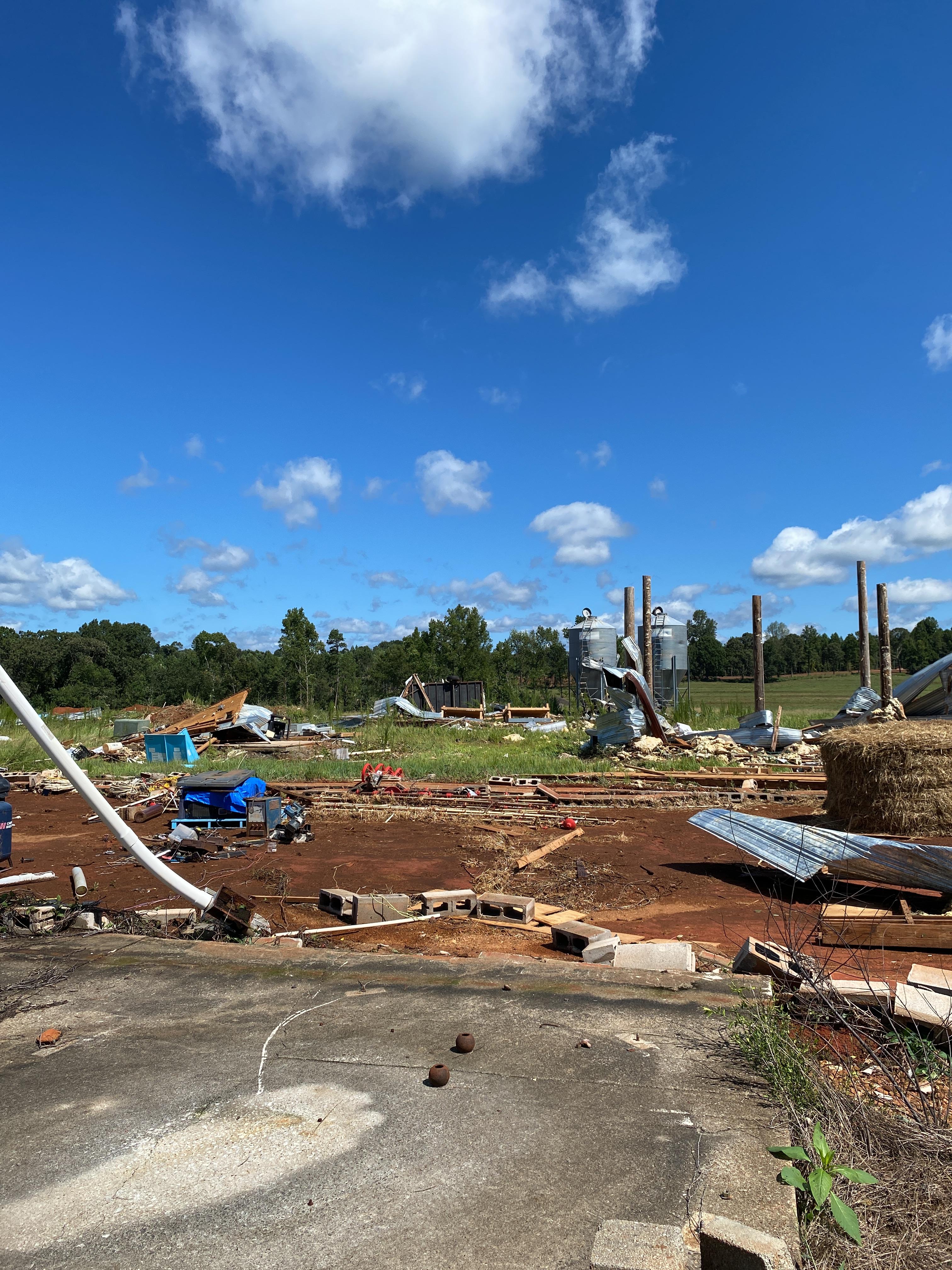
| A chicken house was destroyed in the tornado |
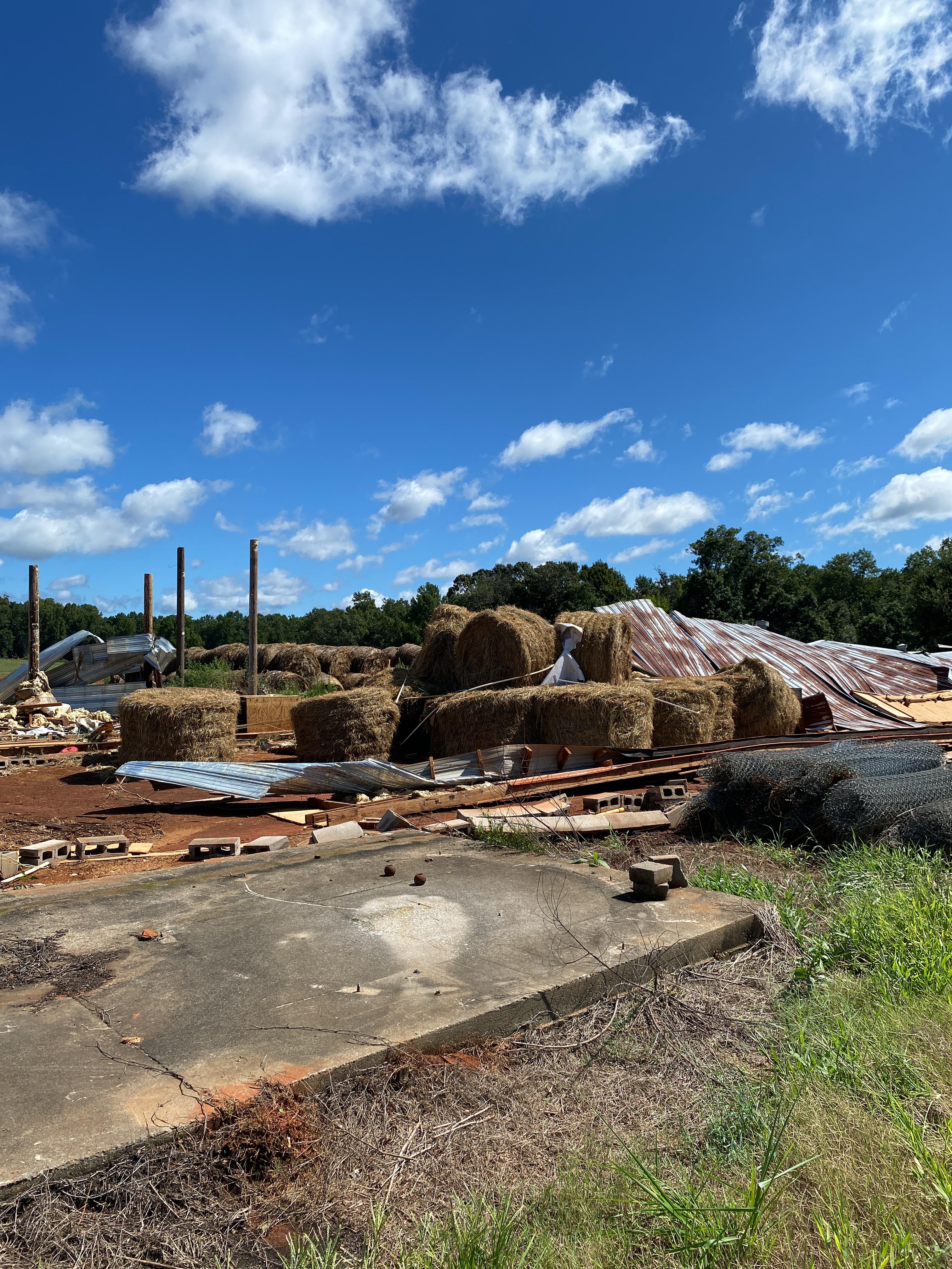
Another vantage point of the damage around the chicken house. |
|
|
 |
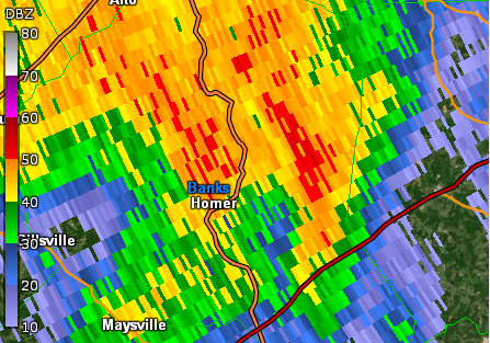
| KGSP Reflectivity (10:28 AM EDT) |
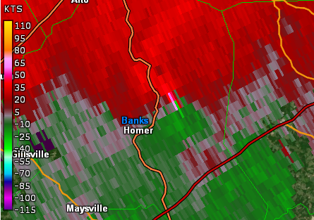
KGSP base velocity (10:28 AM EDT) |
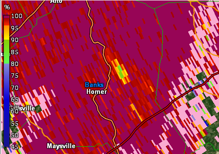 |
| KGSP Correlation Coefficient (10:28 AM EDT) |

