Sioux Falls, SD
Weather Forecast Office
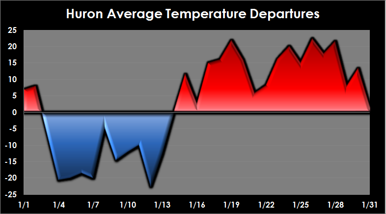
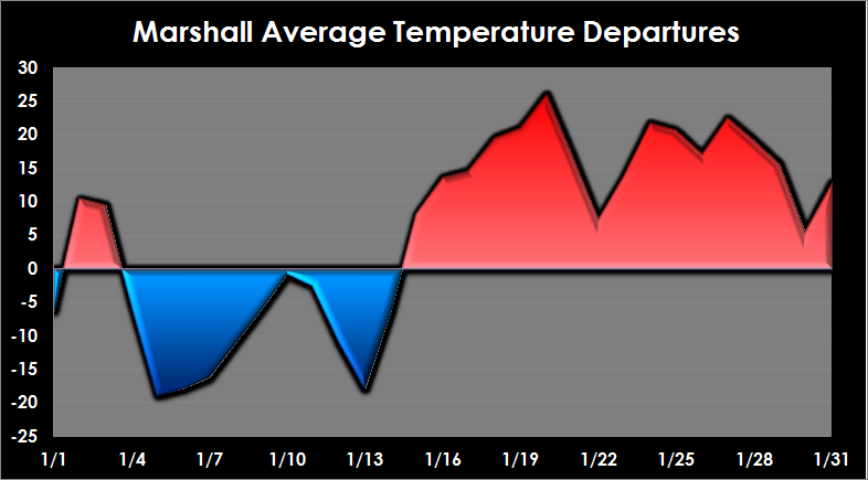
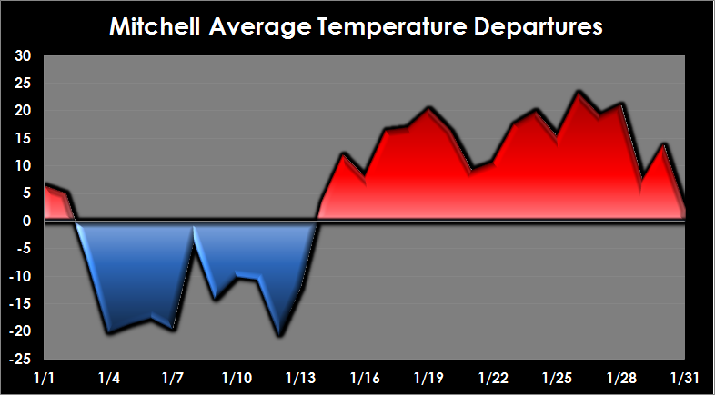
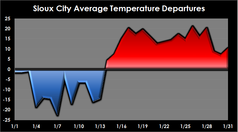
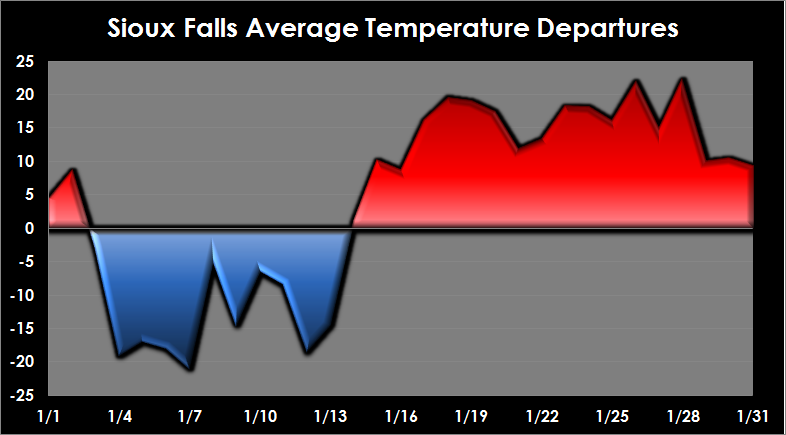
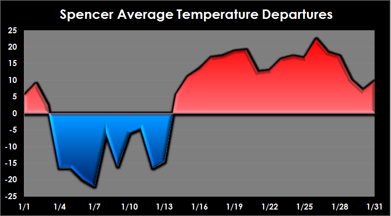
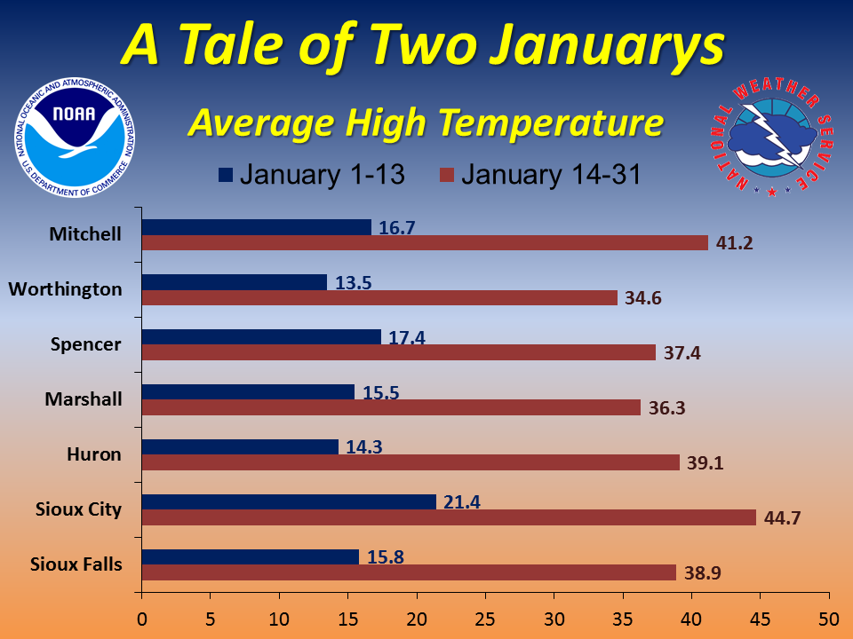
January 2015 had two distinct weather regimes. After a couple of near normal days to start the month, Arctic air set up over the region. The Arctic air was accompanied by snowfall on January 3 and 5 which brought most areas 3 to 8 inches of snow. This cold air remained across the northern plains into mid January. With fresh snow cover, several days had lows well below zero with highs struggling to warm above zero. The weather dramatically changed around the 14th when mild air from the Pacific moved into the area. This began over two weeks of well above normal temperatures with several days above freezing. High temperatures at the end of the month averaged 10 to 15 degrees above normal.
Below are graphics for Huron, SD, Marshall, MN, Mitchell, SD, Sioux City, IA, Sioux Falls, SD and Spencer, IA showing how far above and below normal temperatures were. As can be seen, temperatures were rarely near normal in January. The final graphic shows the average high temperature for January 1-13 and January 14-31.
Popular Pages
Past Weather Events
Regional Weather Roundup
Daily Temp/Precip
Hazardous Weather
Local Climate Archives
Climate Graphs and Data
Seasonal
EvapoTranspiration
Fire Weather
Grassland Fire Danger
Flooding (River)
Summer Weather
Travel Forecasts
Winter Weather
Winter Preparedness
Forecast Snowfall Graphic
Winter Temp Climatology
US Dept of Commerce
National Oceanic and Atmospheric Administration
National Weather Service
Sioux Falls, SD
26 Weather Lane
Sioux Falls, SD 57104-0198
605-330-4247
Comments? Questions? Please Contact Us.


 Weather Story
 Weather Map
 Local Radar