Overview
|
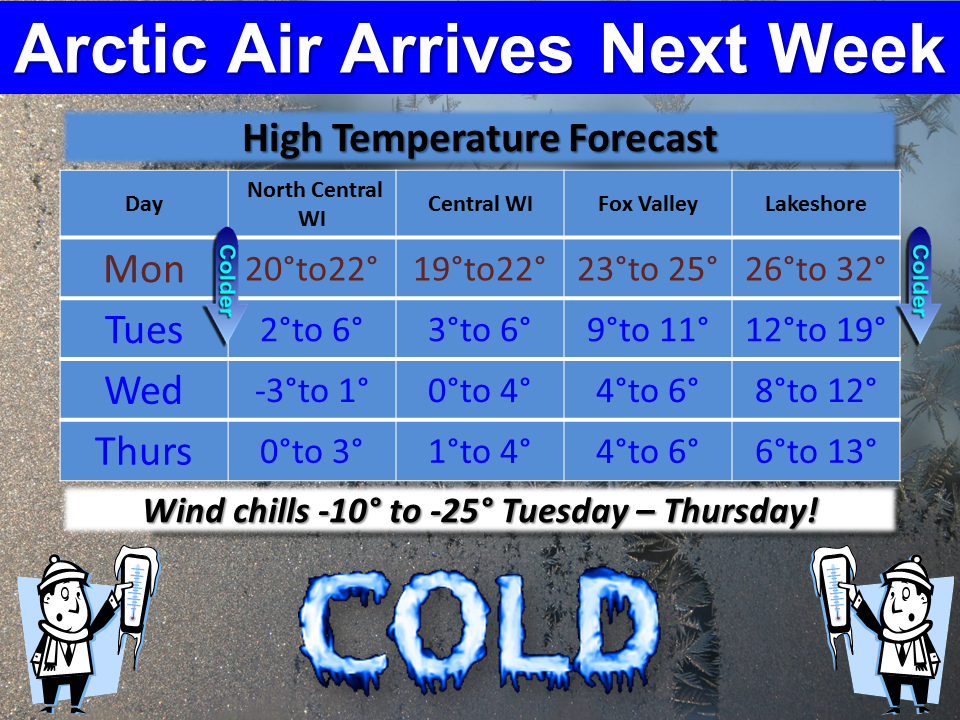
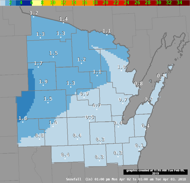
Snow today, followed by the coldest air of the early winter during the middle to latter part of the week, will affect much of the region. The snow will diminish from west to east starting this afternoon. But hazardous travel conditions will linger into the evening across much of the area, and possibly all night in Door County. A total snowfall of 3 to 9 inches is expected across Wisconsin, with the highest amounts in a band from west-central through southeast Wisconsin. See the map at the right for the latest snowfall forecast for today though this evening (does not include snow that fell overnight). Cold air will then pour into the state from the north starting late Monday night, bringing wind chills well below zero by mid-week. See the "Cold" tab below for details on just how cold it will get in your area.
Click HERE for information on how you can avoid being caught unaware on the road in a hazardous winter event. |
 Additional Snowfall Forecast 6 AM - 6 PM |
 |
 |
|
| Latest Advisories | Regional Radar |
Additional Snow
|
Snow will begin to diminish today from west to east across Wisconsin. Some lake-enhancement is possible near Lake Michigan into this evening, especially in Door County. Winds of 10 to 15 mph will be easterly today then turn north and northwest tonight. Although some drifting of the snow is possible (mainly near Lake Michigan), white-out conditions are not expected. |
|
Cold/Wind Chills
|
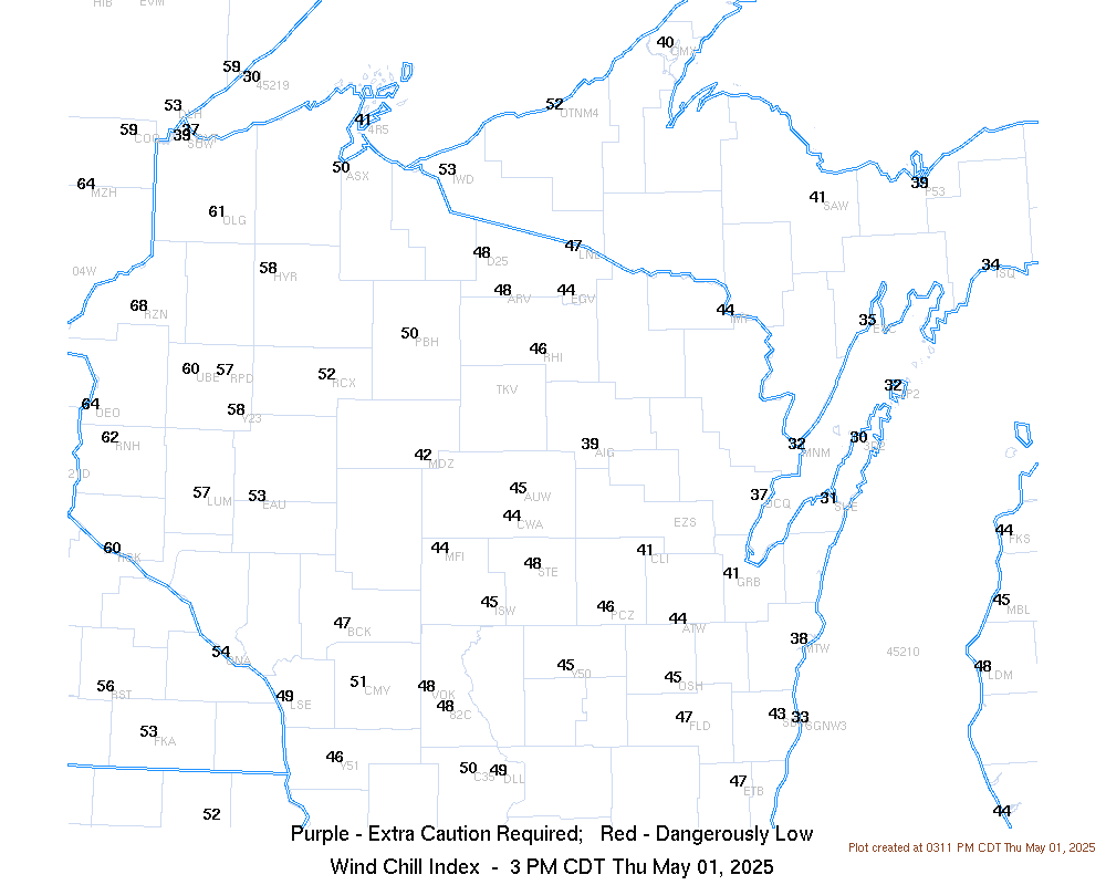
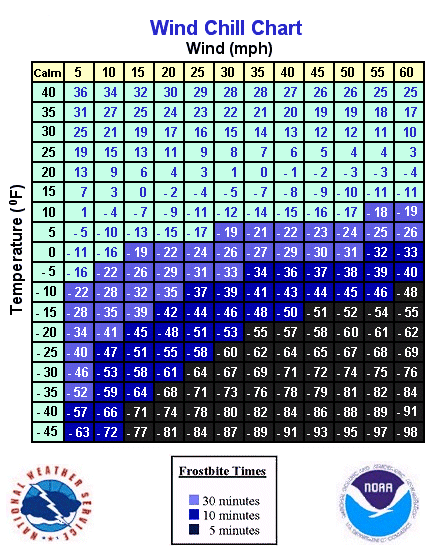
See the image below for the expected high temperatures next week. Wind chills may fall to between -10 to -25 by Wednesday morning at many locations. The current wind chills can be found on the map on the right. Click HERE for a wind chill calculator.
|
 |
 |
Radar
 |
 |
 |
 |
| Green Bay Radar | Milwaukee Radar | Upper Miss. Valley Radar | Great Lakes Radar |
Winter Safety
|
|
|
| Place Caption Here | Place Caption Here |
 |
Media use of NWS Web News Stories is encouraged! Please acknowledge the NWS as the source of any news information accessed from this site. |
|