| NOVEMBER 23 2004 TORNADO OUTBREAK |
| Tornado Outbreak Map |
 |
| Local Storm Reports |
Overview
A significant tornado outbreak affected much of the southern United States on November 23rd and early November 24th. Numerous tornadoes tore through portions of central and eastern Texas, Louisiana, Mississippi, Alabama, Florida, Georgia, South Carolina, and Indiana, causing 4 deaths and numerous injuries. In total, this tornado outbreak produced over 50 confirmed tornadoes.
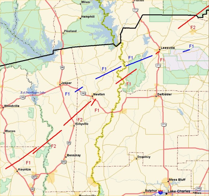
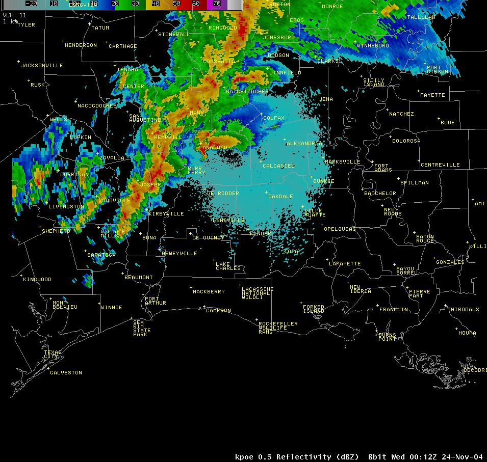
The portions of the NWS Lake Charles County Warning Area that were most affected by this outbreak were eastern Texas and central Louisiana. During the afternoon and evening of the 23rd, Several intense rotating thunderstorms called supercells caused the majority of the severe weather across our area. The first supercell of the outbreak moved northeastward across Tyler, Jasper, and far northern Newton counties. While this storm did not spawn any tornadoes in our region, it did cause large hail up to golf ball size, and damaging winds in excess of 60 mph. A second supercell (tracks shown in red) developed near Baytown, Texas, and produced 7 known tornadoes along its extensive 150 mile trek across the Lake Charles county warning area. This supercell continued into northern Louisiana, and later spawned the deadly tornado in Olla, Louisiana. A third supercell (tracks shown in blue) was responsible for 4 tornadoes across eastern Texas and central Louisiana.
In addition to the tornadoes, an extensive squall line moved eastward out of central Texas late on November 23rd into the 24th. This line of severe thunderstorms swept across the entire Lake Charles County Warning area. By sunrise on November 24th, severe thunderstorm and tornado warnings had been issued for every county and parish in the Lake Charles county warning area. This was the most intense severe weather outbreak across the region since Hurricane Lili produced 12 tornadoes across central and southern Louisiana on October 3rd, 2002.
What was the cause of all these tornadoes? By the afternoon of November 23rd, a powerful storm system was moving out of the southwestern United States into the southern Plains. At the surface, a very warm, moist air mass was in place across the area, with temperatures in the 70’s and 80’s and dewpoints in the upper 60’s and lower 70’s. This warm, humid air created a very unstable atmosphere, leading to the explosive thunderstorm development. Very strong wind speeds were found at all levels of the atmosphere, (up to 120 knots at 200 mb!) and these winds had significant turning with height. This wind profile created a favorable environment for rotation in the thunderstorms that developed.
|
Kountze Tornado |
|
|
|
|
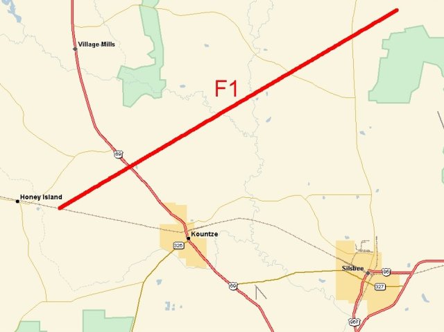
| DATE: 11/23/04 | RATING: F1 |
| TIME: 408 PM | PATH LENGTH: 15 miles |
| COUNTY: Hardin | PATH WIDTH: 200 yards |
| TORNADO WARNING LEAD TIME: 35 minutes | |
| The first tornado from Supercell B began near the community of Dies west of Kountze, where minor tree damage was observed. The tornado continued to cause minor to moderate damage to trees as it crossed Highway 69 about 3 miles north of Kountze. Upon reaching Highway 96 in extreme northern Hardin County, this tornado (and the Fred tornado) damaged numerous trees, homes and mobile homes. The nature of the damage in this area indicated a multiple vortex structure to the storm. | |
|
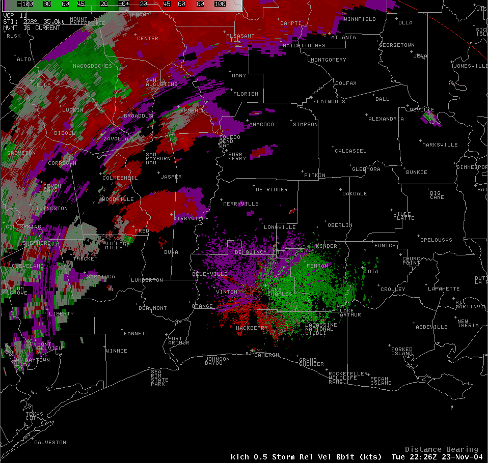
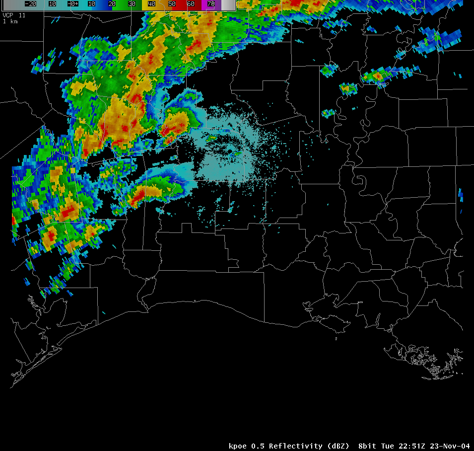
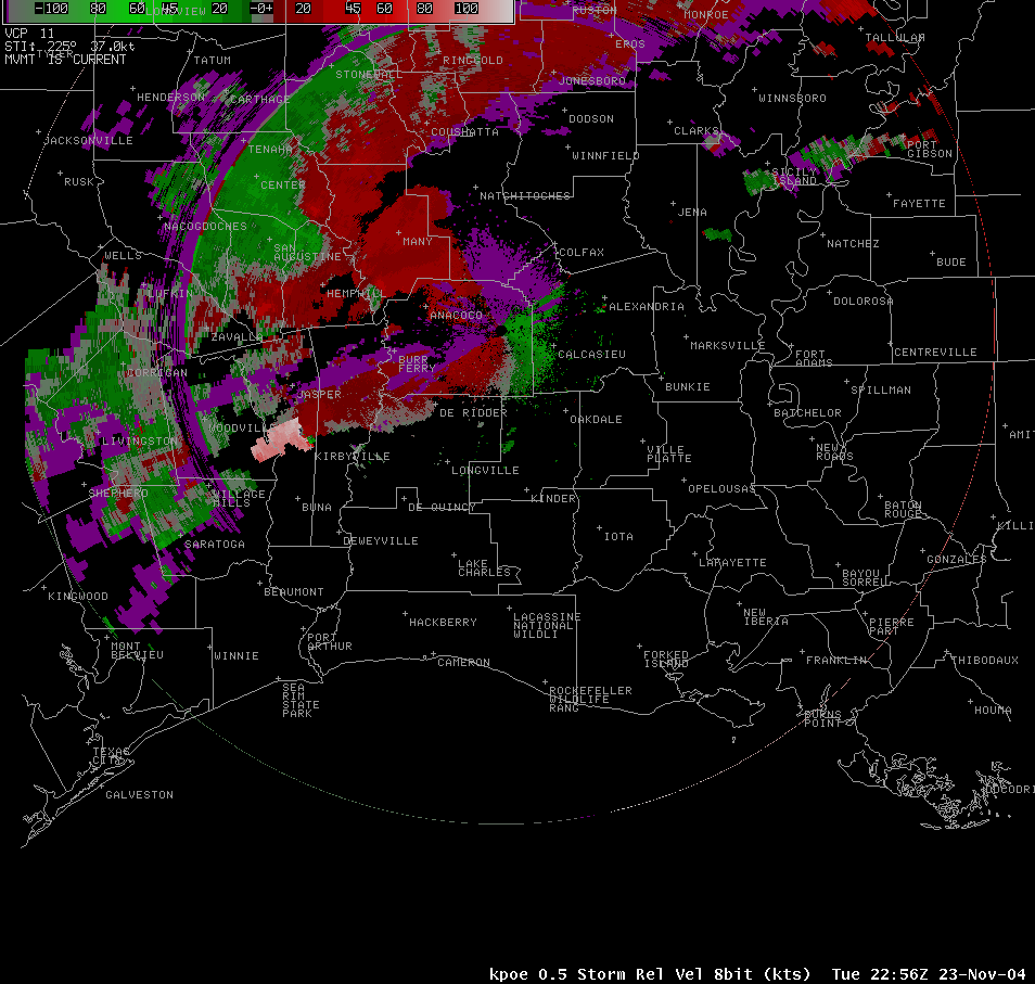
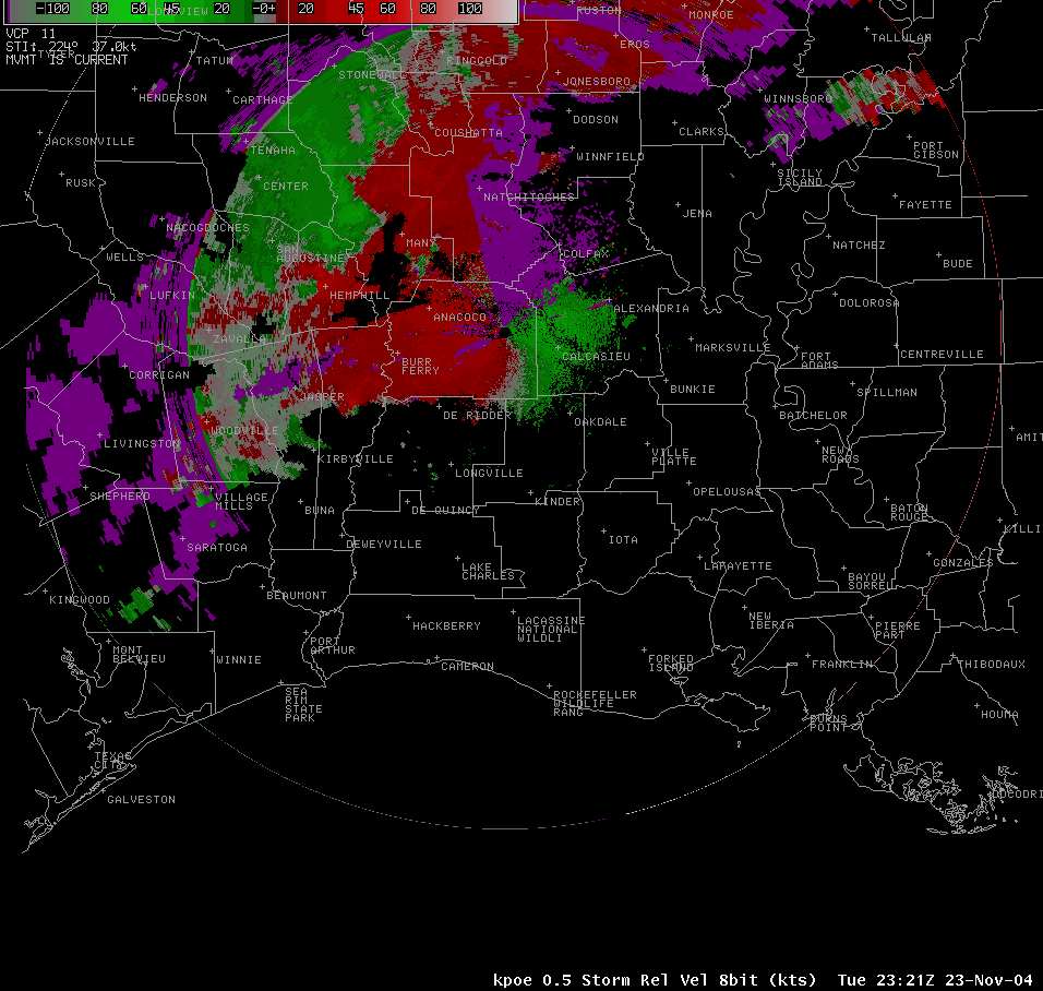
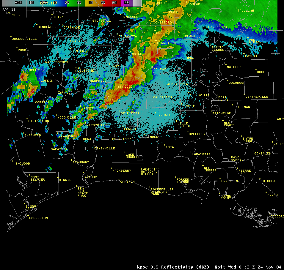
RADAR IMAGERY |
|
 |
|
|
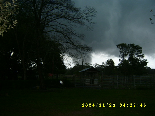
Fred Tornado |
|||||
 |
|||||
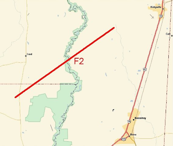
| DATE: 11/23/04 | RATING: F2 | ||||
| TIME: 427 PM | PATH LENGTH: 16 miles | ||||
| COUNTY: Hardin/Tyler/Jasper | PATH WIDTH: 600 yards | ||||
| TORNADO WARNING LEAD TIME: 16 minutes | |||||
|
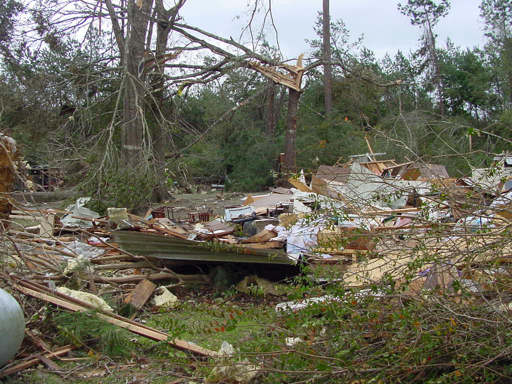
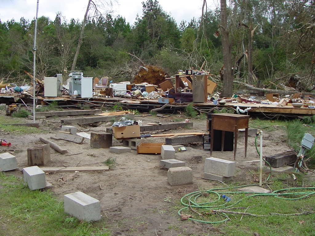
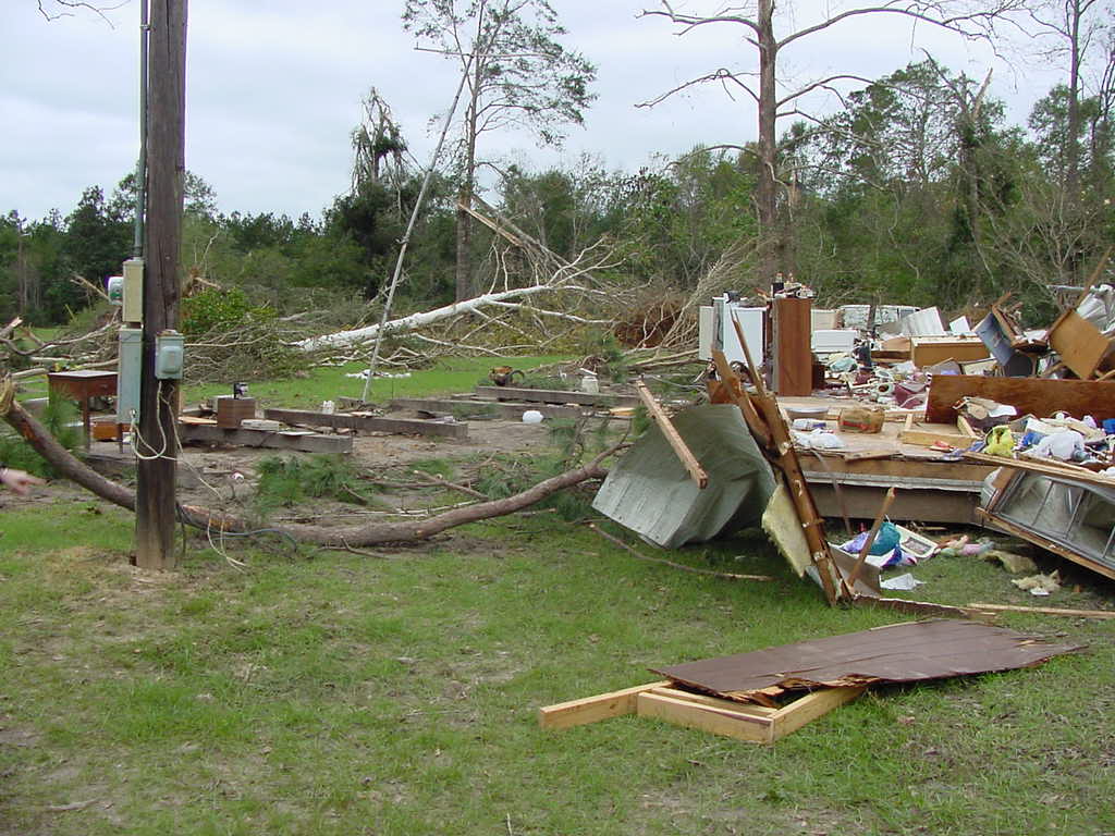
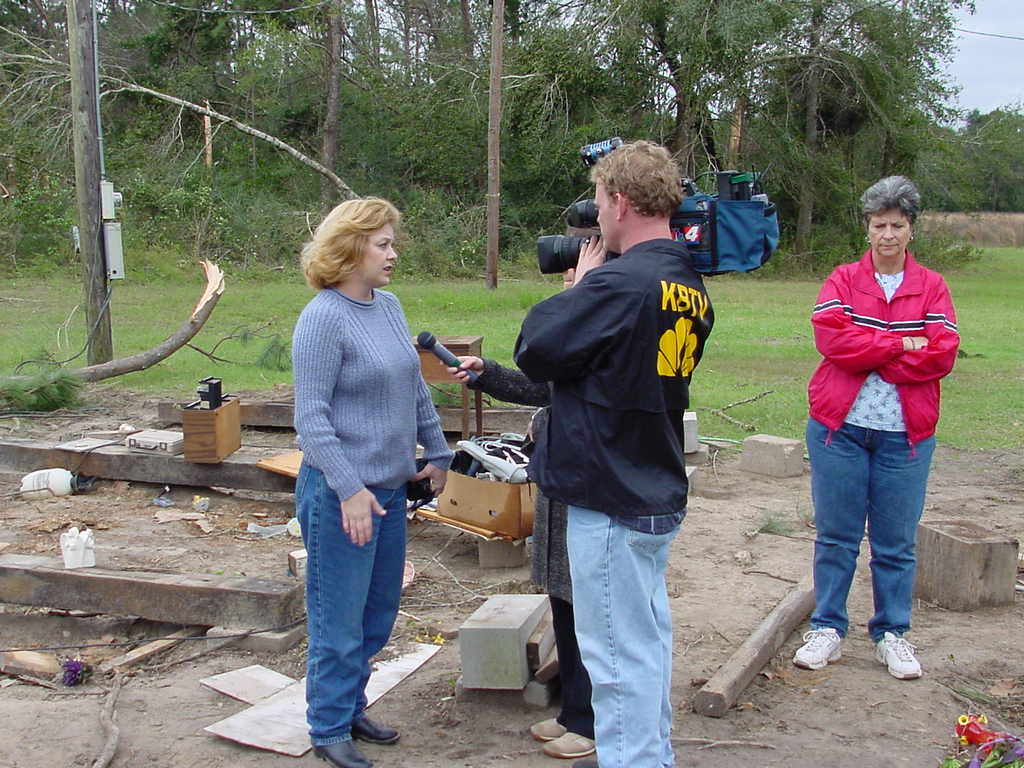
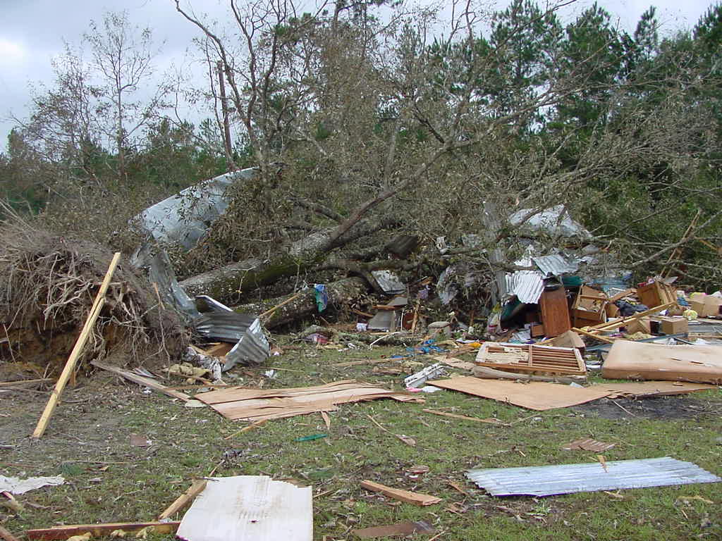
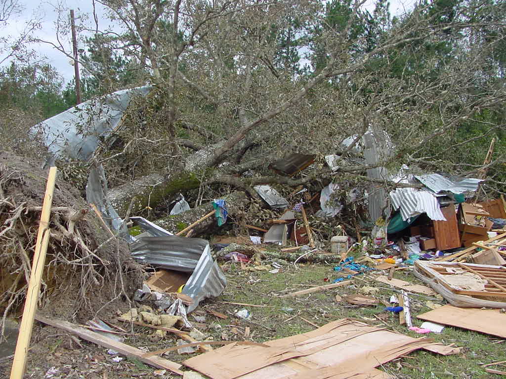
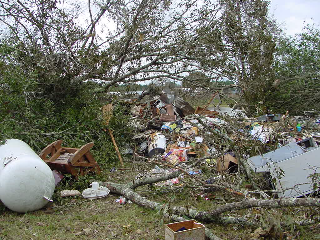
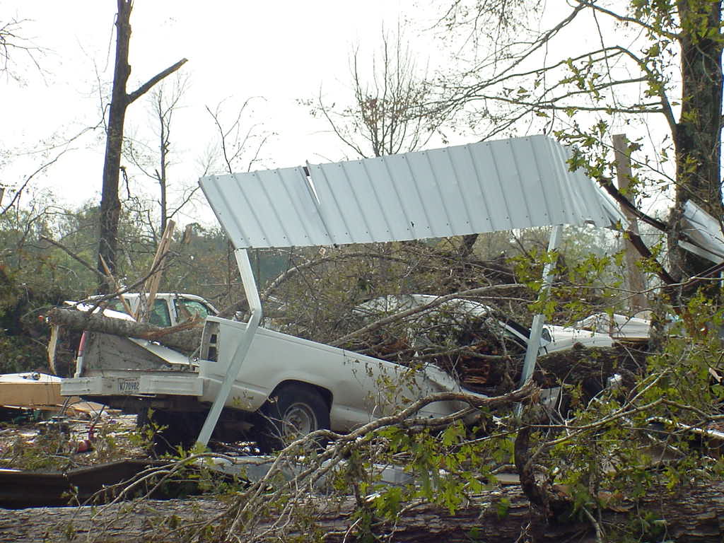
The second tornado from Supercell B developed just west of FM 92 about 4 miles south of Fred, very near the Kountze tornado while it was still on the ground. Both tornadoes were photographed and widely visible in this area, and damaged numerous trees, homes and mobile homes in northeastern Hardin County. One elderly woman was killed when two trees fell into her mobile home just east of the intersection of FM 92 and Old Spurger Highway. This was the first tornado-related death ever reported in Hardin County. Both tornadoes traveled together to the northeast for a few miles across northern Hardin County before the Kountze tornado dissipated. The Fred tornado continued into southern Tyler County, causing widespread damage to trees. Crossing the Neches River into Jasper County, the tornado continued damaging trees before reaching homes and structures southwest and west of Kirbyville. As the tornado dissipated west of Kirbyville, the next tornado was seen developing nearby. |
|||||
|
RADAR IMAGERY |
|||||
 |
 |
||||
|
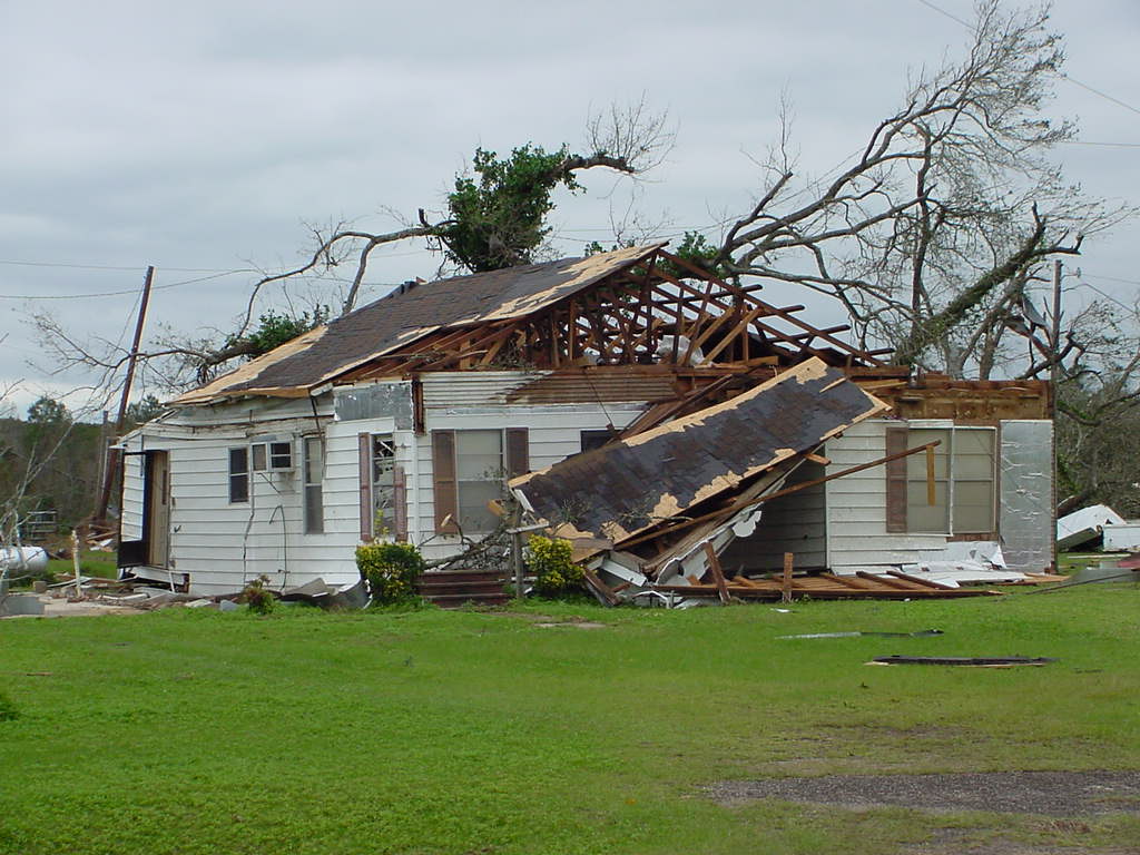
PHOTOS (tornado photos by Tena Burnes) |
|||||
 |
 |
 |
 |
 |
 |
 |
 |
 |
 |
 |
|
|
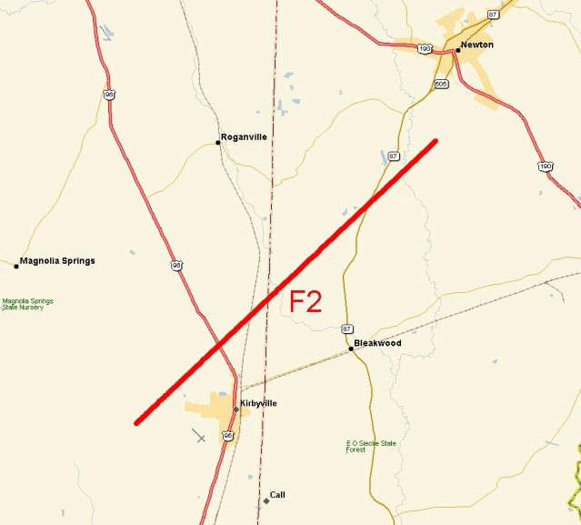
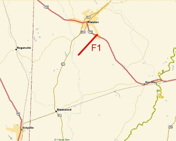
Kirbyville/Pine Grove Tornado |
|
 |
|
| DATE: 11/23/04 | RATING: F2 |
| TIME: 455 PM | PATH LENGTH: 15 miles |
| COUNTY: Jasper/Newton | PATH WIDTH: 500 yards |
| TORNADO WARNING LEAD TIME: 17 minutes | |
|
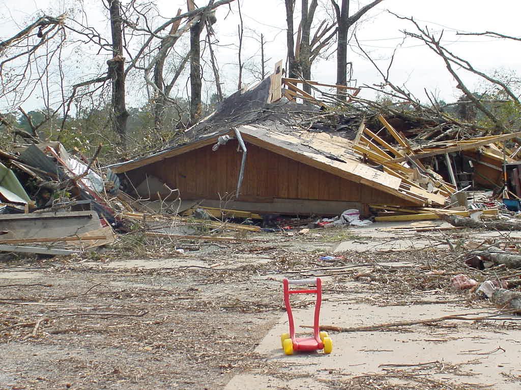
The Kirbyville/Pine Grove tornado was the third tornado from Supercell B and impacted areas just west of Kirbyville to the south of Newton. This tornado caused mainly tree and minor building damage as it crossed FM 1013 west of Kirbyville and Highway 96 about 2 miles north of Kirbyville. Passing into Newton County, the tornado then caused significant damage to trees and homes in the Bonami community. Continuing northeastward, the tornado struck the Pine Grove community of Highway 87. Widespread tree, utility and home damage occurred in this area. Damage to trees and homes continued before the tornado dissipated 2 miles south of Newton. |
|
|
RADAR IMAGERY |
|
 |
 |
|
PHOTOS |
|
 |
|
|
Newton Tornado |
|
 |
|
| DATE: 11/23/04 | RATING: F1 |
| TIME: 512 PM | PATH LENGTH: 3 miles |
| COUNTY: Newton | PATH WIDTH: 300 yards |
| TORNADO WARNING LEAD TIME: 15 minutes | |
|
The fourth tornado from Supercell B caused minor tree and home damage on the southeast side of the City of Newton. |
|
|
RADAR IMAGERY |
|
 |
|
|
Evans Tornado |
|
 |
|
| DATE: 11/23/04 | RATING: F1 |
| TIME: 540 PM | PATH LENGTH: 9 miles |
| COUNTY/PARISH: Newton/Vernon | PATH WIDTH: 500 yards |
| TORNADO WARNING LEAD TIME: 7 minutes | |
|
The fifth tornado from Supercell B began in eastern Newton County, and then crossed the Sabine River into Louisiana. As the tornado spun through western Vernon Parish, it struck the south side of Evans, damaging trees and numerous homes. The tornado continued through the Boise-Vernon Wildlife Management Area and dissipated west of Highway 464, northwest of Fal. |
|
|
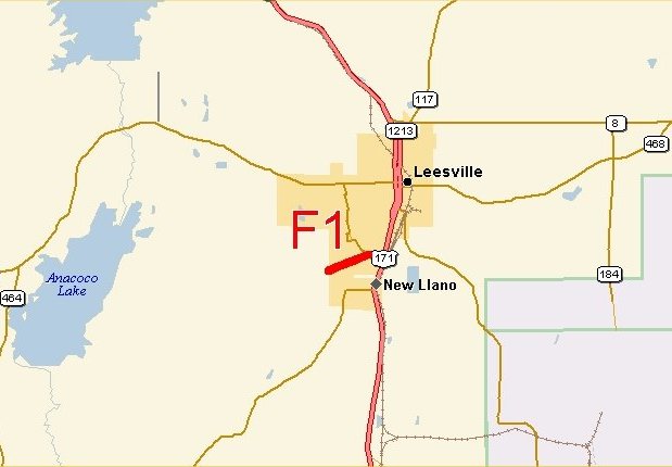
Leesville Tornado |
|
 |
|
| DATE: 11/23/04 | RATING: F1 |
| TIME: 608 PM | PATH LENGTH: 1 miles |
| COUNTY: Vernon | PATH WIDTH: 100 yards |
| TORNADO WARNING LEAD TIME: 39 minutes | |
|
The Leesville tornado touched down in the southern part of the city, damaging several homes and businesses west of Highway 171. Although the tornado weakened and lifted just as it reached 171, debris from the damaged structures closed the highway for a time. |
|
|
RADAR IMAGERY |
|
 |
|
|
Hutton Tornado |
|||||
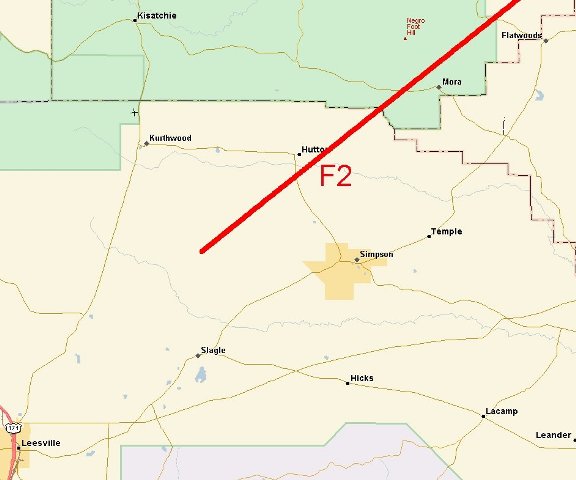 |
|||||
| DATE: 11/23/04 | RATING: F2 | ||||
| TIME: 635 PM | PATH LENGTH: 15 miles | ||||
| COUNTY: Vernon | PATH WIDTH: 600 yards | ||||
| TORNADO WARNING LEAD TIME: 18 minutes | |||||
|
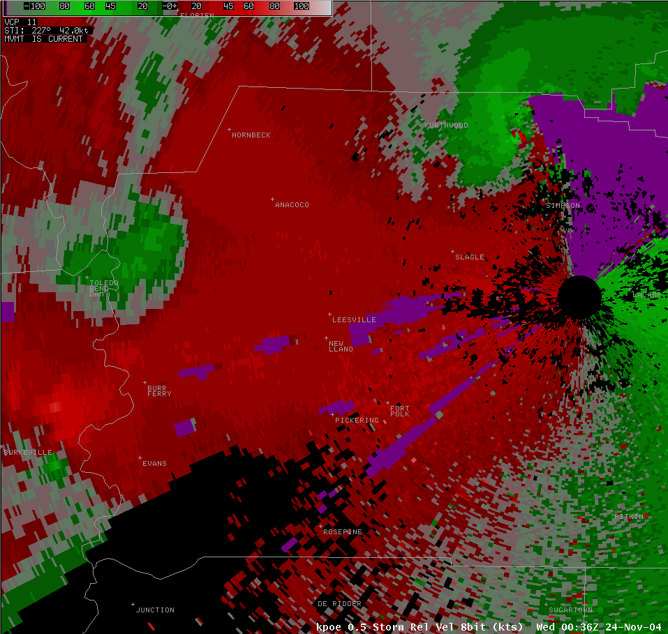
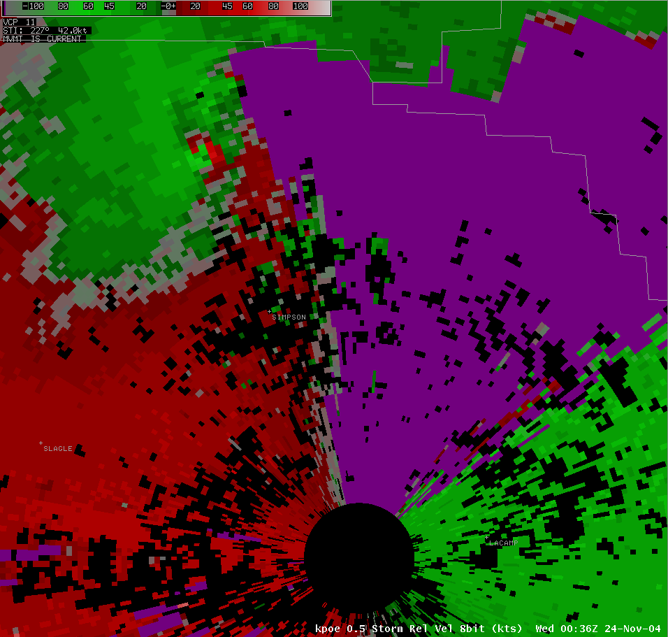
The seventh tornado from Supercell B developed north of Slagle and moved northeastward at over 40 mph. This was likely the strongest tornado in the WFO LCH county warning area during this event, based on a very impressive radar presentation and the damage seen around Hutton. As the tornado crossed Highway 465 south of Hutton, there was a 1/3 mile swath of major tree damage, with numerous trees 1 to 2 feet in diameter snapped off at the base or uprooted. In the Hutton community, several homes were damaged or destroyed. The tornado exited Vernon Parish into Natchitoches Parish west of Mora. Please visit the WFO Shreveport website for more information on this tornado. |
|||||
|
RADAR IMAGERY |
|||||
 |
 |
 |
 |
||
|
PHOTOS |
|||||
 |
 |
 |
 |
 |
 |
|
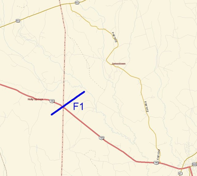
Holly Springs Tornado |
|
 |
|
| DATE: 11/23/04 | RATING: F1 |
| TIME: 610 PM | PATH LENGTH: 2 miles |
| COUNTY: Jasper/Newton | PATH WIDTH: 100 yards |
| TORNADO WARNING LEAD TIME: 7 minutes | |
|
The first tornado from Supercell C in the WFO LCH County Warning Area, it damaged trees along the Jasper/Newton County line. Its northeastward path crossed Highway 190 just east of Holly Springs. |
|
|
RADAR IMAGERY |
|
 |
 |
|
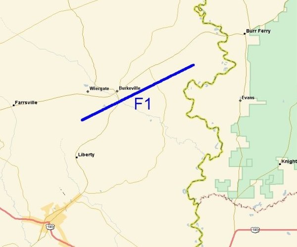
Burkeville Tornado |
|||
 |
|||
| DATE: 11/23/04 | RATING: F1 | ||
| TIME: 630 PM | PATH LENGTH: 10 miles | ||
| COUNTY: Newton | PATH WIDTH: 300 yards | ||
| TORNADO WARNING LEAD TIME: 21 minutes | |||
|
The second tornado from Supercell C began southwest of Burkeville and moved east-northeast just south of the town. Numerous trees, power lines and homes were damaged along its path. |
|||
|
RADAR IMAGERY |
|||
 |
|||
|
PHOTOS |
|||
 |
 |
 |
 |
|
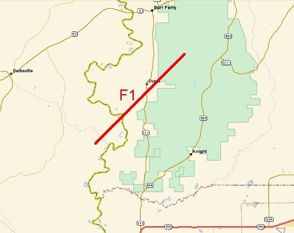
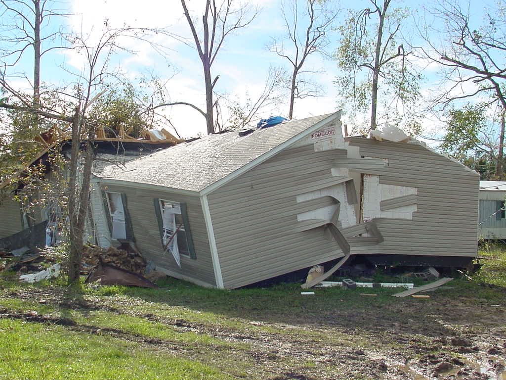
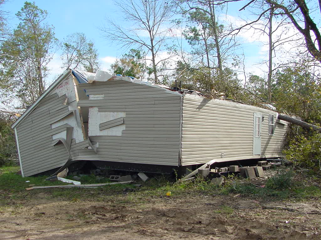
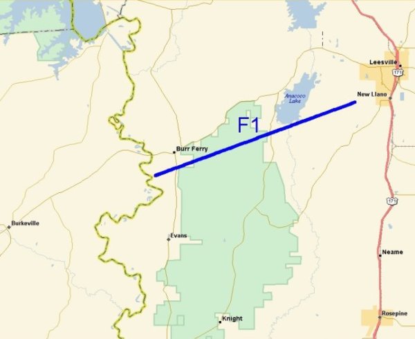
Burr Ferry Tornado |
|
 |
|
| DATE: 11/23/04 | RATING: F1 |
| TIME: 650 PM | PATH LENGTH: 14 miles |
| PARISH: Vernon | PATH WIDTH: 150 yards |
| TORNADO WARNING LEAD TIME: 0 minutes | |
|
The Burr Ferry tornado began along the Texas/Louisiana border and snapped or uprooted numerous trees as it moved east-northeastward across Highway 111 just south of Burr Ferry. Trees and mobile homes continued to be damaged as the tornado crossed Highway 464 about 2 miles south of its intersection with Highway 8. Although the tornado was heading directly for Leesville, it luckily dissipated before reaching the city. |
|
|
RADAR IMAGERY |
|
 |
|
|
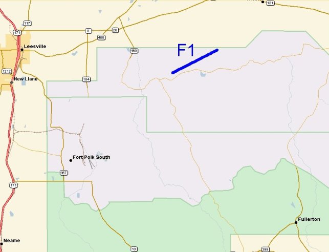
Fort Polk Tornado |
|
 |
|
| DATE: 11/23/04 | RATING: F1 |
| TIME: 720 PM | PATH LENGTH: 3 miles |
| PARISH: Vernon | PATH WIDTH: 200 yards |
| TORNADO WARNING LEAD TIME: 5 minutes | |
|
The fourth tornado from Supercell C damaged trees and power lines on the north side of Fort Polk. |
|
|
RADAR IMAGERY |
|
 |
|