|
First Dust Storm of the Season Strikes |
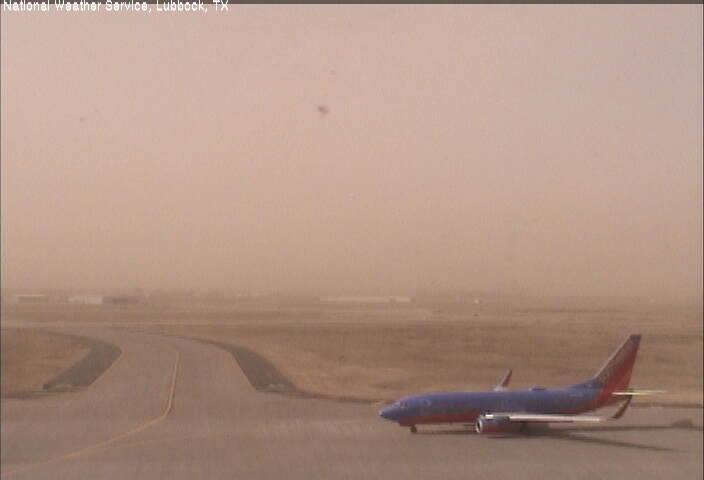 |
| A Southwest jet prepares to depart to Austin amid blowing dust at Lubbock International Airport on Saturday afternoon (16 November 2013). This was near the height of the wind when gusts were near 50 mph. The visibility dropped as 1.25 miles during the height of the dust storm. |
| The wind and dust season kicked off on Saturday for the South Plains region. A strong storm system passing by to the north of the area was responsible for the winds, bringing gusty winds to much of the central and western portion of the nation. Here in northwest Texas winds during the afternoon gusted into the 45-55 mph range. These winds lofted plenty of blowing dust, especially in a corridor from near Plains to Lubbock to Floydada and Childress, as illustrated in the below satellite image. The visibility dropped to near 1 mile during the peak of the dust storm at the Lubbock and Childress airports. Conditions quickly improved near sunset when winds decreased and dust began to settle out. |
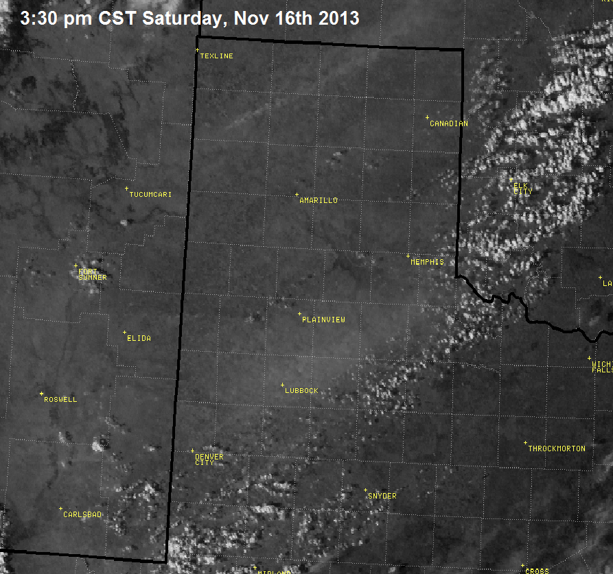 |
| Visible satellite image taken at 3:30 pm on November 16, 2013. A plume of dust is apparent across the central South Plains into the southeast Texas Panhandle. |
| The below image shows the maximum winds observed during the afternoon hours of November 16th. The plume of dust (above) corresponded to a corridor of stronger wind gusts that moved across the central South Plains. Additional wind gusts in excess of 50 mph were also observed over portions of the central and western Texas Panhandle. In Dalhart a peak gust of 62 mph was recorded. |
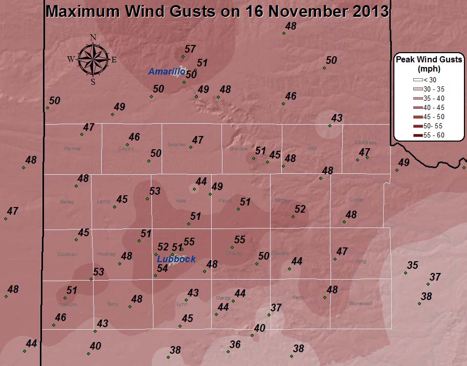 |
| Plot of the maximum wind gusts observed across the region during the afternoon on Saturday, November 16th. The data are courtesy of the West Texas Mesonet and the National Weather Service. |
| Although skies were mostly clear during the afternoon, the dust did filter the sunshine (insolation). Even though this decreased the amount of heating from the sun (see the below graph), the stout southwesterly downslope winds still propelled temperatures well into the 70s, with highs off the Caprock topping out in the lower 80s. |
 |
| (Above) Plot of incoming solar radiation (sunshine), in yellow, measured by the West Texas Mesonet site near Texas Tech University. (Below) Visible satellite image captured around 3 pm, when dust was filtering the sun and reducing heating of the ground. |
| The below plot shows the maximum wind gusts, maximum sustained winds and high temperatures observed by the West Texas Mesonet sites across the region on November 16th. |
|
|
||
|
Toggle Maximum Wind Gust (mph) on November 16, 2013
|
Toggle Maximum Sustained Wind Speed (mph) on Nov. 16, 2013
|
Toggle High Temperatures for November 16, 2013
|


 Follow us on YouTube