| Rain Falls on the Rolling Plains 2 April 2017 |
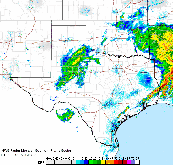 |
| Regional radar animation valid from 4:08 pm to 5:18 pm on Sunday, 2 April 2017. |
| The approach and passage of an upper level storm system, coupled with a cold front, brought persistent cloudy skies along with cool and raw conditions for the first weekend of April. Most locations only saw afternoon highs in the 40s and 50s over the weekend (1-2 April 2017). Additionally, the clouds occasionally became productive, dropping rain in spots. Light rain visited much of the Panhandles on Saturday. The rain then shifted southward closer to the center of the upper level low on Sunday. A broad area of rain, along with a few embedded thunderstorms, visited the far southeast Texas Panhandle and much of the Rolling Plains Sunday. The rain eventually shifted off to the east with the departing storm system Sunday evening. |
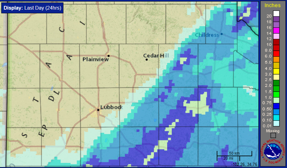 |
| 24-hour radar-estimated and bias-corrected rainfall ending at 1 am on Monday, 3 April 2017. CLICK HERE for a regional view of the above image. |
| Rain totals of a third to half inch were fairly common along and east of a Childress to Tahoka line, with isolated amounts up near an inch. Officially, the Childress Airport recorded 0.44 inches, taking their yearly rainfall total up to 6.15 inches, which is 2.73 inches above average to this point in the year. |
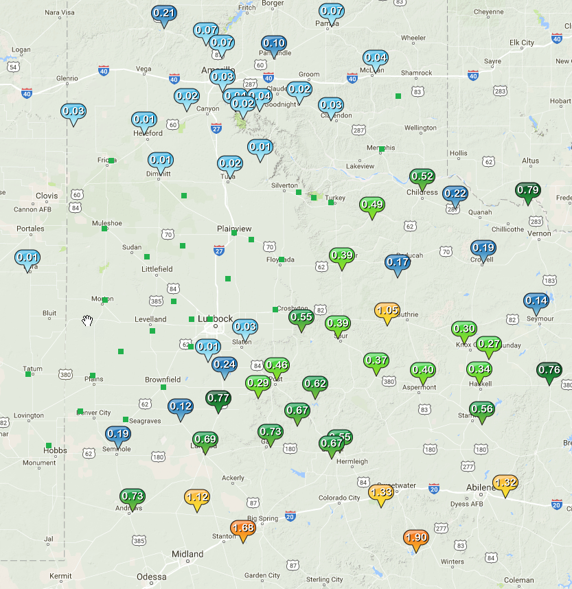 |
| Two-day rainfall totals measured by the West Texas Mesonet, ending at 7 am on 3 April 2017. |

