Highway 12 ("S" Turns) Just north of Rodanthe (9/20/2020). Credit Rob Jenkins.
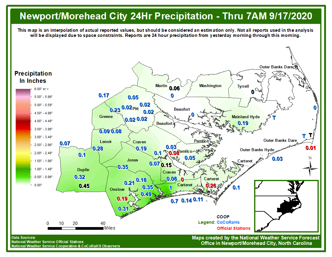
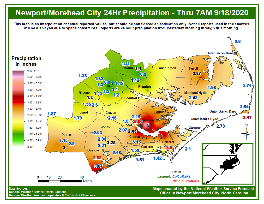
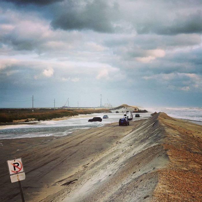
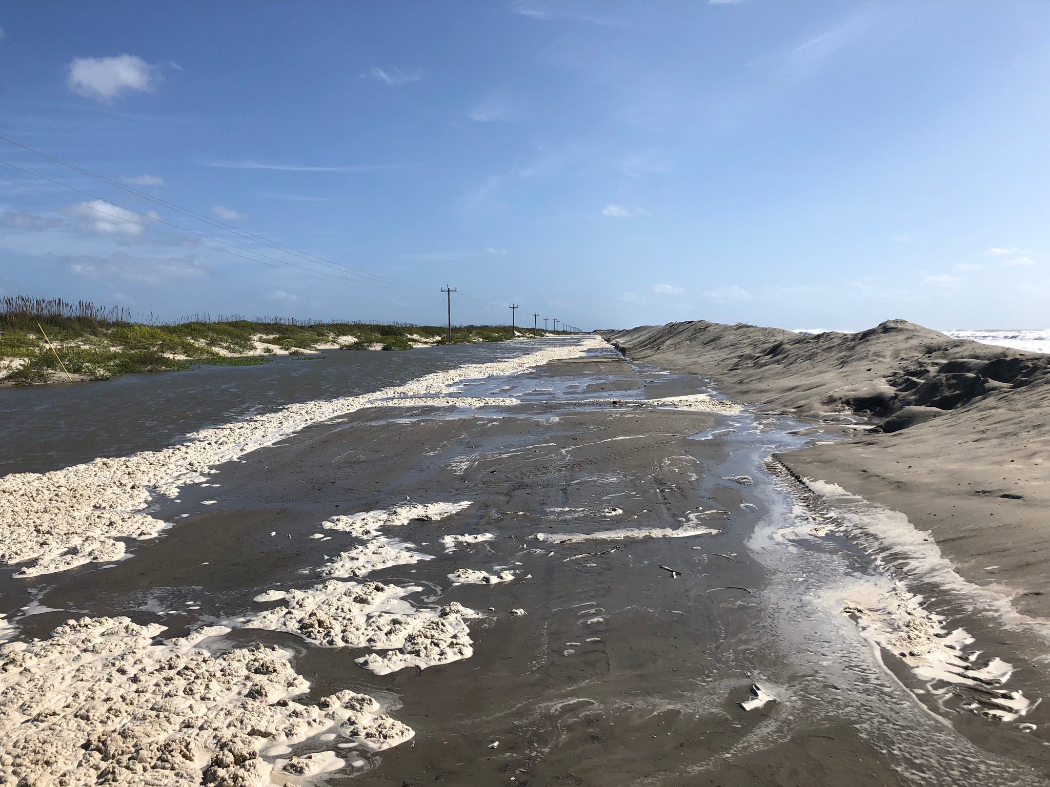
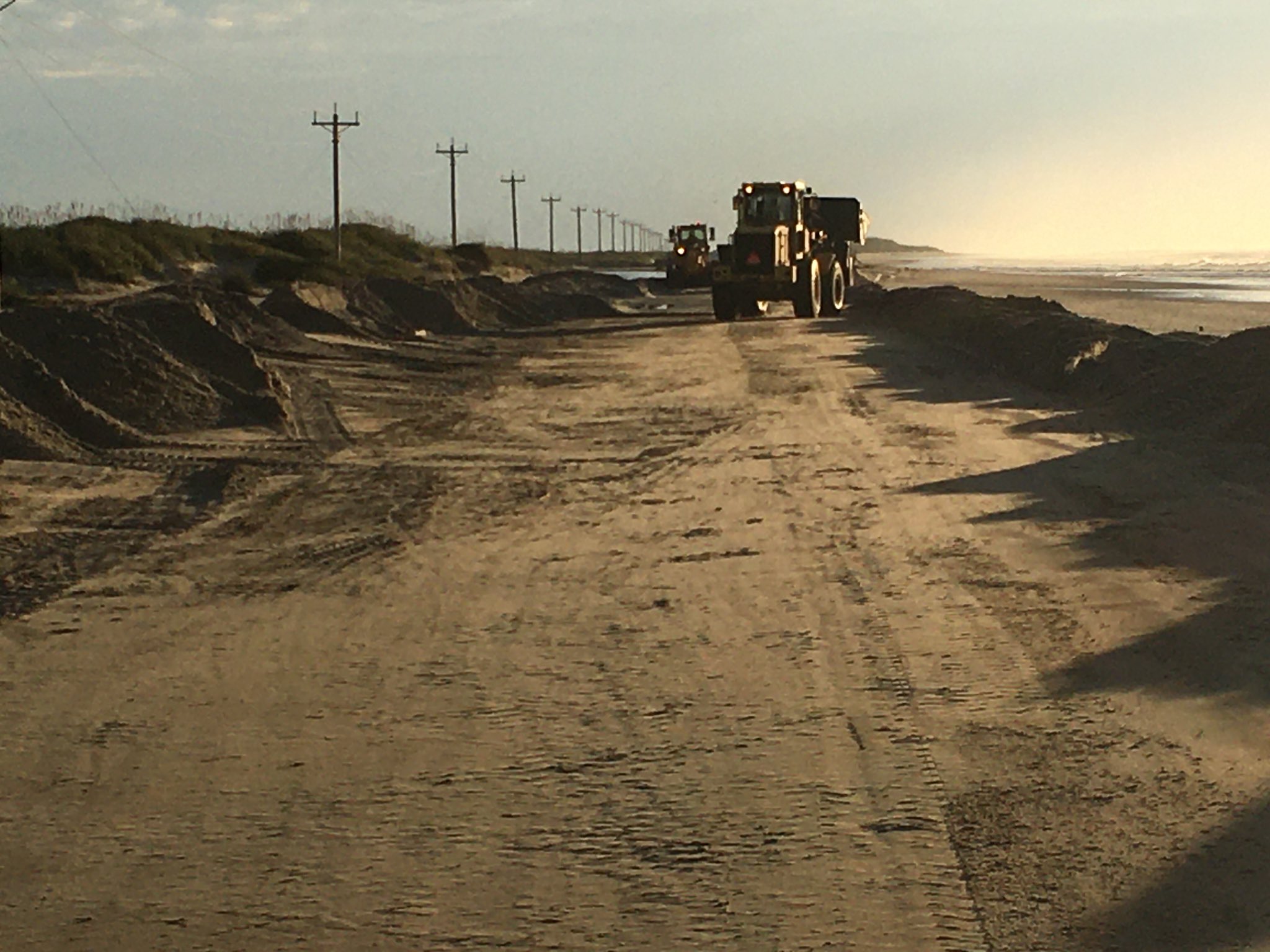
Our area often has direct impacts from tropical cyclone due to our location along the coast of Eastern North Carolina. While much attention is given to landfalling cyclones, impacts can often occur from either decaying cyclones (remnants) or distant storms in the ocean. In the middle of September 2020, the remnants of Hurricane Sally and distant Hurricane Teddy provided excellent examples of that. The biggest impacts were from the distant swells from Hurricane Teddy, which combined with an already high astronomical tide and elevated water due to persistent northeast winds, to produce coastal flooding. This occurred over multiple tide cycles from Sunday September 20th through Tuesday September 22nd. Coastal flooding occurred along the lower Neuse River near Oriental, near the Pamlico Sound in Downeast Carteret County, and also in downtown Morehead City and Beaufort. These impacts were mainly minor, with elevated water levels over most of the adjacent sounds and rivers near these areas. The most severe impacts were over the Outer Banks, especially Hatteras and Ocracoke Islands. Highway 12 was closed for multiple days due to severe beach erosion and ocean over wash. Large sections of dunes were completely washed out. While water levels lowered by Wednesday September 23rd, Highway 12 along portions of the Outer Banks was still closed as ocean over wash still occurred due to the lack of dunes.
The remnants of Sally brought heavy rain to our area Thursday September 17th into the early morning of Friday September 18th. This mainly caused some poor drainage or low lying area flooding due the peak of the rainfall intensity Thursday evening. Most of eastern North Carolina was under a tornado WATCH Thursday evening, with two tornadoes confirmed near Lowland and Merrimon, NC.
Using the tabs below, you will find more information on both events. The tabs go in order of most impacts, not chronological in terms of dates.
Coastal Flooding
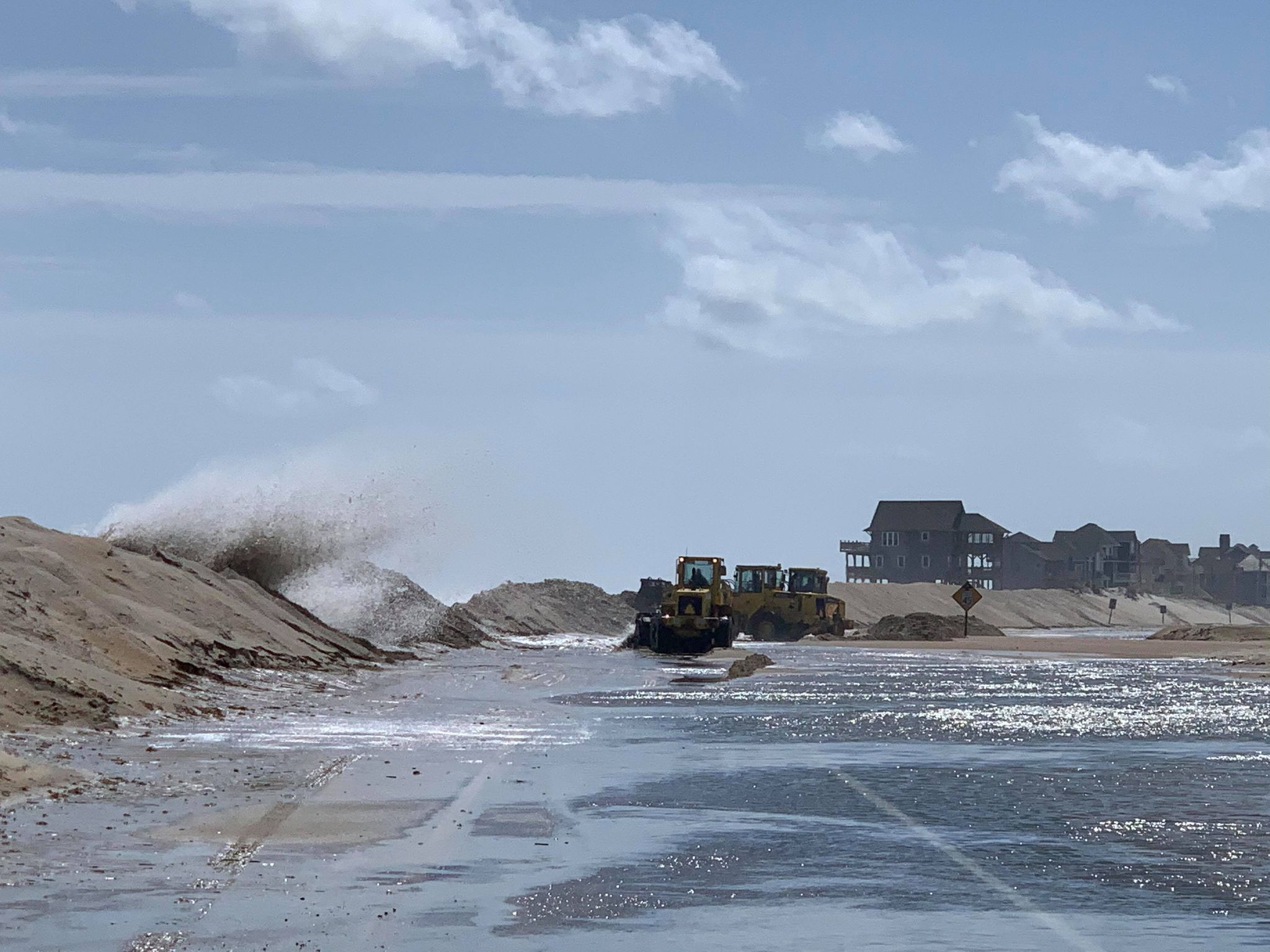
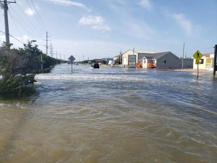
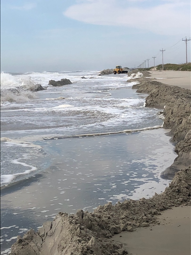
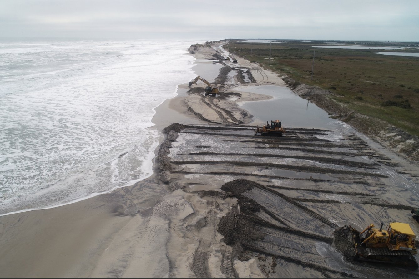
We are going out of order in terms of chronology because the biggest impacts in our area during this time were associated with the coastal flooding. The flooding was caused by three different factors: 1) Certain periods of the year we have higher than normal astronomical tides. These higher tides can cause flooding even absent of other weather factors and often are referred to as "sunny day" flooding or the "king tides". These higher tides caused elevated water levels as early as the 15th of September, and continued through the 21st. 2) During a stretch of 3 days (19th - 21st), we had a persistent northeast to north wind that was quite strong over our coastal waters. This prolonged intensity and similar wind direction caused water levels to increase and enhanced the effect of the already higher than normal tides. 3) Lastly, during this same period (19th - 22nd) we had a large, strong, swell from Distant Hurricane Teddy. The large swell led to wave runup on the beaches, which caused serve beach erosion, along with dune breaches and ocean overwash in many areas along the Outer Banks. Portions of Highway 12 along Hatteras Island and Ocracoke Island were closed for multiple days. More than a few locations along this stretch had more than 1,000 feet of dunes that were washed away.
Below are some weather related graphs and information. Please see the videos and pictures tab for more on the impacts.
.png)
The above gauge at Duck shows that minor to moderate coastal flooding occurred at a few high tide cycles starting from Sunday the 20th through Tuesday the 22nd. The wave run up from distant hurricane Teddy produced caused severe beach erosion with many sections of dunes washed away. Despite "lower" but still elevated tides by mid week (23rd), the lack of dunes caused more ocean overwash and this negated much of the hard work by the NCDOT to open back up Highway 12.
.png)
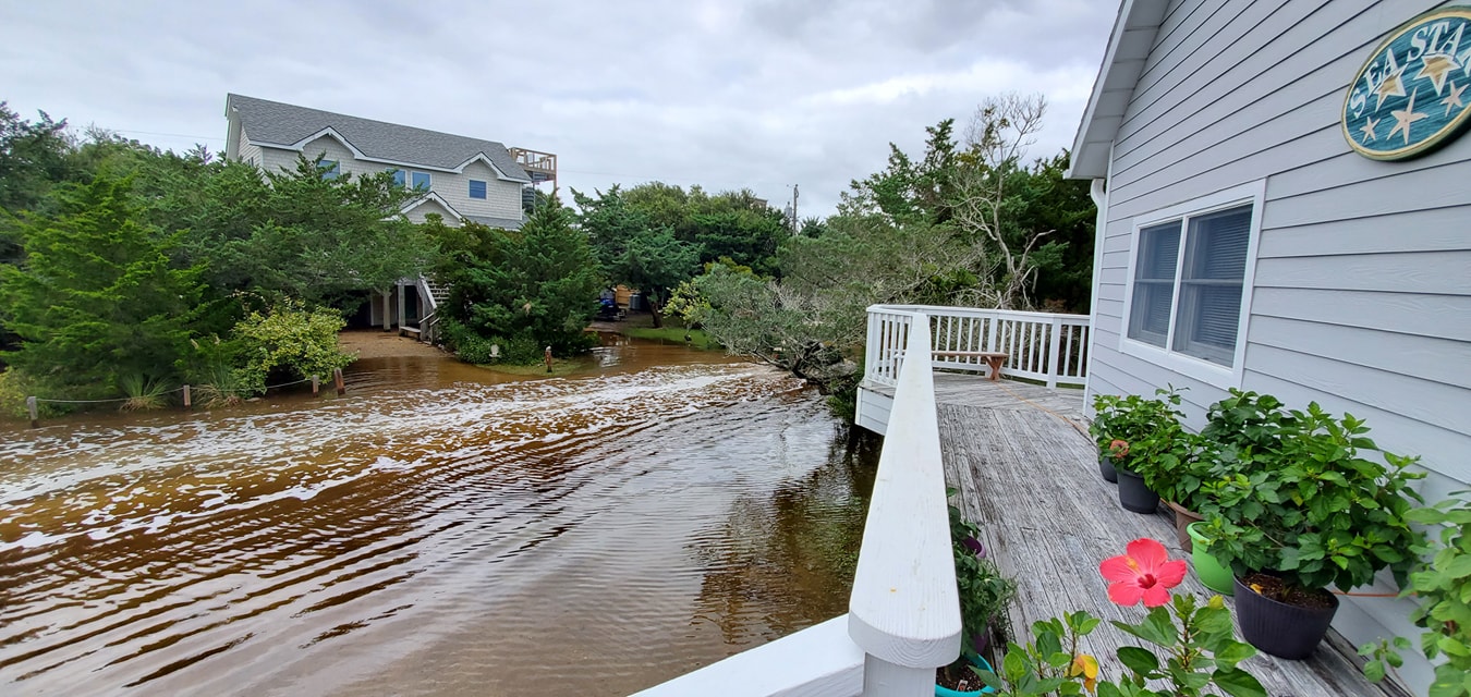
The above gauge at Beaufort shows that minor coastal flooding occurred at a few high tide cycles starting from late morning/midday Sunday the 20th, through midday Monday the 21st and Tuesday the 22nd. Water was observed during these high tides in Downtown Morehead city along Sheperd Street between 9th and 11th streets. Morehead City also saw flooding on the north side of town along 4th street near Floyd's and Fisher street and 7th street near the intersection of Bay Street. Downtown Beaufort also saw some water on the east end of Front Street near Gerald Street, and in the business district along Front Street.
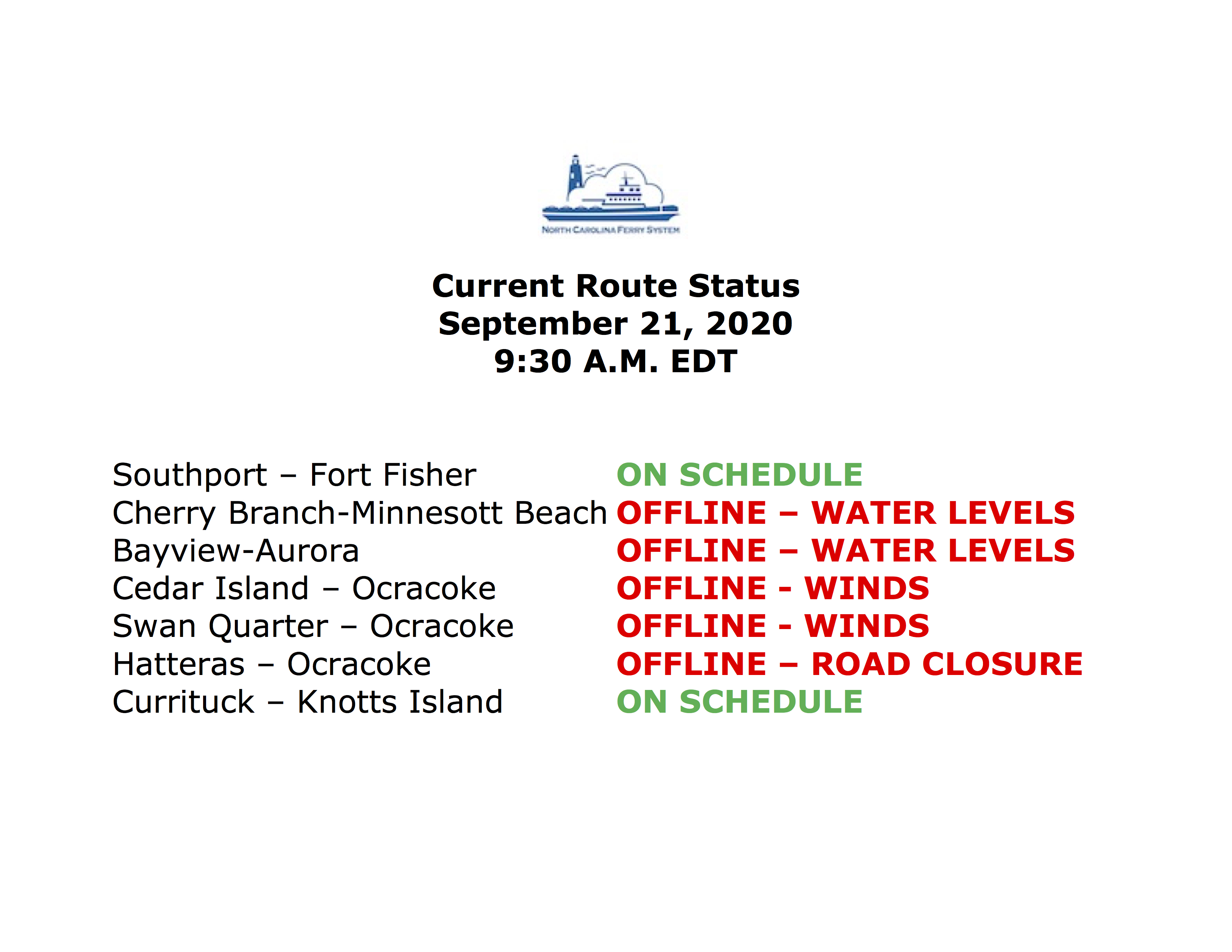
During the peak of the elevated water levels, the higher water levels and/or rough seas and winds caused ferry closures along the lower Neuse River and Pamlico Sounds.
High Surf
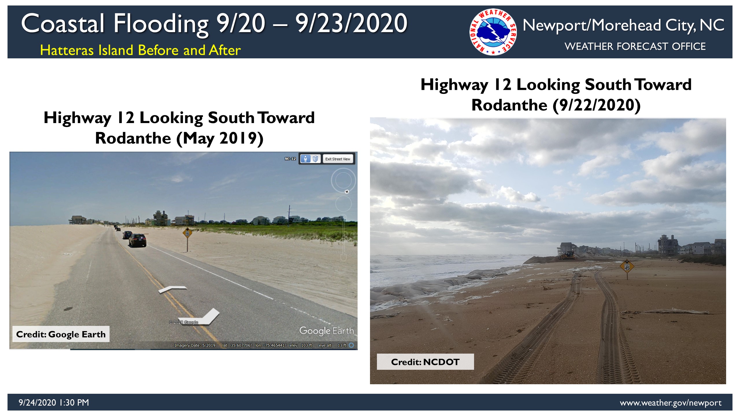
Highway 12 just north of Rodanthe. The image on the left shows what Highway 12 should look like. The image on the right shows how the highway looked late morning on September 22nd, 2020.
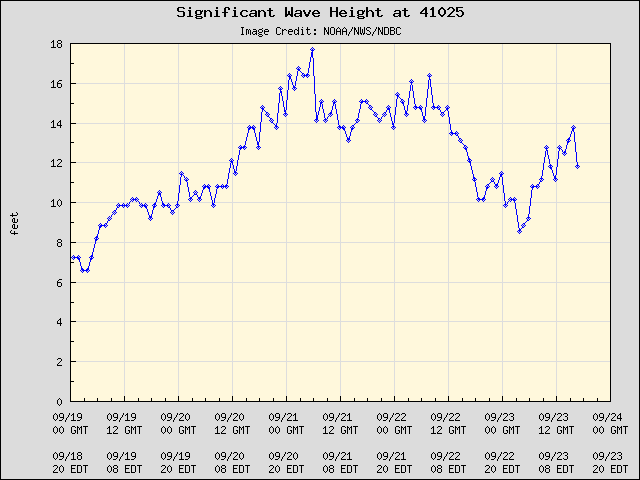
The Diamond Shoals buoy is located less than 20 miles off from Cape Point on Hatteras Island. Wave heights were 10 feet or greater for more than 5 days starting on September 19th. Waves peaked at around 18 feet on the 21st, but as the graph shows above the significant waves continued for a long duration. This long duration swell from distant hurricane Teddy caused severe beach erosion and rough surf all along our coastline.
Videos
***Check back for more soon***
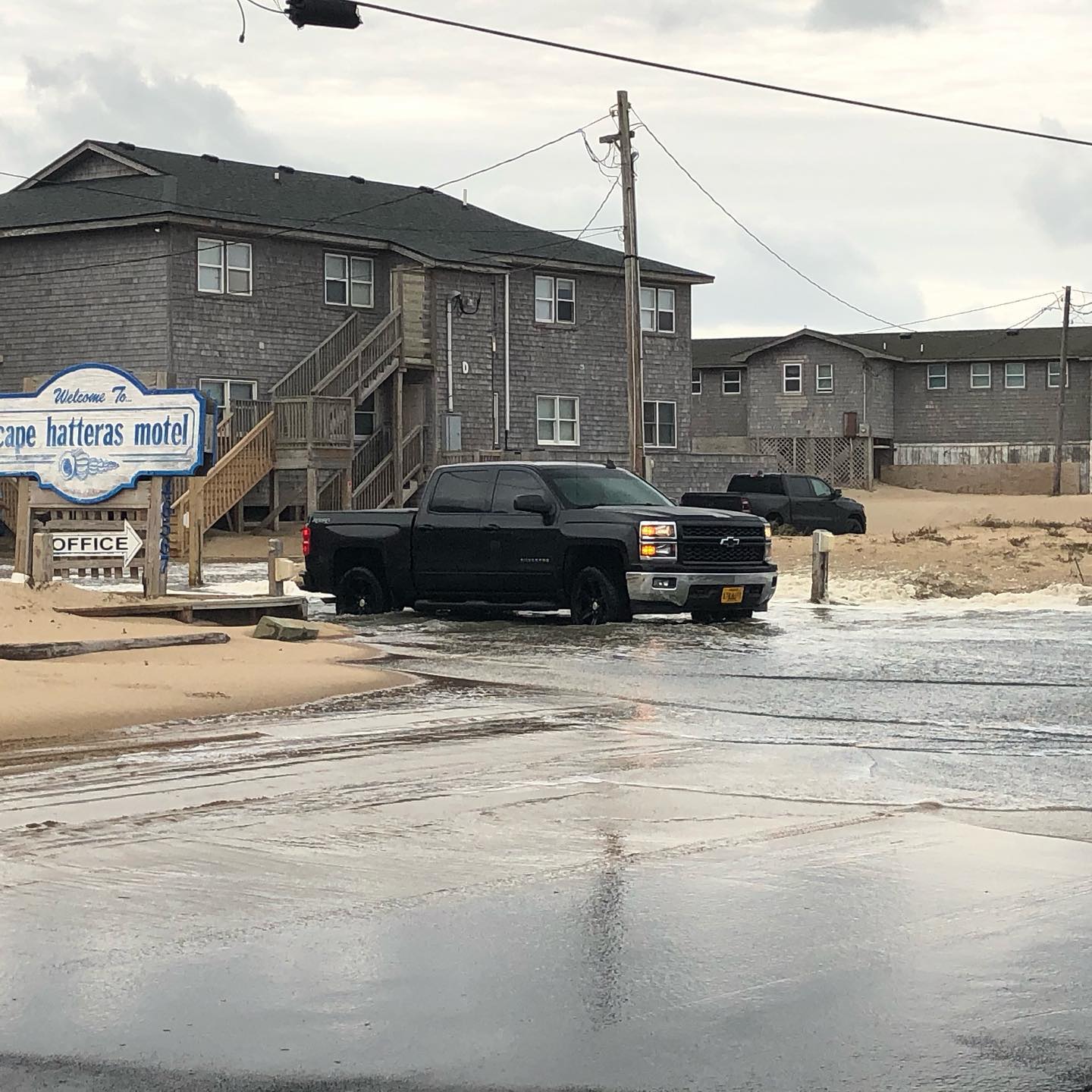
Cape Hatteras Motel Overwash September 21st, 2020
Cape Hatteras Motel Overwash September 21st, 2020
Ocracoke Island Dune Washed Out September 21st - 22nd, 2020
Downtown Morehead City Coastal Flooding September 21st, 2020
Pictures
Hatteras Island Pictures
|
Highway 12 "S" Turns Credit: Michael Flynn. Island Free Press. |
Avon, NC Credit: Joy Crist. Island Free Press. |
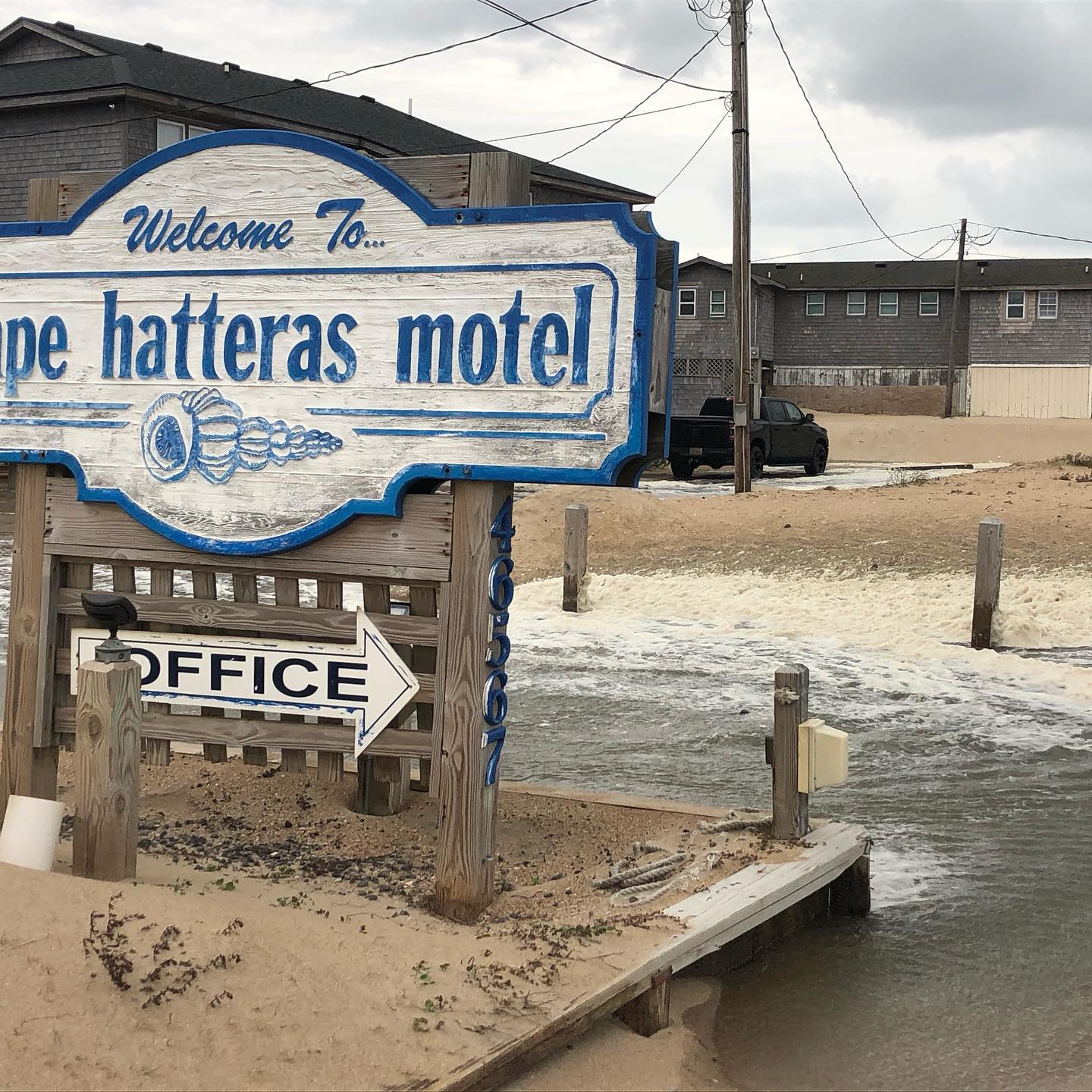
Buxton, NC Credit: Cape Hatteras Motel. |
|
Buxton, NC. Credit: Cape Hatteras Motel. |
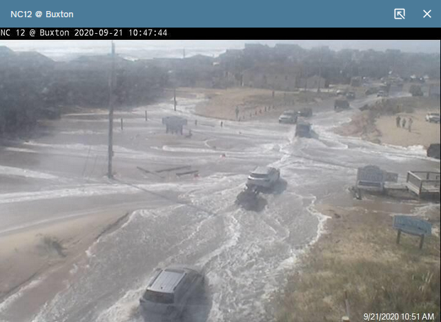
Buxton, NC (Highway 12) Credit: NC DOT |
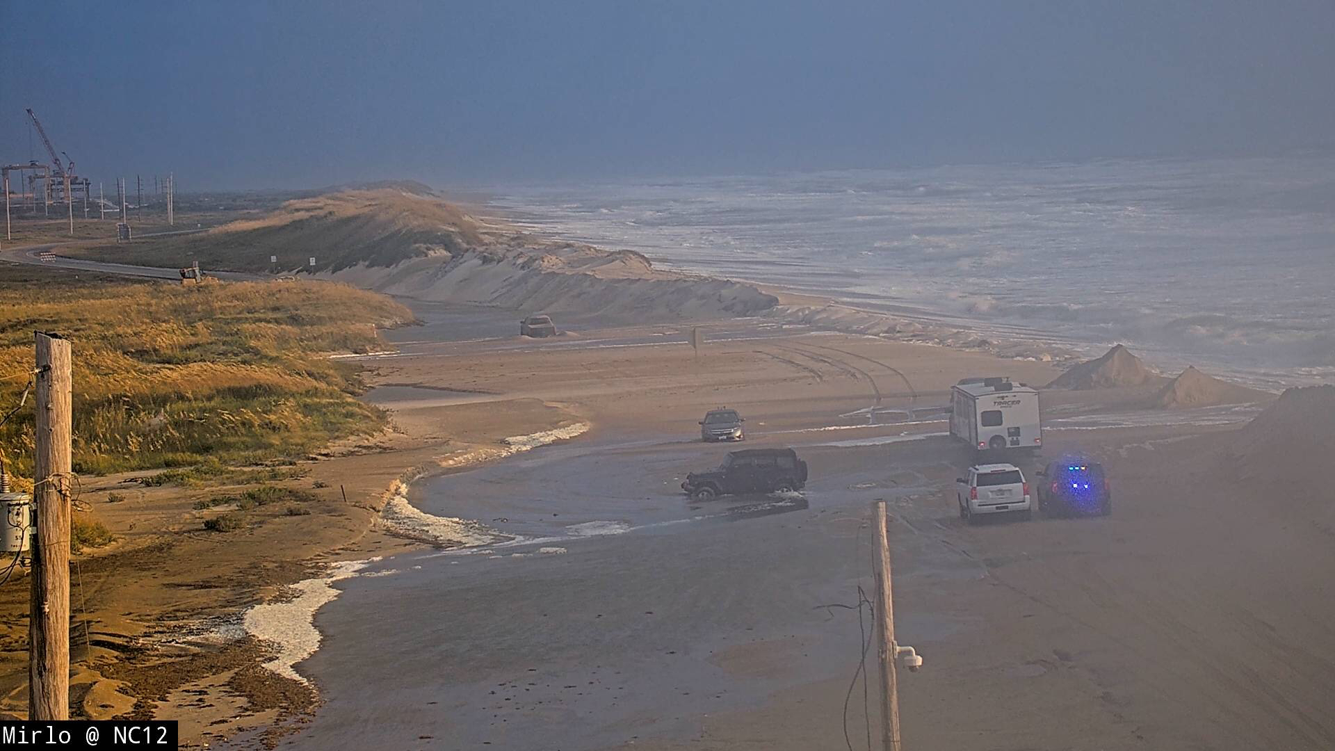
Mirlo, NC (Highway 12) Credit: NC DOT |
Ocracoke Island Pictures
|
Highway 12 North End Ocracoke Island Credit: Cape Hatteras National Seashore. |
Highway 12 North End Ocracoke Island Credit: Cape Hatteras National Seashore. |
Highway 12 North End Ocracoke Island Credit: Cape Hatteras National Seashore. |
|
Highway 12 North End Ocracoke Island Credit: Cape Hatteras National Seashore. |
Ocracoke Island
|
Tornadoes
Sally was a good example of how impacts from any tropical cyclone can extend beyond just winds and from the actual landfall itself. Despite making landfall hundreds of miles away, we still saw tornadoes from the remnants of Sally. Tornadoes are one of five impacts from any tropical cyclone.
EF1 Confirmed Tornado in Merrimon
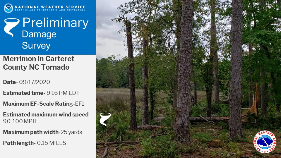 Start Location...Merrimon in Carteret County, NC
Beginning Lat/Lon...34.9364/-76.6291
Ending Lat/Lon...34.9385/-76.6289
EF0 Confirmed Tornado near Lowland
 Start Location...3.5 Miles Northwest of Lowland in Pamlico County, NC
Beginning Lat/Lon...35.259364/-76.606632
Ending Lat/Lon...35.260232/-76.605169
Heavy Rain
As the remnants of Sally spread through the Carolinas, bands of heavier rain moved across our area starting early on the morning of September 17th. The intensity of the rain peaked during the evening of the 17th into the early morning of the 18th. Outside of the far northwest part of our area, a general 2 to 5 inches fell in association with Sally. Our area received only minor impacts due to the rainfall, mainly some issues with ponding of water in low lying or poor drainage areas. In addition we saw steady rises on the rivers the following week.


.png) Surf Forecast/Rip Currents
Surf Forecast/Rip Currents Map View
 Weather Hazard Briefing (when applicable)
 Forecaster Discussion
 Marine
 Text Products
.png) Skywarn
Skywarn Submit Storm Reports
 Coastal Flood
 Follow us on YouTube