
Heavy lake effect snow, gusty winds, and localized blizzard conditions will persist through Thanksgiving near and downwind of the Great Lakes. Rain and mountain snow are forecast for the Pacific Northwest. Confidence is increasing for another winter storm to develop over the northern and central Rockies Friday and track across the central Plains through the Midwest and Great Lakes this weekend. Read More >
Overview
During the early morning hours of July 12th, a line of severe storms tracked from central Minnesota into western Wisconsin. This line of storms created widespread damaging straight line winds across Anoka and northern Washington Counties in eastern Minnesota, with the damaging winds continuing into northwest St. Croix and southwestern Polk counties in western Wisconsin. Within this broad swath of damaging winds, there were four tornadoes. In East Bethel, Columbus, Wyoming, southern Forest Lake, and Hugo, two tornadoes occurred, both with concentrated paths of more significant damage. Two more tornadoes occurred elsewhere: one touched down southeast of Chisago City and the other hit Warner Nature Center and surrounding areas, southwest of Marine on St. Croix.
Tornadoes:
|
Tornado #1 - East Bethel, Columbus, Linwood Township, Wyoming
Tornado #2 - Columbus, Forest Lake, Hugo
Tornado #1 Track Map 
The green dots represent some of the locations of downburst damage.
Tornado #2 Track Map 
The green dots represent some of the locations of downburst damage |
||||||||||||||||||||||||||||||||
|
Tornado #3 - Lindstrom
Tornado #4 - May Township, near Marine on St. Croix
Tornado #3 Track Map 
The green dot represents location of some of the downburst damage Tornado #4 Track Map 
The green dot represents location of some of the downburst damage |
||||||||||||||||||||||||||||||||
The Enhanced Fujita (EF) Scale classifies tornadoes into the following categories:
| EF0 Weak 65-85 mph |
EF1 Moderate 86-110 mph |
EF2 Significant 111-135 mph |
EF3 Severe 136-165 mph |
EF4 Extreme 166-200 mph |
EF5 Catastrophic 200+ mph |
 |
|||||
Photos
 |
 |
 |
 |
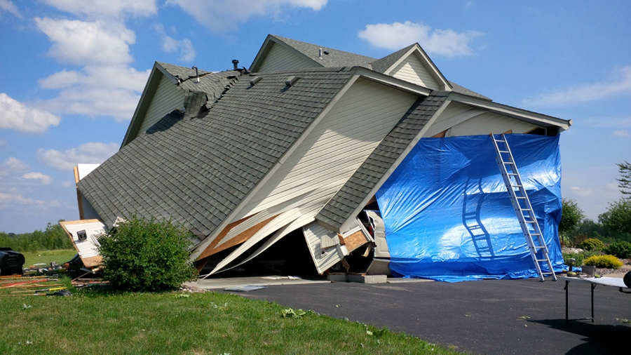
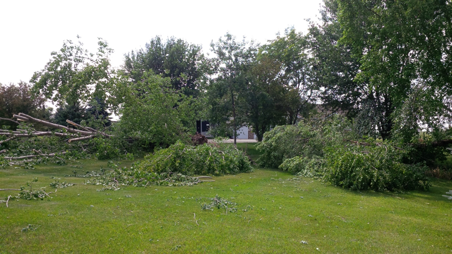
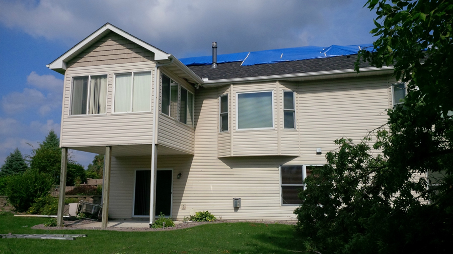
| A garage collapsed just south of Columbus. | Tree damage was common along the path. | Minor roof damage to this home. A window was also broken, but was quickly replaced. | Destroyed barn in southern Chisago County |
Radar:
| Radar reflectivity (left) and storm relative velocity (right) loop of tornadic storm across far eastern Anoka and northwestern Washington counties from 227 AM through 237 AM. |
Storm Reports
Click link to see storm reports for July 9, 2017: http://www.spc.noaa.gov/exper/archive/event.php?date=20170711
Environment
The overall low level environment was not supportive of tornadoes given a sizable stable layer as shown in the special balloon launch a couple hours before the tornado formed. However, if that stable layer mixed out locally as was suspected, then the storm was able to work with a lot of instability and low level shear.
.gif) |
| Special Chanhassen (MPX) sounding at 1 AM |
 |
Media use of NWS Web News Stories is encouraged! Please acknowledge the NWS as the source of any news information accessed from this site. |
|

