
Heavy lake effect snow will persist downwind of the Great Lakes through early Saturday. Snow squalls with heavy snow and gusty winds will create dangerous travel in the Interior Northeast due to low visibility and slippery roads. A major winter storm will bring moderate to heavy, accumulating snow and gusty winds from the eastern Plains to the western Great Lakes today through Saturday. Read More >
Overview
|
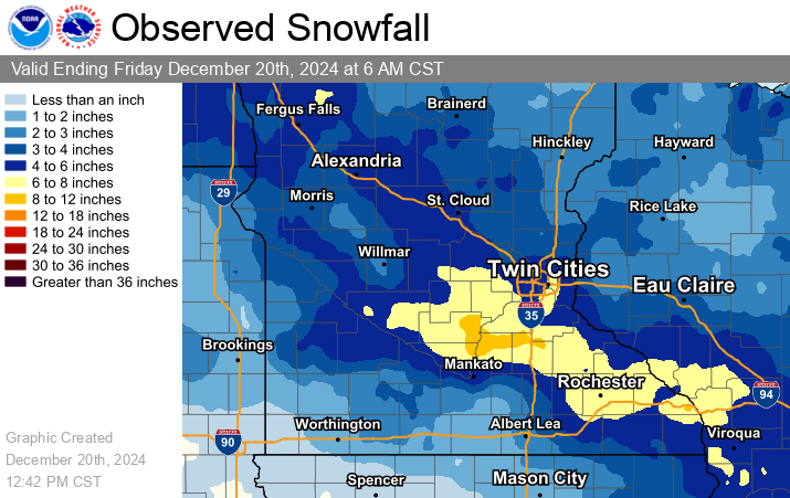
A storm system moved in from the northwest and spread a band of 4 to 7 inches across central Minnesota into western Wisconsin. The heaviest snow fell on Thursday morning, December 19th, which prompted several school closings and caused travel impacts through the evening. A few of the highest amounts are listed below. Here's a link to the Full List of Reports. 8.9 inches near Faribault MN in Rice County. |
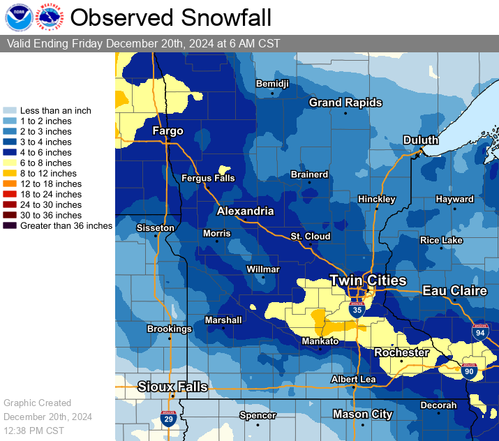 Interpolated snowfall map based on reports from observers across the region. |
Weather Data
 |
 |
 |
 |
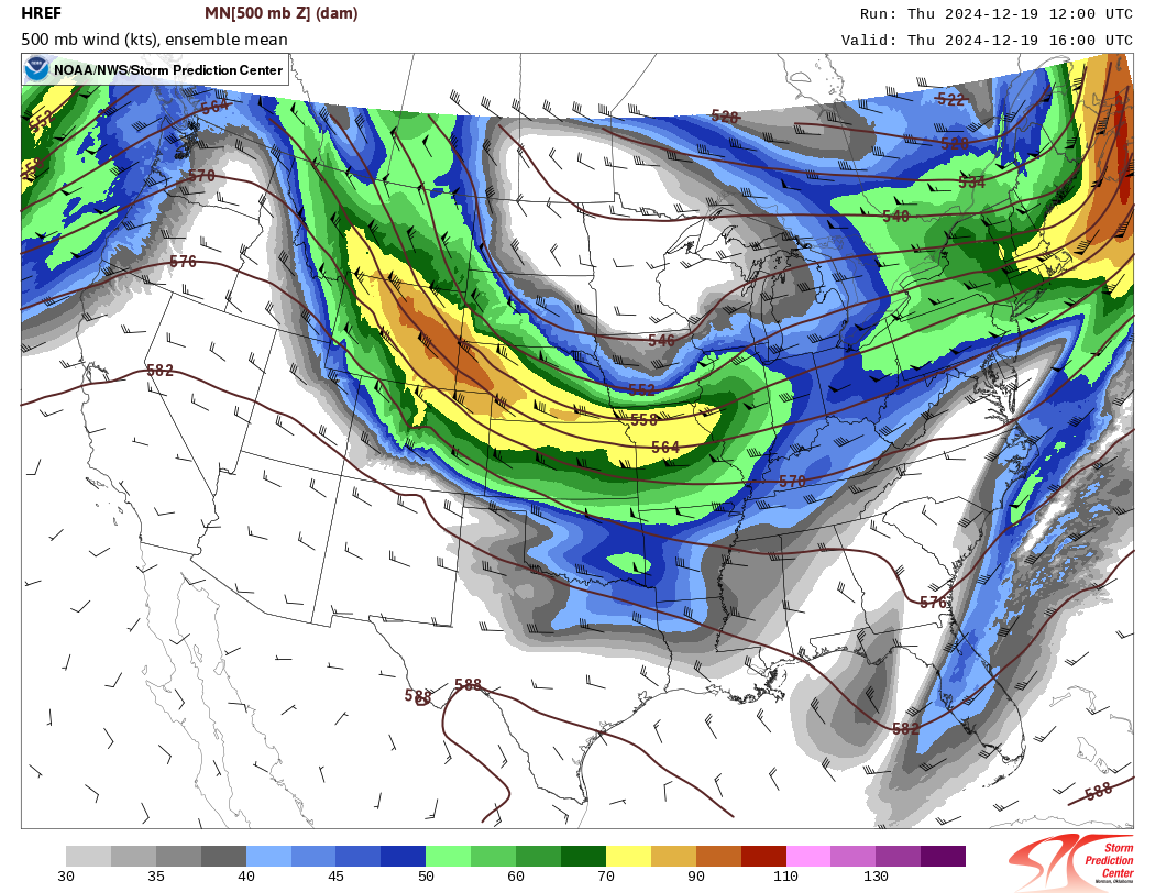
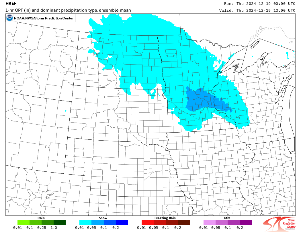
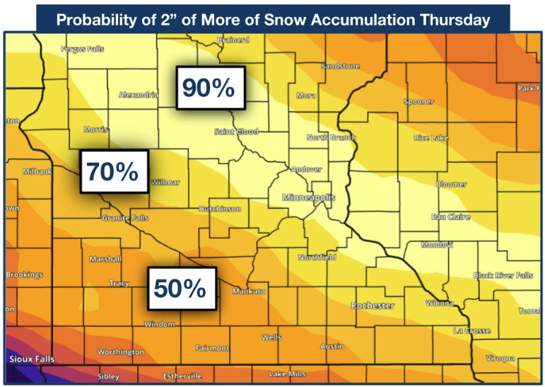
| At 500mb, a northern stream shortwave trough moved across the High Plains toward the Great Lakes. A Jet Streak (color fill) on the southern side, together with the curvature of the flow, created rising motion over Minnesota and Wisconsin. HREF 500mb Height / Wind. | Temperatures were cold enough for the precipitation to fall as snow (blue shading). HREF mean Ptype. | Two days before the event, the heaviest snow was expected along I-94. This is shown by the higher probabilities (yellow) of seeing at least two inches of snow. | As the event drew near, the forecast shifted to the south, and the heaviest snow ended up south of I-94. |
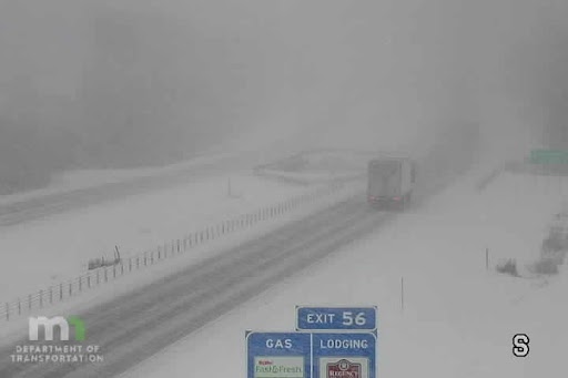
Photos & Video
 |
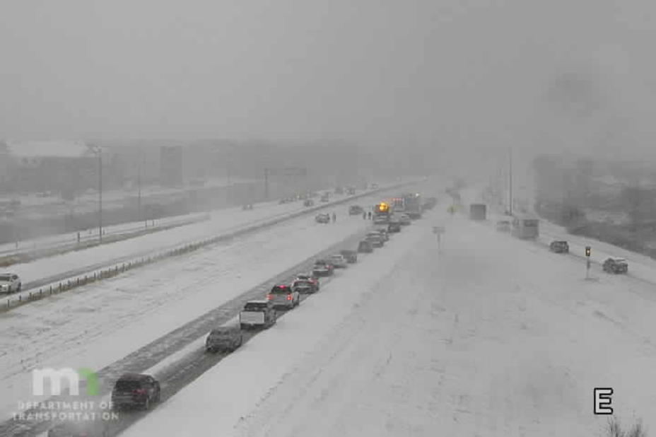 |
| The MNDOT image above shows heavy snow falling along I-35 near Faribault MN. | The MNDOT image above shows heavy snow near Shakopee MN along Hwy 169. |
 |
Media use of NWS Web News Stories is encouraged! Please acknowledge the NWS as the source of any news information accessed from this site. |
|

