Moderate to heavy lake effect snow is expected downwind of the Great Lakes, with the Chicago metro potentially receiving 6 to 12 inches of snowfall. A frigid airmass will bring very cold temperatures to the Central U.S. and Mississippi Valley today, migrating into the Eastern U.S. on Monday. Dry and windy weather will bring critical fire weather conditions to South Texas today. Read More >
Overview
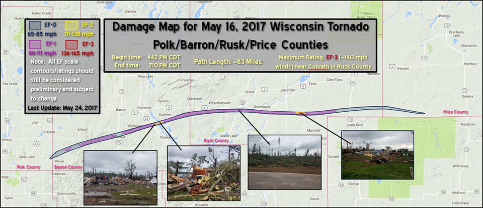
Wisconsin's longest ever tornado tracked across northwest Wisconsin during the late afternoon and early evening of May 16, 2017. It was 83 miles long and affected 4 counties. Sadly, it killed one man north of Chetek. The tornado developed over southeastern Polk County, east of Clear Lake, and moved east-northeast across southern Barron County and into Rusk County. Just before it would have reached the village of Weyerhaeuser, it turned straight east and moved across the rest of Rusk County and into the southwest part of Price County. One hard hit area occurred just north of Chetek, WI where high-end EF2 damage was found. The most intense damage occurred north of the village of Conrath in Rusk County. A family home was completely collapsed down to the foundation and was rated EF3 (140 mph). The remainder of the tornadoes path ranged from EF0 to EF1 with mainly tree damage, and occasional structural damage.
National Weather Service tornado records began in 1950.
Click on the various tabs to see radar, damage pictures, weather maps, and more.
Use our interactive damage survey viewer (using Flash) to see data points, ratings, damage photos and other details along the entire path. The link is here: https://apps.dat.noaa.gov/StormDamage/DamageViewer/. You may want to open this in a new browser window. The front page will ask you to "choose office ID." Select "Twin Cities" and click OK. On the welcome page, click on "continue." The next page will be a map of much of Minnesota and Wisconsin. In the upper right of this page, you can select a begin date. Use the calendar to choose May 16, 2017 and click on the filter button. You can zoom in and out, but to see a specific data point or track map, click on the pencil icon in the top center of the screen. An "Identify Toolbox" pops up. Now click on the "Select" icon. Now you can click on any point such as a triangle, circle, damage path or contour. If you've selected a damage point, you'll see details of the data point as well as a thumbnail photo. If you click on the thumbnail, a separate window will open with a much larger image.
Some notes about the data: some areas paralleling the multiple vortex tornado had substantial damage from the rear flank downdraft, inflow winds, or other nearby downbursts, and where possible, these are indicated by the green circles. The damage surveys took place on the ground on May 17 and 23, the Civil Air Patrol conducted a flight over the entire damage path on May 24, and the state of Wisconsin utilized a network of drone pilot volunteers to locate an operator who flew drone missions on May 17, and who flew the drone again on May 23. The drone photos are denoted by the dark red circles. Unfortunately, photos were not taken over every mile of the damage path, so in those areas, we have relied upon the ground survey data. As new data are provided, we will gladly update this map and refine this information. If you have any pictures or video of the storm itself, particularly the tornado, please contact us at w-mpx.webmaster@noaa.gov or post on our Facebook page, or send us a tweet. Many thanks to the Civil Air Patrol and to drone pilot Branden Bodendorfer of Marshfield, Wisconsin.
Tornadoes:
|
Tornado - Polk - Barron - Rusk - Price County (Northwest Wisconsin Tornado)
|
||||||||||||||||
The Enhanced Fujita (EF) Scale classifies tornadoes into the following categories:
| EF0 Weak 65-85 mph |
EF1 Moderate 86-110 mph |
EF2 Significant 111-135 mph |
EF3 Severe 136-165 mph |
EF4 Extreme 166-200 mph |
EF5 Catastrophic 200+ mph |
 |
|||||
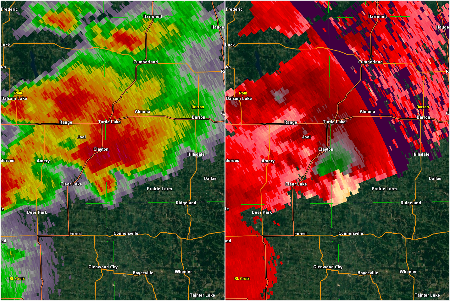
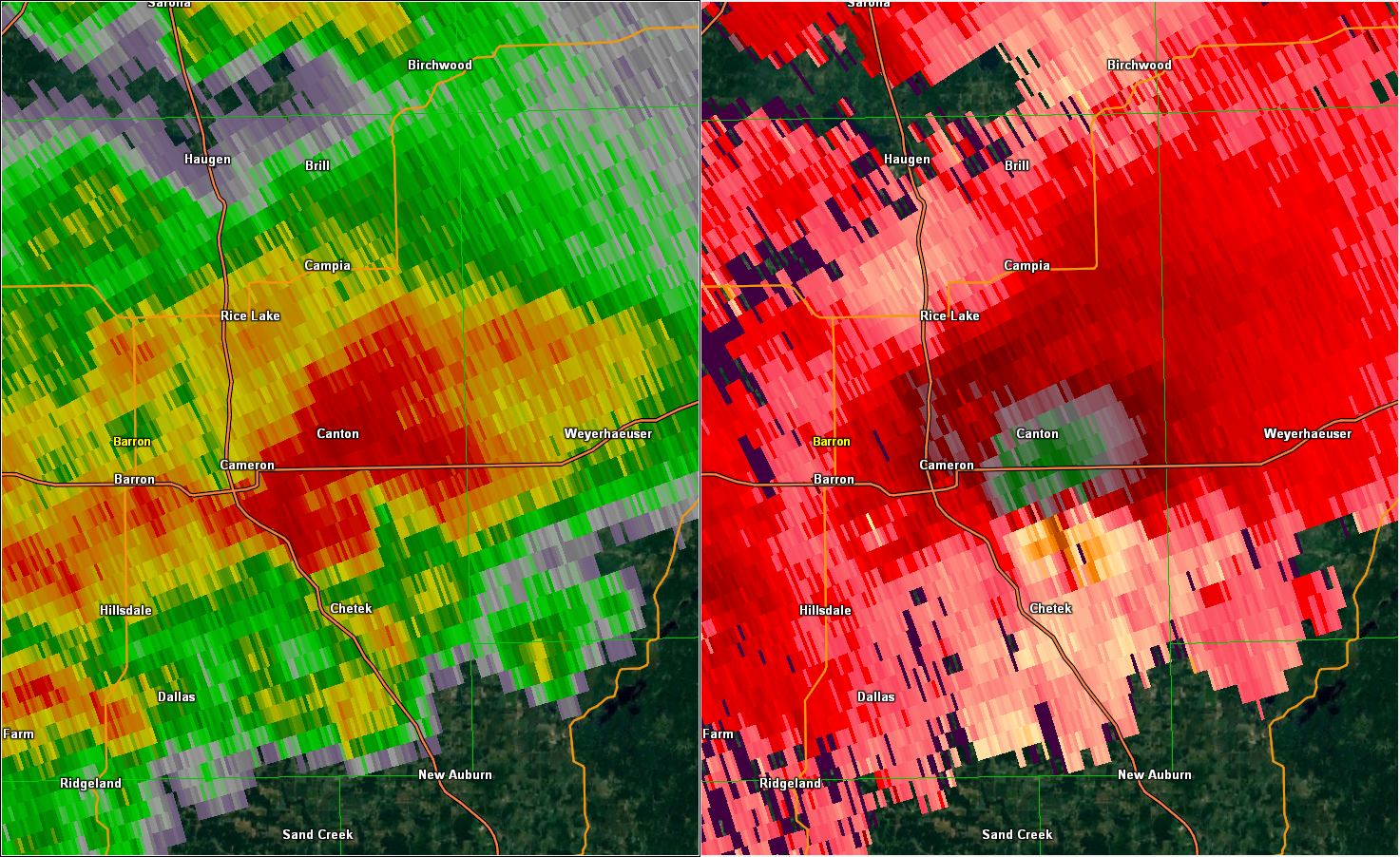
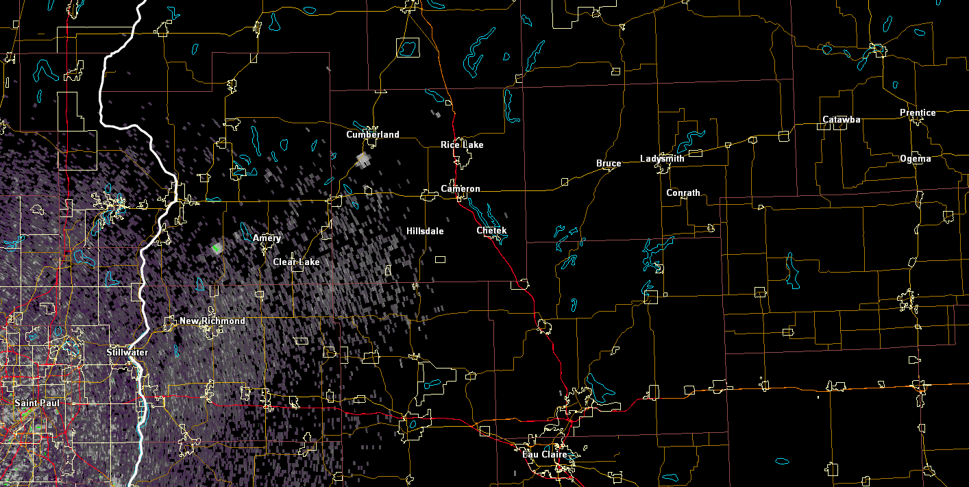
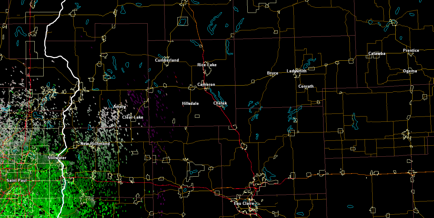
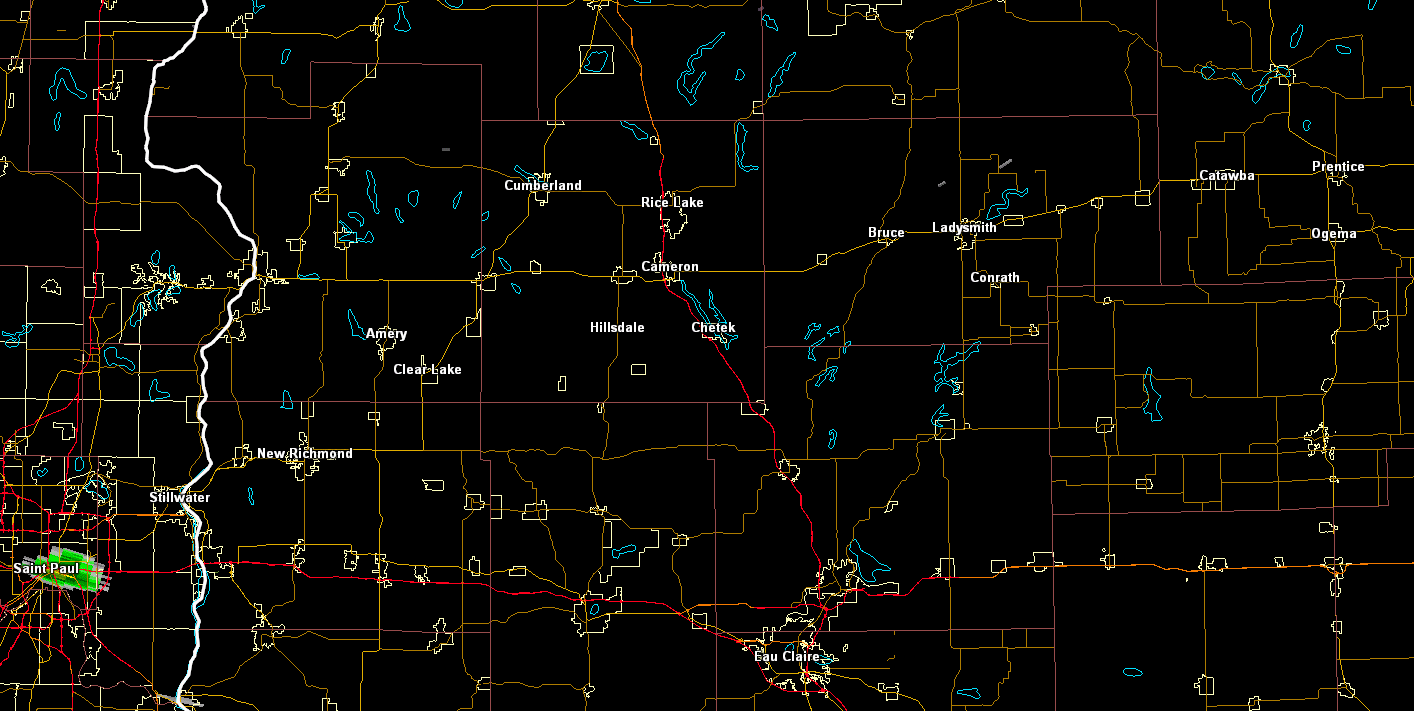
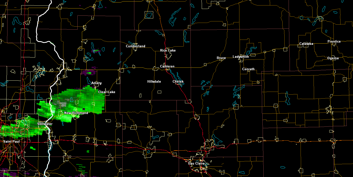
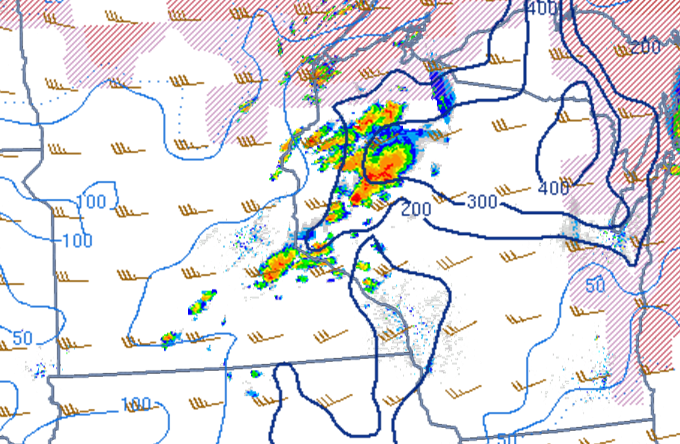
Radar:
Reflectivity and Velocity
 |
 |
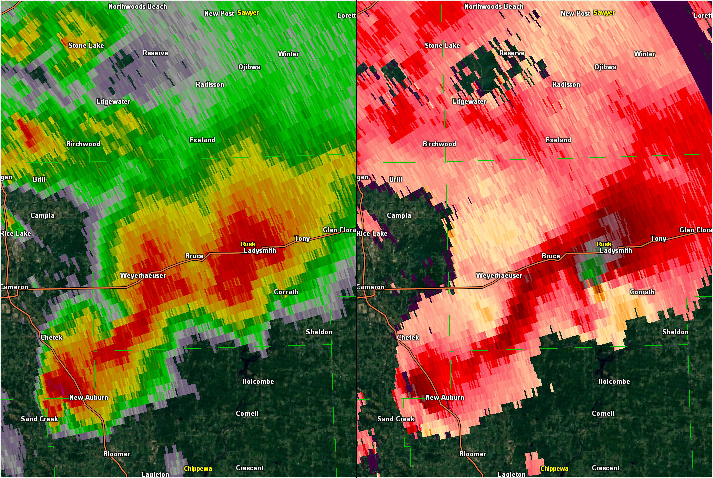 |
| Radar reflectivity (left) and storm relative velocity (right) at 4:45 PM CDT | Radar reflectivity (left) and storm relative velocity (right) at 5:30 PM CDT | Radar reflectivity (left) and storm relative velocity (right) at 6:15 PM CDT |
| Radar reflectivity and storm relative velocity loops from the Twin Cities radar site. Click the thumbnail images to load the loops. |
 Reflectivity loop from 315 PM CDT to 730 PM CDT. |
 Storm relative velocity loop from 330 PM CDT to 730 PM CDT. |
| Radar reflectivity and storm relative velocity loops from the Duluth radar site. Click the thumbnail images to load the loops. |
 Reflectivity loop from 318 PM CDT to 730 PM CDT. |
 Storm relative velocity loop from 356 PM CDT to 730 PM CDT. |
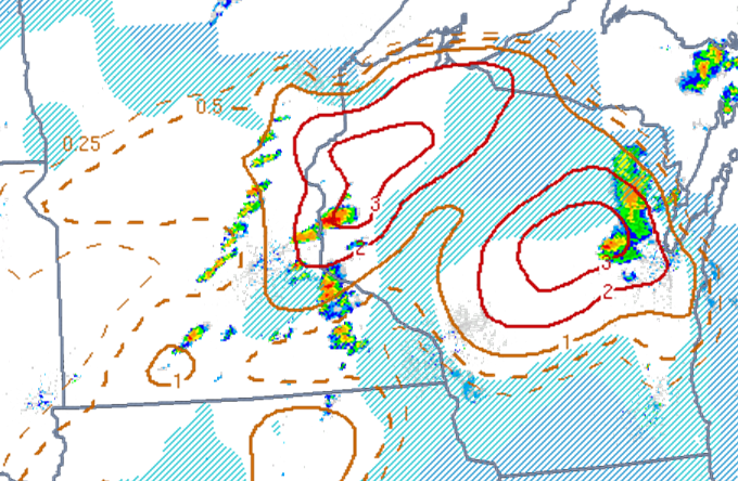
Near Storm Environment:
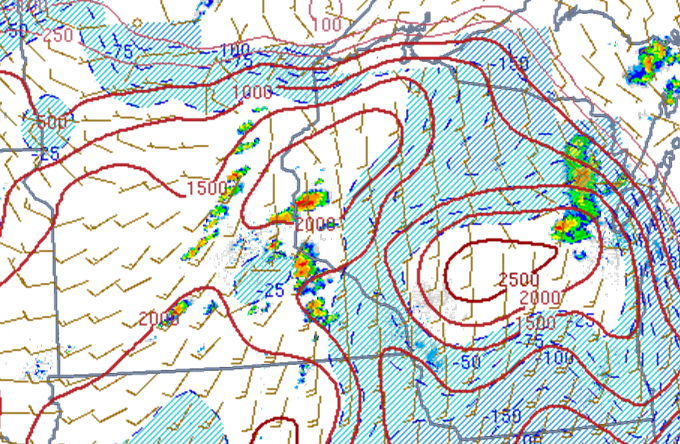
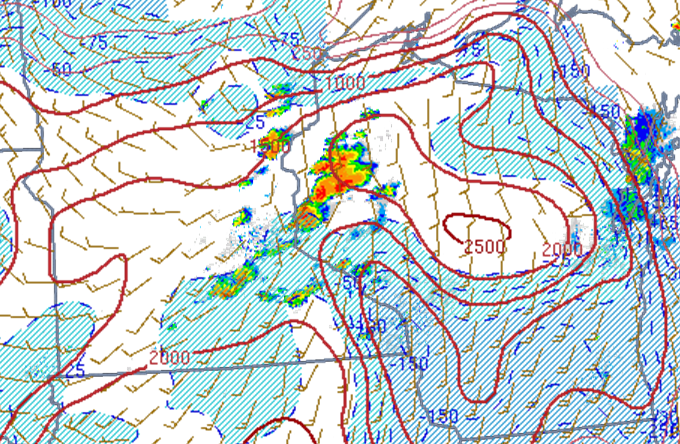
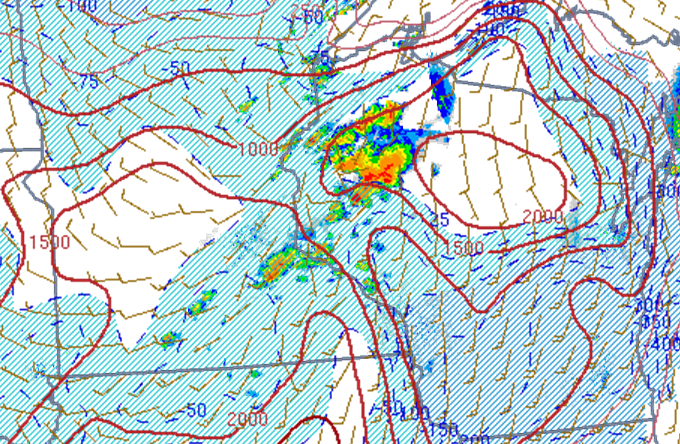
MUCAPE (Instability)
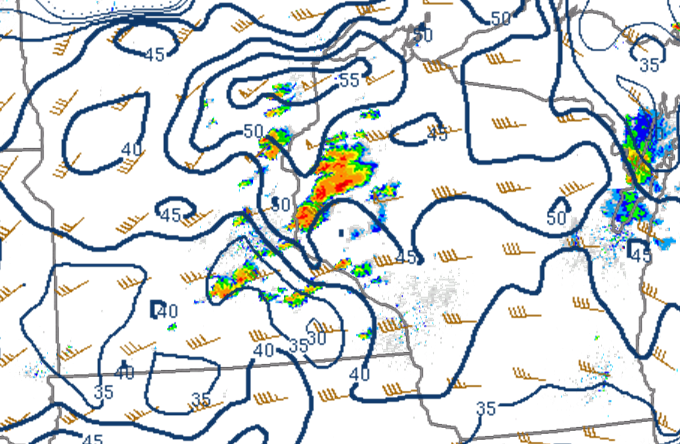
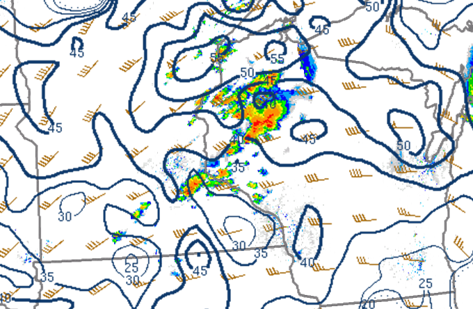
2000 to 2500 J/kg of MLCAPE developed by late afternoon across western Wisconsin.
 |
 |
 |
| Mixed layer CAPE (red contours) and CIN (blue shading) with surface winds at 4:00 PM. | Mixed layer CAPE (red contours) and CIN (blue shading) with surface winds at 5:00 PM. | Mixed layer CAPE (red contours) and CIN (blue shading) with surface winds at 6:00 PM. |
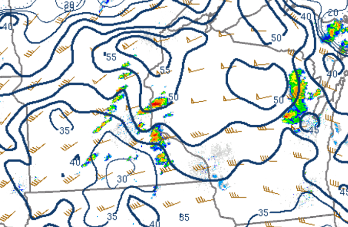
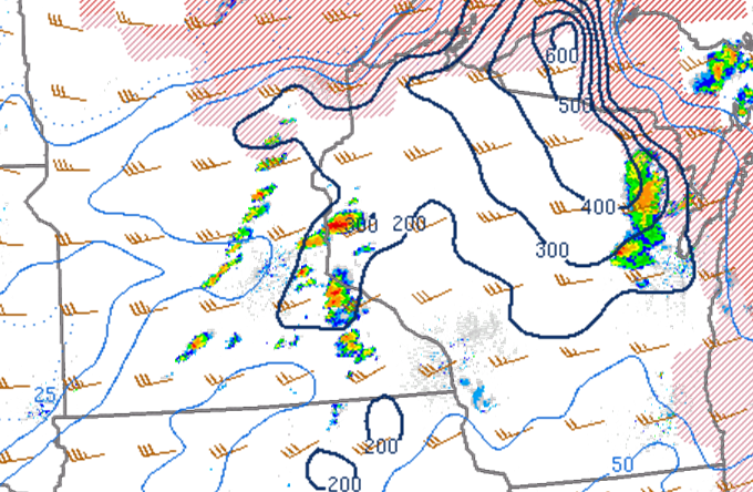
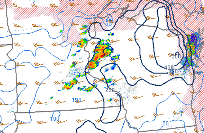
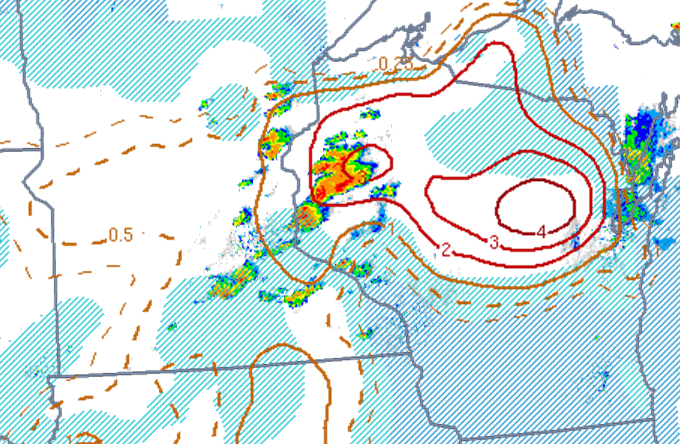
Effective Shear (Deep layer shear)
40 to 50 knots of deep layer shear supported Supercell thunderstorms capable of producing large hail and tornadoes.
 |
 |
 |
| Effective shear (blue contours and wind barbs) at 4:00 PM. | Effective shear (blue contours and wind barbs) at 5:00 PM. | Effective shear (blue contours and wind barbs) at 6:00 PM. |
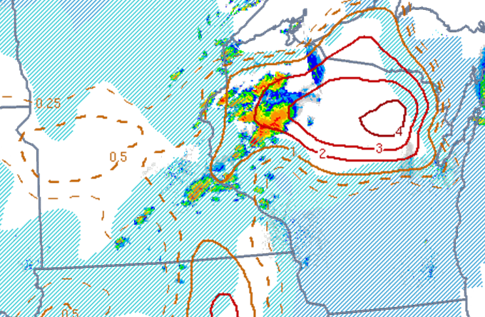
Effective Helicity
The leading storm formed and moved into an environment of high effective helicity which supported low level rotation and tornadoes.
 |
 |
 |
| Effective helicity (blue contours and storm motion) at 4:00 PM. | Effective helicity (blue contours and storm motion) at 5:00 PM. | Effective helicity (blue contours and storm motion) at 6:00 PM. |
Significant Tornado Parameter
Positive values of the significant tornado parameter indicated that the environment this storm developed in had the potential to produce an EF2 or stronger tornado.
 |
 |
 |
| Significant tornado parameter (contours) and MLCIN (blue shading) at 4:00 PM. | Significant tornado parameter (contours) and MLCIN (blue shading) at 5:00 PM. | Significant tornado parameter (contours) and MLCIN (blue shading) at 6:00 PM. |
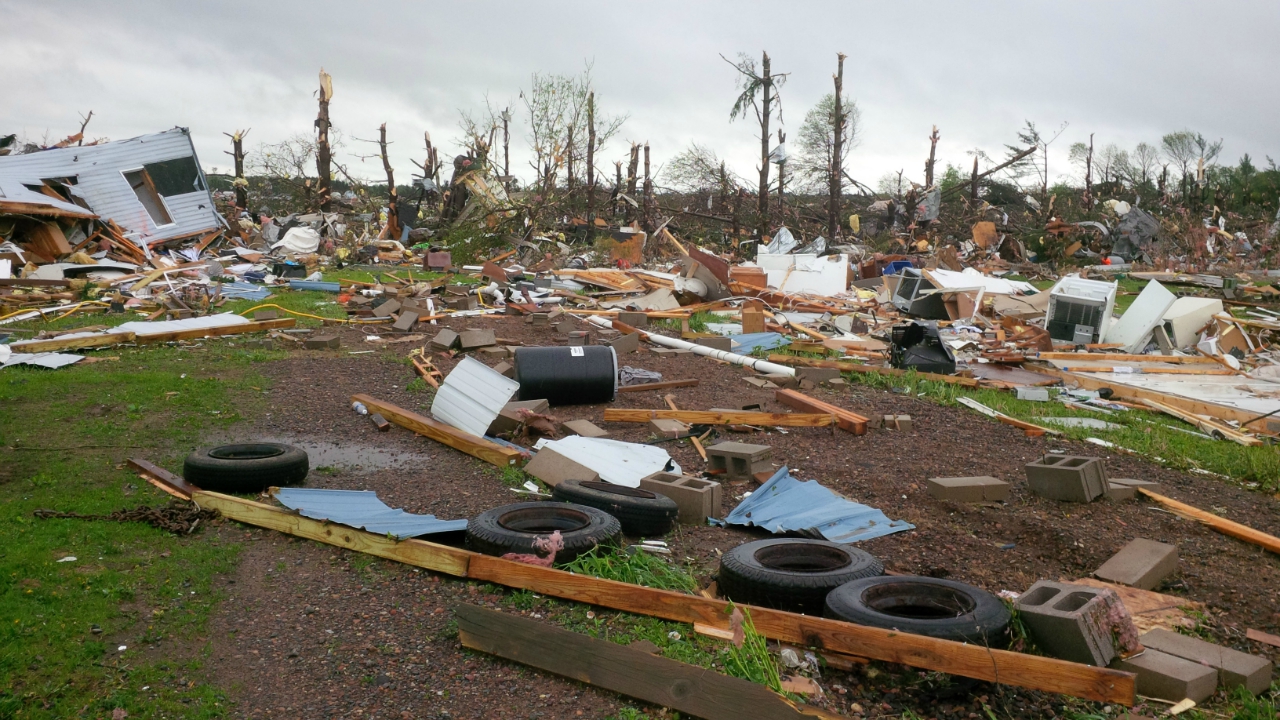
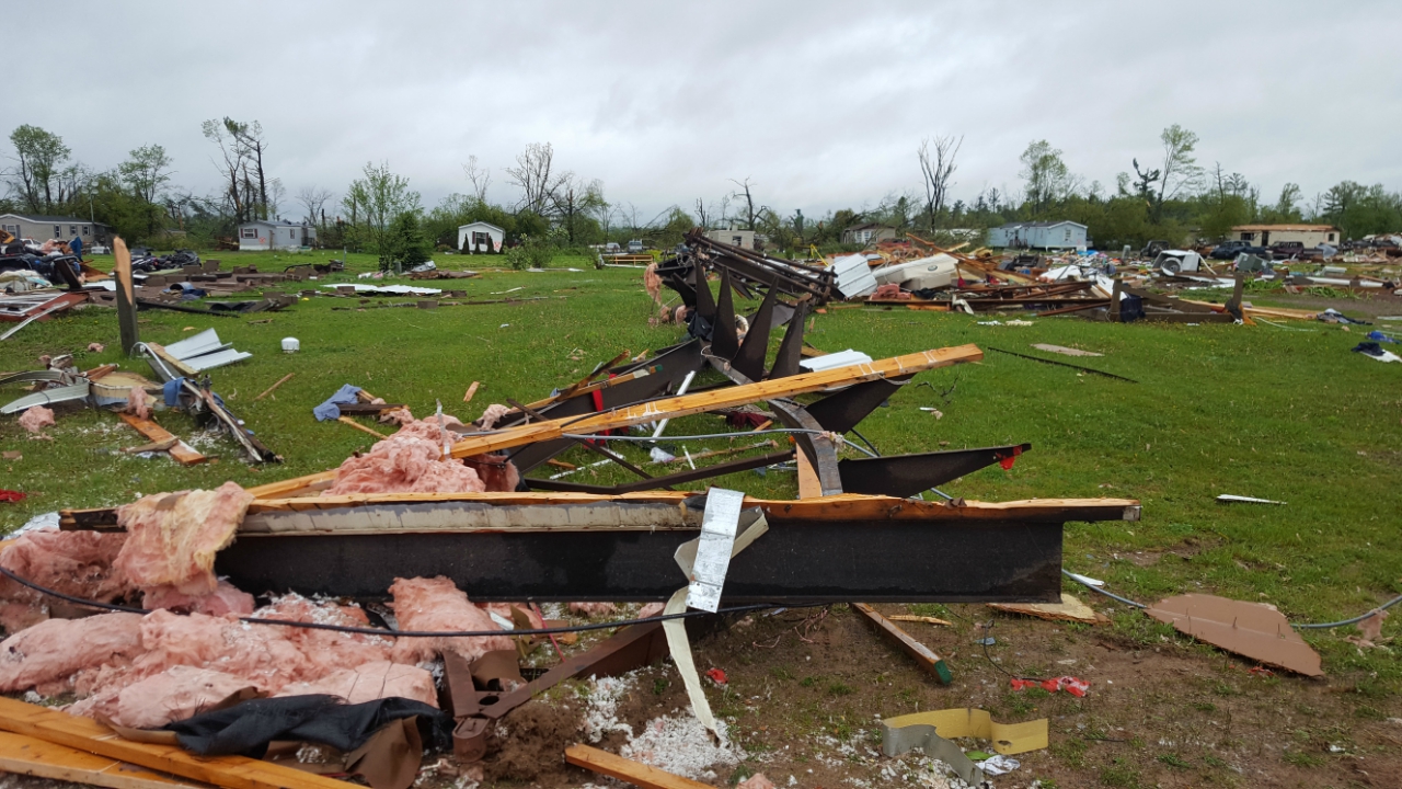
Damage Photos:
Two survey teams went out and observed high-end EF2 damage along the path of the tornado.
 |
 |
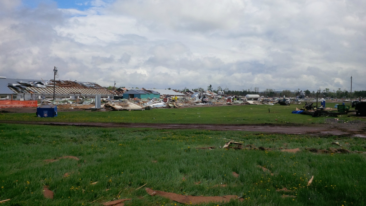 |
| Damage to the mobile home park north of Chetek Wisconsin. | Damage to the mobile home park north of Chetek Wisconsin. | Damage to a turkey farm north of Chetek Wisconsin. |
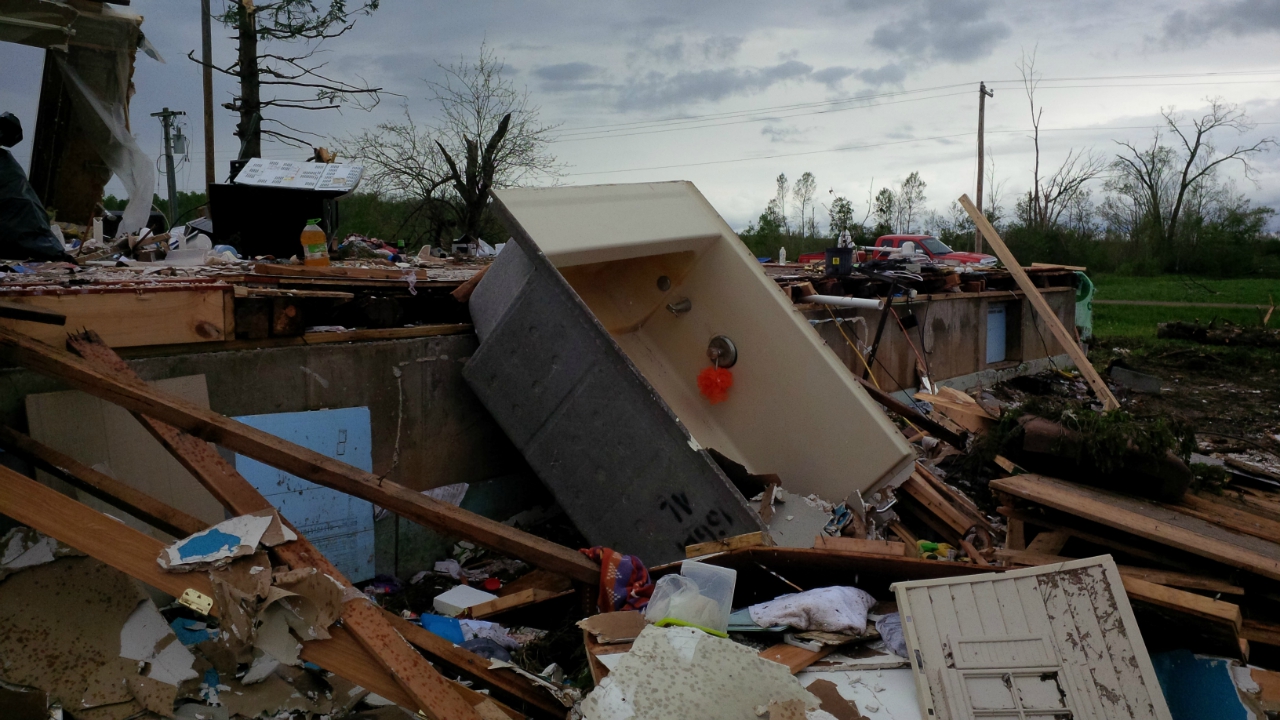
Another survey was completed and they observed EF3 damage along the path of the tornado in southern Rusk County.
 |
||
| Damage to the home near Conrath, Rusk County |
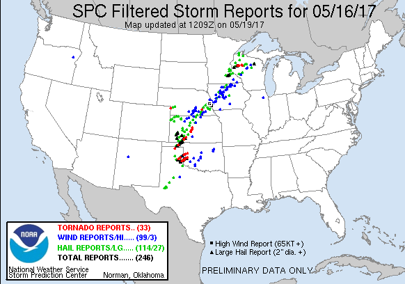
Storm Reports
..TIME...   ...EVENT...      ...CITY LOCATION...     ...LAT.LON...
..DATE...   ....MAG....      ..COUNTY LOCATION..ST.. ...SOURCE....
            ..REMARKS..

0320 PM     HAIL             2 NNW FARIBAULT         44.32N 93.29W
05/16/2017  E1.00 INCH       RICE               MN   TRAINED SPOTTER


0337 PM     HAIL             1 NE DENNISON           44.42N 93.03W
05/16/2017  M1.75 INCH       GOODHUE            MN   PUBLIC

            PICTURE PROVIDED.

0340 PM     HAIL             1 S CANNON FALLS        44.50N 92.91W
05/16/2017  M1.25 INCH       GOODHUE            MN   PUBLIC

            REPORTED VIA TWITTER.

0345 PM     HAIL             2 SE CANNON FALLS       44.49N 92.88W
05/16/2017  M1.75 INCH       GOODHUE            MN   PUBLIC

            TIME ESTIMATED. REPORTED VIA FACEBOOK.

0353 PM     HAIL             CANNON FALLS            44.51N 92.91W
05/16/2017  M1.00 INCH       GOODHUE            MN   PUBLIC

            PICTURE PROVIDED VIA SOCIAL MEDIA.

0409 PM     HAIL             2 SSW INVER GROVE HEIGH 44.83N 93.06W
05/16/2017  E1.75 INCH       DAKOTA             MN   PUBLIC

            DIMES TO GOLF BALLS.

0430 PM     HAIL             NEWPORT                 44.88N 93.00W
05/16/2017  M1.75 INCH       WASHINGTON         MN   PUBLIC

            REPORTED JUST SOUTHEAST OF 494 AND HWY 10
            VIA TWITTER.

0441 PM     HAIL             2 S AMERY               45.28N 92.36W
05/16/2017  M2.50 INCH       POLK               WI   TRAINED SPOTTER


0445 PM     HAIL             WOODBURY                44.92N 92.93W
05/16/2017  M1.00 INCH       WASHINGTON         MN   PUBLIC

            REPORTED VIA TWITTER.

0448 PM     HAIL             1 W ARLAND              45.34N 92.05W
05/16/2017  M1.00 INCH       BARRON             WI   TRAINED SPOTTER

            QUARTER SIZE HAIL COVERING GROUND.

0450 PM     FUNNEL CLOUD     ARLAND                  45.34N 92.02W
05/16/2017                   BARRON             WI   TRAINED SPOTTER


0450 PM     HAIL             LE CENTER               44.39N 93.73W
05/16/2017  M1.00 INCH       LE SUEUR           MN   TRAINED SPOTTER


0450 PM     HAIL             BAYPORT                 45.02N 92.78W
05/16/2017  M1.00 INCH       WASHINGTON         MN   PUBLIC

            TIME WAS ESTIMATED. REPORTED VIA TWITTER.

0513 PM     HAIL             BARRON                  45.40N 91.85W
05/16/2017  M3.00 INCH       BARRON             WI   PUBLIC

            PHOTO INCLUDED WITH REPORT.

0517 PM     HAIL             CAMERON                 45.41N 91.75W
05/16/2017  M1.75 INCH       BARRON             WI   LAW ENFORCEMENT


0517 PM     FUNNEL CLOUD     4 SSE CHETEK            45.26N 91.61W
05/16/2017                   BARRON             WI   PUBLIC


0519 PM     HAIL             CAMERON                 45.41N 91.75W
05/16/2017  M2.00 INCH       BARRON             WI   TRAINED SPOTTER

            HAIL A LITTLE LARGER THAN GOLF BALL FALLING.

0535 PM     TORNADO          4 NW CHETEK             45.36N 91.71W
05/16/2017                   BARRON             WI   EMERGENCY MNGR

            *** 1 FATAL, 20 INJ ***
            NUMEROUS MOBILE HOMES DESTROYED. THERE WAS 1
            FATALITY AND AT LEAST 20 INJURIES.

0540 PM     HAIL             5 ESE KILKENNY          44.29N 93.48W
05/16/2017  M1.50 INCH       RICE               MN   PUBLIC


0545 PM     TORNADO          4 N CHETEK              45.38N 91.65W
05/16/2017                   BARRON             WI   PUBLIC

            PHOTO OF TURKEY BARN DESTROYED 4 MILES N OF
            CHETEK, REPORTED VIA TWITTER. TIME
            ESTIMATED.

0555 PM     HAIL             NORTHFIELD              44.46N 93.16W
05/16/2017  M2.50 INCH       RICE               MN   PUBLIC

            REPORTED VIA TWITTER. INCLUDED PHOTO.

0600 PM     HAIL             3 SW DUNDAS             44.40N 93.24W
05/16/2017  M1.00 INCH       RICE               MN   AMATEUR RADIO


0600 PM     TSTM WND DMG     4 SSE CAMERON           45.36N 91.71W
05/16/2017                   BARRON             WI   PUBLIC


0615 PM     TORNADO          5 WSW WEYERHAEUSER      45.41N 91.52W
05/16/2017                   RUSK               WI   EMERGENCY MNGR


0655 PM     HAIL             RED WING                44.57N 92.54W
05/16/2017  E1.25 INCH       GOODHUE            MN   PUBLIC

            REPORTED VIA FACEBOOK. INCLUDED PHOTO.

0700 PM     TORNADO          1 S LADYSMITH           45.45N 91.10W
05/16/2017                   RUSK               WI   PUBLIC

            REPORT OF WIDESPREAD DAMAGE FROM LADYSMITH
            TO CORNELL, WI. TREES AND POWER LINES DOWN.

0700 PM     TORNADO          CONRATH                 45.39N 91.04W
05/16/2017                   RUSK               WI   EMERGENCY MNGR

            EXTENSIVE STRUCTURAL DAMAGE.

0708 PM     HAIL             7 SE LONSDALE           44.41N 93.34W
05/16/2017  M2.00 INCH       RICE               MN   PUBLIC

            PHOTO VIA SOCIAL MEDIA.
 |
Media use of NWS Web News Stories is encouraged! Please acknowledge the NWS as the source of any news information accessed from this site. |
|