Updated: 05:30 AM CDT Wednesday, July 20, 2016
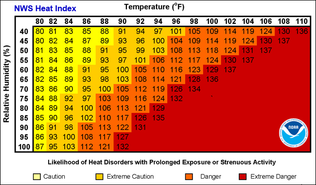
High temperatures today will climb into the 90s, with 100s possible in some areas Thursday. Dew points will be in the 70s to lower 80s, and when combined with the temperatures, heat indices will range from 100 to 110+°F . Little relief is expected at night with lows in the mid 70s to near 80. A cold front will approach the area Friday, but there is some uncertainty as to when cooler and less humid air will arrive.
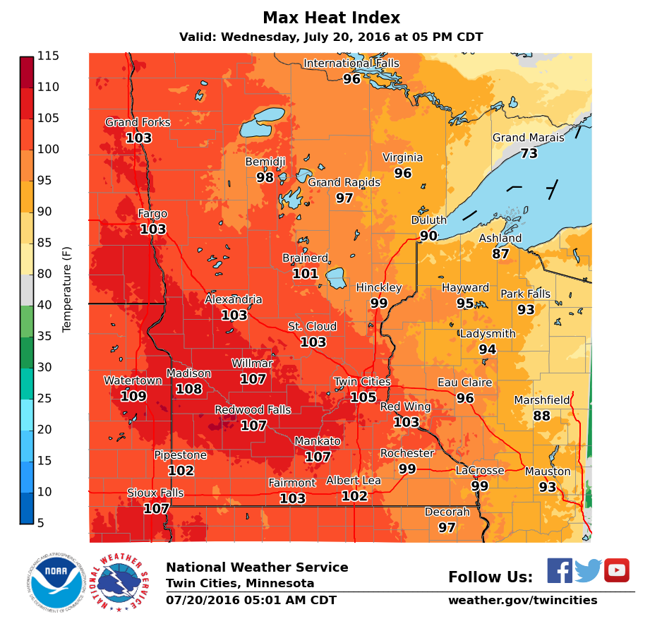
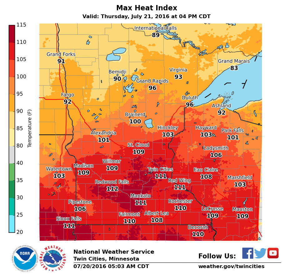
Below are max heat indices expected each day. Click on the image to enlarge.
 |
 |
|
| Today | Thursday |
Cooling Centers in the Twin Cities:
Hennepin County including Minneapolis: https://www.hennepin.us/residents/health-medical/cooling-centers
City of Bloomington: https://www.bloomingtonmn.gov/air-conditioned-public-spaces
City of St. Paul: https://www.stpaul.gov/news/july-heat-safety-tips
Ramsey County: https://www.ramseycounty.us/content/ramsey-county-under-excessive-heat-warning-july-20-22
Anoka County (Coon Rapids): https://salvationarmynorth.org/2016/07/twin-cities-locations-open-as-cooling-centers-this-week/
Heat Wave History for the Twin Cities:
Additional heat wave information is available on the Minnesota State Climatology Office website at: https://www.dnr.state.mn.us/c…/journal/160608_heat_index.html
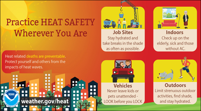
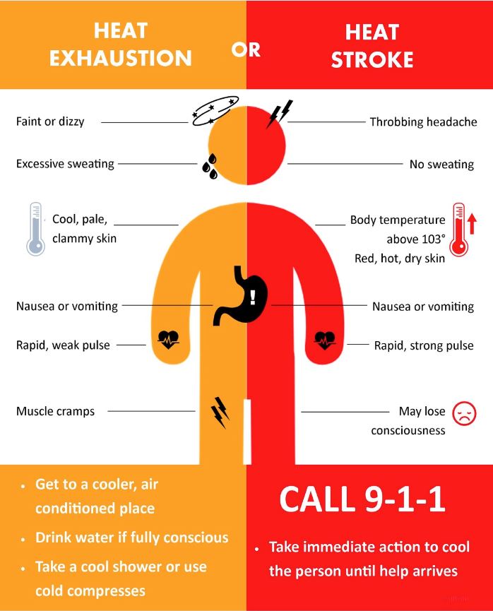
Heat is the #1 weather killer! For heat safety information and tips, please visit the National Weather Service heat safety page.