
A strong atmospheric river moving into northern California later Tuesday will bring a threat for moderate to heavy rainfall and flooding, gusty to high winds, and mountain snows for parts of the Northwest U.S. through at least Wednesday. Gusty winds and isolated rain and snow showers will continue in the Northeast U.S. Tuesday behind a cold front. Read More >
Overview
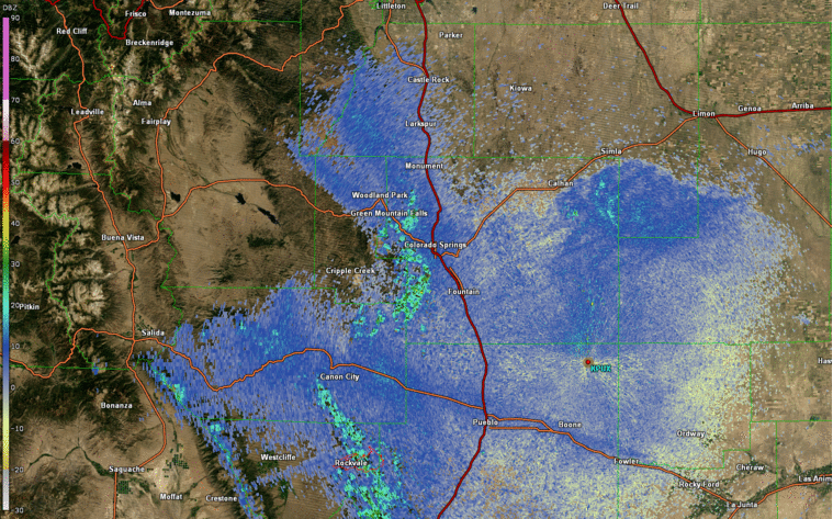
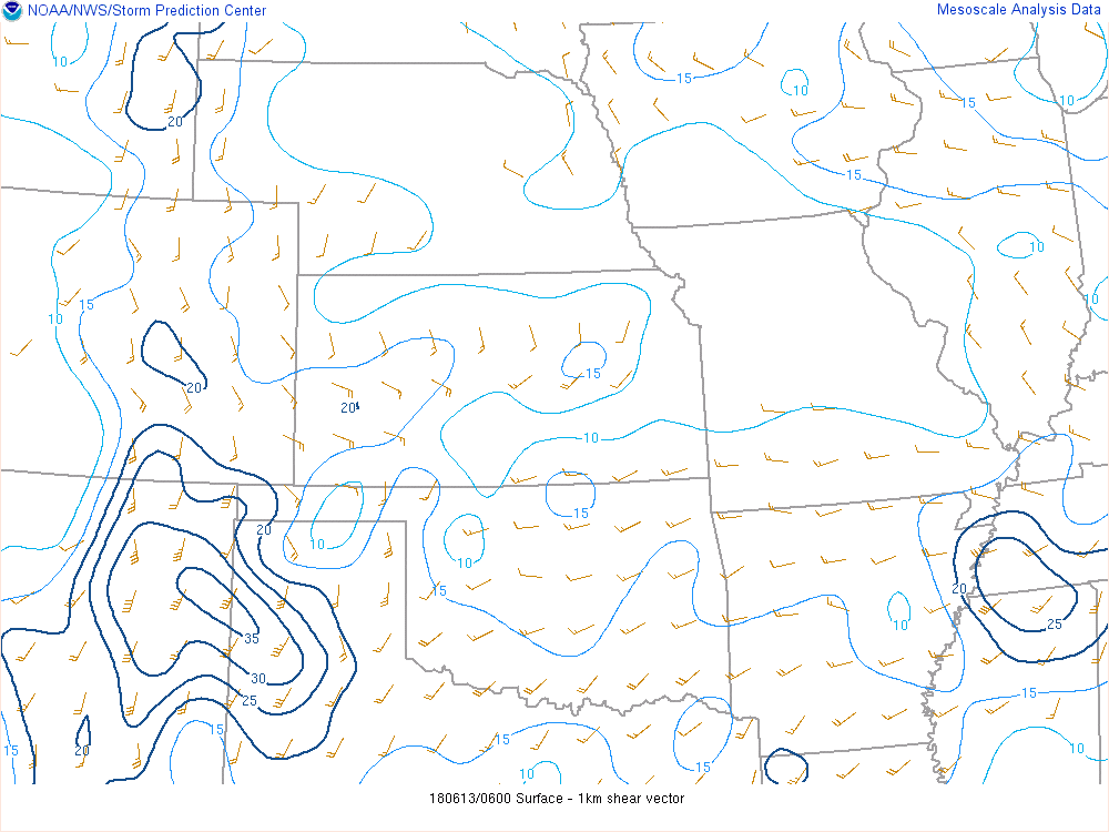
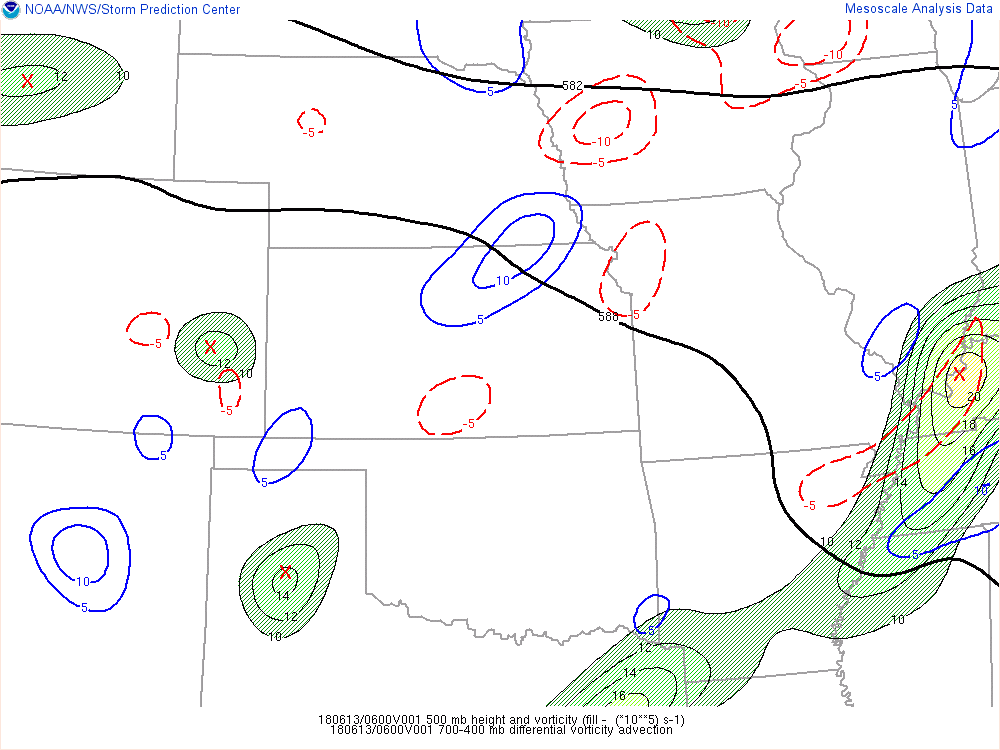
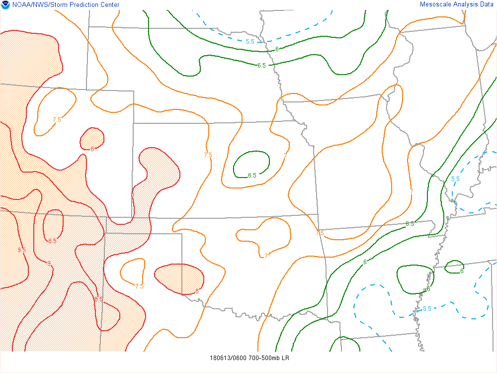
A rare nocturnal hail event impacted El Paso County on Wednesday June 13th, 2018. The origins of the storm stem from storms that occurred earlier in the evening, near the border of Colorado and New Mexico/Oklahoma. The storms produced an outflow boundary that traveled up the Arkansas River Valley, through Colorado Springs and finally up Cheyenne Mountain where the severe thunderstorm developed. The outflow boundary seemed to travel directly up Cheyenne Mountain, which makes it an efficient precipitation producer. The air mass before the outflow boundary propagated over recorded an air temperature of 72F and a dew point temperature of 45F at Colorado Springs Airport (KCOS), and the air mass after the outflow boundary propagated over recorded an air temperature of 69F with a dew point temperature of 52F at KCOS, as well. To put in perspective how moist the air is, the average maximum precipitable water (PWAT) for June 13th in Boulder, Colorado (the most representative point available) is 1.01”, whereas the resolved PWAT value over the thunderstorm initiation point was 1.1”. The Theta-E maps attached in the “Environment” section does a good job illustrating the origins of the moisture. MUCAPE, which happened to be SBCAPE, was around 2000 J/kg during initiation, due to mid-level lapse rates being dry adiabatic and the increase of low level moisture. Shear values were modest at best. Sfc-1km shear values were around 20 m2/s2, sfc-6km values were around 40 m2/s2, and the effective bulk shear values were around 55 knots. Synoptic scale support was difficult to find for this event, but what was found while digging through archived Storm Prediction Center mesoanalysis data was that there was diffluent flow analyzed at 300hPa (divergence aloft), upward ageostrophic accelerations due to various wind maxima at 300hPa, and a steady positive differential vorticity advection over the thunderstorms location.
Storm Evolution:
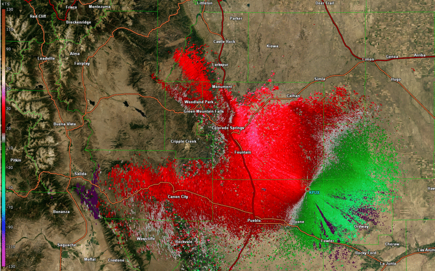
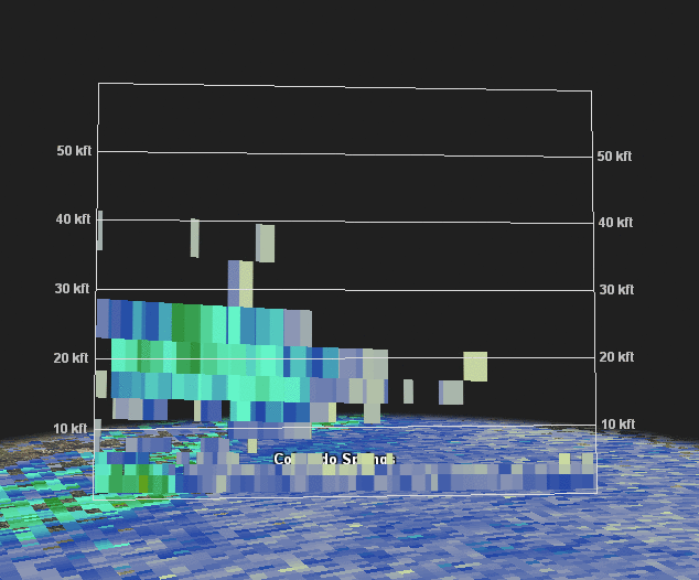
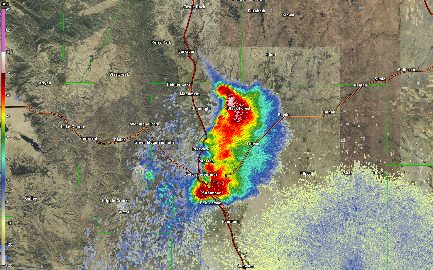
When the storm was developing initially, the 0.5 degree radar volume scans were not able to see anything, but the 6.4 degree radar volume scan did see the storm developing, which means that storm initially developed aloft. The original updraft split in to a left moving supercell and a right moving supercell, but what was odd was that the left moving supercell was anticyclonically rotating and the right moving supercell was moving cyclonically. The northeastern moving supercell quickly moved into Boulder’s region, dropping 1.25” hail over Black Forest, Colorado on its way out. The right moving supercell, remained anchored to the boundary (the mountains) and propagated over Fort Carson dropping 2.5” hail, as reported by a spotter. While the storm was over Fort Carson, a mid-altitude radial convergence (MARC) signature was observed, 170 knot storm top divergence values were observed, and a slew of dual-polarization products supported that there was large hail. The main updraft then disconnected to its mountain boundary, started rotating cyclonically and intensified over Fountain, Colorado where 3.0” hail was reported. The storm remained severe until around 2:45 AM.
Model Performance:
Model guidance was not very useful for this storm. 18Z/00Z NAM was too far north ant too quick with convective development in the evening. The HRRR varied greatly from run to run, with a few mid-evening runs capturing some convection over El Paso County. The HRRR runs right before the event showed no convection developing at all.
Statistics of the Warning for the Hail Event:
False Alarm Ratio: 0.2 (4 out of 5 warnings verified)
Probability of Detection: 0.82
Threat Score: 0.68
Average Lead Time for the First Event: 10.5 Minutes
Average Lead Time for all Events: 17.1 Minutes
Max Lead Time: 45 Minutes
Minimum Lead Time: 0 minutes
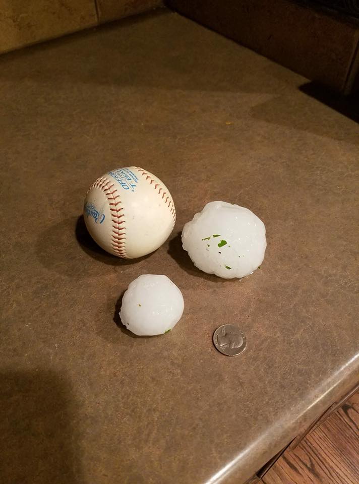
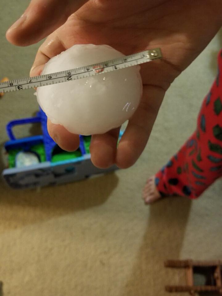
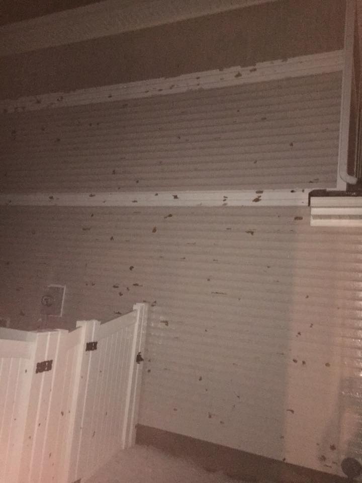
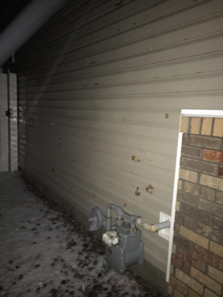
Hail:
Photos of large hail and damage caused by the large hail.
 |
 |
 |
 |
| Large hail in Fountain, Colorado Courtesy of Jennifer Stark | Large hail in Fountain, Colorado Courtesy of Jennifer Stark | Large hail in Fountain, Colorado Courtesy of Jennifer Stark | Large hail in Fountain, Colorado Courtesy of Jennifer Stark |
 |
 |
 |
 |
| Dry and wet hail growth processes visualized from melting hail. Courtesy of Jennifer Stark | Damage in Fountain, Colorado Courtesy of Jennifer Stark | Damage in Fountain, Colorado Courtesy of Jennifer Stark | Large hail at Fort Carson. Courtesy of Noland |
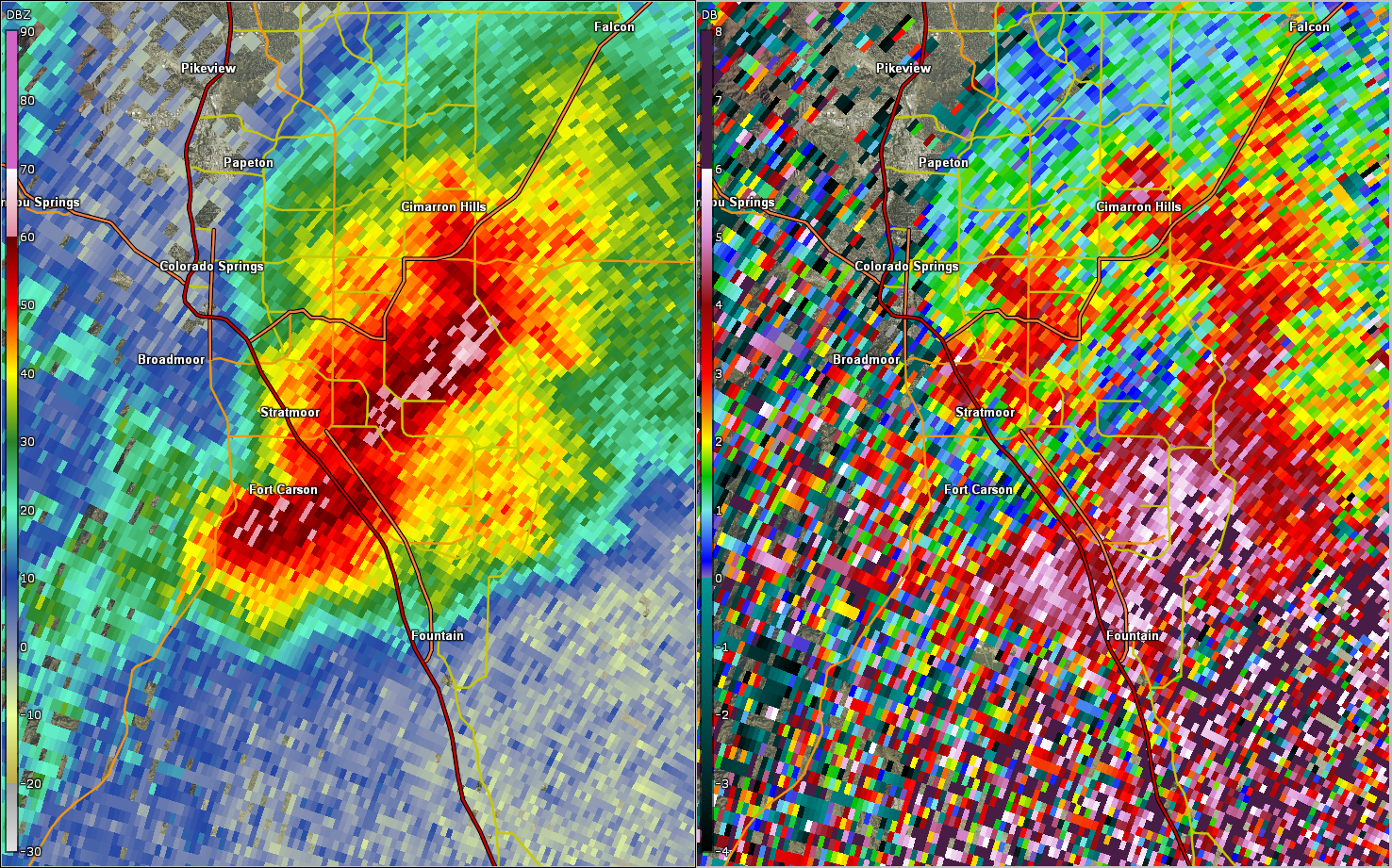
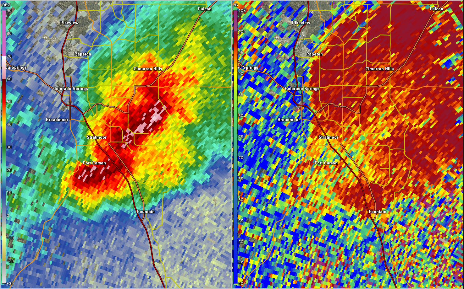
Radar & Satellite:
 |
 |
 |
| 0.5 degree base reflectivity animation of the hail event | 0.5 degree base velocity animation of the hail event | Cross section base refelectivity illustrating a hail core reaching the surface over Fort Carson. |
 |
 |
 |
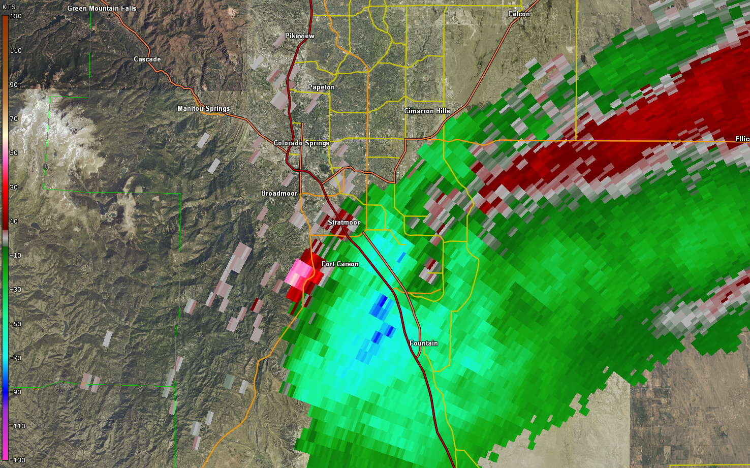 |
| Hail spike analyzed over Black Forest at 12:40AM MDT | ZDR values near 0, indicative a hail, analyzed over Fort Carson at 1:06AM MDT. | Lower CC values analyzed, indicative of mixed hydrometeor types, indicative of hail over Fort Carson at 1:06AM MDT | Storm top divergence of around 170 m/s, which translates to very strong updraft speeds and hail sizes of around 2.5 inches. |
Satellite:
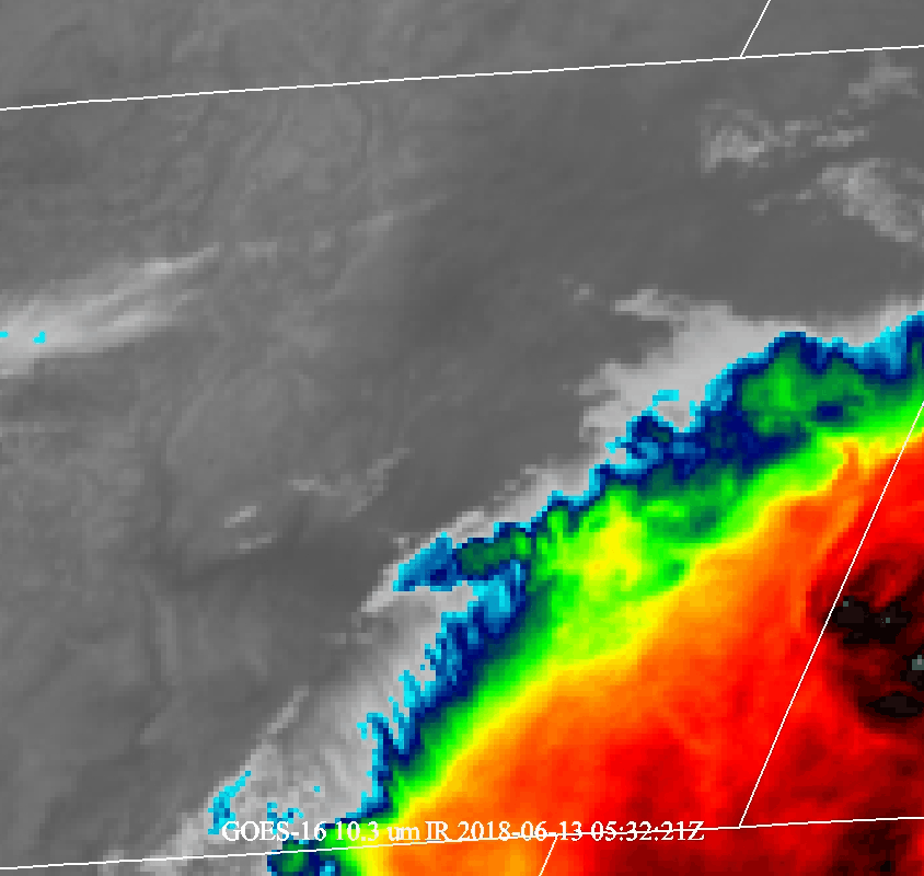 |
| GOES-East Infrared View of the Severe Hail Event |
Storm Reports
ZCZC DENWRKKTS ALL
TTAA00 KDEN DDHHMM
NWUS55 KPUB 131527
LSRPUB
PRELIMINARY LOCAL STORM REPORT...SUMMARY
NATIONAL WEATHER SERVICE PUEBLO CO
927 AM MDT WED JUN 13 2018
..TIME... ...EVENT... ...CITY LOCATION... ...LAT.LON...
..DATE... ....MAG.... ..COUNTY LOCATION..ST.. ...SOURCE....
..REMARKS..
0204 AM HAIL FOUNTAIN 38.69N 104.71W
06/13/2018 M1.75 INCH EL PASO CO PUBLIC
0159 AM HAIL FOUNTAIN 38.69N 104.71W
06/13/2018 M1.25 INCH EL PASO CO PUBLIC
0111 AM HAIL 1 NNE SECURITY 38.75N 104.73W
06/13/2018 M1.00 INCH EL PASO CO TRAINED SPOTTER
0106 AM HAIL 2 WSW PETERSON AFB 38.82N 104.74W
06/13/2018 M2.00 INCH EL PASO CO TRAINED SPOTTER
0105 AM HAIL 3 W PETERSON AFB 38.83N 104.75W
06/13/2018 M1.50 INCH EL PASO CO TRAINED SPOTTER
0102 AM HAIL 1 E SECURITY 38.75N 104.72W
06/13/2018 M1.00 INCH EL PASO CO COCORAHS
0102 AM HAIL SECURITY 38.75N 104.73W
06/13/2018 M1.00 INCH EL PASO CO COCORAHS
0100 AM HAIL 3 N SECURITY 38.78N 104.73W
06/13/2018 M2.50 INCH EL PASO CO COCORAHS
0100 AM HAIL 2 ESE FOUNTAIN 38.67N 104.67W
06/13/2018 M3.00 INCH EL PASO CO TRAINED SPOTTER
TIME ESTIMATED, LOTS OF TREE DAMAGE, CAR
WINDOWS BROKEN OUT.
1257 AM HAIL 3 SW PETERSON AFB 38.80N 104.73W
06/13/2018 M1.25 INCH EL PASO CO TRAINED SPOTTER
1255 AM HAIL 3 WSW PETERSON AFB 38.81N 104.75W
06/13/2018 E3.00 INCH EL PASO CO TRAINED SPOTTER
1250 AM HAIL 3 WSW PETERSON AFB 38.81N 104.75W
06/13/2018 E1.00 INCH EL PASO CO TRAINED SPOTTER
1249 AM HAIL 2 WSW PETERSON AFB 38.82N 104.73W
06/13/2018 M1.00 INCH EL PASO CO PUBLIC
1246 AM HAIL 5 N FALCON 39.00N 104.60W
06/13/2018 E0.88 INCH EL PASO CO TRAINED SPOTTER
1245 AM HAIL 2 SE SECURITY 38.73N 104.71W
06/13/2018 M2.00 INCH EL PASO CO COCORAHS
1240 AM HAIL 3 ESE SECURITY 38.73N 104.68W
06/13/2018 M1.50 INCH EL PASO CO TRAINED SPOTTER
1240 AM HAIL 6 SW BLACK FOREST 38.94N 104.77W
06/13/2018 M0.88 INCH EL PASO CO TRAINED SPOTTER
1239 AM HAIL 3 NE COLORADO SPRINGS 38.86N 104.79W
06/13/2018 E1.00 INCH EL PASO CO TRAINED SPOTTER
1238 AM HAIL 2 SW BLACK FOREST 39.00N 104.72W
06/13/2018 M1.25 INCH EL PASO CO TRAINED SPOTTER
1238 AM HAIL 4 SSE COLORADO SPRINGS 38.78N 104.80W
06/13/2018 M1.00 INCH EL PASO CO TRAINED SPOTTER
1237 AM HAIL 2 N BLACK FOREST 39.05N 104.71W
06/13/2018 M1.25 INCH EL PASO CO TRAINED SPOTTER
1236 AM HAIL 2 SSW COLORADO SPRINGS 38.81N 104.84W
06/13/2018 M1.00 INCH EL PASO CO COCORAHS
1235 AM HAIL 7 NNE COLORADO SPRINGS 38.93N 104.78W
06/13/2018 M1.00 INCH EL PASO CO PUBLIC
1235 AM HAIL 7 NNE COLORADO SPRINGS 38.92N 104.77W
06/13/2018 M1.00 INCH EL PASO CO TRAINED SPOTTER
1230 AM HAIL 6 SE AIR FORCE ACADEMY 38.95N 104.79W
06/13/2018 E1.00 INCH EL PASO CO TRAINED SPOTTER
1230 AM HAIL 2 WSW BLACK FOREST 39.01N 104.72W
06/13/2018 M1.25 INCH EL PASO CO COCORAHS
&&
$$
Environment
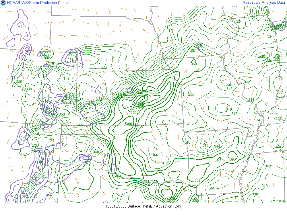 |
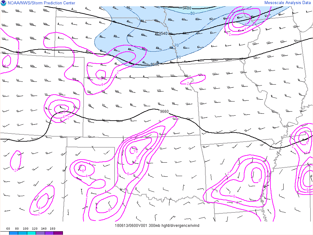 |
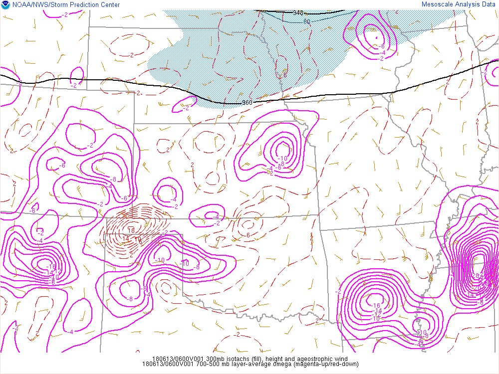 |
| Thet-E Advection at 11PM 6/12/13 Illustrates Low Level Moisture | 300hPa analysis at 12AM 6/13/18 illustrates diffuluent flow aloft, therefore upper-level divergence | Ageostrophic circulations caluculated at 12AM 6/13/18, inferring upward vertical motion over thunderstorm |
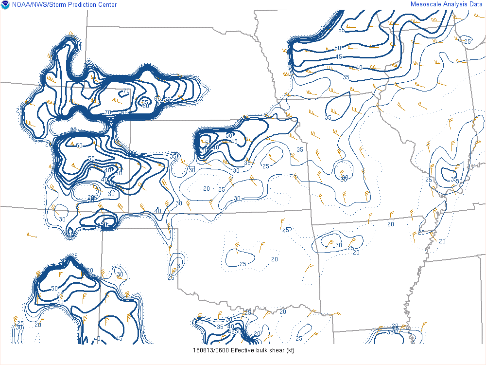 |
 |
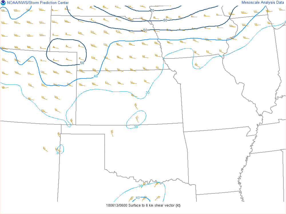 |
| Effective Bulk Shear at 12AM 6/13/18 | SFC-1Km shear at 12AM 6/13/18 | SFC-6km shear at 12AM 6/13/18 |
 |
 |
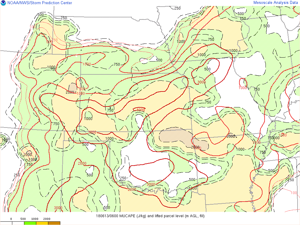 |
| Positive differential vorticity advection calculated at 12AM 6/13/18 | Mid-level lapse rates calculated at 12AM 6/13/18 | MUCAPE calculated at 12AM 6/13/18 |
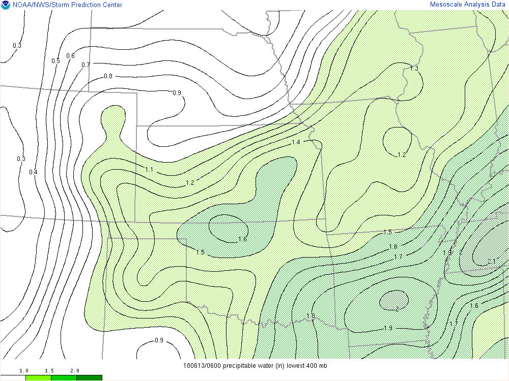 |
| PWAT calculated at 12AM 6/13/18 |
 |
Media use of NWS Web News Stories is encouraged! Please acknowledge the NWS as the source of any news information accessed from this site. |
|

