 |
Tornadoes, Severe Storms & Flooding - March 31st, 2008National Weather Service, Springfield, MO |
 |
Buffalo, MO March 31st Tornado
EF-2
Width: 300 yards
Length: 5 miles
Winds: Estimated 120 mph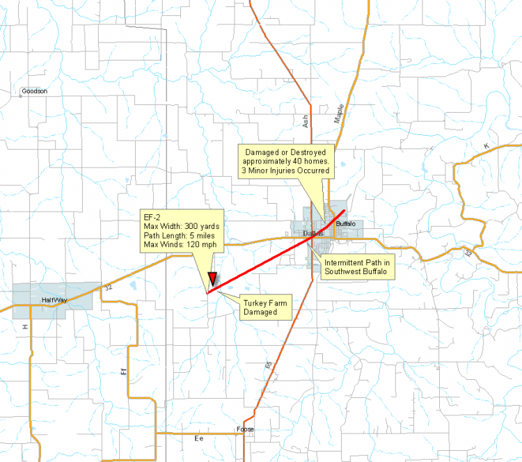
Gainesville, MO March 31st, 2008 Tornado
EF0
Width: 20 yards
Length: 1/10th of a mile
Winds: Estimated at 65 mph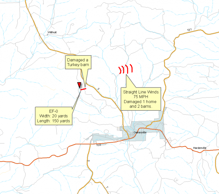
Lebanon Tornado - March 31 2008
EF- 0
Width: 75 yards
Length: 1/2 mile long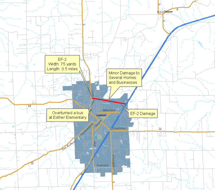
Neosho, MO March 31, 2008 Tornado
EF - 1
Width: 80 Yards
Length: 1 mile
Winds: Estimated 90 to 100 mph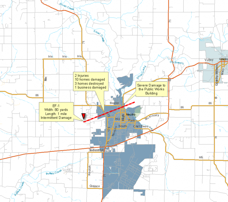
Pleasant Hope, MO - March 31, 2008 Tornado
EF - 0
Width: 50 yards
Length: 1/3 of a mile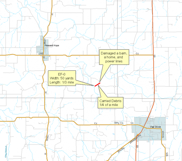
Seneca, MO - March 31, 2008 Tornado
EF - 1
Width: 60 yards
Length: 600 yards
Winds: Estimated 88 to 95 mph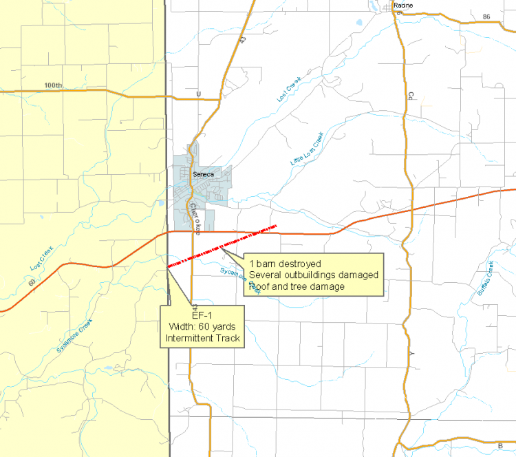
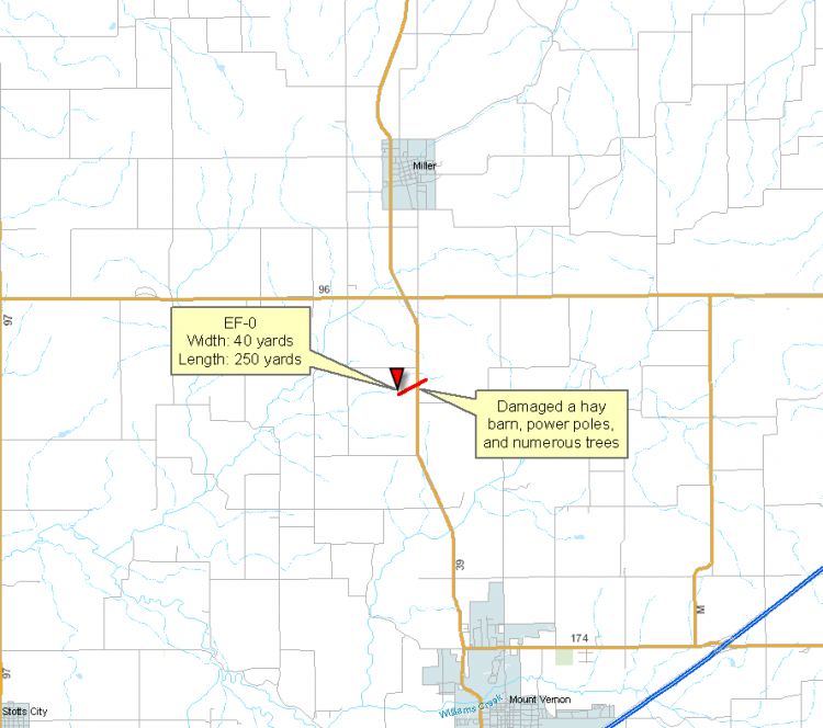
South Fork, MO - March 31, 2008 Tornado
EF - 0
Width: 20 yards
Length: 150 yards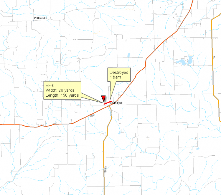
El Dorado Springs Tornado, March 31, 2008
EF - 0
Width: 75 yards
Length: 0.5 miles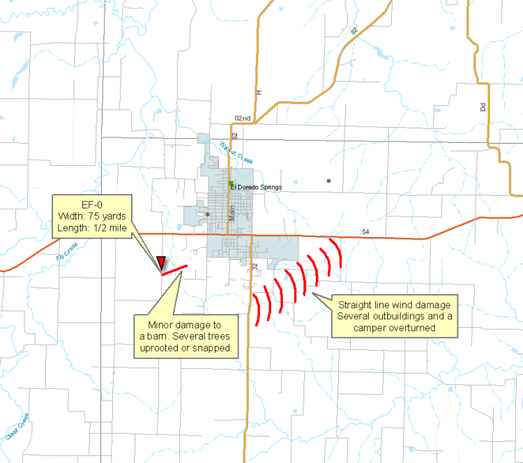
EF - 1
Length: 4 miles
Winds Estimated at 90 mph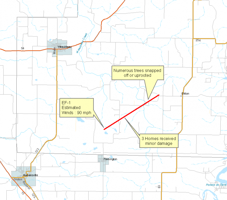


 Weather Story
 Weather Map
 Local Radar
 Follow us on YouTube