Overview
|
Convection began to develop just before 5:00 pm CDT across southeastern Kansas and the Missouri Ozarks. Storms initiated along two boundaries moving east across the region, the first being a cold front extending from northeastern Missouri into central Oklahoma and the second being a remnant boundary which had been slowly moving east across southern Missouri, left over from overnight/early morning convection. Through the evening these storms prompted numerous severe thunderstorm warnings with over 50 reports of thunderstorm wind damage, severe wind gusts, and hail associated with the strongest of these storms. The first severe thunderstorm warning was issued at 5:49 pm CDT as thunderstorms intensified across Cherokee County Kansas and Jasper and Newton Counties in Missouri. Through the course of the evening, 27 severe thunderstorm warnings were issued across the region, with over 50 reports of severe weather, the majority being severe thunderstorm wind damage and gusts over 60 mph. Severe storms would continued through midnight across the region, with scattered showers and thunderstorms continuing through the overnight hours into the early morning of August 5th. |
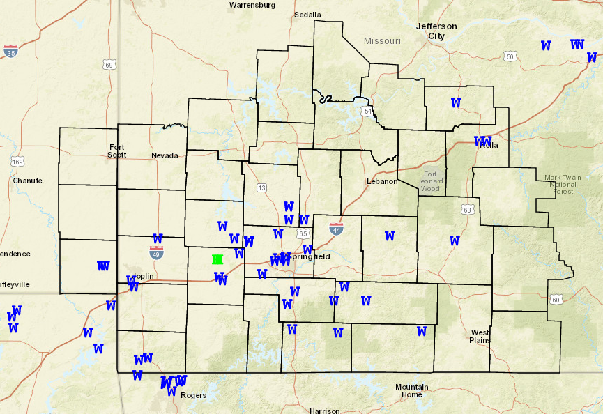 Storm Reports |
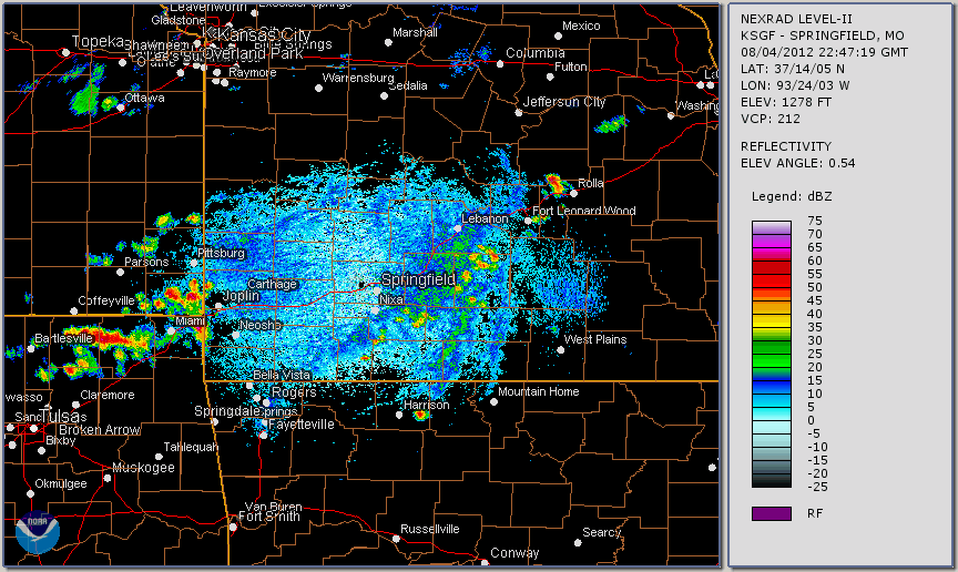
Radar:
 |
Media use of NWS Web News Stories is encouraged! Please acknowledge the NWS as the source of any news information accessed from this site. |
|


 Weather Story
 Weather Map
 Local Radar
 Follow us on YouTube