Overview
|
A mixture of freezing rain and sleet developed during the early to mid-morning hours of March 4th, 2015. Sleet accumulations were quite significant across portions of southern Missouri and ranged from one-quarter to near one-half of an inch. A few locations in far south-central Missouri had sleet accumulations near three-quarters of an inch. Freezing rain accumulations were light and generally amounted to just a light glaze. The mixed precipitation then changed to snow from northwest to southeast across the region from mid-morning through early afternoon. The snow became heavy at times across south-central Missouri during the afternoon and early evening hours. Snow accumulations ranged from 4 to 7 inches in far south central Missouri with a report of 8 inches at Koshkonong in Oregon County. Accumulations were lighter farther northwest ranging from 1 to 3 inches along and south of the I-44 corridor to just a dusting from southeastern Kansas into central Missouri. |
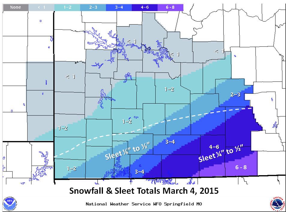 Snowfall and Sleet Totals |
 |
Media use of NWS Web News Stories is encouraged! Please acknowledge the NWS as the source of any news information accessed from this site. |
|


 Weather Story
 Weather Map
 Local Radar
 Follow us on YouTube