|
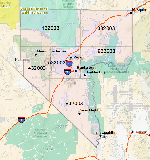
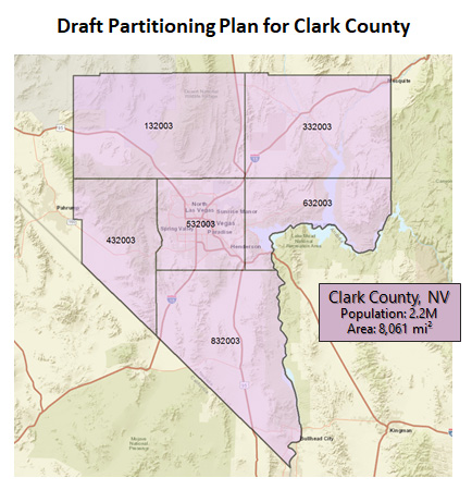
WFO Las Vegas will incorporate county partitioning algorithms into its software baseline and will invoke county partitioning for the warnings conveyed via SAME and to broadcaster’s encoder/decoder equipment. NWS and area partners have agreed on six county partitions for this test. The boundaries of the partitions will be fixed. Based on feedback, NWS may adjust the boundaries of the six partitions as needed. Below is a Clark County, NV, map with the six partitions and the six digit, SAME/EAS location codes for each partition. |
 |
|
Here is a Clark County map with the six partitions, noting the major cities and towns, major highways, major DOD and DOE properties, etc.
More Information |
|
Here are separate maps for each of the 6 partitions