Tulsa, OK
Weather Forecast Office
Information about the last time there was a white Christmas and other bits of Christmas climatological information for the observing sites at Tulsa, Fayetteville, and Fort Smith can be found on our Christmas climatology webpages.
On any given year, what is the historical probability of seeing a White Christmas? The following graphics from the National Centers for Environmental Information show these probabilities for the entire country. Additional information is available here. For this year, check out the latest NWS Tulsa forecast for your location at www.weather.gov/tsa
A White Christmas, defined as at least 1" of snow depth on Christmas morning, just doesn't happen that often in eastern Oklahoma and northwest Arkansas, generally around 5 percent of the time, except for locations near the Kansas and Missouri borders. Tulsa and Fayetteville have a 7% chance of having a white Christmas each year, while Fort Smith has a 2% chance. The last White Christmas occurred in 2012 in Fort Smith and 2009 in Tulsa and Fayetteville.
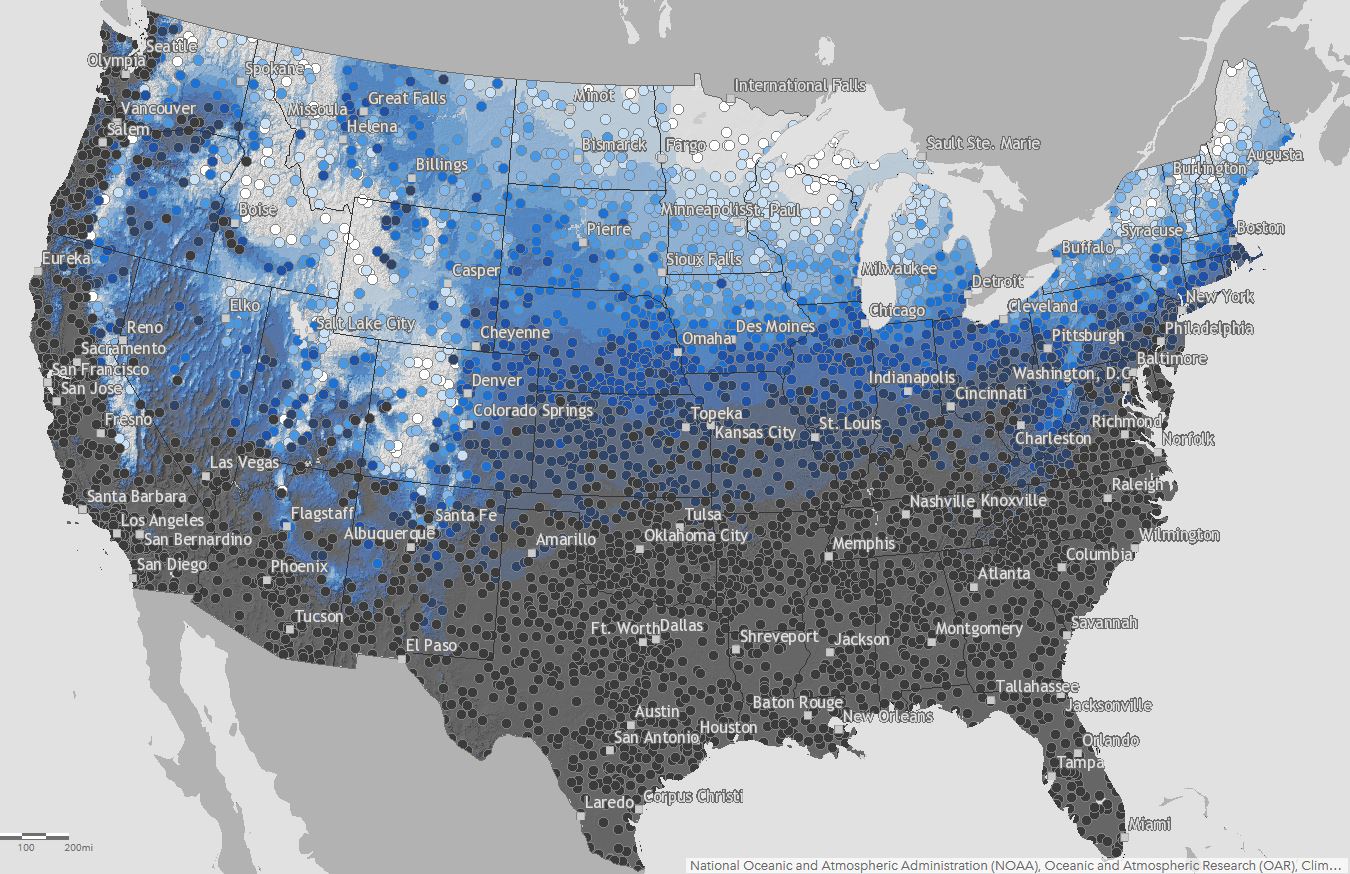
Click the image above for an interactive map.

Last updated: December 14, 2023
US Dept of Commerce
National Oceanic and Atmospheric Administration
National Weather Service
Tulsa, OK
10159 E. 11th St. Suite 300
Tulsa, OK 74128
918-838-7838
Comments? Questions? Please Contact Us.

