
More added in the future...


There were no deaths locally that were directly related to Hurricane Barry.
Summary of all Local Storm Reports (LSRs) across the area during Hurricane Barry and LSRs across the region during Barry.
Hurricane Barry made landfall west of our area (coastal Louisiana). The majority of this document will focus on the impacts from coastal flooding and rainfall across southeast Mississippi, southwest Alabama and northwest Florida. Below are some of the regional impacts...
Jump to - Rainfall, Coastal Flooding, Wind, or Additional Information sections.
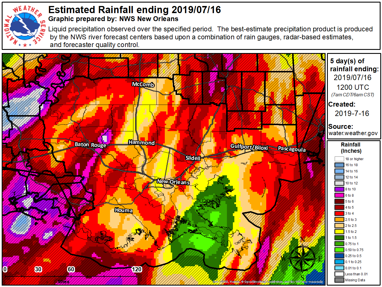
 Due to Hurricane Barry making landfall west of our area, the axis of heaviest rains also occurred further west of the local area. However, several outer rain bands set-up across the western half of the NWS Mobile/Pensacola county warning area, which led to high rainfall amounts. The animated graphic to the right, a compilation of the daily rainfall plots from NWS Birmingham, shows the gradient in storm total rainfall amounts from west to east across our counties in Alabama and Florida.
The highest storm total rainfall amount in our area was 8.36" near the city of Fairhope in Baldwin County, AL with numerous reports of 5+" across the western half of the area. The axis of heaviest rain extended through our southeast Mississippi Counties and into Mobile and Baldwin Counties in Alabama.
Heavy rainfall from the outer rain bands of Hurricane Barry led to standing water and flooding in a few communities predominantly near the coast.
Storm total rainfall amounts from Friday, July 12th through Monday, July 15th are listed in the table below. The list includes rainfall amounts from the CoCoRaHS network (Community Collaborative Rain, Hail, & Snow Network), which is a group of volunteers working together to measure precipitation, along with National Weather Service ASOS and COOP sites marked as (A) and (C) respectively. Storm total rainfall amounts shown below are sorted in order from highest observed totals to lowest for each county's sites. The locations are noted in miles from the nearest city or community.
| Alabama | Florida |
 |
 |
| Mississippi | |
 |
|
For more information on CoCoRaHS rainfall totals and the CoCoRaHS program, visit our CoCoRaHS rainfall website from this event.
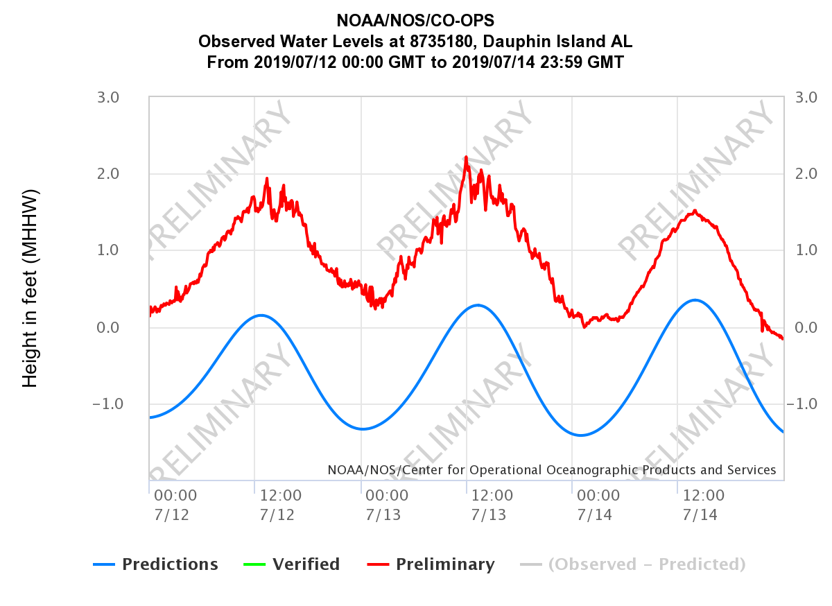
Official NOAA/NOS/CO-OPS tide gauges were used to measure the maximum storm surge and storm tide across the area during Hurricane Barry. Several of the time series plots from the NOAA/NOS/CO-OPS tide gauges across coastal Alabama and northwest Florida can be viewed below.
Coastal flooding (less than 3 feet) was observed in several locations across the coast with the peak inundations listed in the table below. Wave run-up resulted in coastal flooding that began along Bienville Blvd on the west end of Dauphin Island (Mobile County) a few days before landfall of Barry. At times, water was 1-2 feet deep along Bienville Blvd. After the water receded, Bienville Blvd had spots with 2-3 feet of sand while numerous side streets had several feet of sand covering the road.
Coastal flooding also led to water covering parts of the Cochrane Causeway and several low-lying roads near the coast in downtown Mobile. Water covered the Causeway over Mobile Bay, which led to the closure of the east bound lanes and closure of the exit/entrance ramps to the I-10 Bayway. Further south in Mobile County, coastal flooding led to water over the road north of the Dog River Bridge and Shell Belt Road and Coden Belt Road in Bayou La Batre became impassable due to water covering the road. Minor coastal flooding was also observed around Weeks Bay, especially near Pelican Point and Isle of the Pines.


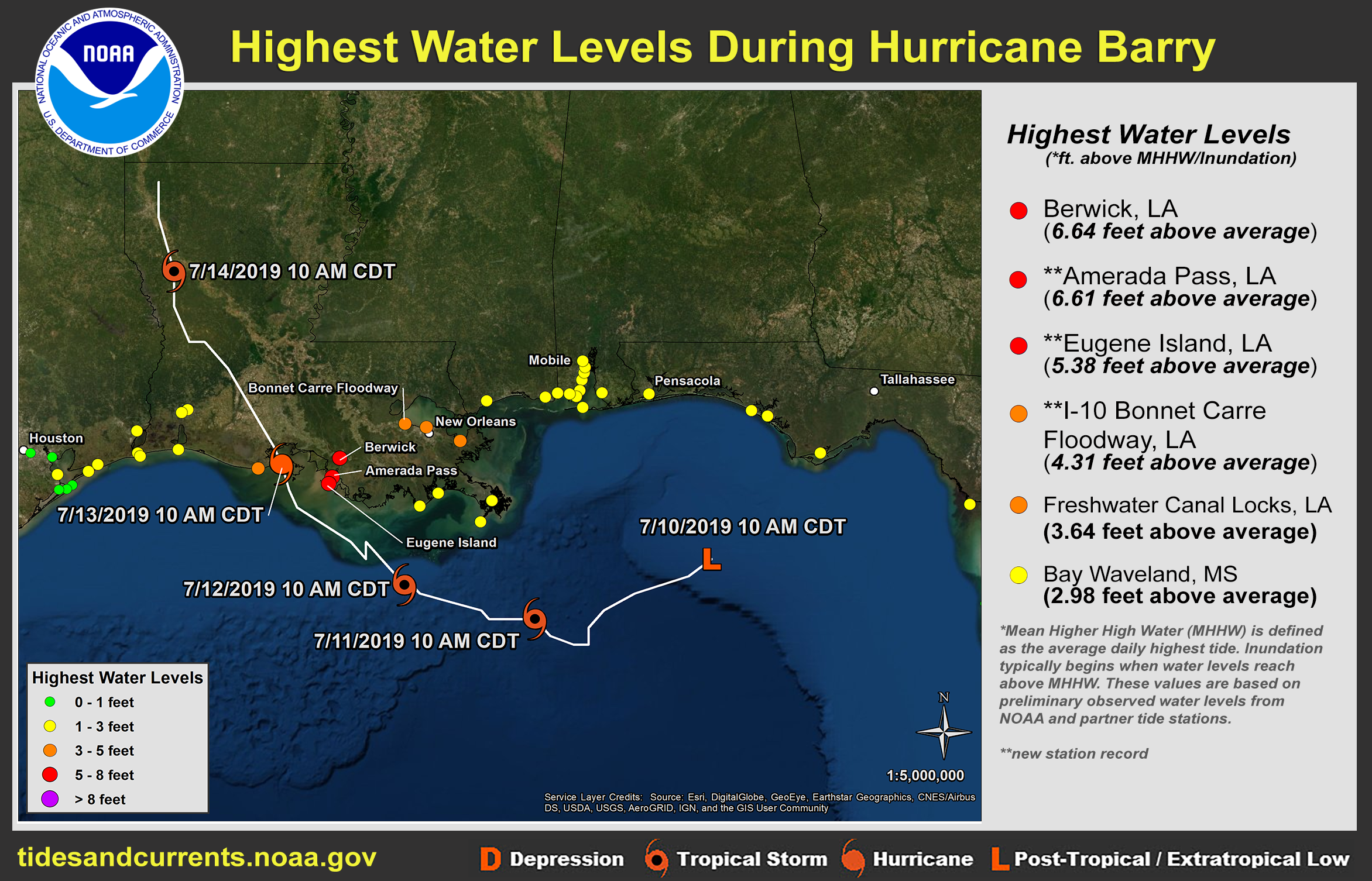
The graphic below, produced by the NOAA/NWS National Hurricane Center Storm Surge Unit, graphically depicts the preliminary peak water levels in MHHW from Hurricane Barry.

Several wind gusts in excess of 39 mph were measured in thunderstorms in the outer rain bands of Hurricane Barry. All of these locations are located within a mile of a bay or coastal waters.

NHC Advisory Archive
WPC Archive
NHC Tropical Cyclone Report - Hurricane Barry
NOAA Tides & Currents - Highest Storm Water Levels
NOAA Tides & Currents - Archived Storm QuickLooks (not available yet)
USGS Coastal Change Hazards Portal - Hurricane Barry
National Geodetic Survey Emergency Response Imagery
NWS Local Write-Ups and Webpages:
NWS New Orleans
NWS Lake Charles
NWS Jackson, MS
Acknowledgements: Page created by Morgan Barry (forecaster) and Joe Maniscalco (forecaster).
LAST UPDATED: January 2020


 Follow us on YouTube