|
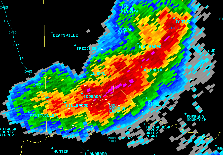
On the afternoon of Tuesday, August 4th, 2009, central Alabama arguably saw the strongest thunderstorm of the summer in Alabama. During the previous overnight period, a very weak boundary drifted south from Tennessee and draped itself over the eastern half of the state. Daytime temperatures in the low to middle 90s and dew points in the low 70s across the state helped to fuel a line of convection that fired up this particular storm over Elmore County.
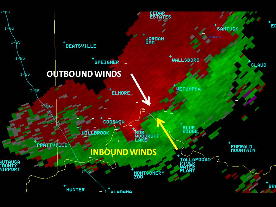
The 2 images on the top, reflectivity (left) and storm relative motion velocity data, are from KBMX in Calera, AL. Both images were captured at the same time, 425 pm CDT, and are at the same level in the storm, 8,500 ft. Though a little lower in the storm than normal, the velocity data clearly shows what is refered to as a Mid-Altitude Radial Convergence (MARC) signature. It is identifiable by the convergence of the inbound and outbound wind velocities meeting at the same level in the storm and coinciding with the strongest reflectivity core in the storm. This particluar storm in Elmore County created dime sized hail and caused some minor roof damage to a house when a tree fell on it. There were also reports of power outages around the area. To learn more about radar data, please click here.
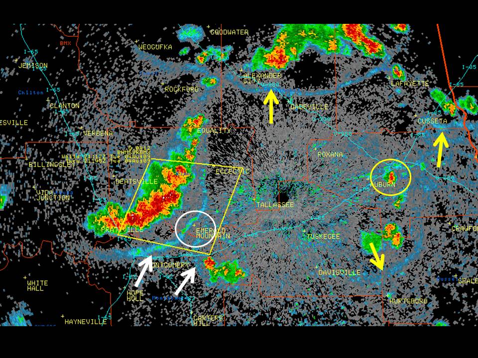
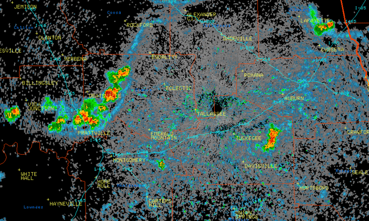
The images on the bottom are an illustration of outflow boundaries. Outflow boundaries are the result of thunderstorm downdrafts that hit the ground and spread out in all directions. It is that cool gust of air that you feel when a thunderstorm is approaching you.
The image on the bottom left is a still image of the animation on the bottom right. If you click on the image to enlarge it, the arrows are depicting the outflow boundaries (the big blue arcs of reflectivity). The white arrows are highlighting two particular outflow boundaries which collided over southern Elmore County and created another thunderstorm within the white circle. The yellow circle is a thunderstorms that was initiated just to the east of Auburn by the collision of 2 other outflow boundaries. The yellow box is the severe thunderstorm warning that was issued for Elmore County.
|


 Follow us on YouTube