Accurate liquid-equivalent precipitation accumulation measurements are essential for hydrological, flood forecasting, and agriculture applications. For aviation purposes, freezing or frozen precipitation accumulation measurements provide a quantitative dimension to the qualitative detection and reporting of freezing or frozen precipitation by other ASOS sensors.
In the early development of an automated precipitation accumulation gauge, it was recognized that automated measurement of liquid and LEFP each presented a unique challenge, so a separate specification was written for each type of precipitation. The automated Heated Tipping Bucket (HTB) technology from the 1970s was adopted and modified to meet these needs. Over the years, many improvements were made and incorporated into ASOS. Early versions of the heated gauge applied excessive heat creating excessive evaporation and the under-reporting of the liquid-equivalent mass.
The current version of the HTB gauge applies less heat over a longer heating cycle, thus yielding a more accurate mass measurement of frozen precipitation. Changes in the tipping bucket inner design also have improved overall performance in liquid precipitation events.
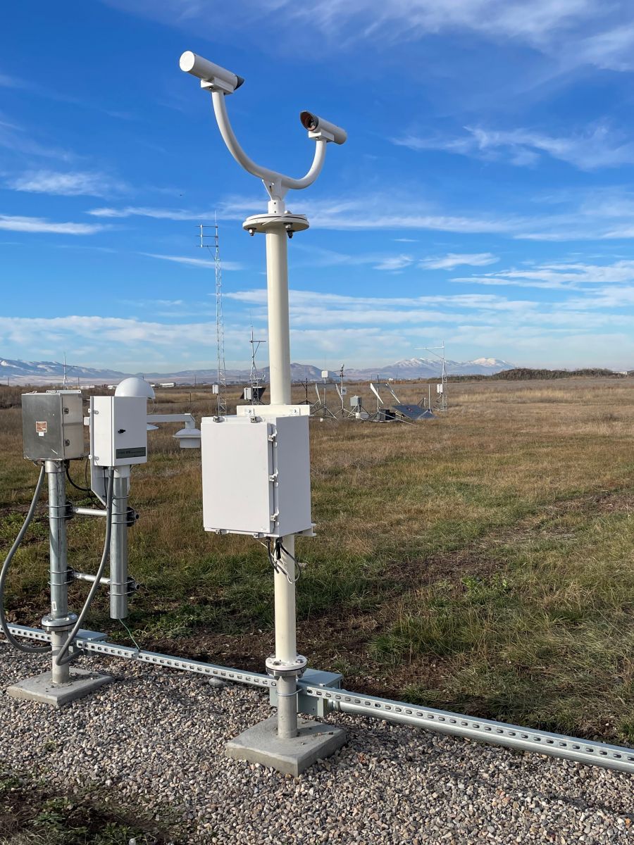
The Precipitation Identification sensor (PI), better known as a Light Emitting Diode Weather Identifier (LEDWI), differentiates rain from snow and determines the intensity of the precipitation.
The LEDWI contains a coherent light transmitter (i.e., there is a continuous relationship among the various phases of the light waves within the beam) and a photodiode receiver. The transmitter and receiver are mounted on a cross arm 10 feet above the ground or base of the platform. They are equipped with heated lens hoods, face directly at each other, are separated by a distance of 2 feet and are oriented in a north-south direction with the receiver looking north.
The transmitter generates a coherent Infrared (IRED) light beam, 50 millimeters in diameter, aimed directly at the receiver. The receiver lens is masked with a narrow 1 millimeter horizontal slit aperture through which the transmitter light beam passes before it is focused by the lens and impinges on the photodiode. The narrow aperture makes the receiver more sensitive to beam fluctuations caused by particles down to the size of a small raindrop (0.04 inch diameter).
Because the slit is much wider than its height, the receiver is more sensitive to beam fluctuations induced by the vertical velocity component of particles passing through the beam than the horizontal component. Built-in sensor algorithms minimize the possibility of any false identification caused by greater sensitivity.
As a particle of rain or snow passes through the coherent light beam, the particle creates a shadow that modulates the light, which then passes through the receiver's horizontal slit aperture as a partially coherent (intermittently disrupted), collimated (parallel to the slit) beam. The shadow varies depending on the size and speed of descent of the particle as it falls across the receiver.
When many particles fall through the beam, a scintillation pattern is created. The fluctuating beam pattern is sensed by a photo diode and amplified, creating a jumble of frequencies containing information on the size and speed of the falling particles. A spectral analysis reveals how much energy or power is contained in the various frequency bands. For example, a predominance of power in low frequencies from 75 to 250 Hz indicates snow. When energy is predominantly in a band from 1000 to 4000 Hz, the precipitant is almost certainly rain. The LEDWI registers rain and snow mixed as a "smearing" of the spectral power, which is usually reported by ASOS as unknown precipitation (UP). This analysis is the basis of the discrimination algorithm, which differentiates rain from snow.
When the precipitation is not mixed, (i.e., pure rain or pure snow) the LEDWI can determine the intensity of the precipitation. The intensity is determined by the power of the signal return in the rain (1-4 kHz) or snow (75-250 Hz) portion of the power spectrum. The power return of rain is derived from the size and fall velocity of the particles whose size distribution correlates well with liquid water content. It is possible to accurately determine the rain intensity through an empirical relationship (the Marshall-Palmer distribution), which can distinguish light (up to 0.10 inch per hour), moderate (0.11-0.30 inch per hour), or heavy (greater than 0.30 inch per hour) intensities for rain.
In the case of snow, it is again the size and fall velocity of the snowflakes that determines their size distribution. This correlates well with the rate of snow accumulation. Unlike rain however, the density of snow can vary significantly depending on whether the snow is "wet" or "dry," and so the liquid content cannot be accurately determined.
| Back to Sensor Suite Design |

