|
Dejá Vu...all over again.
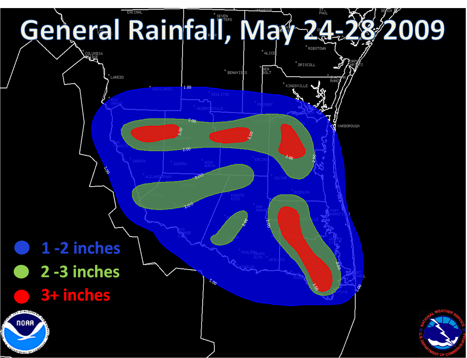
In Mid May, 2008, portions of the Rio Grande Valley and Deep South Texas received virtually the only severe weather of an otherwise dry, hot, and uneventful spring. Hailstorms raked Zapata County on May 14th, and less than 36 hours later, microbursts swept from near Edinburg to Harlingen. Beginning on May 24th, and returning on May 26th through May 28th, welcome, torrential rains swept across most of the RGV and Deep South Texas, punching down the drought a bit. The welcome rains were accompanied by not so welcome gusty and sometimes damaging wind, large hail, and frequent cloud to ground lightning.
The Setup
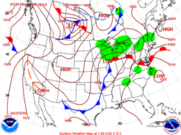
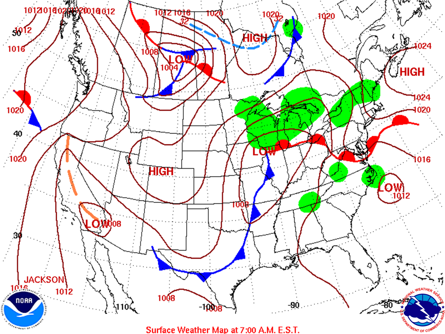
A series of upper level disturbances embedded in west to northwest flow well above the ground acted on a very unstable atmosphere, with an approaching surface front (below, early on the 27th) providing additional lift. In some cases, such as during the pre dawn hours of May 24th, and more robustly shortly after midnight on May 28th, the disturbances linked with some upslope flow across the Sierra Madre Oriental west of the upper Rio Grande Valley to produce rapidly developing thunderstorm clusters, which then raced east or southeast through the region, assisted by the mid level west to northwesterly flow. After the crash and bang of early Thursday morning stabilized the atmosphere, quieter conditions prevailed, and continued to close out the week. How long would the quiet weather last? As of this writing, it appeared the weekend would be fairly typical heading into early June, with isolated showers and perhaps an afternoon thunderstorm.
May 24th: Morning...and Evening
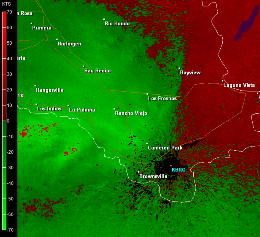
The first small thunderstorm complex rudely punctured a pleasant tropical early morning, intensifying over the western portion of the Lower RGV before accelerating through Weslaco, La Feria, Brownsville, and South Padre Island before racing into the Gulf. Lightning burned down a home in Weslaco, then microbursts with gusts above 50 mph (radar image, below) whipped southern Cameron County, sinking boats in the Laguna Madre and tearing awnings at Isla Blanca park.
|
May 24th: Morning...and Evening
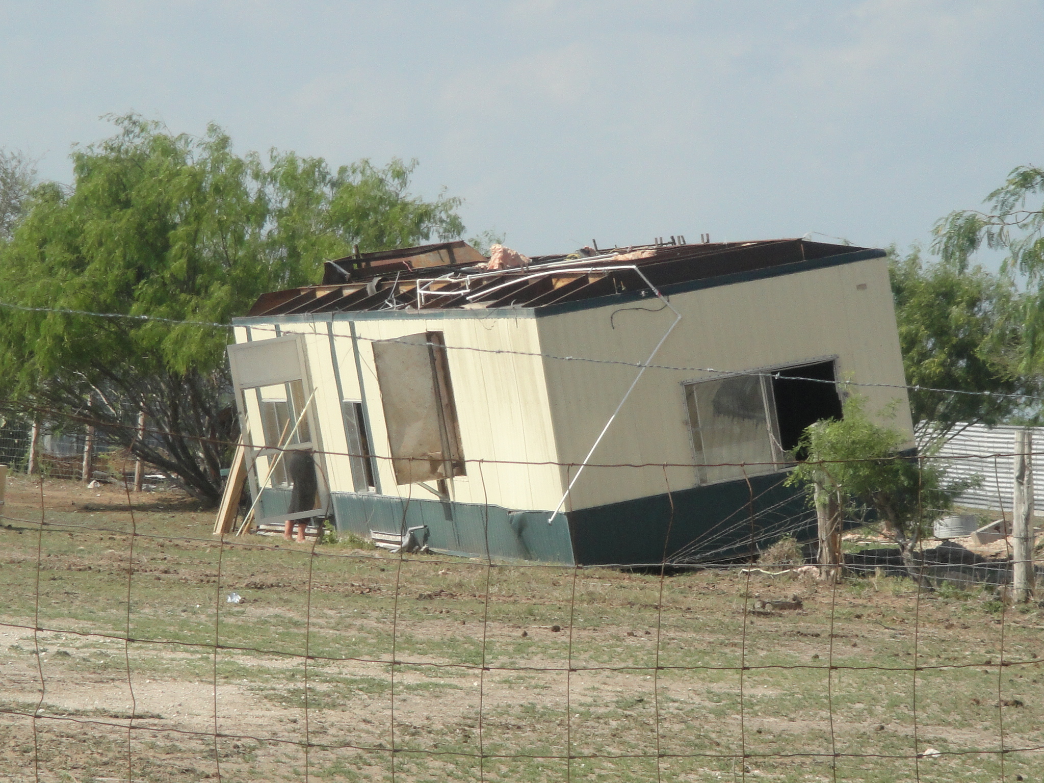
After a sunny, hot day, scattered storms fired once again, initially sliding southeast from Brooks and Kenedy County before intensifying into Willacy County, where long duration hail fell, and a microburst rolled a new but unsecured mobile home just west of Raymondville. At the same time, a very small but potent storm raced northeast from near Reynosa, México, thruogh Donna and Weslaco before linking up with the cell driving southeast from Willacy County.
May 27-28: Afternoon rain, overnight Hail
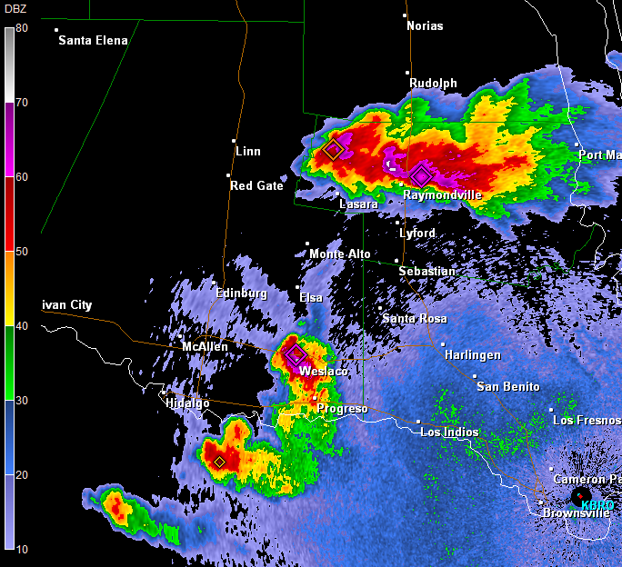
Outflows from a complex of storms moving through the Coastal Bend met up with very unstable air across Deep South Texas, setting the stage for more welcome rains, but also a few individual storms producing a prolonged 35 to 45 mph wind across Cameron County in addition to frequent lightning and large hail. Bigger storms developed around midnight east of the Sierra Madre west of Laredo, and these would soon form a large complex of activity which would eventually cover the entire area before the night was through. One set of storms, containing a continuous hail core and likely microbursts, raced from Zapata due east through Jim Hogg, Brooks, and Kenedy County; outflows from these combined with other outflows sliding northeast from Nuevo Léon Province to form other storms which moved from Starr County east through the Lower RGV.
Yet another home was sizzled by lightning in McAllen before daybreak; large hail up to the size of golf balls was reported southwest of Hebbronville, and similar hail may well have fallen farther east in Jim Hogg and Brooks County before activity weakened a bit prior to moving off the Kenedy County coast. When all was said and done, the four days of locally torrential rain helped green up some of the parched landscape, to the tune of 1 to nearly 4 inches. 3.56 fell in Los Fresnos (Cameron County); and 2.73 fell in Raymondville (Willacy County).
Click here for a map of large hail, damaging wind, and known lightning damage events between May 24th and 28th.
|


