 |
 |
 |
 |
||
|
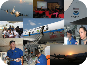
Did you ever want to know how the brave men and women known as Hurricane Hunters fly into these wicked storms? Perhaps you’ve always wondered how the aircraft, a Lockheed Orion WP–3D model, survives the intense winds and rain. Or, how the crew measures critical data to determine how intense a storm has become, in order to help improve forecasts? Maybe you're interested in meeting the dedicated pilots and crew who fly the missions, and some of the specialists who use the data to provide information that ultimately might save your family’s lives? If you’re interested in answers to these questions and more, please come to the Air Cargo Building on the northeast side of the Brownsville/South Padre Island International Airport between 3 and 4:30 PM on Monday, April 26th. Ask questions of the flight crews, the hurricane forecasters, and others who play vital roles in monitoring and predicting these storms. Walk through the spacious hangar and check out exhibits from local emergency management agencies, disaster relief organizations, utility companies, and much more. Admission is FREE, and plenty of parking will be available. We hope to see you here! |
||
 Map of Southern Cameron County. Hurricane Awareness Tour located at the red dot. Arrows show primary routes from the west (Military Highway 281 to Boca Chica Boulevard), northwest (Expressway 77/83 to Boca Chica Boulevard), and north (Expressway 77/83 to Farm to Market Road 511 near Olmito, then South to Boca Chica Boulevard). |
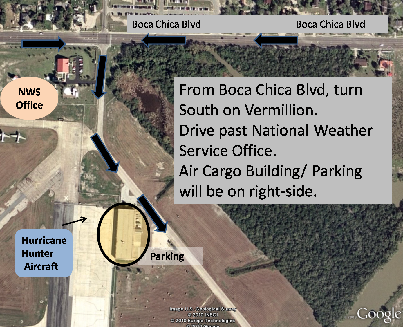 Map of the event location. Turn onto Vermillion Road and follow the signs. Helping hands will guide you to the parking areas and the tour. |

