
Tropical system in the Gulf expected to gradually strengthen the next couple of days off the Florida Panhandle and Alabama coasts. Instances of flash flooding will be possible through Thursday along the eastern and central Gulf Coast. Severe thunderstorms will develop and move along a cold front crossing the Upper Midwest, and through the Ohio Valley/Mid-Atlantic on Tuesday. Read More >
Glasgow, MT
Weather Forecast Office
2 Day Forecast:
| Click on the image below for the latest 2 day Fort Peck Lake Recreation Forecast. |
.png)
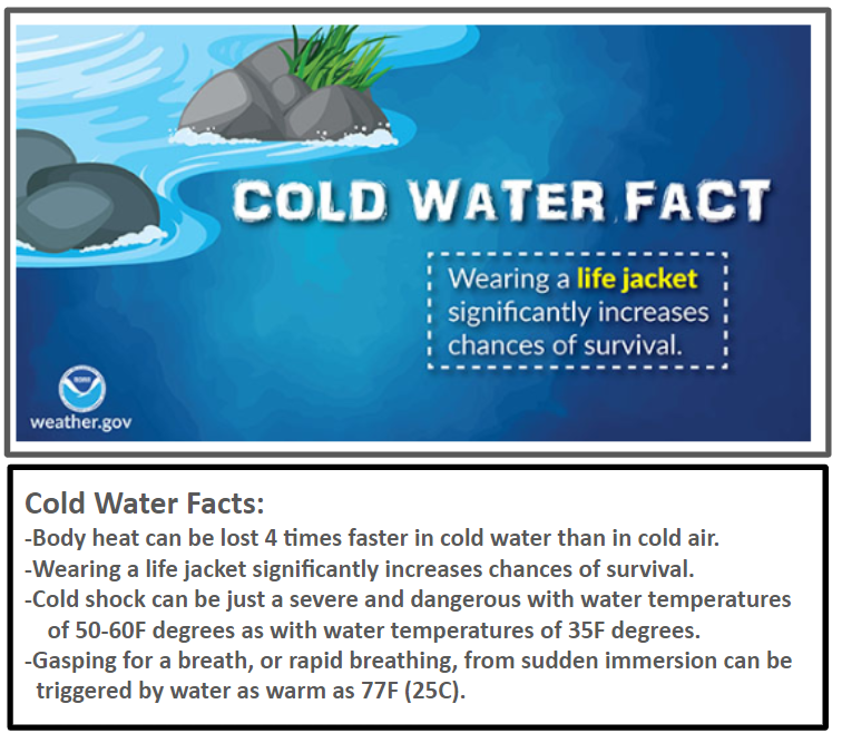
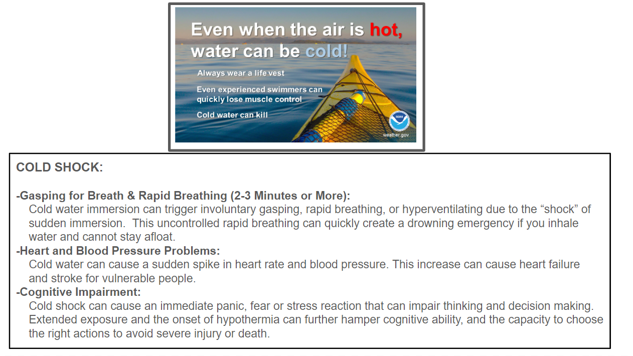
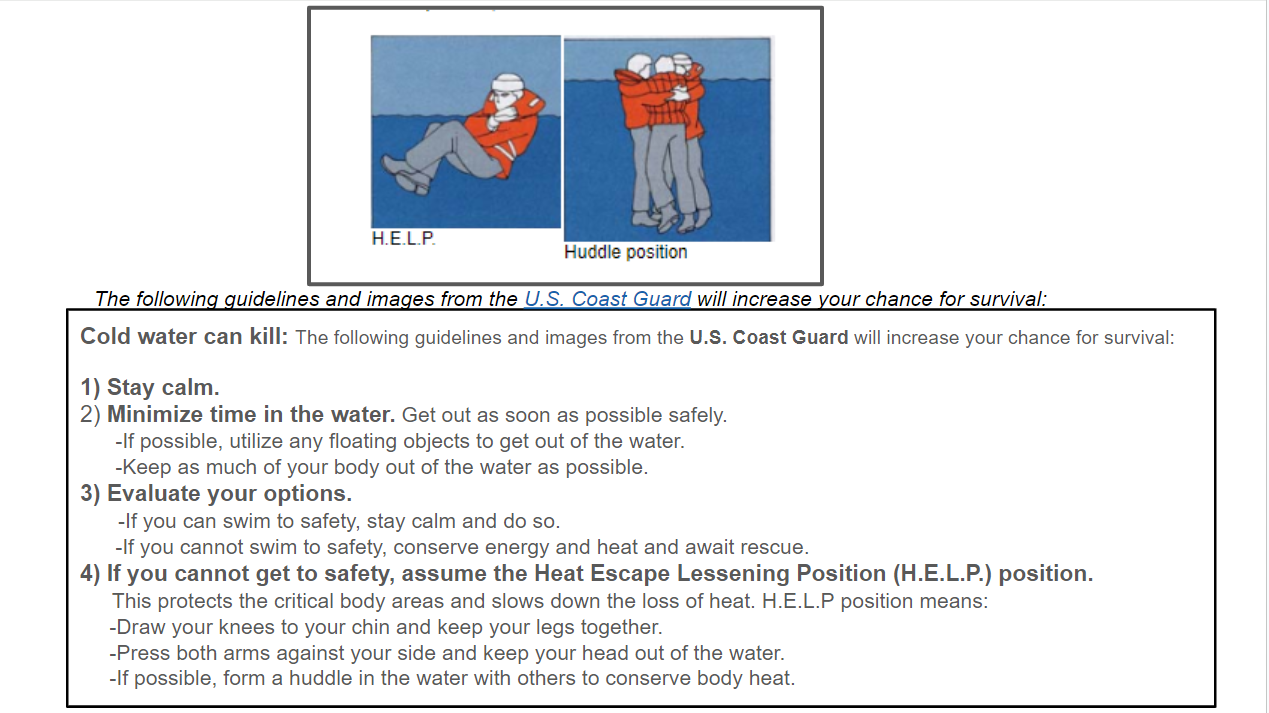
Cold Water Hazards and Safety:
| Click on each image to enlarge |
7 Day Forecast:
|
Click on a lake image (top row) to retrieve the latest 7-day marine |
 Dam Area |
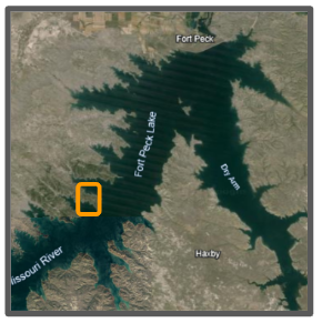
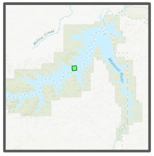 West End Area |
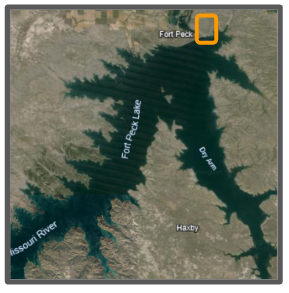
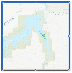 Dry Arm Area |
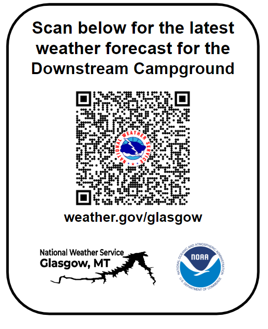 Downstream Campground |
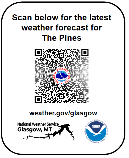 The Pines |
 Rock Creek |
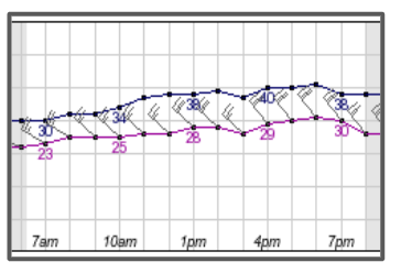
Weather Observations & Forecast winds:
Click a box for the latest weather observations
 |
 |
| Fort Peck Dam |
Pines Rec Area
|
 |
|
|
| 0-48hr Winds | 48-96hr Winds | 96-144hr Winds |
US Dept of Commerce
National Oceanic and Atmospheric Administration
National Weather Service
Glasgow, MT
92 Airport Road
Glasgow, MT 59230
(406)228-4042
Comments? Questions? Please Contact Us.

