Dangerous and extreme heat will remain across portions of the central U.S. this week, persisting across the mid to lower Mississippi Valley, Gulf Coast, southern Plains and portions of Texas. A heat wave over the Southwest U.S. will peak this weekend. Heavy to excessive rainfall may produce flash flooding from the Delmarva Peninsula north into the Hudson Valley today and tonight. Read More >
|
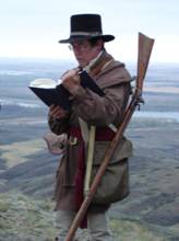
May 8-10, 1805…Captain Meriwether Lewis and Lieutenant William Clark expedition survey from what is now Signal Hill NWR transmitter site, name Milk River and collect weather observations before moving further up the Missouri River. |
Bud Clark, a descendant of Capt. William Clark reads from the Journals 200 years to the day of Lewis and Clark visiting the site above the Missouri and Milk River Confluence on May 8, 2005. Photo by Mike Fransen
|
|
|
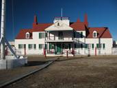
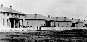
Fort Union (above) and Fort Buford (below)
|
June 23, 1828…Fort Union Trading Post is established and the American Fur Company begins informal record of weather commentary. Fort Union is dismantled and abandoned for nearby US Army Fort Buford in 1867. Fort Buford surgeon staff conducted the US Army Signal Corps weather observations program until November 23, 1893. |
|
|
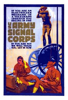
February 9, 1870…President Ulysses S. Grant assigns weather observational duties and storm warning responsibilities to the US Army Signal Service Corps, Division of Telegrams and Reports for the Benefit of Commerce. |
|
|
|
Fort Assiniboine in the late 1800’s
|
October 6, 1879…Fort Assiniboine starts systematic weather observation record shortly after construction is completed. Fort Assiniboine weather observation program is transferred to United States Weather Bureau (USWB) when the Havre Weather Bureau Office (WBO) opens in May 5, 1902. |
|
|
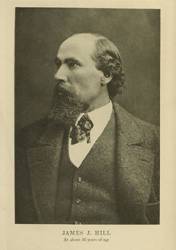
July 23, 1887…Jim Hill’s Great Northern Railroad (St Paul, Minneapolis and Manitoba Railway Company) construction crews reach Siding #45, the future site of Glasgow, MT, as they extend the Great Northern rail line from Minneapolis, MN to Seattle, WA. Paralleling the US-Canadian border, the Great Northern Railroad is labeled the “Hi-Line”, a name eventually applied to northeastern Montana along US Highway 2.
|
|
|
|
|
November 8, 1889…Montana is granted statehood as the 41st state. |
|
|
July 1, 1891…Weather observing, forecasting and warning responsibility is transferred from the US Army Signal Corps to the US Weather Bureau. The Organic Act of 1890 is approved by Congress and signed by President Benjamin Harrison to create a civilian USWB within the US Department of Agriculture (USDA). |
|
|
|
|
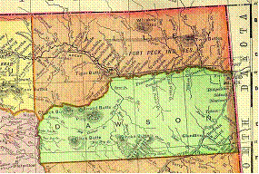
March 17, 1893…The Montana Legislature approves the creation of Valley County from the northern portion of Dawson County.
|
|
|
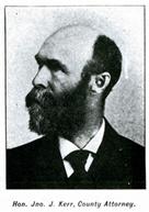
March 30, 1893…John J. Kerr, the first Valley County Attorney, becomes the first USWB cooperative program observer in Glasgow, Montana. |
|
|
|
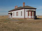
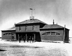
Historic Photos of Fort Buford from the ND Historical Society
|
November 23, 1893…The Williston Weather Bureau Office (WBO) is opened on the Rawson block of downtown Williston, ND, when Fort Buford observations cease. |
|
|
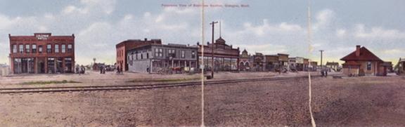
June 6, 1902…The community of Glasgow is officially incorporated. |
Postcard of Glasgow from 1900
|
|
|
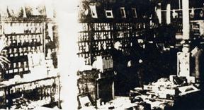
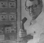
William Mabee in the drug store.
|
July 1, 1905…William Wallace Mabee, Valley County probate judge and druggist, takes over as the Glasgow cooperative observer. |
|
|
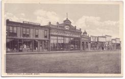
May 1, 1907…The Glasgow cooperative observer site is moved between several business locations on the 300-400 block of Front Street (now 1st Street South) from 1907 to 1911.
Old Postcard of Glasgow’s Front Street. Courtesy of Valley County Pioneer Museum
|
||
|
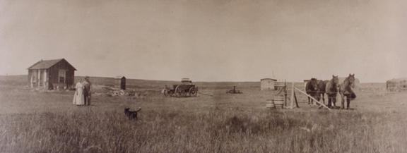
February 19, 1909…The Enlarged Homestead Act permits settlers to claim 320 acres, double previous, for agricultural use.
Early Homesteaders (Ollingers) between Glasgow and St. Marie. Courtesy of Valley County Pioneer Museum
|
||
|
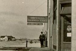
May 1, 1911…The Glasgow cooperative observations are collected from the 2nd Street South site of the Imperial Lumber Company block. |
Imperial Lumber Yard in early 1900’s. Courtesy of Valley County Pioneer Museum
|
|
|
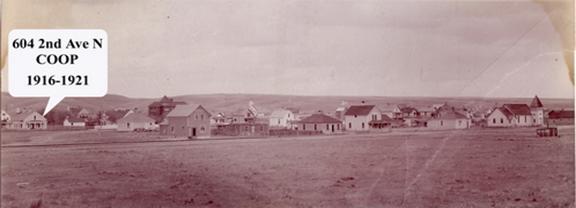
May 1, 1916…The Glasgow cooperative site is transferred to L. E. Jones, secretary of the Glasgow Chamber of Commerce and Agriculture Committee. Courtesy of Valley County Pioneer Museum
|
||
|
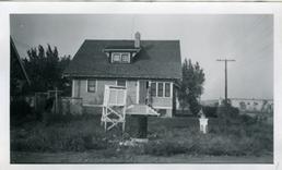
Photo of Elmer Hall and his home with the Cotton Region Shelter in the foreground
|
April 1, 1921…Elmer Hall, local druggist, takes over as the Glasgow cooperative observer from his home at 305 5th Street South. Elmer, “Doc”, Hall becomes the longest serving Glasgow cooperative observer, volunteering 25 years. |
|
|
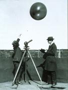
NOAA image of Kite Observations
|
July 1, 1936…Ellendale, ND kite soundings cease as USWB radiosonde program expands. Ellendale was the last USWB kite station. |
|
|
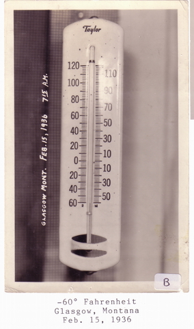
Feb 15, 1936 – The record coldest temperature ever measured occurred through northeast Montana, and across the majority of the northern Plains. These record low temperatures still hold to this day. |
Courtesy of Valley County Pioneer Museum
|
|
|
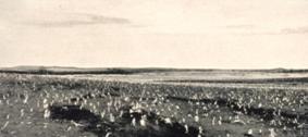
NOAA Photo Library- Drought leads to insect infestations that sweeps through the region in the 1930s
|
July 1936 The record warmest month on record at Glasgow, with seven record high days set during this month. The record high temperatures set during this month still stand for the majority of the northern Plains.
|
|
|
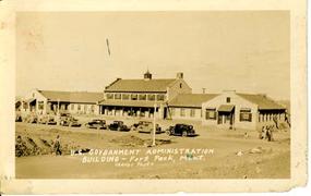
September 28, 1936…Six-hourly airways observations are conducted at the Fort Peck dam construction site by US Army Corps of Engineers (USACE) chemistry laboratory personnel. The observations are telephoned to Chicago for transmission over USWB circuits. USACE personnel also establish a cooperative weather station on November 10, 1934, though observations actually started on August 1, 1934.
|
USACE Administration Building in Fort Peck
|
|
|
|
June 30, 1940…The USWB is transferred into the Department of Commerce from the Department of Agriculture.
|
|
|
December 12, 1940…Elmer Hall assumes the task of taking six-hourly airways observations when USACE construction is complete on Fort Peck dam. The USACE continues the Fort Peck cooperative station. “Doc” Hall takes the airways observations until June 30, 1943.
|
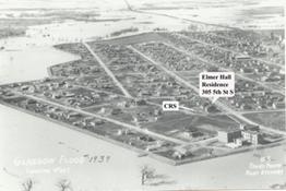
Elmer Hall Residence in Glasgow’s south Side along with the 1939 Milk River Flood
|
|
|
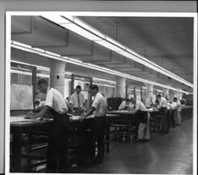
December 4, 1942…The Central Analysis Center (CAC) is created in Washington DC. The CAC is renamed the Weather Bureau Army-Navy Analysis Center (WBAN Analysis Center) in 1947, the National Weather Analysis Center (NAWAC) in 1955, the National Meteorological Center (NMC) in 1958 and National Centers for Environmental Prediction (NCEP) in 1995. |
NOAA image, early forecasters at the NMC
|
|
|
|
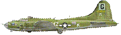
December 10, 1942…The Glasgow Army Air Field (AAF) begins B-17 flight crew training and starts hourly airways observations. Army Air Force weather observations ceased at Glasgow AAF on December 6, 1943.
|
|
|
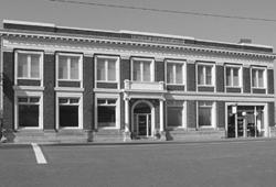
June 6, 1943…The Glasgow WBO opens in the second floor of the First National Bank Building at 501 1st Avenue South. The Glasgow office takes six-hourly airways and upper air observations. Rabals (72.2 MHz) are launched at 0300Z. Pibals are taken at 0900Z, 1500Z and 2100Z from the bank building roof. One month overlap in surface climatology observations between “Doc” Hall and WBO site during June, 1943. Rabals/Raobs had meteorological instrumentation attached to large balloons, and Pibals were used just to track the wind speeds and direction with a smaller balloon. |
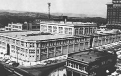
First National Bank Building in Glasgow
|
|
|
Glasgow WBO roof observations around 1945
|
April 4, 1944…Glasgow WBO begins launching upper air soundings at 0300Z and 15Z. The office is open between 0200-2300 LST.
|
|
|
May 18, 1950…Hourly aviation observations are collected and transmitted by USWB employees between 0600-1800 LST. Three and six hourly observations continue unchanged. |
|
|
|
NOAA Photo showing the old NWRC building in Asheville, NC
|
November 5, 1951…The National Weather Records Center (NWRC) is established in Asheville, NC. The NWRC is renamed the National Climatic Center (NCC) in 1970, then the National Climatic Data Center (NCDC) in 1982.
|
|
|
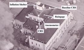
December 30, 1952…Solar radiation measurements begin with the installation of a Brown solar radiometer instrument on the inflation shelter roof. |
Glasgow roof observation locations
|
|
|
NOAA Photo NWS Billings Office in the 1950’s
|
March 1, 1953…The USWB Montana state forecast office is relocated to Great Falls from Billings. The Montana public forecast is comprised of nine forecast zones. (In 2008, we forecast for 62 zones in Montana).
|
|
|
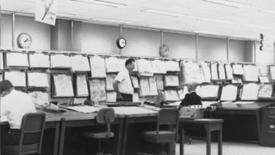
June 13, 1953…Severe Local Storm Warning Center (SELS) is created from earlier Severe Weather Unit (SWU) of the Weather Bureau Army-Navy Analysis Center (WBAN) in Washington DC. SELS relocated to Kansas City, MO in 1954. SELS renamed Storm Prediction Center (SPC) in 1995. SPC moved to Norman, OK in 1997. |
SELS in Kansas City, Late 1960s
|
|
|
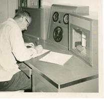
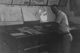
Official In Charge Robert Ronald working at the desk. He was the OIC from 1947-1955
|
January 1, 1955…Glasgow WBO staff goes on a 24 hour/day shift schedule. Hourly aviation observations with three/six hourly coded data and synoptic observations are recorded and transmitted. |
|
|
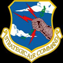
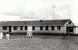
July 18, 1955…Construction begins on Glasgow Air Force Base (GAFB). The Air Defense Command (ADC) base is activated in 1958 with the arrival of F-101 Voodoo fighter-interceptors. The runways are extended to accommodate Strategic Air Command (SAC) B-52 bombers in 1960. GAFB is deactivated in 1968. The facility is temporarily reopened between 1972 and 1976 as a SAC dispersal base and a Safeguard Antiballistic Missile (ABM) supply depot. Hourly aviation observations are collected by Air Weather Service (AWS) Detachment 23 of the 9th Weather Squadron from the control tower Remote Observation Site (ROS).
|
|
|
|
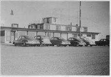
Glasgow WBO in the mid 1950’s
|
October 25, 1955…USWB relocates the Glasgow office to the Glasgow Municipal Airport. The Glasgow WBO is renamed the Glasgow Weather Bureau Aviation Station (WBAS). The 24 hour/day Glasgow WBAS transmits hourly aviation observations with 3 hourly coded data. Radiosonde runs are done at 03Z and 15Z with Pibals at 09Z and 21Z daily. |
|
|
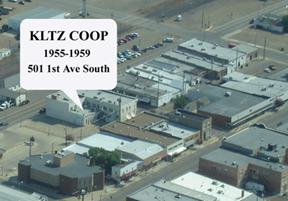
October 27, 1955…Glasgow radio station KLTZ becomes the downtown Glasgow cooperative observation station from the First National Bank Building.
|
|
|
|
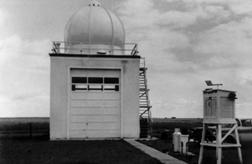
Upper Air building at the Glasgow Airport
|
June 1, 1957…Upper air soundings are shifted 3 hours. Raobs are done at 00Z and 12Z. Pibals are optically tracked from 06Z and 18Z.
|
|
|
August 25, 1957…The Glasgow WBAS adopts a 21 hour/day schedule (0300-2200 Local). Pibal runs are performed once a day at 18Z, when the 06Z Glasgow Pibal is eliminated. |
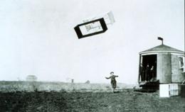
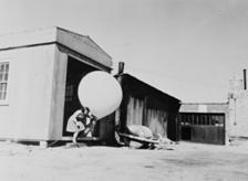
NOAA photo showing a balloon release during WWII when many women filled in while the men were overseas
|
|
|
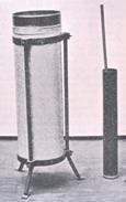
NOAA Photo showing an 8” rain gage
|
January 31, 1959…Cooperative observations at the downtown Glasgow KLTZ radio station cease. Downtown Glasgow KLTZ rain gage had been removed on October 9, 1957. |
|
|
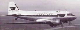
November 2, 1959…The newly arrived Frontier Airlines adds a three cup anemometer on a 37 foot mast between runways. The anemometer is sited 1,650 feet NE of the Glasgow WBAS with a direct read dial inside the office. |
Frontier Airlines DC-3
|
|
|
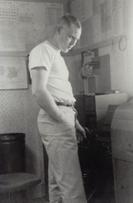
Eddie Stensland working at the Glasgow office in the 1950’s.
|
December 1, 1959…The Glasgow office is reclassified as a Supplemental Airways Weather Reporting Station (SAWRS) until December 31, 1961. Special observations are conducted between 0700-1900 LST only. |
|
|
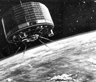
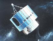
April 1, 1960…The first weather satellite, Television Infrared Observation Satellite (TIROS), is successfully launched aboard a Thor-Able rocket from Cape Canaveral, FL.
|
|
|
|
|
July 13, 1965…USWB is transferred into the newly-formed Environmental Science Services Administration (ESSA) of the Department of Commerce by Reorganization Plan Number 2 of 1965. |
|
|
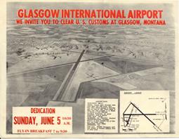
June 1, 1966…Glasgow Municipal Airport becomes Glasgow International Airport. Glasgow International Airport renamed Wokal Field – Glasgow International
|
Invitation to the Glasgow International Airport Dedication Ceremony
|
|
|
NOAA Photo showing a balloon release
|
June 1, 1968…The Glasgow weather office returns to 24 hour/day schedule and full aviation observation program. The 18Z Pibal ceases and the Glasgow requirement is placed locally “on-call”. |
|
|
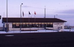
May 5, 1969…The Glasgow weather office moves into the Glasgow International Airport Terminal. The Cotton Region Shelter (CRS) and rain gages are relocated 385 feet SSW to near the new airport terminal office. The 24 hr/day Glasgow Weather Service Office (WSO) issues first period adaptive forecasts, disseminates local warnings, takes hourly aviation observations and synoptic reports. The upper-air program continues 00Z and 12Z Raobs, but Pibals are on an “on-call” basis only. |
Glasgow Airport Terminal. The WSO office was on the back side of the building
|
|
|
|
October 3, 1970…ESSA is transferred into the newly formed National Oceanic and Atmospheric Administration (NOAA) with Reorganization Plan Number 4 of 1970. The USWB is renamed the National Weather Service (NWS) on October 9, 1970 through Department Organizational Order 25-5A. |
|
|
October 16, 1975…The first Geostationary Operational Environmental Satellite (GOES) is launched with a Delta 2914 rocket from Kennedy Space Center. |
|
|
|
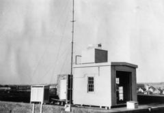
Ed Tipton records a broadcast for the Glasgow NOAA Weather Radio
|
September 17, 1976…NOAA Weather Radio (NWR) WXL-32 begins broadcast service for central Valley County from a newly constructed airport radio vault. |
|
|
June 20, 1981…Ocean weather ship “PAPA” (50oN, 145oW) goes permanently off station as an economy measure by Canadian PM Trudeau.
|
Ship PAPA, an important weather observation ship in the Pacific NW owned by the Canadians
|
|
|
Lee Tracy analyzing the upper air weather maps.
|
June 26, 1986…The VIZ B radiosondes are employed with newly installed MiniART Raob ground unit. |
|
|
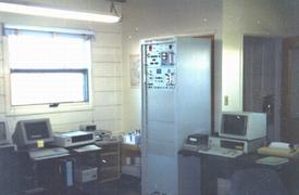
November 17, 1989…The Glasgow Weather Service Office Upper Air system is updated to include an IBM 8088 computer that automatically logs the data. It used to print out on a sheet of paper and was then hand coded by the office staff.
|
NWS Glasgow upper air computer system
|
|
|
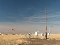
Automated Weather Observation (ASOS) Station at Wokal Field in Glasgow, MT
|
April 1, 1994…The Glasgow International Airport (KGGW) Automated Surface Observing Systems (ASOS) is commissioned. This site is the official temperature, wind, cloud, visibility, pressure and weather sensor for Glasgow, MT. |
|
|
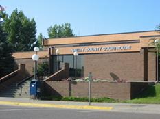
May 9, 1994…Valley County Law Enforcement Center is added as a cooperative observer site at 501 Court Square to re-establish a downtown Glasgow site. Temperature is measured with an electronic Maximum-Minimum Temperature Sensor (MMTS) and precipitation determined with a standard eight inch rain gage. |
Valley County Courthouse
|
|
|
Photo from the Fort Peck Flyer
|
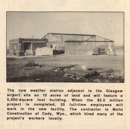
September 25, 1994…Moltz Construction Company of Cody, WY “breaks ground” for the construction of the new NWS Glasgow forecast office. |
|
|
August 14, 1995…NWS personnel move to the nearly completed new NWS office as new employees arrive and staffing starts to overflow at the old airport office. |
NWS Glasgow office staff photo
|
|
|
Upper Air Shelter at it’s new location
|
August 29, 1995…Automation of Field Operations (AFOS) computer system is upgraded and installed. The MicroARTS upper air system is relocated to the new inflation shelter south of Airport Road. The office cotton region shelter (hold thermometers) and rain gages are relocated behind the new office. The upgraded NOAA Weather Radio system is completed. |
|
|
May 5, 1996…Joe Albert Friday, NWS director, dedicates the new NWS Glasgow forecast office at a ceremony held at the new office.
|
Dr. Joe Friday, Former NWS Director
|
|
|
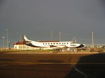
Big Sky Airline plane at the Glasgow Airport
|
July 1, 1996…Weather observations switch from the old Surface Airways Observations (SAO) into the international METAR format and the aviation weather forecast adopts the international Terminal Aerodrome Forecasts (TAF) format.
|
|
|
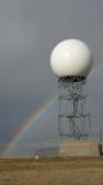
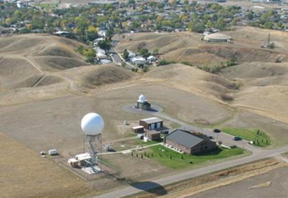
August 15, 1996…The Glasgow NEXRAD WSR-88D doppler radar is commissioned.
|
WFO Glasgow WSR-88D Radar Tower and Dome
|
|
|
|
January 25, 1998…The northeast Montana hydrologic program responsibility is transferred to the Glasgow NWFO. This includes the Lower Yellowstone River, portions of the Upper Missouri River, the Poplar River and the lower Milk River Basins within Montana.
|
|
|
October 6, 1998…The Wolf Point L. M. Clayton Airport ASOS (KOLF) is commissioned. |
Google Map showing Wolf Point Airport
|
|
|
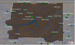
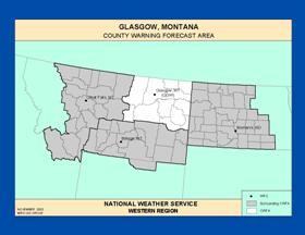
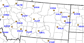
(Map of NWS Glasgow forecast area in
|
January 13, 1999…The public forecast and warning program is transferred to the Glasgow WFO. There are 16 forecast zones in the Glasgow WFO County Warning Area (CWA), with a total of 62 state-wide.
|
|
|
January 31, 1999…WFO Glasgow has a full staff of forecasters, including 5 senior forecasters and 3 general forecasters.
|
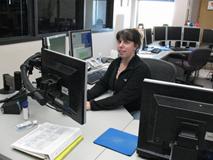
Senior Forecaster Ruth Ebert
|
|
|
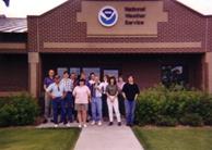
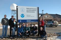
WFO Glasgow office staff
|
May 24, 1999…Glasgow WFO staff is presented with the NWS Modernization award for record “spin-up” to full service capabilities. |
|
|
June 1, 1999…The aviation program is assumed by the Glasgow WFO. The office begins issuing forecasts for the Glasgow, Sidney and Glendive Airports. Wolf Point was added in 2002.
|
|
|
|
|
September 2, 1999…Specific Area Message Encoding (SAME) is activated for NE Montana NOAA Weather Radio sites. This allows the public to program their radios to receive the alerts for just the county or counties they are interested in. |
|
|
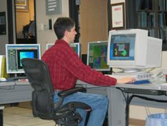
May 15, 2000…The Advanced Weather Interactive Processing Systems (AWIPS) computer is commissioned at NWS Glasgow. This replaced the 1970’s AFOS technology and integrated all of our satellite, radar, observation and computer model information into one computer system.
|
Senior Forecaster Ted Jamba at the AWIPS text workstation
|
|
|
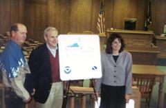
Valley County DES Coordinator Rick Seiler, NWS Director Jack Kelly and NWS Warning Coordination Meteorologist Kim Campbell at the StormReady Ceremony
|
October 6, 2000…Glasgow, MT becomes the first StormReady Community in Northeast Montana. NWS Director Jack Kelly and Western Region NWS Director Vickie Nadolski attend the ceremony.
|
|
|
February 2001 – NWS adds another general forecaster position to the staff, with the person fulfilling the role of an Incident Meteorologist.
|
Incident Meteorologist Jennifer Zeltwanger providing forecast support for a major wildfire.
|
|
|
NWS Glasgow Fire Weather Forecast Zones
|
May 1, 2001…The fire weather program is transferred to Glasgow WFO. |
|
|
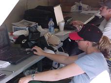
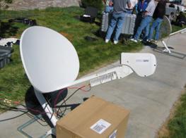
August 7, 2001…First IMET Dispatch from NWS Glasgow to a fire along the eastern boundaries of Glacier National Park |
Satellite dish used for IMET forecasters on incidents.
|
|
|
|
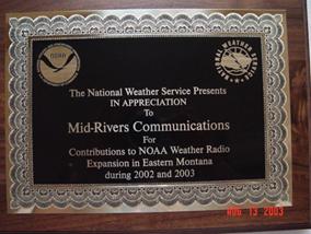
April 17, 2002…MidRivers Communications was nominated by WFO Glasgow and Billings for the NOAA/NWS Mark Trail Award. They were selected as winners and went to Washington D.C. to accept the award. The award was for their work in expanding the NOAA Weather Radio Transmitter network in eastern Montana. They have assisted with the installation of the Circle, Baker, Jordan, Winnett and Broadus transmitters, donating money, tower space and telephone lines. |
|
|
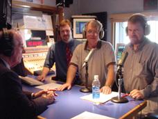
April 2003 – John Pulasky of the Northern Ag Network receives the NOAA Environmental Hero Award for his dedication to getting weather information to the people of Montana. All four Montana NWS offices have nominated him for this award.
|
John Pulasky receives his award while live on the air. NOAA Administrator Conrad Lautenbacher called into the Berg in the Morning Radio Show and surprised him with the announcement.
|
|
|
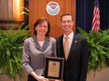
Meteorologist in Charge Julie Adolphson accepts the Bronze Medal Award from NWS Director Jack Kelly and NOAA Administrator Conrad Lautenbacher
|
October 24, 2003 – NWS Glasgow is Award the Department of Commerce Bronze Medal Award for “Advanced, accurate warnings provided to the citizens of northeast Montana during two significant flash flooding events which resulted in extensive property damage.”
|
|
|
June 15, 2003…Gridded public forecast products are released using the Interactive Forecast Preparation System (IFPS).
|
|
|
|
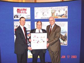
NOAA Administrator Conrad Lautenbacher, Norm Parrent and Mark Trail Comic Creator Jack Elrod at the ceremony.
|
June 17, 2003…Norm Parrent, State of Montana DES Coordinator for District 4 receives the NOAA/NWS Mark Trail Award for his assistance in expanding the NOAA Weather Radio network throughout Southeastern Montana.
|
|
|
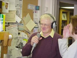
April 20, 2004…Retired Meteorologist in Charge Jim Rea receives the NOAA Environmental Hero Award for his dedication to the hydrology program in northeast Montana. The award was presented to him by Western Region Director Vickie Nadolski on a live radio show on KLTZ/KLAN. |
Jim Rea is surprised live on the air
|
|
|
|
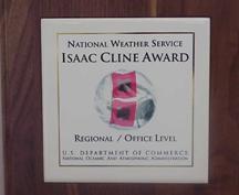
December 2004 – NWS Glasgow receives the Western Region Isaac Cline Award for their superb Upper Air Weather Observations. |
|
|
October 2005 – NWS Glasgow is award the Department of Commerce Bronze Medal Award “For life-saving service throughout record breaking blizzards during the 2003-2004 winter season in northeast Montana.” |
Meteorologist in Charge Julie Adolphson accepts the Bronze Medal Award from NOAA Administrator Conrad Lautenbacher
|
|
|
NWS Director DL Johnson, NOAA Administrator Conrad Lautenbacher, Gary Johnson, Mark Trail Comic Creator Jack Elrod and Dennis Brockmeyer with the Mark Trail Awards.
|
September 19, 2006….Roosevelt County DES Coordinator Dennis Brockmeyer and State Farm Insurance Agent Gary Johnson receive the NOAA/NWS Mark Trail Award in Washington D.C. for their work to expand the use of NOAA Weather Radio across Roosevelt County and the Fort Peck Reservation. State Farm awarded the county a $5000 grant to purchase over 200 NOAA Weather Radios that are utilized in businesses and critical facilities. |
|
|
December 1, 2006…Community Collaborative Rain, Hail and Snow (CoCoRaHs) reporting program started in Montana.
|
|
|
|
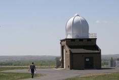
Hydro-Meteorological Technician Jim Branda walks to the upper air building to release a balloon
|
July 19, 2007…The Radiosonde Replacement System (RSS) is installed and operational. This replaces the early 1970’s technology that we had been using for upper air observations. The new system has a GPS tracking unit that makes the position data of the balloon more accurate.
|
|
|
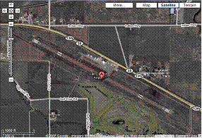
Aerial View of NWS Glasgow Fall 2008
|
||
|
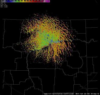
Aug 2012 Dual Pol Radar upgrade completed. Our first image from the upgrade shows some insects and birds in the area.
August 2016- BMH (Broadcast Message Handler) replaces old hardware and software for NWS radio operations.
|
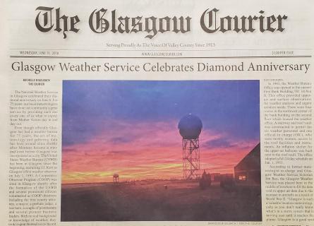
June 2018 - Glasgow Weather Service Office celebrates it's 75th Anniversary.
|
|
This history of the role of the government in weather for northeast Montana would not have been possible without the dedicated research of retired Meteorologist in Charge, Jim Rea. Thank you Jim!
Photos are from the NOAA Photo Library, NWS Glasgow collection, Jim Rea collection, and Valley County Pioneer Museum