USING AGOL
This is an ESRI imageservice that houses 28 hourly mosaics. (7 each for CONUS, Hawaii, Alaska, and Puerto Rico.) Raster are identifiable using the GIS Subset field in the data. (The four regions in this data are identifiable with “co” for CONUS, “ak” for ALASKA, “hi” for HAWAII, and “pr '' for Puerto Rico.
The service contains 1-hour (from the top of the hour), 3-hour, 6-hour, 12-hour, 24-hour, 48-hour and 72-hour Radar-only MRMS QPE values in inches.
The default images are the 1-hour QPE raster for the four regions.
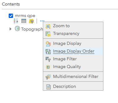
To change to another time period, Click the ellipse next to the layer and select “Image Display”
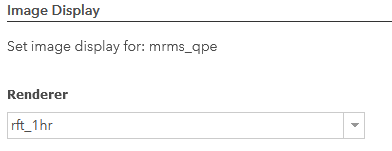
From the next menu, you can select the necessary renderer:
Selecting the renderer will select the correct images/rasters. For example, select the 12hr renderer will select the 12 QPE mosaics for the four regions.
After you have selected the renderer (note in some cases the legend may change), Click “Apply”, and you should see the image change.
USING QUERIES AGAINST THE SERVICE
If you are using this service in queries (WMS, IDENTIFY) you will need to select the raster(s) and the matching renderer in your query. For example, this identify calls the raster (mrms_12h_co) and renderer (rft_12hr):