
Heavy to excessive rainfall will continue through tonight from the Texas Big Bend region into southern Oklahoma. Scattered damaging wind gusts and a few tornadoes may accompany a line of severe thunderstorms that is expected across the Mid-Atlantic into New England Friday. A Typhoon Watch continues for Guam and CNMI as Tropical Storm Champi will strengthen and approach the islands this weekend. Read More >
Grand Rapids, MI
Weather Forecast Office
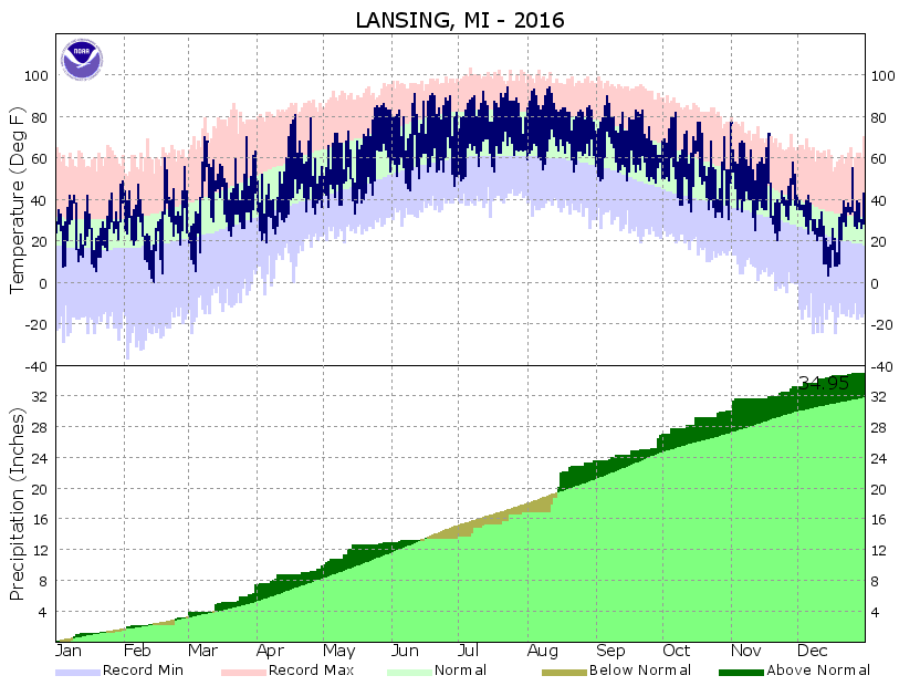
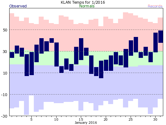
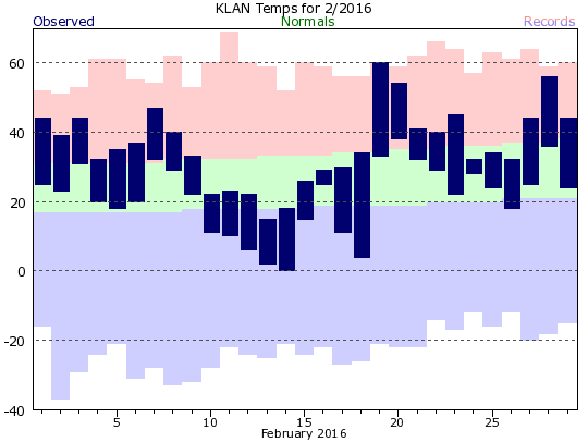
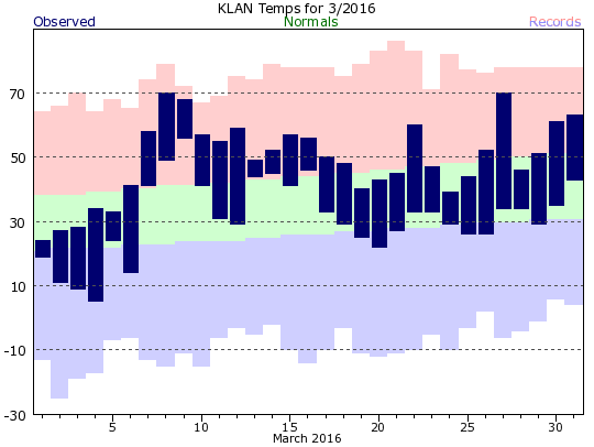
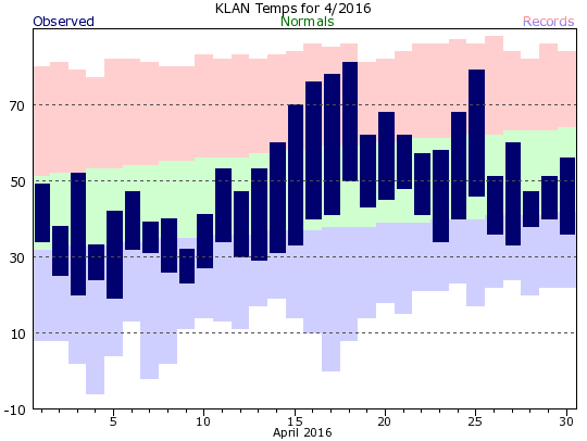
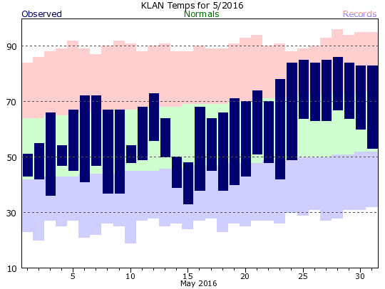
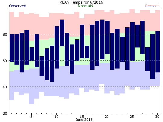
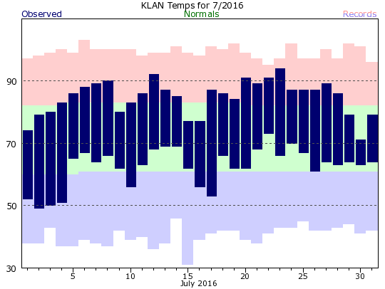
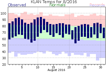
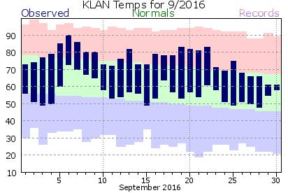
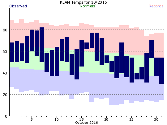
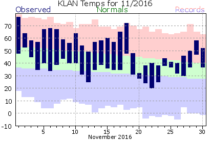
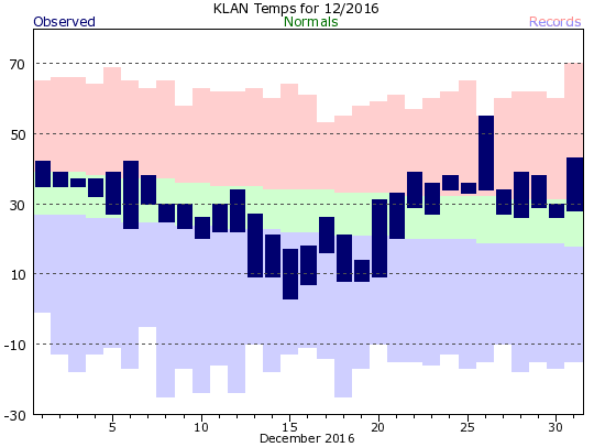
This data can also be found in text table format on our climate page. (For daily data for a month, choose "Preliminary Climatology Data (CF6)")
 |
 |
 |
 |
 |
 |
 |
 |
 |
 |
 |
 |

US Dept of Commerce
National Oceanic and Atmospheric Administration
National Weather Service
Grand Rapids, MI
4899 Tim Dougherty Drive SE
Grand Rapids, MI 49512-4034
616-949-0643
Comments? Questions? Please Contact Us.


 Follow us on X
 Follow us on Facebook
 Follow us on YouTube
 GRR RSS Feed