
A Nor'easter well off the East Coast will slowly track north this week and may gain some subtropical characteristics. Strong onshore winds will bring flooding, dangerous marine conditions, and beach erosion along the Mid-Atlantic coast. A Pacific storm will bring gusty winds, severe thunderstorms, and mountain snow to portions of California and the Southwest U.S. through Thursday. Read More >
Grand Rapids, MI
Weather Forecast Office

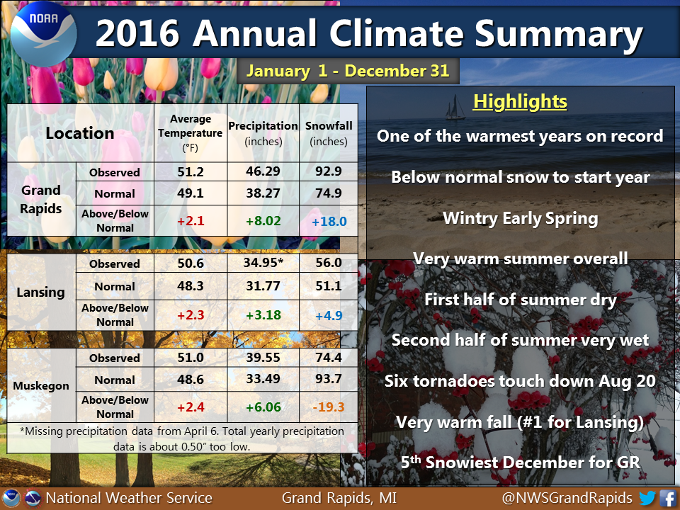
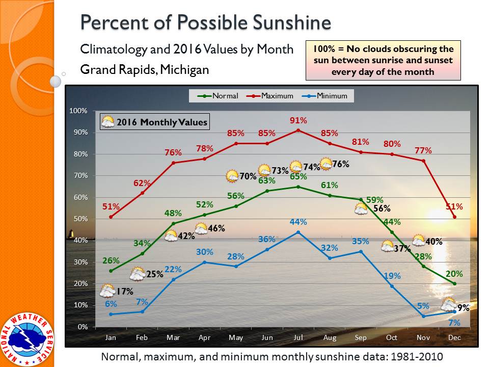
December was kind of a mixed bag: two weeks cold & snowy, sometimes mild & rainy, but rarely sunny. Grand Rapids had 9% of possible sunshine. The lowest December amount recorded was 7% and the average is 20%. Relative to normal, it was our coolest month since April.
 |
Media use of NWS Web News Stories is encouraged! |
|

US Dept of Commerce
National Oceanic and Atmospheric Administration
National Weather Service
Grand Rapids, MI
4899 Tim Dougherty Drive SE
Grand Rapids, MI 49512-4034
616-949-0643
Comments? Questions? Please Contact Us.


 Follow us on X
 Follow us on Facebook
 Follow us on YouTube
 GRR RSS Feed