Overview
|
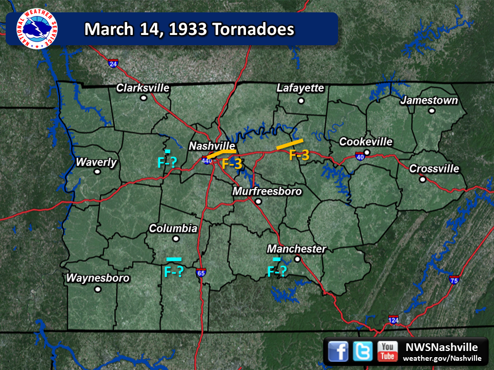
One of the worst tornado outbreaks in the history of Tennessee struck during the afternoon and evening hours of March 14, 1933. What was likely a squall line of thunderstorms (also known as a Quasi-Linear Convective System, or QLCS) with embedded supercells tracked eastward across the entire length of Tennessee, spawning numerous tornadoes and killing or injuring hundreds of people. One particular supercell likely spawned at least 9 tornadoes, several of which were estimated to be F3-F4 in intensity, as it tracked from Caruthersville, Missouri eastward to south of Paris, Tennessee, through Nashville and Lebanon, then northeastward through the East Tennessee towns of Jellico, Kingston, and Bristol. Another likely supercell tracked eastward from Jackson, Tennessee to south of Columbia through Manchester, dropping at least 3 tornadoes. Across Middle Tennessee, research by meteorologists at the National Weather Service office in Nashville have determined that at least 5 tornadoes touched down, the worst of which struck downtown Nashville and remains the deadliest tornado in the history of the city. |
|
The Nashville Tornado of March 14, 1933
|
Nashville Tornado
Track Map 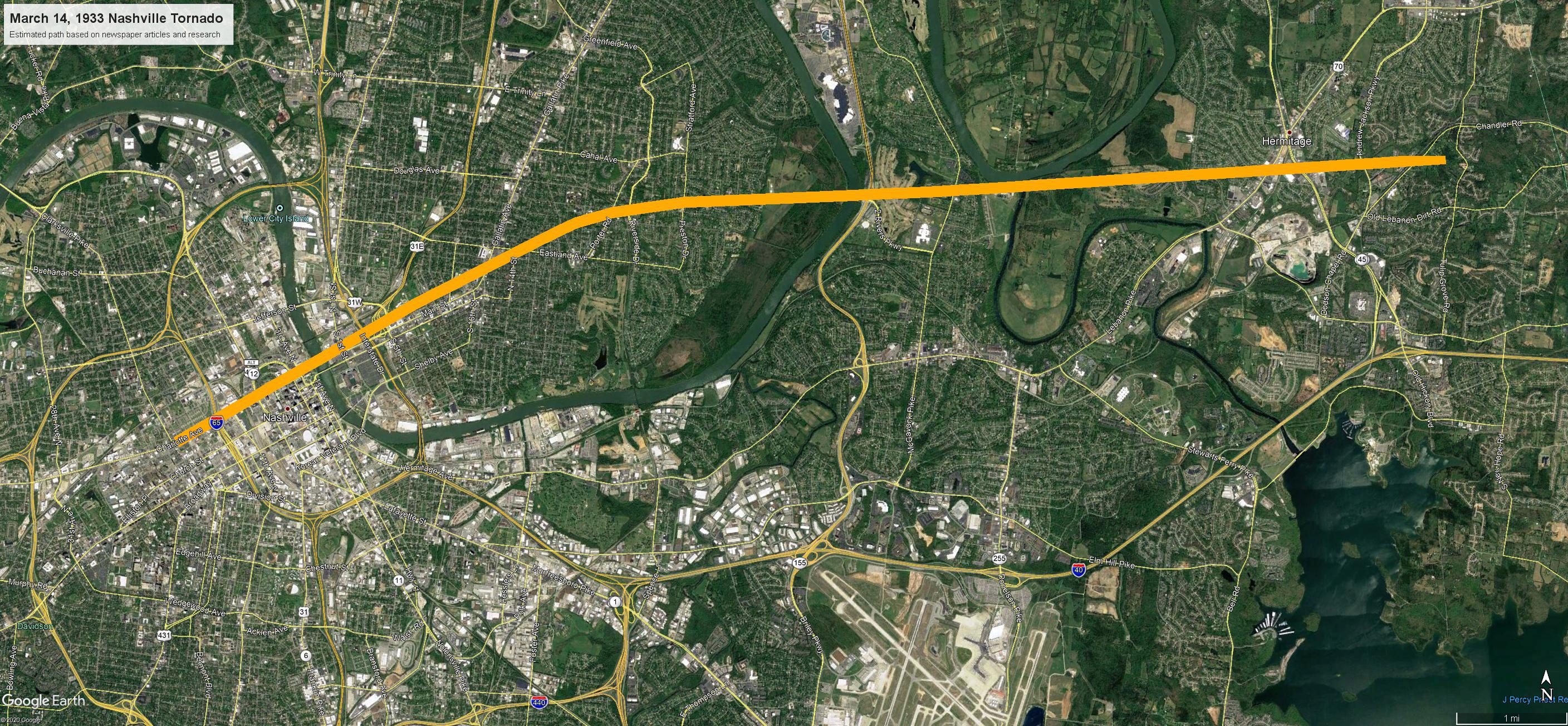 
|
||||||||||||||||
The Nashville Tornado of March 14, 1933
by Mark A. Rose, circa 2002
Meteorologist
National Weather Service
Old Hickory, Tennessee
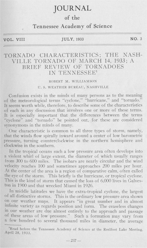
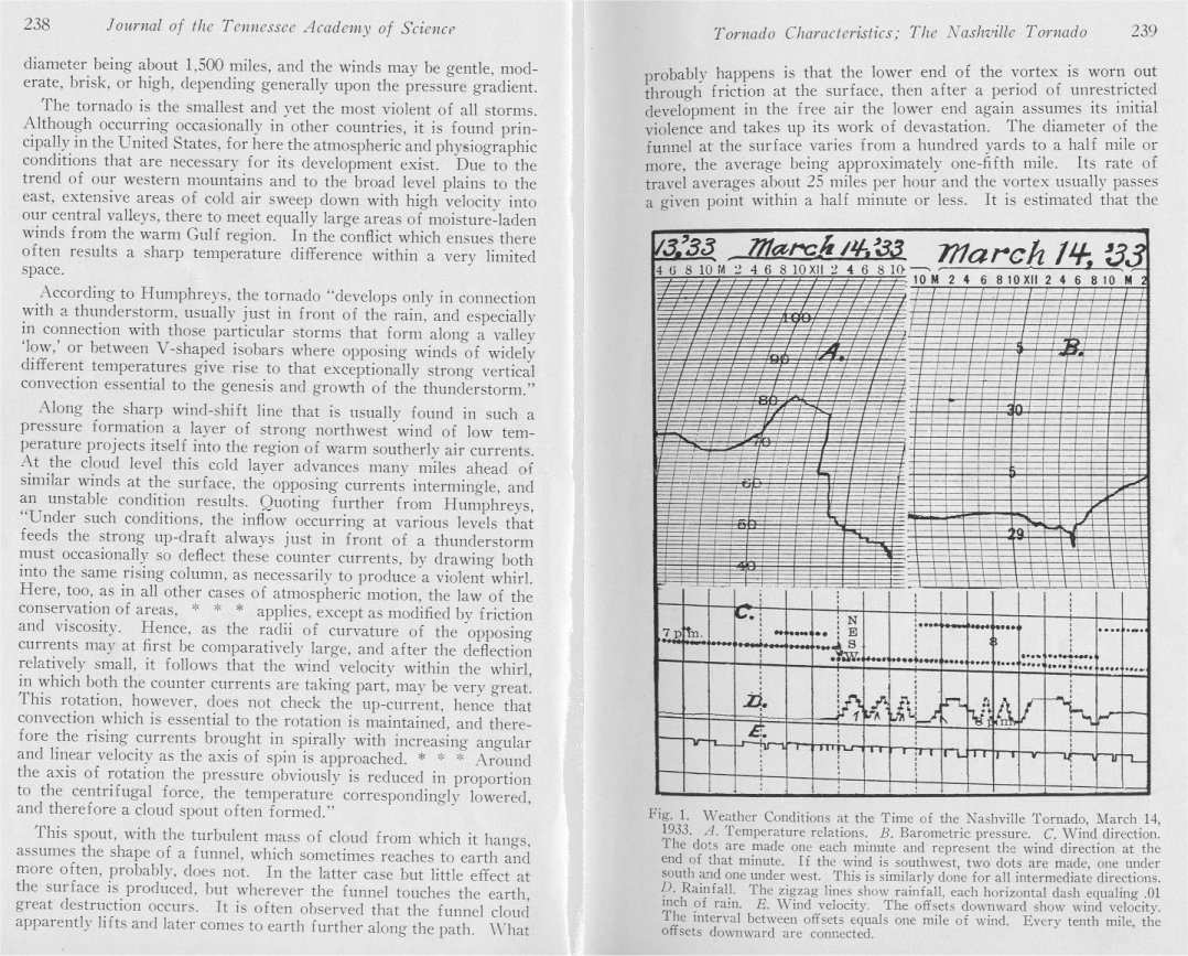
It was an unusually mild late-winter day in Nashville. A warm, moist air mass covered most of the southeast. A powerful cold front lay to the northwest, and centers of low pressure sat over the Great Lakes and western Arkansas. [1] The warming trend had begun after the 10th of March, when the temperature had failed to rise out of the 30's. [2] By the 13th, the temperature had climbed to 73 degrees, as a persistent southerly wind fed air from the Gulf of America several hundred miles northward. That night, as high- and mid-level clouds began to thicken over the region, the temperature dropped only 12 degrees, to a reading of 61 on the morning of 14 March 1933. Although the sky remained mostly cloudy that day, the thermometer climbed to a remarkable 80 degrees at 3:00 p.m. - unusually early in the year for an 80 degree reading. (At the time, this was the highest temperature ever recorded on March 14 in Nashville.) Despite high humidity, the citizens of Nashville no doubt enjoyed their first real taste of spring that afternoon. For many, though, that enjoyment later turned to terror.
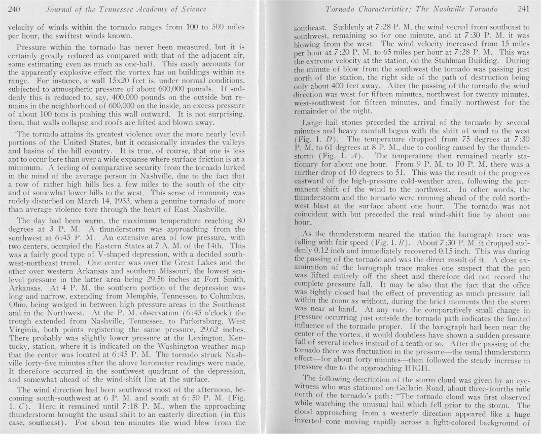
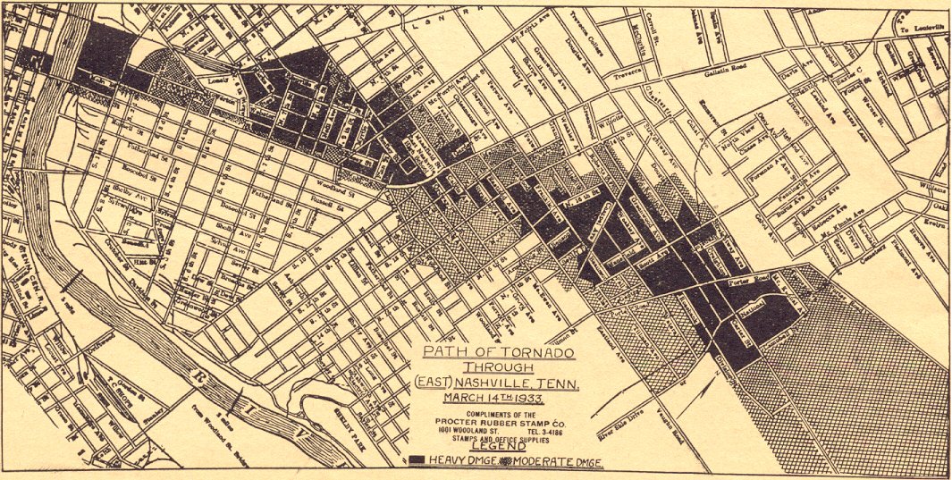
The cold front was fast-moving. It swept through the city rather quickly, dumping 0.81 inches of rainfall in a relatively short time. But what accompanied the squall line of severe thunderstorms was the deadliest tornado in Nashville's history. [3] It all happened after dark. (The sun set that afternoon at 5:53 p.m.) By the early evening, thunderstorms threatened, accompanied by shifting winds. [4] Then, while the air was still warm and humid, destruction began four miles west of downtown over the rim of hills, near Charlotte Pike and Fifty-first Avenue. The damage between this point and downtown was not great, but the twister quickly intensified. It passed either directly over or very near the State Capitol, on Charlotte Avenue, shaking glass from its windows. [5] Then the storm hit with force on the north side of the Public Square, significantly damaging several buildings, and passing within 400 feet of the Weather Bureau [6], then located in the Stahlman Building at Third Avenue and Union Street. [7]
At 7:28 p.m., torrential rainfall and large hailstones came with a sudden veering of the wind from southeast to southwest. [8] The wind continued from that direction for around a minute. Wind equipment at the Weather Bureau registered an increase in speed from 15 mph at 7:20 p.m. to 65 mph at 7:28 p.m. [9] About 7:30 p.m., the barometer, which had been recording falling pressure since 10:00 a.m., showed a sudden drop of 0.12 inches, followed by an immediate recovery of 0.15 inches as the tornado went past.
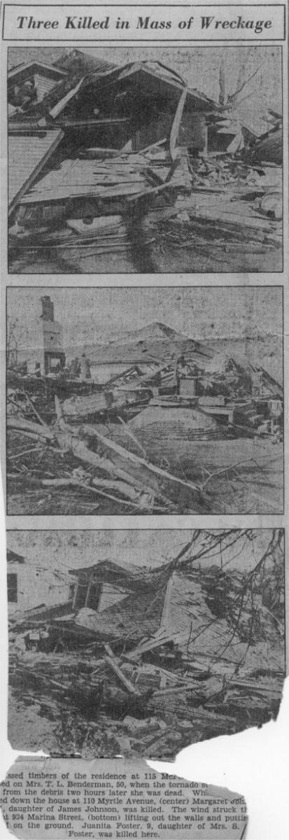
The tornado thereafter crossed the Cumberland River above the Woodland Street Bridge, and traveled eastward. The path widened from 200 to 400 yards, and damaged a row of four-story factory buildings along First Street, and a large portion of a brick wall of the building occupied by the National Casket Company, located at Second Street and Woodland. From this point, the path of destruction spread out to a width of 600 to 800 yards. For three miles, the tornado tore through a district of homes, churches, schools, and stores. [10] Weather Bureau meteorologist Roger M. Williamson, whose home on Eastland Avenue narrowly escaped the storm\'s destruction, reported "for a terrifying fraction of a minute...walls, roofs, chimneys, garages and trees were crashing only a few yards away." Property damage was extensive, numbering 1,400 homes, 16 churches, 36 stores, five factories, four schools, one library, and a lodge hall. [See figures 1 and 2]
Said one observer on Gallatin Road, about three-quarters of a mile north of the storm, "The tornado cloud was first observed while watching the unusual hail which fell prior to the storm. The cloud approaching from a westerly direction appeared like a huge inverted cone moving rapidly across a light-colored background of rain, looking very much similar to a shadow moving across a motion picture screen." [11]
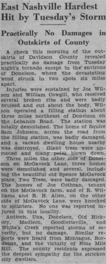
Areas around Donelson were the hardest-hit of the city's suburbs. Three miles west of Donelson, on McGavock Lane, three homes were demolished, and several, including the Spence McGavock place, "Two Rivers", sustained major damage. [12] The homes on either side of the residence were "knocked to splinters." Farther down, a filling station about three miles northeast of Donelson on Lebanon Road was completely destroyed. Two injuries, including the station operator, occurred at this locale. The home across the street from the filling station was badly damaged, and a vacant house nearby was also destroyed. Giant trees were uprooted, and many utility poles blown down.
The injuries on Lebanon Road were multiplied at other locations across the city. Altogether, eleven persons in Nashville and its suburbs died in the storm. That the death toll was not higher is remarkable, considering the extensive devastation, with property losses adding up to $2,000,000, and that the area covered by the storm was populated by around 10,000 residents. [13]
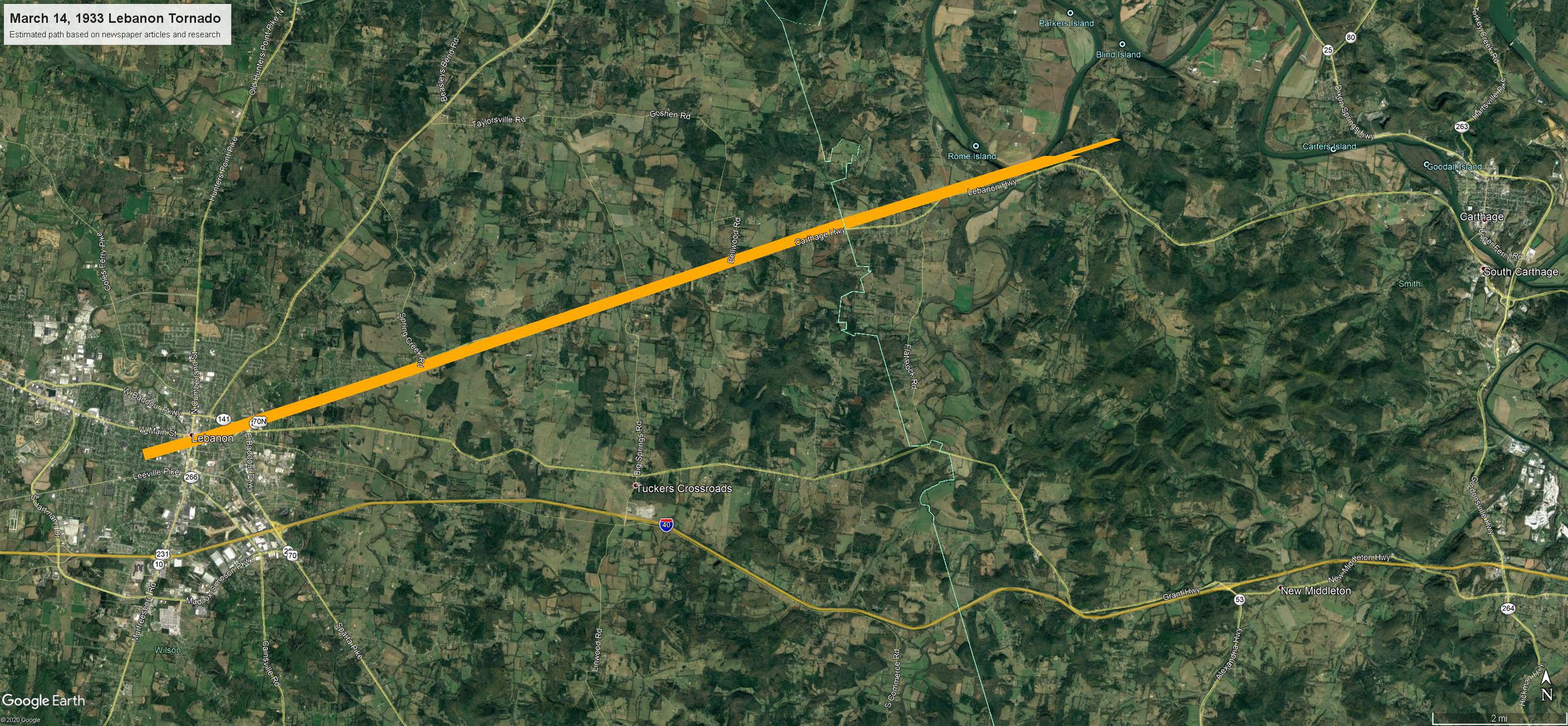
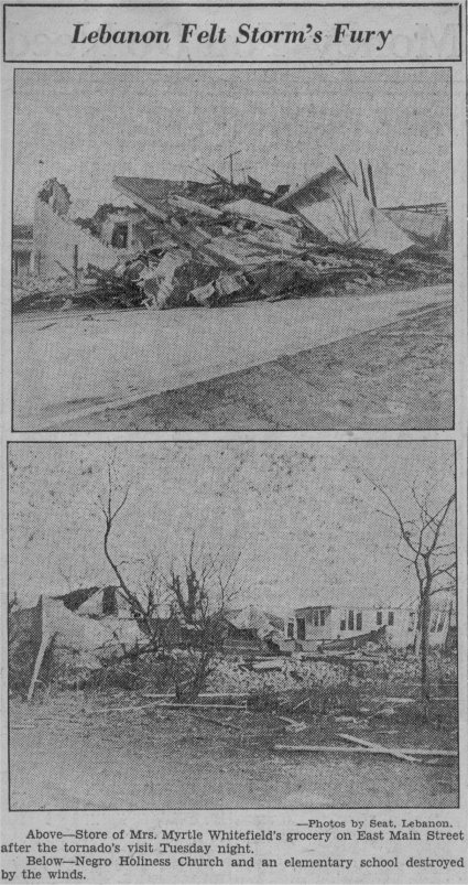
After Donelson, the storm seems to have weakened and lifted, as those living in the outskirts of Davidson County reported virtually no damage. [14] However, at some point, another tornado formed and left major damage in Lebanon. A grocery located on East Main Street was destroyed, and an African-American church and adjacent elementary school were leveled. [15] In all, 228 buildings in Lebanon sustained damage, twenty completely ruined. [16] Property damage totaled $125,000. [17] The tornado continued into Smith County, where damage was slight, before finally lifting. [18]
The efficiency with which law enforcement officials carried out their duties during the moments following the storm's fury was impressive. Every available policeman and substitute rushed to the area, joined soon by National Guardsmen, legionnaires, Red Cross workers, Boy Scouts, and Salvation Army members. [19] Virtually no pillaging or looting was reported, and no panic or disorder developed in the immediate aftermath. The guardsmen continued on duty throughout the damaged areas until the city was declared under control by civil officers on the morning of March 16. By then, some of the guardsmen had been on duty up to thirty-six hours. [20] All refused compensation for their services.
The day after the storm, Wednesday, March 15, telegraph companies reported a strenuous workload of handling messages from residents to relatives and friends who lived elsewhere, as well as telegraphic inquiries from outsiders about the storm. Long distance telephone service suffered similar stresses.
By Thursday morning, work crews had cleared the streets of all debris, thus re-opening them to traffic. Organized relief was making progress in restoring order, and clearing and re-building East Nashville. Coordinated by the American Red Cross, the city's relief agencies were providing shelter, clothing, and food to storm victims.
Following are some interesting tidbits gathered from various newspaper clippings.
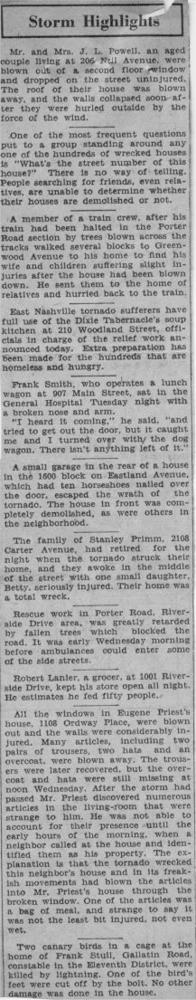
Mr. and Mrs. J. L. Powell, an elderly couple living at 206 Neil Avenue, were blown out of a second floor window and dropped to the street uninjured. The roof of their house was blown away, and the walls collapsed soon after they were tossed outside. [21]
Nashville's eleventh fatality was realized on March 16, when W. B. Hill, Jr., 35, died at the General Hospital. Mr. Hill was struck by a falling tree as he walked along Neil Avenue, and suffered a crushed chest. [22]
Without the aid of familiar landmarks, people searching for friends, even relatives, were unable to determine whether their houses were demolished or not. [23]
East Nashville tornado sufferers enjoyed full use of the Dixie Tabernacle\'s soup kitchen at 210 Woodland Street. Extra preparation had been made for the hundreds of homeless and hungry. [24]
Frank Smith, who operated a lunch wagon, sat in the General Hospital Tuesday night with a broken nose and arm. "I heard it coming," he said, "and tried to get out the door, but it caught me and I turned over with the dog wagon. There isn't anything left of it." [25]
A small garage in the rear of a house on Eastland Avenue's 1600 block escaped the wrath of the tornado. The house in front was completely demolished. [26]
The family of Stanley Primm, 2108 Carter Avenue, had gone to bed when the tornado struck. They awoke in the middle of the street with their daughter, Betty, who was seriously injured. Their home was destroyed. [27]
Rescue work in the Riverside Drive area was greatly impeded by fallen trees blocking the road. It was early Wednesday morning before ambulances could enter some of the side streets. [28]
Robert Lanier kept his grocery store on Riverside Drive open all night. He estimates he fed 50 people. [29]
All the windows in Eugene Priest's house, 1108 Ordway Place, were blown out and the walls were heavily damaged. Many items, including two pairs of trousers, two hats, and an overcoat, were carried away. After the storm had passed, Mr. Priest discovered numerous articles in the living room that were strange to him. They belonged to his neighbor. One of the articles was a bag of meal, dry and uninjured. [30]
Two canary birds in a cage at the home of Constable Frank Stull, on Gallatin Road, were killed by lightning. One of the bird\'s feet were cut off by the bolt. No other damage was done in the house. [31]
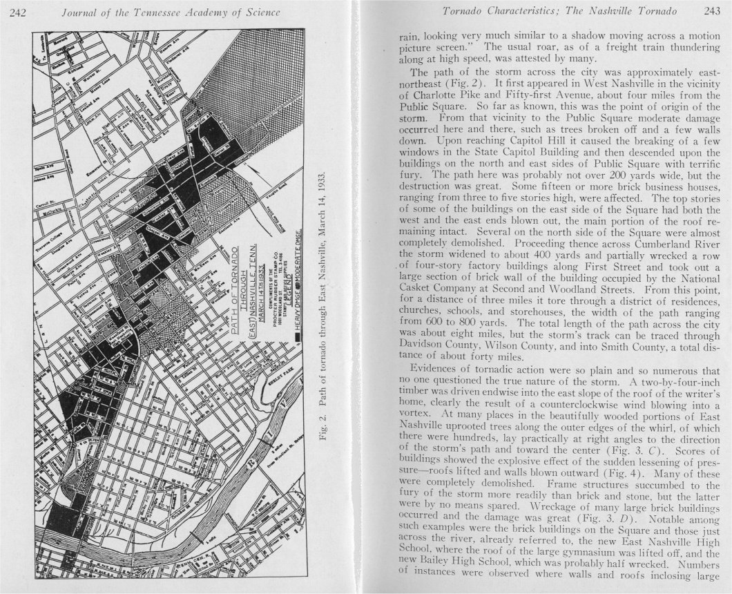
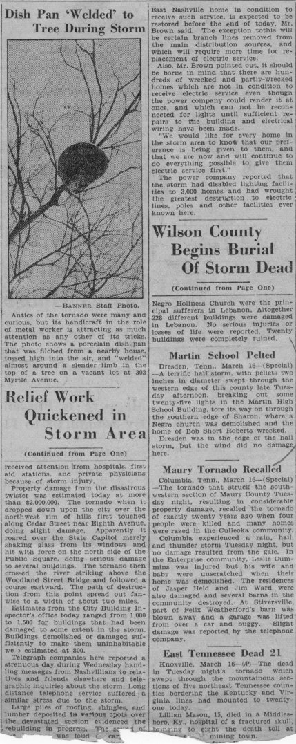
Freaks of the tornado were many and curious (Figure 3). In one instance, a porcelain dish pan was flinched from a house, tossed high into the air, and "welded" almost around a slender limb in the top of a tree on a vacant lot at 302 Myrtle Avenue. [32]
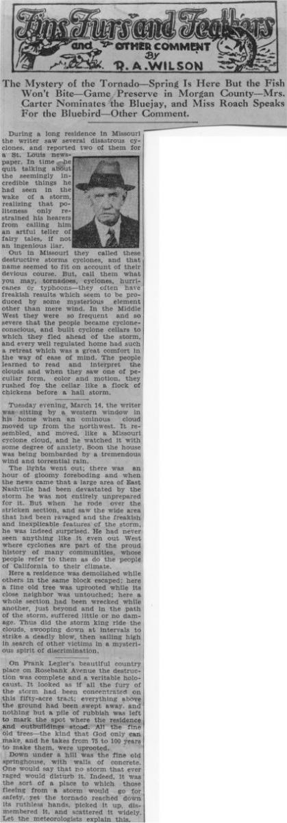
R. A. Wilson, writer of a Nashville Banner column entitled "Fins Furs and Feathers," included his account of the experience. Of the drama the evening of March 14, he writes, "Tuesday evening...the writer was sitting by a western window in his home when an ominous cloud move up from the northwest." His house was soon thereafter "bombarded by a tremendous wind and torrential rain. The lights went out; there was an hour of gloomy foreboding and...news came that a large area of East Nashville had been devastated by the storm...."
Wilson describes more freakish outcomes of the twister. "Here a residence was demolished while others in the same block escaped; here a fine old tree was uprooted while its close neighbor was untouched; here a whole section had just been wrecked while another, just beyond and in the path of the storm, suffered little or no damage." He writes metaphorically of the randomness of the tornado as a "mysterious spirit of discrimination."
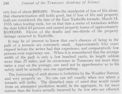
Nashvillians had more or less thought themselves immune to tornadoes, due to the row of hills that lie to the south and west of the city. [33] (It was known even then that tornadoes tend to travel from the southwest toward the northeast, and that tornadoes reach their greatest intensity over relatively flat land.) Of course, the science and technology in meteorology were quite primitive compared with the present era. In 1933, there was no weather radar, and therefore no weather warnings. Weather Bureau Meteorologist Robert M. Williamson, who himself was in the path of the tornado in East Nashville, wrote, "The forecasting of [tornadoes] is forbidden by the Weather Bureau, and very properly so. No one can tell exactly when nor where a tornado will strike. The disturbed state of mind that would result from an attempted prediction would, in the aggregate, be far more serious than the losses actually incurred by the few who are affected."
Sixty-five years would pass before downtown Nashville took another direct hit from a tornado. On April 16, 1998, an F3 tornado [34] touched down one mile west of Charlotte Pike and I-440 [35], approximately five blocks from the touchdown location of the 1933 tornado. This storm followed much the same path of its predecessor as well, passing directly through the downtown. After crossing the Cumberland River, the twister tore through residential sections of East Nashville and Donelson. Although the writer of this paper did not experience the close encounter as the writer of the 1933 paper, he did hear the tornado as he and his family hid under a heavy oak table while the tornado passed less than two miles from their home in the Pennington Bend area of Donelson.
The tornado continued eastward through Hermitage, where it destroyed more than a thousand trees on the 600-acre estate of former President Andrew Jackson. As the storm crossed into Wilson County, it came precariously near the National Weather Service Office located at Langford's Cove on Old Hickory Lake. Meteorologists had briefly gathered outside to observe the twister, which continued on the ground for 32 miles before lifting near Hartsville in Trousdale County. By contrast, this storm had turned northeastward east of Nashville, thus carrying it away from the more heavily populated corridor along Highway 70 from Mt. Juliet through Lebanon. [3]
Although property damage from this tornado exceeded $100 million, and 60 persons were reported injured (all in Davidson County), fatalities were limited to one. The differences this time were the warning and communications systems in place. The Doppler weather radar operated by the National Weather Service enabled a tornado warning to be issued for Davidson County before it ever touched down, and heavy media coverage broadcast the warning to the public almost simultaneously.
The similarities between these two storms, separated by more than sixty-five years, are striking, especially when one considers the truly random nature of tornadoes. (See the appendix.) Then again, the differences are magnified not only by the shift in demographics, but by changes in warning coordination procedures and technology. No one can guess when the next tornado may strike downtown Nashville, or the downtown of any other major city or township in Tennessee. However, due to the advanced warning systems currently in place, it is likely that enough "lead-time" can be afforded those citizens to preclude a large loss-of-life such as that which accompanied the Nashville tornado of 1933.
Appendix - Similarities and Differences between the Nashville Tornadoes of 1933 and 1998
| Similarities | ||
|---|---|---|
| Characteristic | March 14, 1933 | April 16, 1998 |
| Point-of-Origin |
|
|
| Affected areas in Nashville |
|
|
| Proximity to the Weather Office |
|
|
| Injuries |
|
|
| Path Length (miles) |
|
|
| F-scale Classification |
|
|
| Differences | ||
|---|---|---|
| Characteristic | March 14, 1933 | April 16, 1998 |
| Track east of Nashville |
|
|
| Damage in eastern Davidson County |
|
|
| Fatalities |
|
|
| Population and land area of Nashville |
26.0 square miles |
473.3 square miles |
| Total property damage |
|
|
| Weather Warning |
|
|
Endnotes
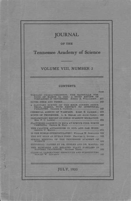
1. Robert M. Williamson, "Tornado Characteristics: The Nashville Tornado of March 14, 1933; A Brief Review of Tornadoes in Tennessee." Journal of the Tennessee Academy of Science, 240.
2. Prevailing meteorological conditions were inferred using daily climatological statistics for Nashville. Available online at https://w2.weather.gov/climate/index.php?wfo=ohx.
3. Tornado Database for Middle Tennessee. Available online at http://www.midsouthtornadoes.msstate.edu/index.php?cw=ohx.
4. Williamson, "Tornado characteristics," 240.
5. "Relief Work Quickened in Storm Area," Nashville Banner, 16 March 1933.
6. Williamson, "Tornado characteristics," 241.
7. Bobby Boyd, "History of the National Weather Service in Nashville, Tennessee." Available online at https://www.weather.gov/ohx/nwshistory.
8. "Tennessee Calendar," Nashville Banner, 14 March 1940.
9. Williamson, "Tornado characteristics," 241.
10. "Tennessee Calendar," Nashville Banner, 14 March 1940.
11. Williamson, "Tornado characteristics," 241, 243.
12. "East Nashville Hardest Hit by Tuesday's Storm," periodical and date unknown.
13. Williamson, "Tornado characteristics," 245.
14. "East Nashville Hardest Hit by Tuesday's Storm," periodical and date unknown.
15. "Lebanon Felt Storm's Fury," Nashville Banner, 16 March 1933.
16. "Wilson County Begins Burial of Storm Dead." Nashville Banner, 16 March 1933.
17. "Tennessee Calendar," Nashville Banner, 14 March 1940.
18. Tornado Database for Middle Tennessee. Available online at http://www.midsouthtornadoes.msstate.edu/index.php?cw=ohx.
19. Title unknown, Nashville Banner, March 1933.
20. "Relief Work Quickened in Storm Area," Nashville Banner, 16 March 1933.
21. "Storm Highlights," periodical and date unknown.
22. "Relief Work Quickened in Storm Area," Nashville Banner, 16 March 1933.
23. "Storm Highlights," periodical and date unknown.
24. Ibid.
25. Ibid.
26. Ibid.
27. Ibid.
28. Ibid.
29. Ibid.
30. Ibid.
31. Ibid.
32. "Dish Pan 'Welded' to Tree During Storm," Nashville Banner, 16 March 1933.
33. Williamson, "Tornado characteristics," 240.
34. According to the Fujita Tornado Damage Scale, an F3 tornado produces severe damage, with estimated winds of 158-206 mph. Damages characteristic of F3 tornadoes include roofs and some walls torn off well-constructed houses, trains overturned, most trees in forests uprooted, and heavy cars lifted off the ground and thrown.
35. Storm Data, April 1998, National Climatic Data Center, Asheville, North Carolina.
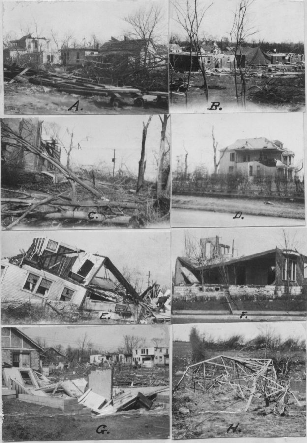
Figure 1. Effects of the Tornado in East Nashville.
A. General view back of Calvin Avenue.
B. General view looking southeast from Greenwood viaduct towards the rear of Riverside Drive.
C. Blown-down trees on the grounds of the Bailey High School.
D. Injury to the Eastwood Christian Church, showing badly damaged trees.
E. The Grissom home at the corner of Sixteenth Street and Franklin, where six people were trapped but none harmed.
F. A home at the corner of Gartland Avenue and Gallatin Road where five people were injured, some seriously.
G. Carl Dixon\'s home in which his wife and baby were injured.
H. A high tension transmission tower twisted and bent to the ground, but not pulled from its foundation.
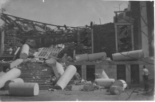
Figure 2. The Entrance to the Auditorium of the Bailey High School. The auditorium exploded, i. e., the walls were forced outward, allowing the roof to cave in.
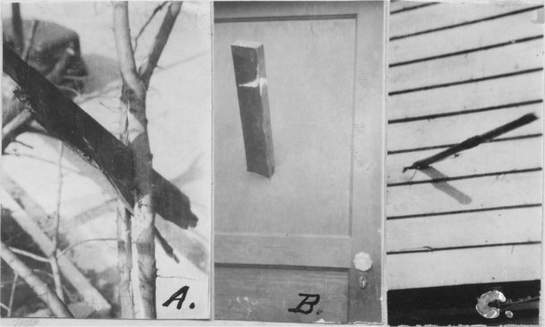
Figure 3. Freaks of the Nashville Tornado.
A. A piece of plank driven through a two-and-a-half-inch limb of a Mississippi Hackberry tree.
B. A two-by-four driven through a door panel without leaving splinters.
C. Weatherboarding pierced by a cornstalk.
Articles, correspondence, and photographs of the Nashville tornado of March 14, 1933
by Mark A. Rose, circa 2002
Meteorologist
National Weather Service
Old Hickory, Tennessee
Exhibit 1. Article entitled "Tornado characteristics: The Nashville tornado of March 14, 1933; A brief review of tornadoes in Tennessee" written by Robert M. Williamson of the U.S. Weather Bureau, Nashville, and published in Journal of the Tennessee Academy of Science, Volume VIII, Number 3. [Page 237] [Pages 238-239] [Pages 240-241] [Pages 242-243] [Pages 244-245] [Pages 246-247] [Page 248]
Exhibit 2. Original map of the damage path through East Nashville shown in Exhibit 1, Page 242.
Exhibit 3. Original photographs of effects of the tornado in east Nashville shown in Exhibit 1, Page 244.
Exhibit 4. Original photograph of the Bailey High School auditorium shown in Exhibit 1, Page 245.
Exhibit 5. Original photographs of freaks of the Nashville tornado shown in Exhibit 1, Page 246.
Exhibit 6. Newspaper article East Nashville Hardest Hit by Tuesday's Storm. Date, publication, and columnist unknown.
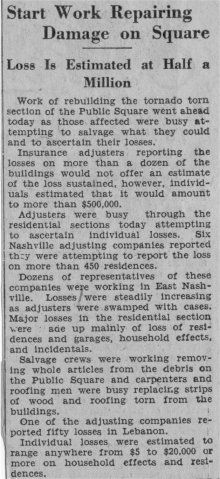
Exhibit 7. Newspaper article Start Work Repairing Damage on Square. Date, publication, and columnist unknown.
Exhibit 8. Newspaper article Storm Highlights. Date, publication, and columnist unknown.
Exhibit 9. Nashville Banner article Lebanon Felt Storm's Fury, which appeared on March 16, 1933, two days following the tornado.
Exhibit 10. Nashville Banner article Relief Work Quickened in Storm Area, which appeared on March 16, 1933, two days following the tornado. Other stories are included with part two of this story.
Exhibit 11. Nashville Banner article Three Killed in Mass of Wreckage, which appeared on March 16, 1933, two days following the tornado.
Exhibit 12. Nashville Banner article Fins Furs and Feathers and Other Comments by R.A. Wilson, which appeared on March 26, 1933, twelve days following the tornado. This article discusses, among other things, the mystery of the tornado.
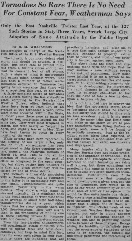
Exhibit 13. Nashville Banner article Tornadoes So Rare There Is No Need For Constant Fear, Weatherman Says by R.M. Williamson (U.S. Weather Bureau, Nashville), which appeared on March 11, 1934, nearly a year following the tornado.
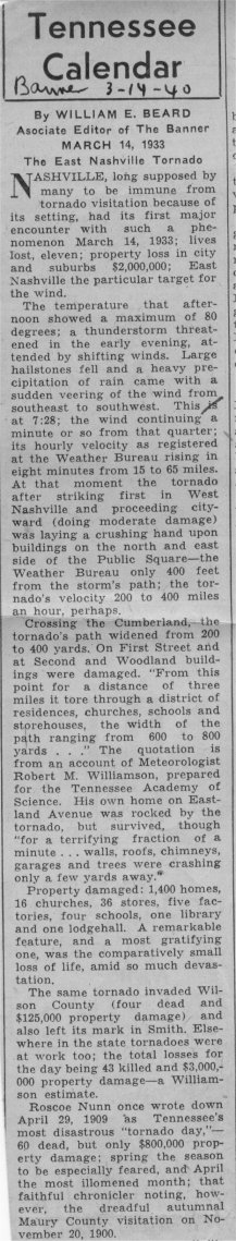
Exhibit 14. Nashville Banner article Tennessee Calendar by William E. Beard, which appeared on March 14, 1940, seven years after the 1933 tornado.
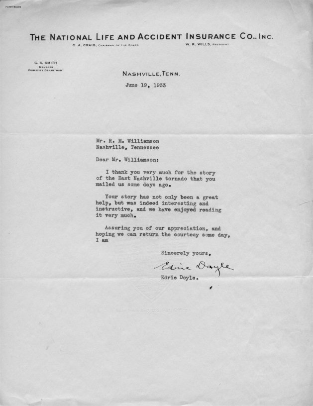
Exhibit 15. Correspondence to R.M. Williamson from the The National Life and Accident Insurance Co., Inc., dated June 29, 1933.
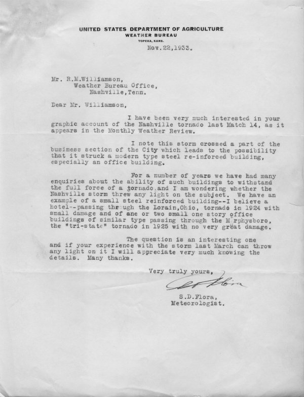
Exhibit 16. Correspondence to R.M. Williamson from the Weather Bureau in Topeka, Kans., dated November 22, 1933.
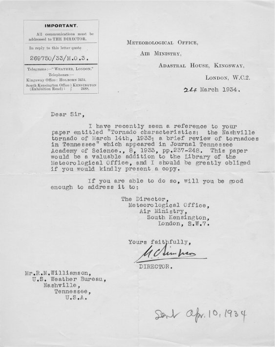
Exhibit 17. Correspondence to R.M. Williamson from the Meteorological Office Director of the British Air Ministry, dated March 24, 1934.
Exhibit 18. Research paper authored by M.A. Rose in 2003, The Nashville Tornado of March 14, 1933.
The Lebanon Tornado of March 14, 1933
|
Lebanon Tornado
Track Map
|
||||||||||||||||
Other Tornadoes of March 14, 1933
|
Petway Farm Tornado
Track Map 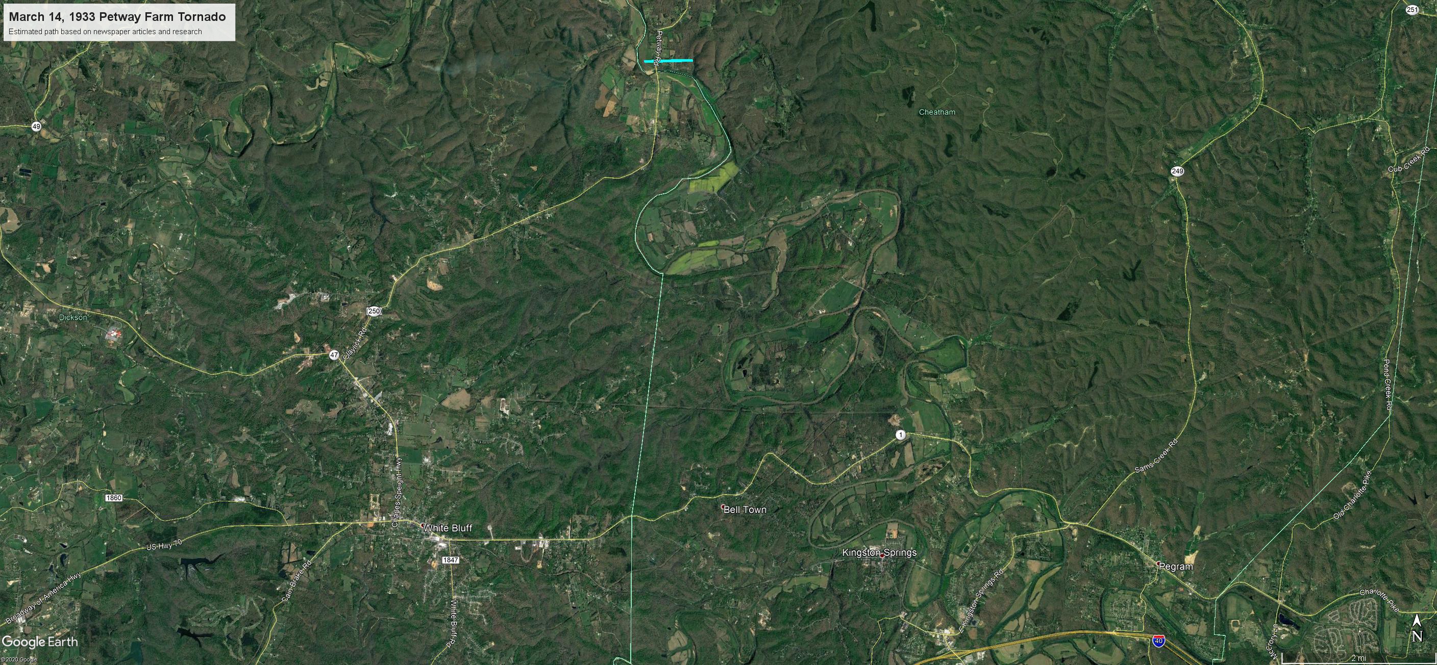
|
||||||||||||||||
|
Enterprise-Stiversville Tornado
Track Map 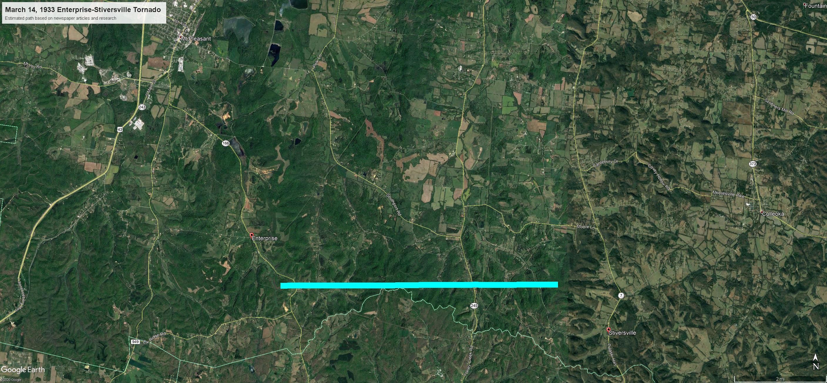
|
||||||||||||||||
|
Doddy Creek Tornado
Track Map 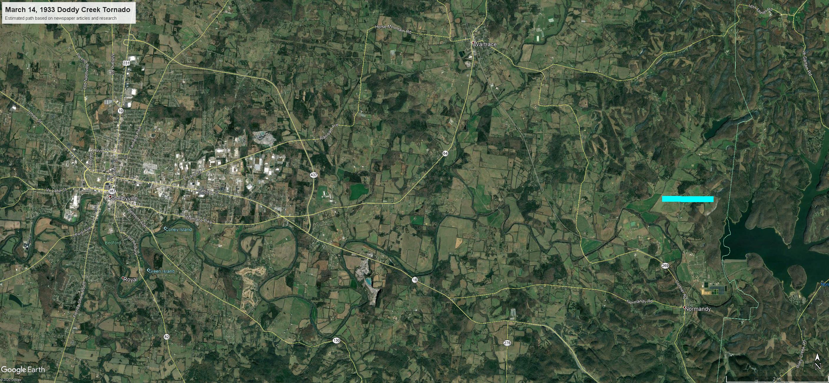
|
||||||||||||||||
 |
Media use of NWS Web News Stories is encouraged! Please acknowledge the NWS as the source of any news information accessed from this site. |
|

