Nashville, TN
Weather Forecast Office
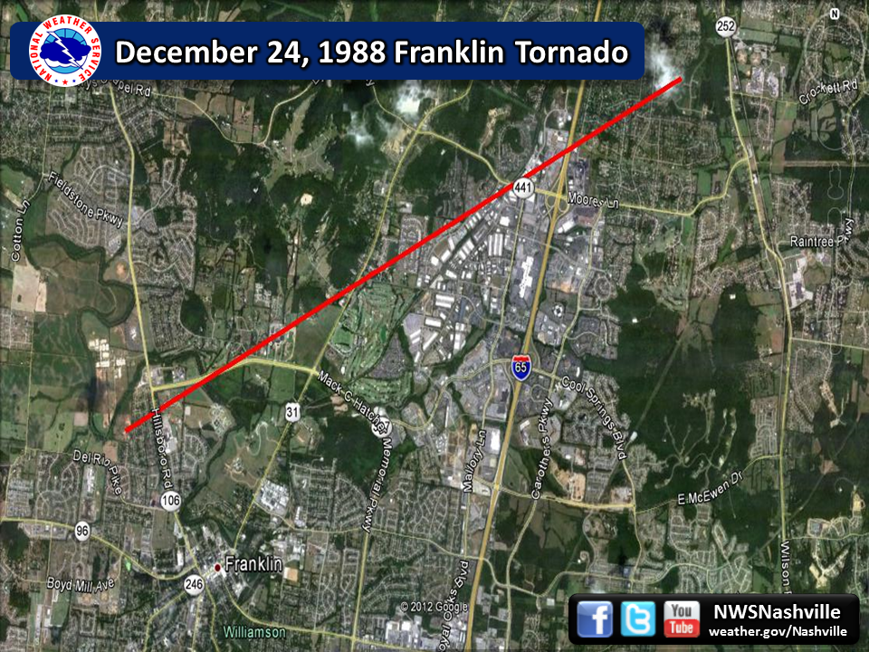
| F4 Franklin Tornado | |
| Counties: | Williamson |
| Time: | 6:04 AM CST |
| EF Scale: | F4 |
| Damage Path Length: | 6 miles |
| Damage Path Width: | 150 yards |
| Fatalities: | 1 |
| Injuries | 7 |
|
Damage: This tornado began just west of Franklin High School in the Rebel Meadows area along Hillsboro Road, then tracked northeast striking homes (where the fatality occurred) and the LDS Church along Ernest Rice Lane. The tornado then damaged a private airpark on the west side of Franklin Road. The worst damage was along General George Patton Drive from the Brentwood Pointe condos northward to Moores Lane, where several businesses were heavily damaged and destroyed. |
|
US Dept of Commerce
National Oceanic and Atmospheric Administration
National Weather Service
Nashville, TN
500 Weather Station Road
Old Hickory, TN 37138
615-754-8500
Comments? Questions? Please Contact Us.

