
Much higher than typical October temperatures will continue across coastal southern California up through the Bay Area and Central Valley through midweek resulting in result in Major to Extreme HeatRisk. A tropical depression is likely to form over the Gulf of America during the middle part of this week with further strengthening possible as it moves northeastward later this week. Read More >
Nashville, TN
Weather Forecast Office
| April 19, 2015 Severe Storms |
 |
| Overview |
| Scattered strong to severe thunderstorms affected parts of Middle Tennessee during the afternoon and evenings hours on Sunday, April 19, 2015. These storms brought a few reports of wind damage. After midnight, a squall line of strong to severe thunderstorms developed along a cold front across Arkansas, which then moved across Middle Tennessee in the early morning hours on Monday, April 20, 2015. These storms brought more widespread damaging straight-line winds to the southeast half of Middle Tennessee, with some of the worst damage reported in Grundy County. |
| Reports & Outlooks | |||
| SPC Storm Reports | SPC Event Archive | Local Storm Reports | |
| Grundy County Wind Damage | |
| Counties: | Grundy |
| Time: | 145-200 AM |
| Wind Speed Estimate: | 70 MPH |
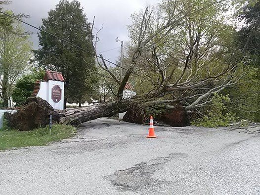
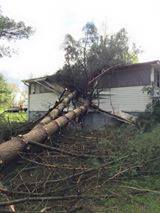
| Description: Numerous trees and power lines were blown down across southern Grundy County, with some trees falling on houses and blocking roads in Monteagle, Pelham, and Gruetli-Laager. This wind damage was caused by straight-line winds estimated at up to 70 mph in association with a squall line. |
|
|
Damage Photos submitted to NWS Nashville Facebook page: |
|

US Dept of Commerce
National Oceanic and Atmospheric Administration
National Weather Service
Nashville, TN
500 Weather Station Road
Old Hickory, TN 37138
615-754-8500
Comments? Questions? Please Contact Us.







 Follow us on X
 Follow us on Facebook
 Follow us on YouTube
 OHX RSS Feed