
Much higher than typical October temperatures will continue across coastal southern California up through the Bay Area and Central Valley through midweek resulting in result in Major to Extreme HeatRisk. A tropical depression is likely to form over the Gulf of America during the middle part of this week with further strengthening possible as it moves northeastward later this week. Read More >
| Tornado Statistics | ||||||||
| # | Counties | Rating | Time (CST) | Length (miles) | Width (yards) | Fatalities | Injuries | |
| 1 | Perry/Lewis | EF1 | 613 PM | 7.2 miles | 300 yards | 0 | 0 | |
| Overview | |
| Numerous showers and thunderstorms, many of which were strong to severe and included a few supercells, moved across Middle Tennessee during the afternoon and evening hours on Monday, March 27. Many reports of large hail up to 3 inches in diameter and wind damage to trees and buildings were received across the area, and one EF1 tornado was confirmed to touch down in Perry and Lewis Counties. |
| Radar | |
 |
 |
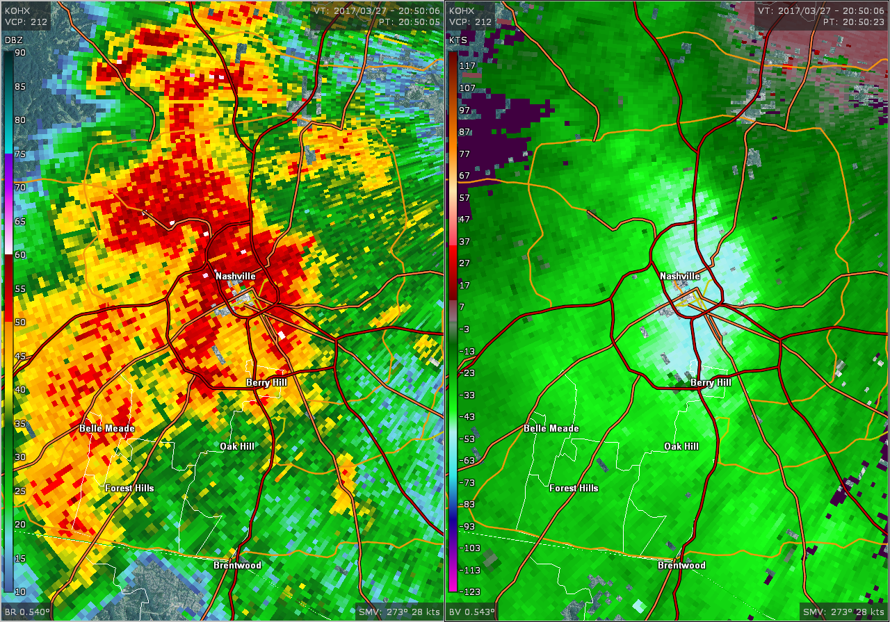
| OHX BR/BV Radar Image of Nashville Downburst at 350 PM CDT |
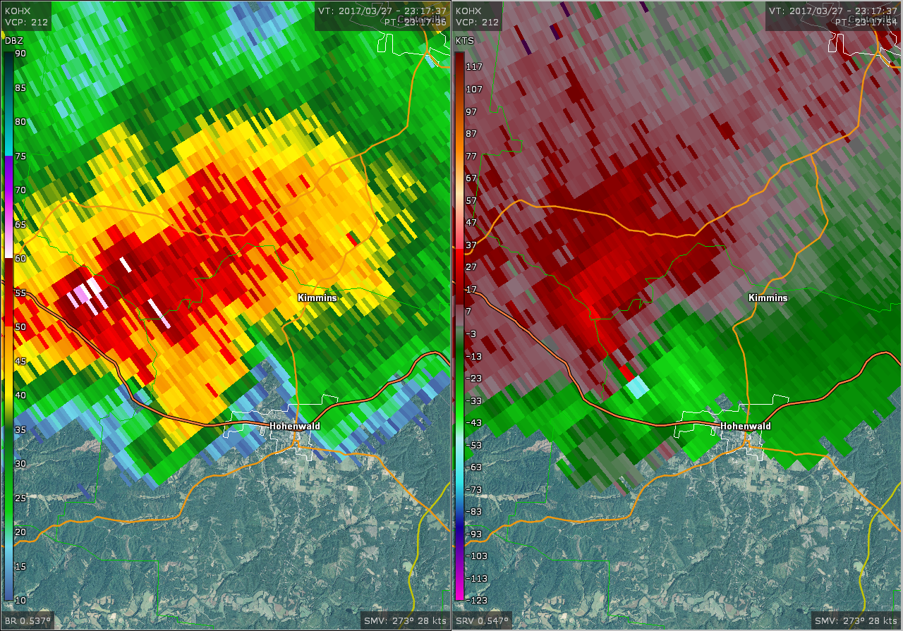
OHX BR/SRV Radar Image of Hohenwald EF1 Tornado at 617 PM CDT |
| Reports & Outlooks | |||
| SPC Storm Reports | SPC Event Archive | Local Storm Reports | Public Information Statements |
| EF1 Perry/Lewis County Tornado | |
| Counties: | Perry/Lewis |
| Time: | 613 PM |
| EF Scale: | EF1 |
| Estimated Peak Winds: | 105 mph |
| Damage Path Length: | 9.75 miles |
| Damage Path Width: | 500 yards |
| Fatalities: | 0 |
| Injuries | 0 |
|
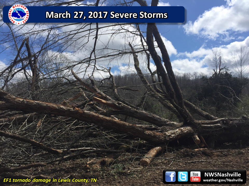
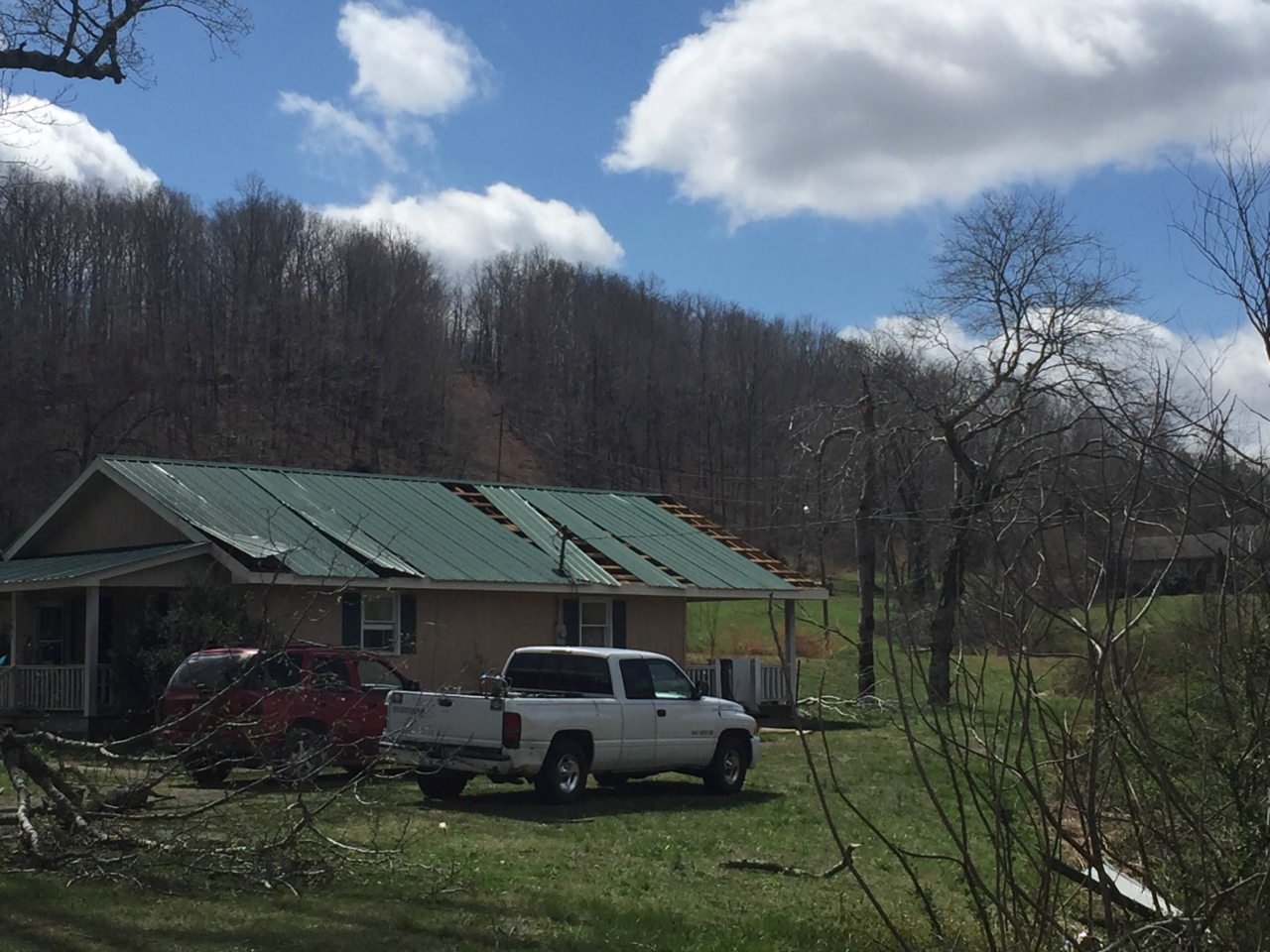
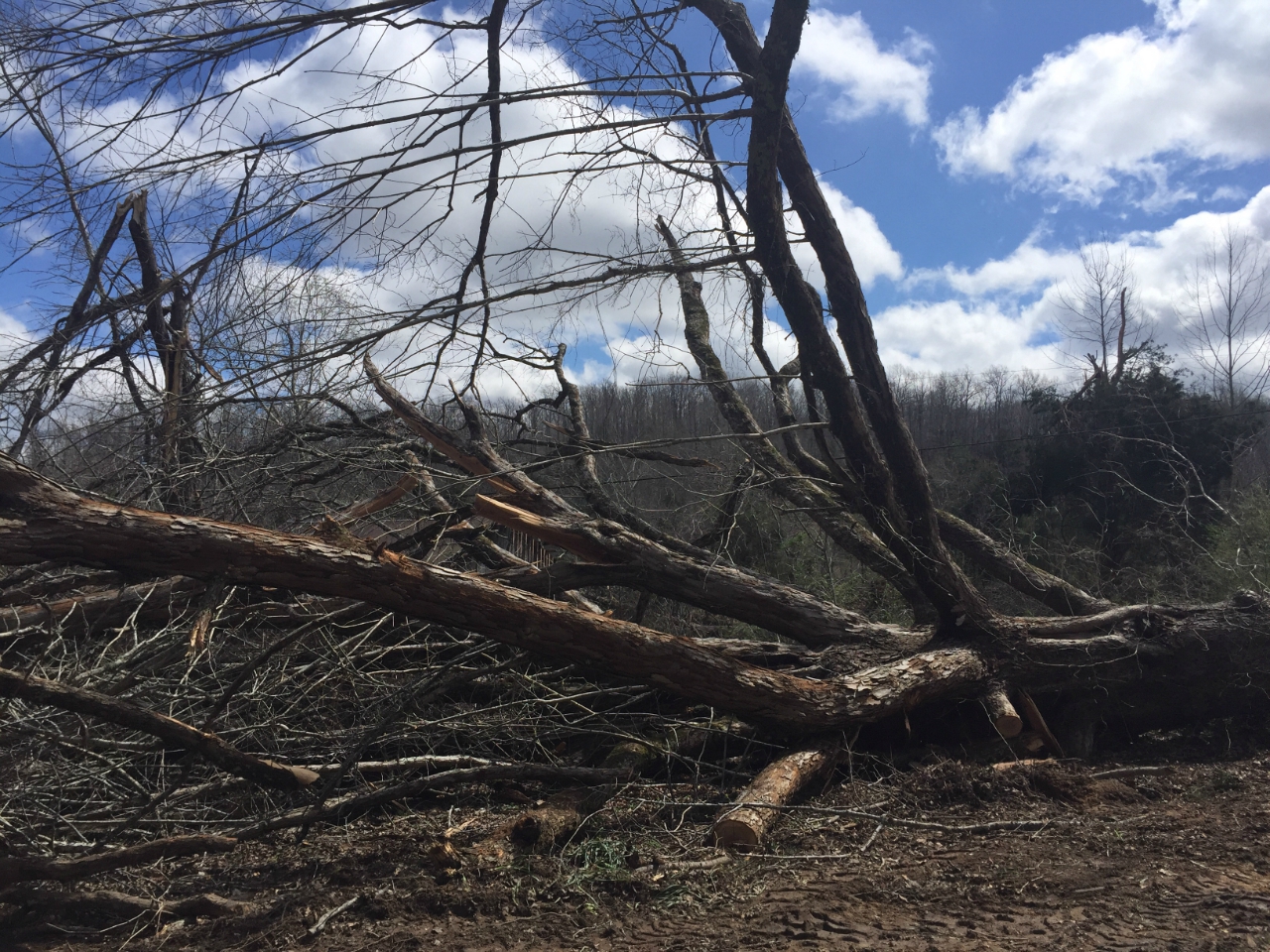
Storm Survey: This EF-1 tornado touched down in a forested area in extreme eastern Perry County north of Stanley Hinson Road then moved northeast, blowing down numerous trees before crossing Highway 412 into Lewis County. The tornado strengthened as it continued northeast, snapping and uprooting hundreds of hardwood and softwood trees and causing some minor roof and outbuilding damage on McCord Hollow Road. Continuing northeast across Goodman Branch Road, the tornado blew down more trees and passed within a mile of the tornado that occurred almost exactly one year prior on March 31, 2016. The tornado weakened as it turned more eastward, but continued to blow down dozens of trees as it crossed Darbytown Road and Coble Road. A barn was damaged on Keeton Drive and many more trees were blown down on both sides of Highway 48. Scattered trees continued to be blown down further to the east across rural forested areas before the tornado finally lifted just west of Indian Creek Road. The total path length across Perry and Lewis Counties was 9.75 miles. The damage summary, beginning and ending times, path length, and path width of this tornado were updated in July 2019 based on newly available high resolution Google Earth satellite imagery. |
|
|
Lewis County Damage Survey Photos (McCord Hollow Road): |
|
 |
 |
 |
|



 Follow us on X
 Follow us on Facebook
 Follow us on YouTube
 OHX RSS Feed