Nashville, TN
Weather Forecast Office
| Overview | |
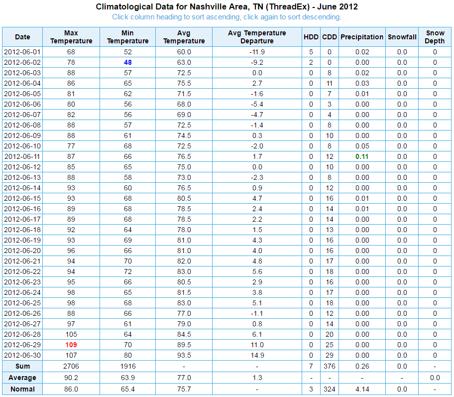
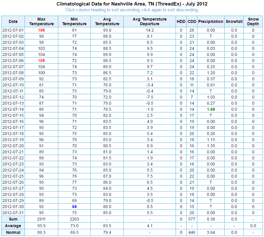
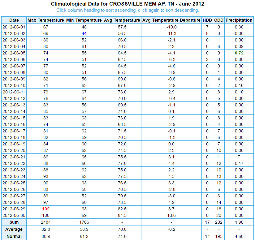
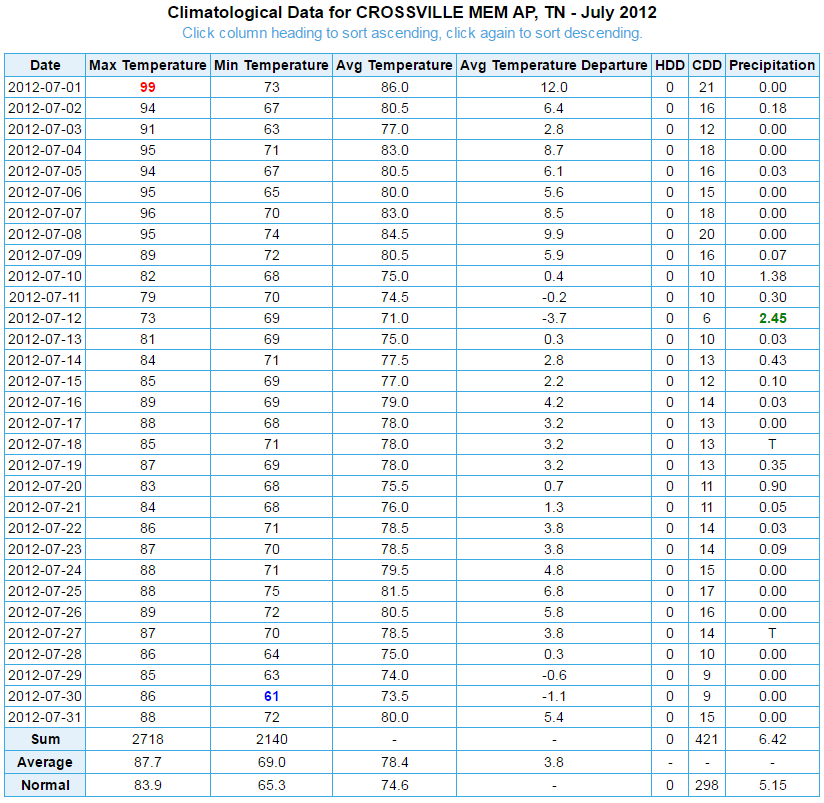
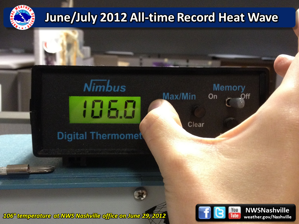
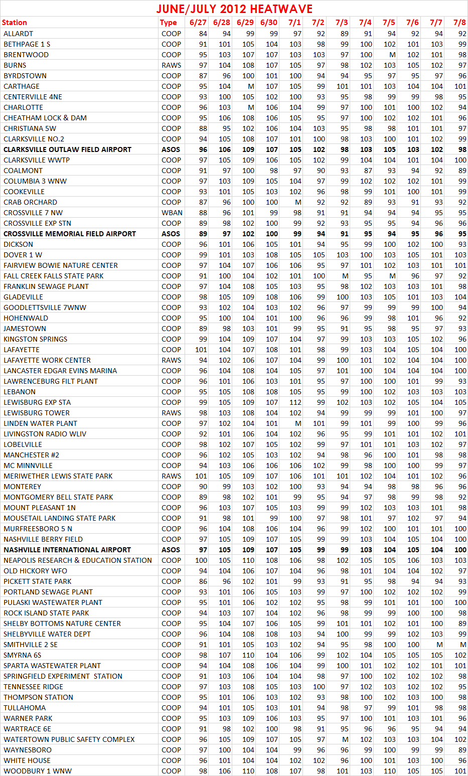
| An unusually intense heat wave affected much of the eastern United States from late June 2012 into early July 2012. Temperatures reached well over 100° for several days in a row, and in some areas even topped 110°. Across Middle Tennessee, temperatures reached near or over 100° nearly every day between June 28 through July 8. Many locations even set the highest temperatures ever recorded at their stations on June 29, including the official ASOS stations at Nashville (109°) and Crossville (102°). |
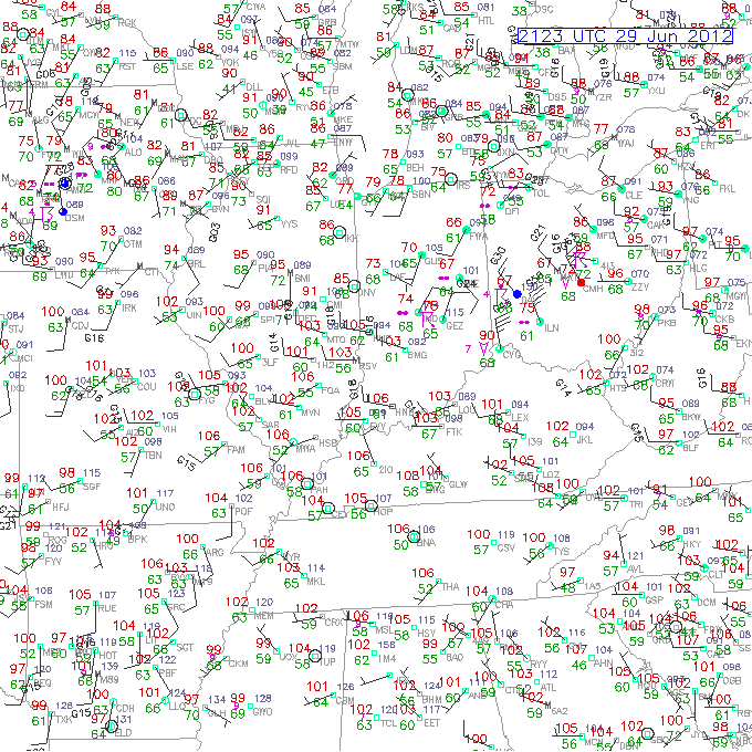
| June 29, 2012 4PM CDT Surface Observations | |
 |
| June/July 2012 Heatwave Daily High Temperatures | |
 |
| Official Surface Observations | |
| June 2012 Nashville Observations | July 2012 Nashville Observations |
| June 2012 Crossville Observations | July 2012 Crossville Observations |

US Dept of Commerce
National Oceanic and Atmospheric Administration
National Weather Service
Nashville, TN
500 Weather Station Road
Old Hickory, TN 37138
615-754-8500
Comments? Questions? Please Contact Us.


 Follow us on X
 Follow us on Facebook
 Follow us on YouTube
 OHX RSS Feed