Safety
National Program
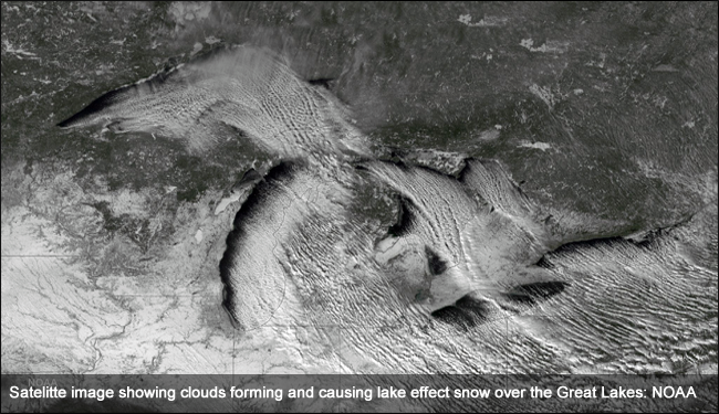
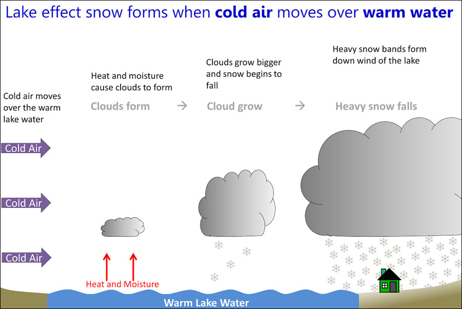
Lake effect snow is common across the Great Lakes region during the late fall and winter. Lake Effect snow occurs when cold air, often originating from Canada, moves across the open waters of the Great Lakes. As the cold air passes over the unfrozen and relatively warm waters of the Great Lakes, warmth and moisture are transferred into the lowest portion of the atmosphere. The air rises, clouds form and grow into narrow band that produces 2 to 3 inches of snow per hour or more.
Wind direction is a key component in determining which areas will receive lake effect snow. Heavy snow may be falling in one location, while the sun may be shining just a mile or two away in either direction. The physical geography of the land and water is also important. National Weather Service meteorologists consider these factors as well as others when forecasting lake effect snow.
US Dept of Commerce
National Oceanic and Atmospheric Administration
National Weather Service
Safety
1325 East West Highway
Silver Spring, MD 20910
Comments? Questions? Please Contact Us.

