Severe flooding is part of the history of many U.S. communities. Despite this reality, many residents are not fully aware of the flood potential in their area. To help raise awareness of flood risk, NWS began a project in 2006 to install High Water Mark signs in prominent locations within communities that have experienced severe flooding. Location are selected based more on visibility than location of the flood. For example, a sign might be placed on the wall of a building downtown rather than near a rarely visited riverbank. Service Hydrologists from local NWS offices coordinate with emergency management and other local officials to select the best locations for the signs. The U.S. Geological Survey is involved as well, providing historical data and aiding with the surveying of high water mark signs in their districts.
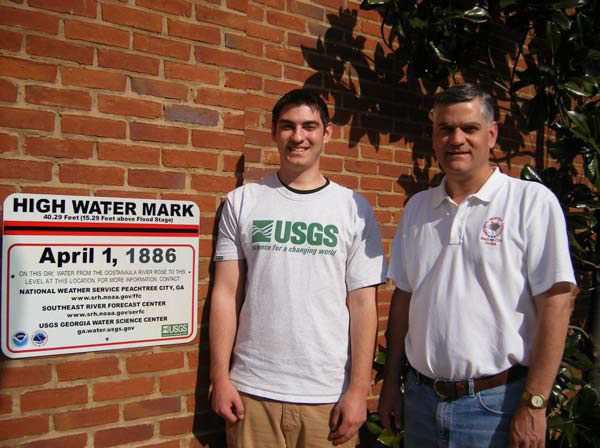
The first sig (shown here) was unveiled in Rome, GA., on March 21, 2007, during Flood Safety Awareness Week. Rome’s record flood occurred on April 1, 1886, when the Ostanaula River rose to a stage of 40.3 feet, inundating some parts of downtown Rome with more than 20 feet of water. The downtown area was so severely damaged that the city opted to fill in much of it, so that street level of present-day downtown Rome is what used to be the second floor. Even so, the high water mark was more than four feet above the ground. The sign was installed on the side of the Rome Area History Museum building.