National Weather Service United States Department of Commerce

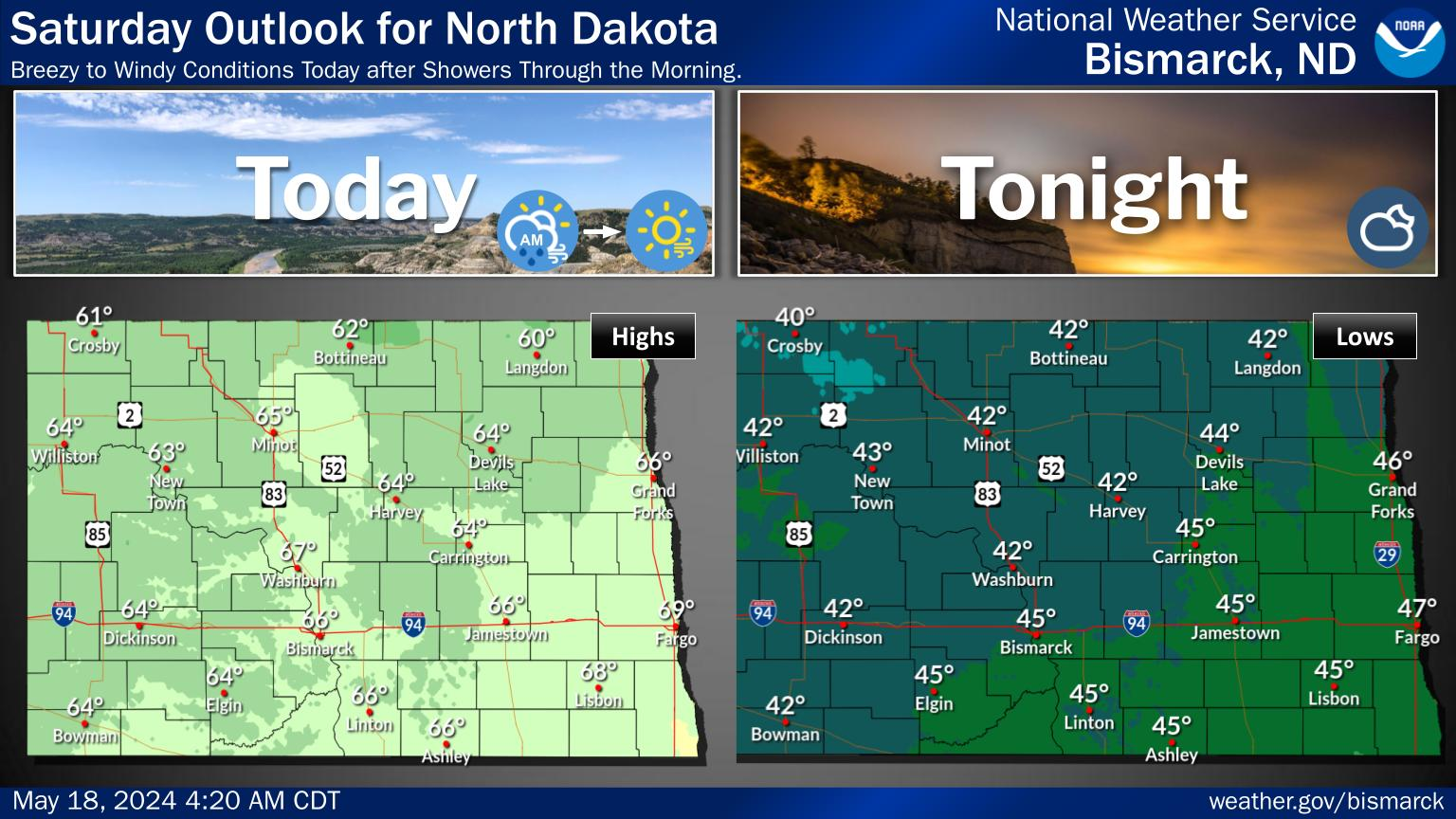
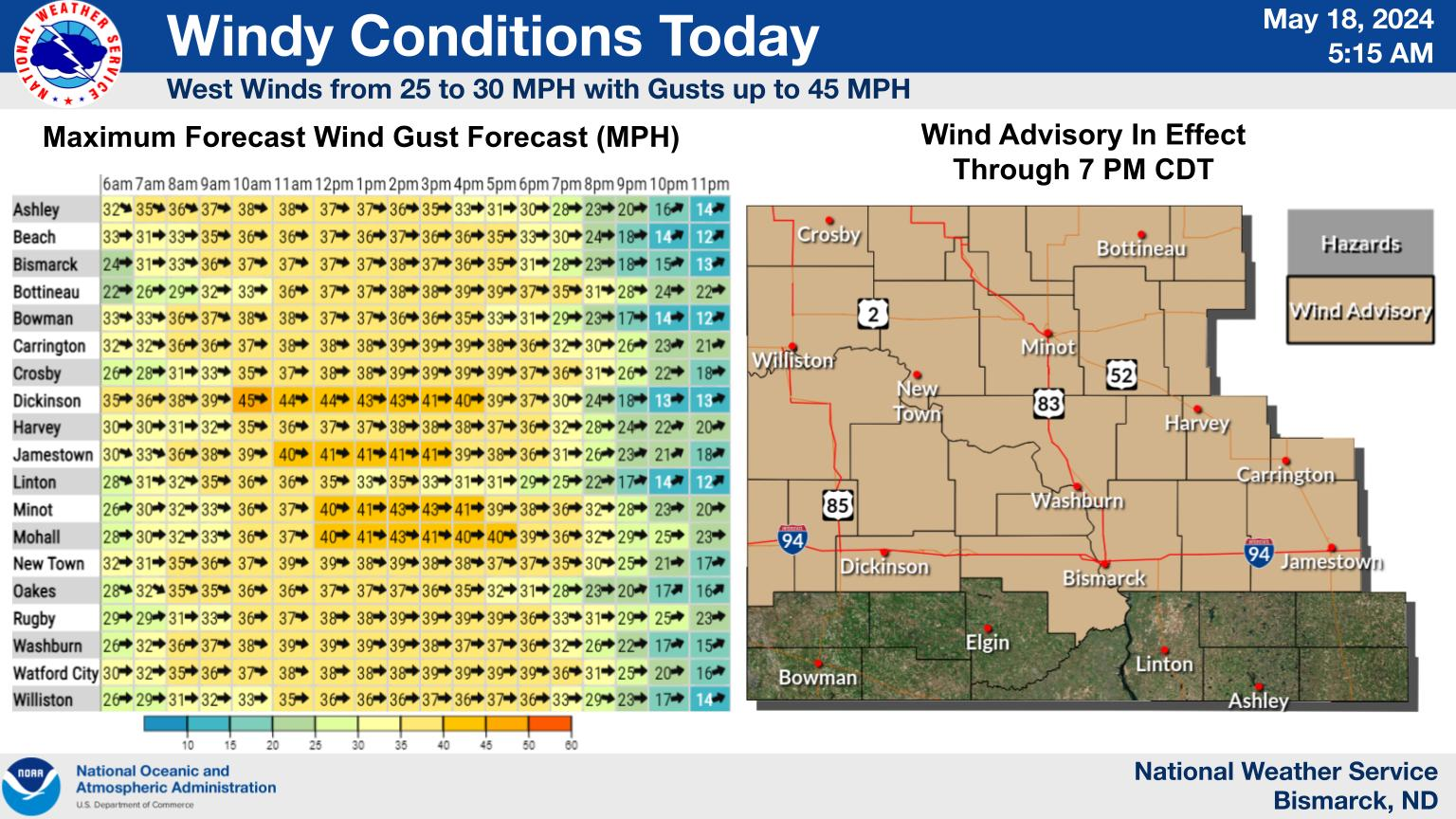
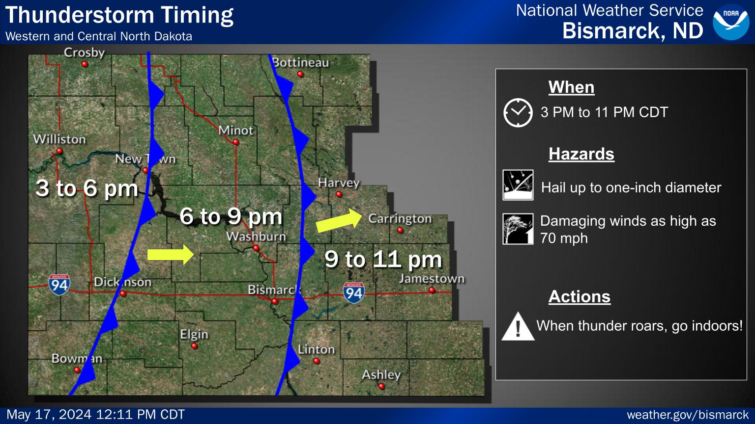
It will be warmer today with widespread highs in the lower 60s to lower 70s. However, winds will be on increase this afternoon, potentially gusting to 50 mph across the west and south central. Widespread showers are then expected through Wednesday with some isolated thunderstorms on Monday.
Winds will start to increase from west to east this afternoon, kicking off a windy period through Tuesday evening. Use extra caution. Winds this strong can make driving difficult, especially for high profile vehicles.
If you have plans to get out into the garden this weekend remember that the average last freeze for most of western and central North Dakota falls in the middle third of May (May 11th - 20th). The forecast through next week favors cooler temperatures.