
Isolated to scattered severe thunderstorms appear possible across portions of the Southeast and Carolinas on Saturday where a Slight Risk (Level 2 of 5) has been issued. A Slight Risk Excessive Rainfall Outlook (Level 2 of 4) has been issued for part of the northern Gulf Coast Saturday due to the threat of flash, urban, and riverine flooding. Read More >
Last Map Update: Sat, May. 18, 2024 at 1:30:18 am MDT


|
Text Product Selector (Selected product opens in current window)
|
|


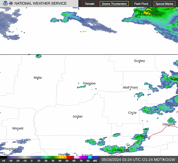 Glasgow Radar
 Satellite
 Current observations
 Webcams
 Forecast discussion
 Montana weather
 Fire weather
 Recreation forecasts
.png) Transportation forecast
Transportation forecast.png) Weather Prediction Center
Weather Prediction Center Storm Prediction Center
 Aviation weather
.png) Skywarn
Skywarn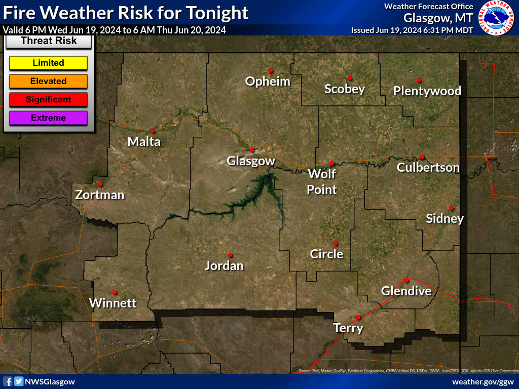 GHWO
GHWO Follow us on YouTube