NWS All NOAA
Great Falls, MT
Weather Forecast Office
Last Map Update: Mon, Jun 29, 2026 at 11:58:20 am MDT
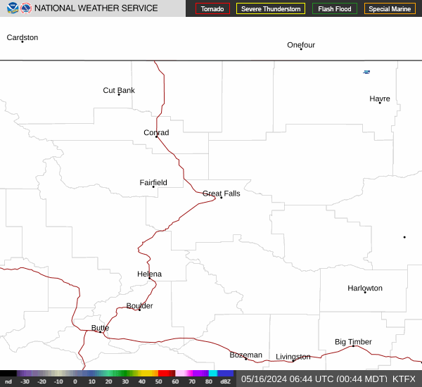


 Great Falls Radar
 Satellite
 Current Observations
 Forecast Discussion
 Montana Weather
 Fire Weather
 Winter Weather Forecasts
 Transportation Forecasts
 Weather Prediction Center
 Storm Prediction Center
 Aviation Weather
 Weather Stats